Photo: Wikipedia
Strategic Assessment of Herndon, VA
Multiple tactical vulnerabilities. Population density, target proximity, or disaster risk are likely compounding. A retreat property and exit planning is required.
What does the Strategic Assessment tell us?
Our Strategic Assessment grades tactical survivability of an area. Major population centers, military targets, fallout zones, natural disasters, and border exposure all drive risk — lower exposure means a more defensible position in a crisis.
This is heavily inspired by Joel Skousen's Strategic Relocation book. Highly recommended you checkout the book ($)What does this tell us?
Our Strategic Assessment grades tactical survivability of an area. Major population centers, military targets, fallout zones, natural disasters, and border exposure all drive risk — lower exposure means a more defensible position in a crisis.
This is heavily inspired by Joel Skousen's Strategic Relocation book. Highly recommended you checkout the book ($)Strategic Pillars

Key Distances
Regional Safe Places
Below is our recommended "safe zones" in Virginia and the surrounding area based on our strategic heuristics. For most people, it's unrealistic to live in a “safe zone” full-time due to work, family or other personal reasons. They tend to be more rural. However, many of these areas are perfect for second homes and retreat properties that double as a vacation home or even a short-term rental.


Important Note: For informational purposes only. This does not mean nothing bad ever happens in the green zones. Please use common sense. This is based on public data and modeled with AI. We tried to take a conservative approach but mistakes happen. We update this regularly as new information becomes available.
Solar Generator Recommendations
Backup power matters more here than in safer locations. We've picked three solar generators across budgets and capacity tiers — start with the budget unit if you only need a few essentials, or step up if you want to run a fridge and HVAC for days at a time.

Jackery Portable Power Station Explorer 300
Budget OptionPower on the Go: Weighing only 11 lbs, it's convenient to set up and store with book-sized foldable solar panels

BLUETTI Portable Power Station AC180
Designed for both indoor and outdoor scenarios, AC180 is highly capable as it has a robost capacity and continuous output power.

EF ECOFLOW DELTA Pro Ultra Power Station
Upgraded PickEcoFlow DELTA Pro Ultra is a whole-home energy system designed to grow with your family. Integrated with the Smart Home Panel 2, it scales to meet your evolving energy needs — keeping your home powered, intelligent, and secure through every stage of life.
We earn a commission, at no additional cost to you.
Strategic Assessment Analysis
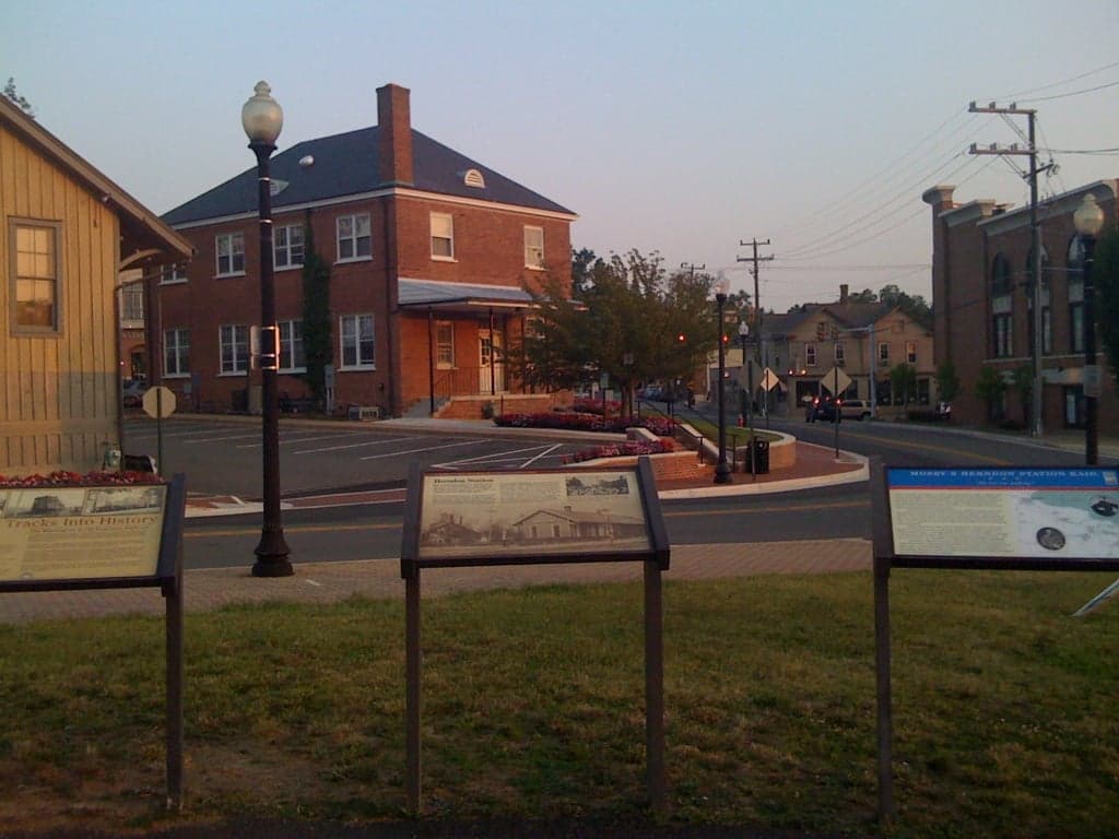
Herndon, Virginia, sits in a precarious but potentially advantageous position for those prioritizing resilience and strategic relocation. Its location in Fairfax County places it within the Washington, D.C. metropolitan area, a region that is both a target for civil unrest and a hub of logistical and economic stability. For the conservative prepper, Herndon offers a mix of suburban infrastructure and proximity to rural escape routes, but it also carries significant risks tied to its proximity to the nation's capital and major government installations. The key is understanding that Herndon is not a bug-out location but a potential base of operations—if you can navigate its vulnerabilities.
Geographic position and natural advantages for strategic relocation
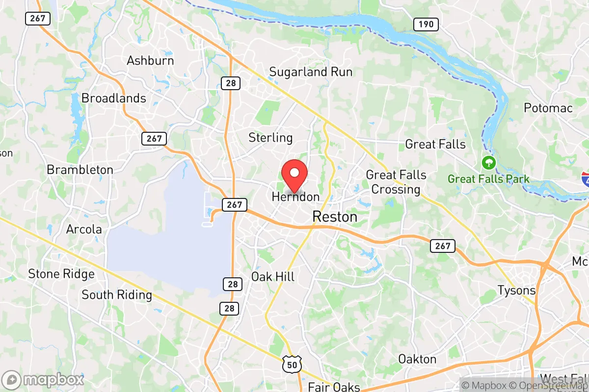
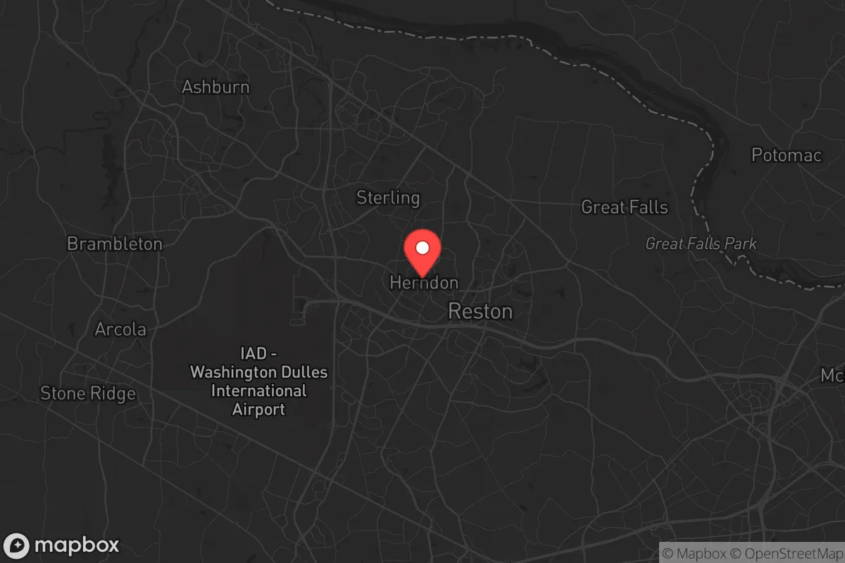
Herndon's geographic position is defined by its location in the Piedmont region, roughly 25 miles west of Washington, D.C. This places it on the edge of the suburban sprawl, with the Blue Ridge Mountains and Shenandoah Valley accessible within an hour's drive. The area's natural advantages include a temperate climate with four distinct seasons, which supports year-round gardening and livestock if you have the land. The Potomac River and its tributaries, including Difficult Run and Sugarland Run, provide surface water sources, though they are not pristine and require filtration. The region's rolling hills and mixed hardwood forests offer some natural cover and defensibility, but the terrain is not rugged enough to deter determined threats. The proximity to major highways—the Dulles Toll Road (VA-267), I-66, and the Fairfax County Parkway—provides multiple egress routes, but these same arteries can become choke points during an evacuation. For a relocator, the key advantage is the ability to blend into a dense suburban environment while maintaining a short line of retreat to more defensible rural areas like Loudoun County or Fauquier County.
Risks, exposures, and proximity to fallout-relevant landmarks
The primary risk for Herndon is its location within the bullseye of the D.C. metro area. The city is roughly 10 miles from Dulles International Airport, a major transportation hub that could be a target for terrorism or a staging ground for government operations during a crisis. It is also within 15 miles of the Central Intelligence Agency headquarters in Langley and the Pentagon in Arlington. These are high-value targets for any adversary, and a conventional or nuclear strike on D.C. would put Herndon in the fallout zone. The prevailing winds from the west would carry radioactive debris toward the city, making a post-event evacuation eastward a deadly gamble. Additionally, the area's dense population—over 24,000 residents in Herndon proper, with over 1.1 million in Fairfax County—means that any civil unrest, food shortage, or grid collapse would trigger rapid resource depletion and potential violence. The proximity to major data centers in Ashburn (the "Data Center Alley") is a double-edged sword: it provides economic stability but also makes the region a target for cyberattacks or physical sabotage that could cripple communications and power grids. For the prepper, the risk of being caught in a mass casualty event or a government-directed lockdown is high, and the area's reliance on just-in-time logistics means that a supply chain disruption would empty grocery shelves within 48 hours.
Practical resilience for a relocator: food, water, energy, and defensibility
For a relocator looking to establish a resilient household in Herndon, the practical challenges are significant but not insurmountable. Water is the most critical concern. The municipal supply comes from the Potomac River via the Fairfax County Water Authority, which is vulnerable to contamination, sabotage, or pump failures. A prepper should invest in a high-capacity Berkey or reverse osmosis filter, and consider drilling a private well if purchasing a home with land—though most lots in Herndon are less than a quarter-acre. Rainwater collection is legal in Virginia but limited to 250 gallons per property without a permit, so plan accordingly. Food security requires a deep pantry and a plan for local sourcing. The Herndon Farmers Market operates seasonally, but for year-round resilience, you need to establish relationships with farms in Loudoun County (e.g., Great Country Farms) or join a CSA. Growing your own food is possible with raised beds and a greenhouse, but the suburban HOA restrictions in many neighborhoods can be a barrier—look for properties in the older, unincorporated sections of town. Energy independence is achievable with solar panels and battery storage, but Fairfax County's permitting process is bureaucratic. A backup generator running on propane or natural gas is more practical for most, and the area's natural gas grid is relatively reliable. Defensibility is the weakest link. Herndon's suburban layout—with cul-de-sacs, strip malls, and interconnected neighborhoods—offers limited tactical advantage. A single-family home on a corner lot with a fenced backyard is better than a townhouse in a dense development. The local police presence is strong (Fairfax County Police), but during a SHTF scenario, they will be overwhelmed. The best strategy is to cultivate a network of like-minded neighbors and establish a neighborhood watch that can coordinate security. The nearby W&OD Trail, a 45-mile rail-trail, provides a potential evacuation route on foot or bike, but it is also a known thoroughfare for criminals during a breakdown of order.
The overall strategic picture for Herndon is one of calculated risk. It is not a survivalist paradise—it is a suburban outpost on the edge of a potential disaster zone. For the conservative relocator who values economic opportunity and proximity to government infrastructure (for those working in defense or contracting), Herndon offers a viable base if you are willing to invest heavily in self-sufficiency and maintain a low profile. The key is to treat it as a temporary staging area: build your supplies, establish your skills, and have a bug-out plan for the Shenandoah Valley or West Virginia within 90 minutes. The area's schools (e.g., Herndon High School, ranked in the top 10% nationally) and low crime rates (violent crime is 60% below the national average) make it a reasonable choice for families, but the threat of civil unrest and fallout from D.C. means you must be prepared to leave at a moment's notice. In short, Herndon is a place to live and work, not a place to hunker down for the long haul. If you can accept that trade-off, it can work. If you are looking for a true retreat, keep driving west.
* Values derived from national, state, county, city and local statistics and may differ in a specific area. Last updated: 2026-05-01T16:07:47.000Z
Narrative content on this page is AI-generated and may contain mistakes. Verify any details that matter before acting on them.
ReloMaps may earn a commission from affiliate links at no extra cost to you.