Photo: Wikipedia
Strategic Assessment of Hobbs, NM
Workable tactical position. Some exposure to population density or targets, but generally defensible in a crisis.
What does the Strategic Assessment tell us?
Our Strategic Assessment grades tactical survivability of an area. Major population centers, military targets, fallout zones, natural disasters, and border exposure all drive risk — lower exposure means a more defensible position in a crisis.
This is heavily inspired by Joel Skousen's Strategic Relocation book. Highly recommended you checkout the book ($)What does this tell us?
Our Strategic Assessment grades tactical survivability of an area. Major population centers, military targets, fallout zones, natural disasters, and border exposure all drive risk — lower exposure means a more defensible position in a crisis.
This is heavily inspired by Joel Skousen's Strategic Relocation book. Highly recommended you checkout the book ($)Strategic Pillars

Key Distances
Regional Safe Places
Below is our recommended "safe zones" in New Mexico and the surrounding area based on our strategic heuristics. For most people, it's unrealistic to live in a “safe zone” full-time due to work, family or other personal reasons. They tend to be more rural. However, many of these areas are perfect for second homes and retreat properties that double as a vacation home or even a short-term rental.

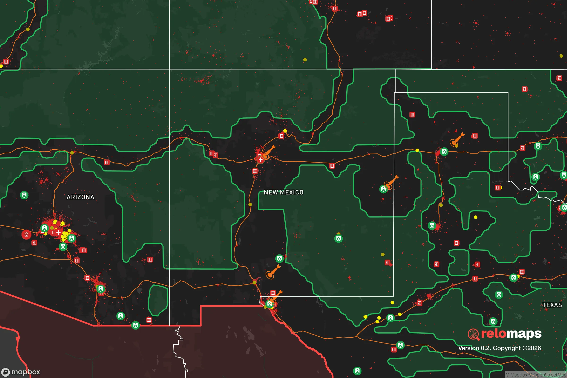
Important Note: For informational purposes only. This does not mean nothing bad ever happens in the green zones. Please use common sense. This is based on public data and modeled with AI. We tried to take a conservative approach but mistakes happen. We update this regularly as new information becomes available.
Solar Generator Recommendations
Backup power matters more here than in safer locations. We've picked three solar generators across budgets and capacity tiers — start with the budget unit if you only need a few essentials, or step up if you want to run a fridge and HVAC for days at a time.

Jackery Portable Power Station Explorer 300
Budget OptionPower on the Go: Weighing only 11 lbs, it's convenient to set up and store with book-sized foldable solar panels

BLUETTI Portable Power Station AC180
Designed for both indoor and outdoor scenarios, AC180 is highly capable as it has a robost capacity and continuous output power.

EF ECOFLOW DELTA Pro Ultra Power Station
Upgraded PickEcoFlow DELTA Pro Ultra is a whole-home energy system designed to grow with your family. Integrated with the Smart Home Panel 2, it scales to meet your evolving energy needs — keeping your home powered, intelligent, and secure through every stage of life.
We earn a commission, at no additional cost to you.
Strategic Assessment Analysis
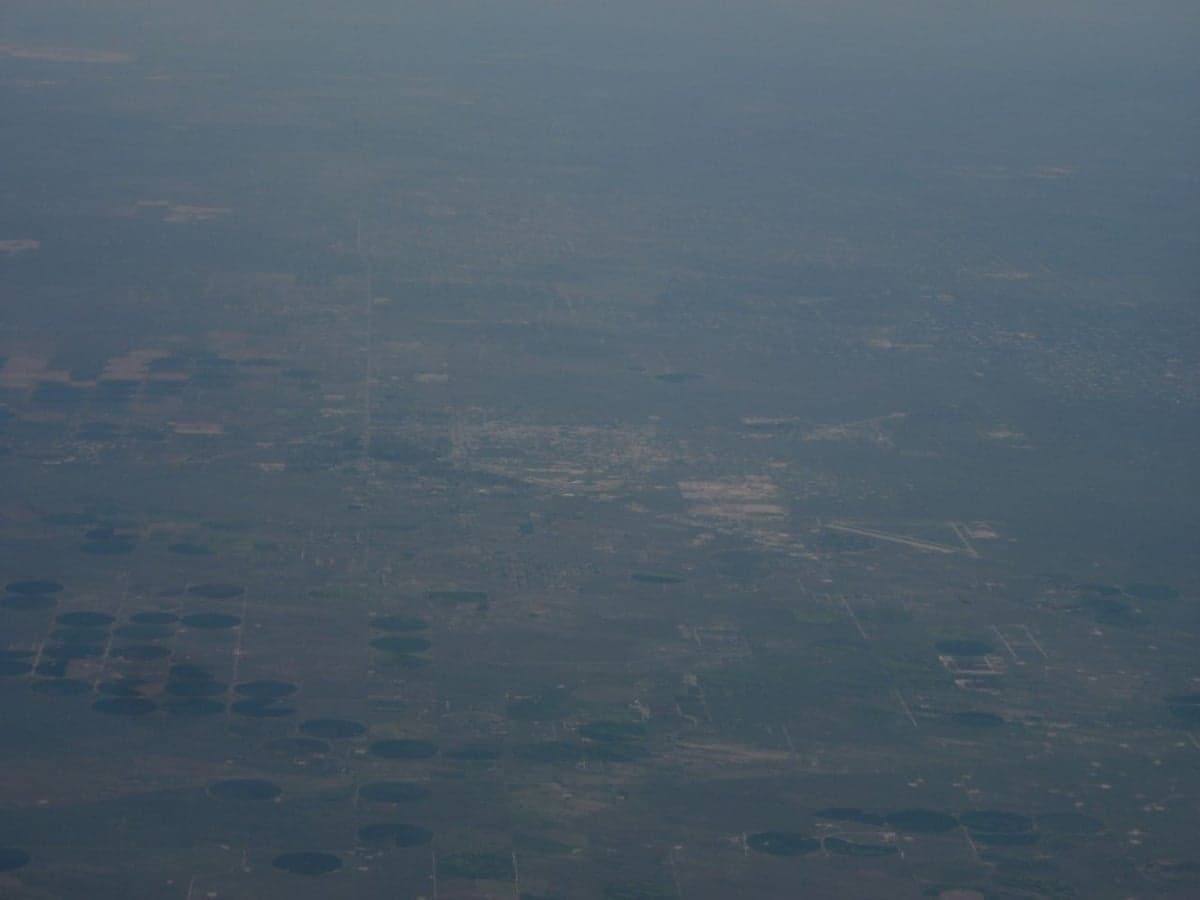
Hobbs, New Mexico, sits in a unique strategic pocket that most relocation analyses completely miss. It’s not a prepper fantasyland—it’s a working-class oil-and-gas hub with real infrastructure, real water access, and a location that puts it outside the blast radius of major strategic targets while still being connected enough to function. For someone thinking about where to ride out the next decade of instability, Hobbs offers a surprisingly solid mix of isolation and utility, provided you understand its specific strengths and very real limitations.
Geographic position and natural advantages for long-term stability
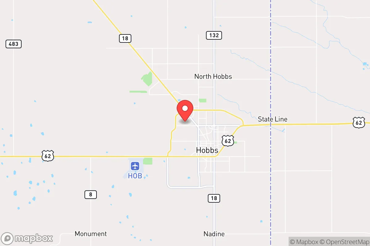
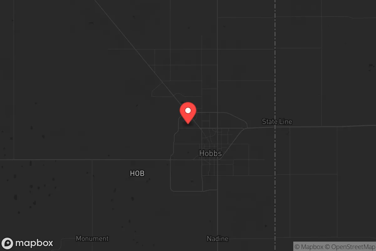
Hobbs is planted in the southeastern corner of New Mexico, roughly 30 miles from the Texas state line and about 100 miles from the Permian Basin’s core. That’s not a coincidence—the area sits atop the Bone Spring and Wolfcamp shale formations, which means energy independence is baked into the local economy. The city itself is at about 3,600 feet elevation, which gives it a semi-arid climate with low humidity and minimal natural disaster risk. You’re not worrying about hurricanes, earthquakes, or wildfires in any meaningful way. The biggest weather threat is the occasional dust storm or flash flood from a monsoon cell, neither of which is civilization-ending.
The real advantage here is distance from high-value targets. Hobbs is roughly 200 miles from Albuquerque, 300 miles from Dallas, and 350 miles from Denver. No major military bases, no nuclear command centers, no major ports or rail hubs within a 150-mile radius. The closest facility that might draw a kinetic or EMP strike is Cannon Air Force Base in Clovis, about 120 miles northwest, or the Waste Isolation Pilot Plant (WIPP) near Carlsbad, about 75 miles southwest. WIPP is a deep geological repository for transuranic waste—it’s a potential target, but it’s hardened and remote. A strike there wouldn’t produce a fallout cloud that drifts over Hobbs under prevailing westerlies; the wind patterns push that risk toward the southeast, into Texas ranchland.
Risks, exposures, and proximity to fallout-relevant landmarks
Let’s be honest about the downsides. Hobbs is not a bunker. It’s a city of roughly 40,000 people, and it has the vulnerabilities that come with being a regional economic hub for oilfield services. The Lea County Regional Airport is a general aviation facility with a 7,000-foot runway—it could be used for military logistics in a crisis, which makes it a secondary target. The Hobbs Industrial Airpark and several large oilfield supply depots along Highway 18 are also potential points of interest for anyone trying to disrupt energy production.
The bigger concern is proximity to the Permian Basin’s critical infrastructure. The Permian produces about 6 million barrels of oil per day. That makes it a strategic asset. If a conflict escalates, the pipeline hubs, compressor stations, and rail loading facilities within a 50-mile radius of Hobbs could see sabotage or drone strikes. The Yates Oil Field and the Jal gas processing plants are about 40 miles south. A major incident there could produce a toxic plume or a fire that disrupts air quality for days. But that’s a localized industrial risk, not a nuclear fallout scenario.
On the nuclear side, the closest significant fallout risk is from Pantex Plant in Amarillo, about 180 miles northeast. Pantex is the nation’s primary nuclear weapon assembly and disassembly facility. It’s a Tier 1 target. If it’s hit, the prevailing winds in that region blow east-northeast toward Oklahoma, not toward Hobbs. The Uranium enrichment facilities in Eunice, New Mexico (about 30 miles south) are a more immediate concern. Urenco USA operates a centrifuge enrichment plant there. It’s a hardened facility, but a conventional strike could release uranium hexafluoride. That’s a localized hazard, not a regional fallout event. Hobbs is upwind of Eunice under typical conditions, but a shift in wind direction during a release would be problematic.
Practical resilience for a relocator: food, water, energy, and defensibility
This is where Hobbs actually shines for someone with a prepper mindset. Water is the first concern in any long-term scenario. Hobbs sits above the Ogallala Aquifer, one of the largest freshwater aquifers in the world. The local water table is about 200-300 feet deep, and the city’s municipal supply comes from wells drawing from that system. It’s not infinite—the Ogallala is being depleted across the High Plains—but in a crisis scenario, you’re not going to run dry in a month. The city also has two surface water reservoirs: Green Meadow Lake and Harry McAdams Park Lake, both small but usable for emergency supply with proper filtration.
Energy is a non-issue. You’re in the middle of an oil and gas field. Natural gas is cheap and abundant. Propane is everywhere. The local electrical grid is served by Lea County Electric Cooperative and Xcel Energy, both of which have redundant transmission lines running through the Permian. In a grid-down scenario, anyone with a basic natural gas generator and a 500-gallon tank can keep running indefinitely. Solar potential is excellent—over 300 sunny days per year—so a modest off-grid solar setup with battery storage is very practical here.
Food security is the weak point. Hobbs is not surrounded by farmland. The soil is sandy and alkaline, and rainfall averages only about 13 inches per year. You’re not going to grow a self-sufficient garden without significant soil amendment and irrigation. The local grocery supply chain is dominated by Walmart, Albertsons, and Lowe’s Market, all of which rely on trucking from distribution centers in Lubbock and El Paso. In a prolonged disruption, those shelves empty fast. The Lea County Farmers Market operates seasonally but is small. Serious preppers should plan for at least 6-12 months of stored food, or invest in a greenhouse with hydroponic capability.
Defensibility is mixed. Hobbs is flat. There’s no high ground, no natural chokepoints. The city layout is a standard grid with wide streets and low-density housing. That makes it hard to defend against a motivated group. But the population density is low—about 1,100 people per square mile—and the surrounding area is vast, empty ranchland. If you’re willing to live 10-15 miles outside town on a rural parcel, you gain significant security through isolation. The Lea County Sheriff’s Office is professional but understaffed, with about 40 deputies covering 4,400 square miles. In a crisis, you’re largely on your own outside city limits.
Overall strategic picture for a conservative relocator
Hobbs isn’t a glamorous choice, and it’s not a survivalist compound. What it is, is a functional, low-profile, resource-rich location that sits far enough from the major fault lines of American instability to give you breathing room. The local culture is conservative, blue-collar, and self-reliant—the kind of place where people still keep a rifle in the truck and a generator in the shed. The economy is tied to energy, which means it’s volatile but also means the people know how to work hard and fix things themselves. If you’re looking for a place to relocate that gives you a realistic shot at weathering a decade of unrest, economic turbulence, or even a limited conflict, Hobbs deserves a serious look. Just bring your own food plan, a good water filtration system, and a willingness to drive an hour for anything beyond basic supplies. That’s the trade-off for being off the radar, and it’s one worth making.
* Values derived from national, state, county, city and local statistics and may differ in a specific area. Last updated: 2026-05-01T06:13:02.000Z
Narrative content on this page is AI-generated and may contain mistakes. Verify any details that matter before acting on them.
ReloMaps may earn a commission from affiliate links at no extra cost to you.