
Photo: Wikipedia
Strategic Assessment of Huron, SD
Strong survivability profile. Good buffer from population centers, with manageable environmental and tactical risks.
What does the Strategic Assessment tell us?
Our Strategic Assessment grades tactical survivability of an area. Major population centers, military targets, fallout zones, natural disasters, and border exposure all drive risk — lower exposure means a more defensible position in a crisis.
This is heavily inspired by Joel Skousen's Strategic Relocation book. Highly recommended you checkout the book ($)What does this tell us?
Our Strategic Assessment grades tactical survivability of an area. Major population centers, military targets, fallout zones, natural disasters, and border exposure all drive risk — lower exposure means a more defensible position in a crisis.
This is heavily inspired by Joel Skousen's Strategic Relocation book. Highly recommended you checkout the book ($)Strategic Pillars

Key Distances
Regional Safe Places
Below is our recommended "safe zones" in South Dakota and the surrounding area based on our strategic heuristics. For most people, it's unrealistic to live in a “safe zone” full-time due to work, family or other personal reasons. They tend to be more rural. However, many of these areas are perfect for second homes and retreat properties that double as a vacation home or even a short-term rental.


Important Note: For informational purposes only. This does not mean nothing bad ever happens in the green zones. Please use common sense. This is based on public data and modeled with AI. We tried to take a conservative approach but mistakes happen. We update this regularly as new information becomes available.
Solar Generator Recommendations
Backup power matters more here than in safer locations. We've picked three solar generators across budgets and capacity tiers — start with the budget unit if you only need a few essentials, or step up if you want to run a fridge and HVAC for days at a time.

Jackery Portable Power Station Explorer 300
Budget OptionPower on the Go: Weighing only 11 lbs, it's convenient to set up and store with book-sized foldable solar panels

BLUETTI Portable Power Station AC180
Designed for both indoor and outdoor scenarios, AC180 is highly capable as it has a robost capacity and continuous output power.

EF ECOFLOW DELTA Pro Ultra Power Station
Upgraded PickEcoFlow DELTA Pro Ultra is a whole-home energy system designed to grow with your family. Integrated with the Smart Home Panel 2, it scales to meet your evolving energy needs — keeping your home powered, intelligent, and secure through every stage of life.
We earn a commission, at no additional cost to you.
Strategic Assessment Analysis
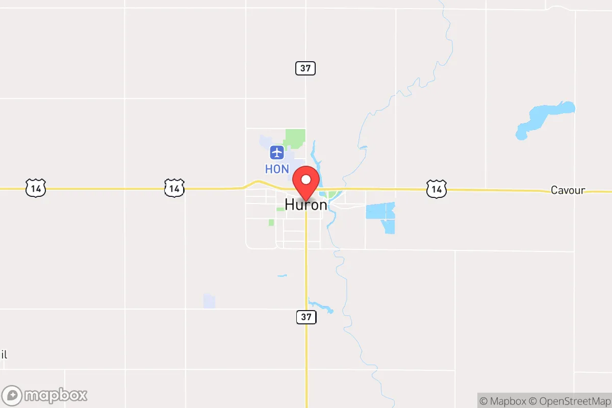
Huron, South Dakota, presents a compelling case for the strategic relocator who prioritizes resilience over convenience, offering a blend of geographic isolation, agricultural self-sufficiency, and low population density that is increasingly rare in the Lower 48. Its position in the heart of the James River Valley, roughly 120 miles from Sioux Falls and 150 miles from the Fargo-Moorhead area, places it outside the immediate blast and fallout zones of major population centers while still providing access to regional infrastructure. For those assessing long-term stability in an era of potential civic unrest, supply chain disruptions, or mass casualty events, Huron’s combination of flat, arable land, a stable water table, and a politically conservative, community-oriented population makes it a location worth serious consideration.
Geographic position and natural advantages for long-term stability
Huron sits in a region defined by its agricultural productivity and relative isolation from major geopolitical targets. The city is the seat of Beadle County, a rural expanse where the nearest metropolitan area of over 100,000 people is Sioux Falls, a two-hour drive southeast. This distance is a deliberate advantage: Huron is far enough from the Interstate 29 corridor to avoid the chaos of a major evacuation route, yet close enough to reach a regional medical center (Avera McKennan in Sioux Falls) or a major airport (Sioux Falls Regional) within a few hours. The surrounding landscape is predominantly flat, open farmland, which offers clear lines of sight for security and minimal natural cover for potential threats. The James River, which runs through the city, provides a consistent surface water source, though it is not a major navigable waterway—meaning it is less likely to be a target for infrastructure disruption. The area’s climate is continental, with cold winters and hot summers, which demands proper preparation but also reduces the risk of vector-borne diseases common in warmer regions. For the prepper, the key takeaway is that Huron’s geography offers a buffer: it is not a strategic military target, not a transportation hub, and not a population magnet, which makes it a low-priority location for any large-scale disruptive event.
Risks, exposures, and proximity to fallout-relevant landmarks
While Huron’s isolation is a strength, it is not without exposure. The most significant risk is its proximity to the Ellsworth Air Force Base near Rapid City, roughly 250 miles to the west. Ellsworth is home to the 28th Bomb Wing, operating B-1B Lancer bombers, and is a high-priority target in any major conflict involving the United States. In a nuclear exchange, prevailing winds from the west could carry fallout across the state, potentially affecting Huron within 12-24 hours depending on yield and weather patterns. However, the distance provides a critical window for evacuation or sheltering. More immediate risks include the city’s reliance on a single major highway, US-14, which connects Huron to I-29 and I-90. A major accident or deliberate blockage on this route could isolate the city for days. Additionally, the flat terrain makes the area susceptible to severe weather, including tornadoes and blizzards, which can disrupt power and transportation for extended periods. The James River is prone to flooding in heavy rain years, though the city’s flood control measures are adequate for most events. For the strategic relocator, the calculus is clear: Huron is not a zero-risk location, but its risks are primarily natural and manageable, rather than the cascading, human-caused catastrophes that would plague a major metro area.
Practical resilience for a relocator: food, water, energy, and defensibility
Huron’s practical resilience is anchored in its agricultural base. The city is surrounded by some of the most productive farmland in the country, with corn, soybeans, and wheat as primary crops. This means that in a prolonged disruption of national supply chains, local food production would likely continue, and barter networks based on grain, livestock, and produce would emerge. The city is also home to a major turkey processing plant (Dakota Provisions) and a large ethanol plant (Redfield Energy, about 30 miles north), which provide both food and fuel resources. Water is a strong point: the city draws from the James River and a series of deep aquifers, and the municipal water system is well-maintained. For those on private wells, the water table is generally high and reliable. Energy is a mixed picture. Huron is served by the Midcontinent Independent System Operator (MISO) grid, which has seen increasing strain from renewable integration, but the city has a natural gas-fired power plant (the Huron Power Station) that provides local generation capacity. In a grid-down scenario, this plant could be a critical asset, though it would likely be prioritized for municipal and industrial use. Defensibility is moderate. The flat terrain offers no natural chokepoints, but the city’s layout—with a compact downtown and residential areas spreading outward—means that a small, organized group could establish perimeter security with relative ease. The local law enforcement presence is small (Beadle County Sheriff’s Office and Huron Police Department), but the community is tight-knit and historically self-reliant. For the relocator, the key is to arrive with skills, not just supplies: knowledge of gardening, animal husbandry, and basic mechanical repair will be far more valuable than a stockpile of freeze-dried meals.
The overall strategic picture for Huron is one of calculated trade-offs. It lacks the immediate amenities and economic opportunities of a larger city, but it offers a level of baseline stability that is hard to find in more densely populated regions. The community is predominantly conservative, with a strong work ethic and a cultural resistance to top-down mandates, which aligns well with a prepper mindset. The biggest challenge for a relocator is the social integration: Huron is not a transient city, and newcomers will need to invest time in building trust and relationships. But for those willing to do the work, the payoff is a location that is defensible, resource-rich, and far enough from the chaos to give you a fighting chance when things go sideways. In a world where the margin for error is shrinking, Huron offers a solid, if unglamorous, foundation for long-term resilience.
* Values derived from national, state, county, city and local statistics and may differ in a specific area. Last updated: 2026-04-19T05:10:25.000Z
Narrative content on this page is AI-generated and may contain mistakes. Verify any details that matter before acting on them.
ReloMaps may earn a commission from affiliate links at no extra cost to you.