Photo: Wikipedia
Strategic Assessment of Jeffersonville, VT
Meaningful friction. Expect exposure to either population pressure, blast zones, or natural disaster risk. Consider buying a retreat property.
What does the Strategic Assessment tell us?
Our Strategic Assessment grades tactical survivability of an area. Major population centers, military targets, fallout zones, natural disasters, and border exposure all drive risk — lower exposure means a more defensible position in a crisis.
This is heavily inspired by Joel Skousen's Strategic Relocation book. Highly recommended you checkout the book ($)What does this tell us?
Our Strategic Assessment grades tactical survivability of an area. Major population centers, military targets, fallout zones, natural disasters, and border exposure all drive risk — lower exposure means a more defensible position in a crisis.
This is heavily inspired by Joel Skousen's Strategic Relocation book. Highly recommended you checkout the book ($)Strategic Pillars

Key Distances
Regional Safe Places
Below is our recommended "safe zones" in Vermont and the surrounding area based on our strategic heuristics. For most people, it's unrealistic to live in a “safe zone” full-time due to work, family or other personal reasons. They tend to be more rural. However, many of these areas are perfect for second homes and retreat properties that double as a vacation home or even a short-term rental.


Important Note: For informational purposes only. This does not mean nothing bad ever happens in the green zones. Please use common sense. This is based on public data and modeled with AI. We tried to take a conservative approach but mistakes happen. We update this regularly as new information becomes available.
Solar Generator Recommendations
Backup power matters more here than in safer locations. We've picked three solar generators across budgets and capacity tiers — start with the budget unit if you only need a few essentials, or step up if you want to run a fridge and HVAC for days at a time.

Jackery Portable Power Station Explorer 300
Budget OptionPower on the Go: Weighing only 11 lbs, it's convenient to set up and store with book-sized foldable solar panels

BLUETTI Portable Power Station AC180
Designed for both indoor and outdoor scenarios, AC180 is highly capable as it has a robost capacity and continuous output power.

EF ECOFLOW DELTA Pro Ultra Power Station
Upgraded PickEcoFlow DELTA Pro Ultra is a whole-home energy system designed to grow with your family. Integrated with the Smart Home Panel 2, it scales to meet your evolving energy needs — keeping your home powered, intelligent, and secure through every stage of life.
We earn a commission, at no additional cost to you.
Strategic Assessment Analysis
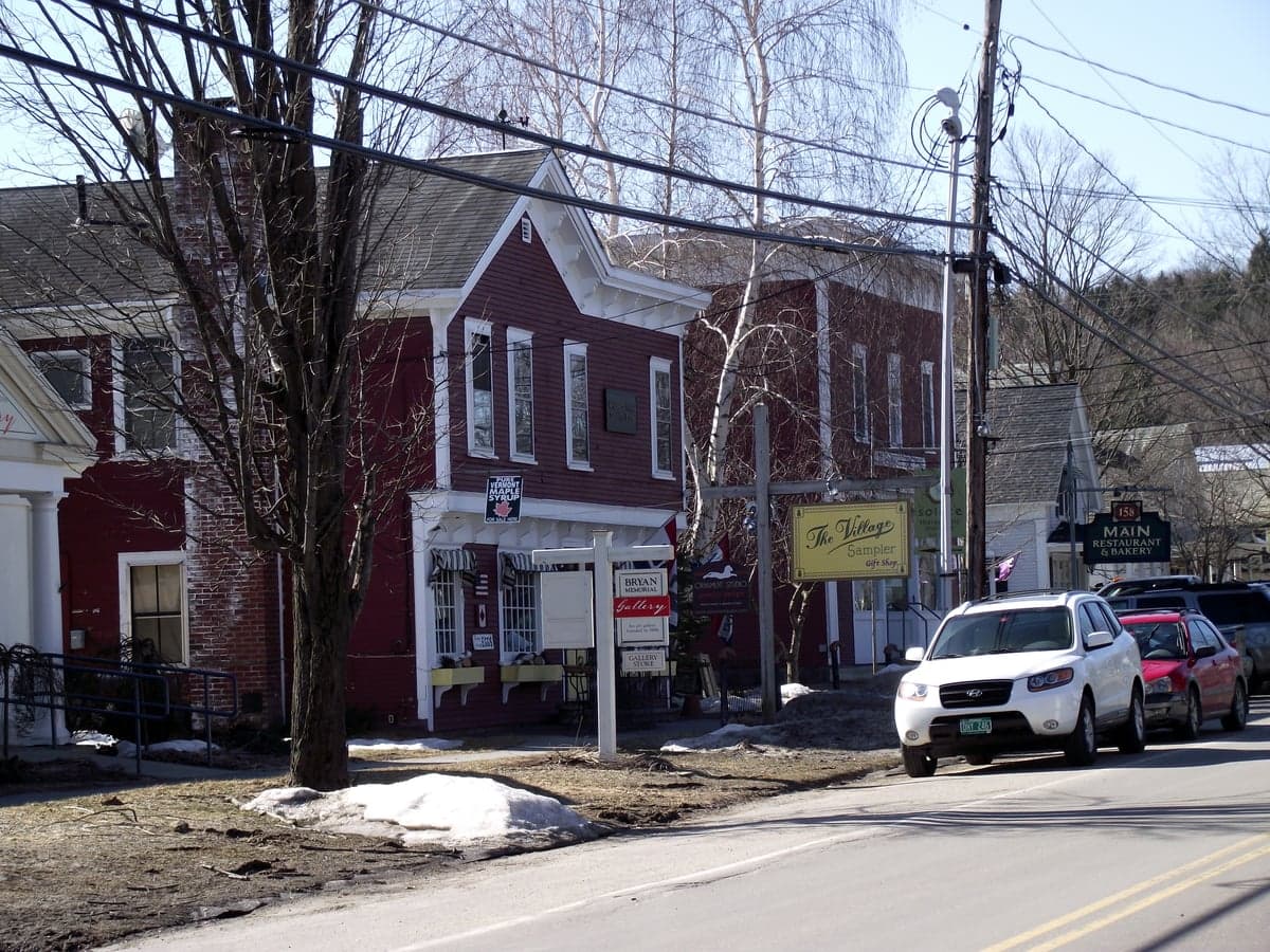
Jeffersonville, Vermont, presents a mixed strategic picture for the conservative prepper or survivalist. Its primary resilience lies in its remoteness and low population density, but its location in a narrow valley and proximity to certain vulnerabilities demand careful consideration. For those seeking a retreat from the chaos of urban collapse or federal overreach, this small town in Lamoille County offers a genuine escape, but it is not without its own set of strategic liabilities that must be factored into any relocation calculus.
Geographic position and natural advantages for long-term survival
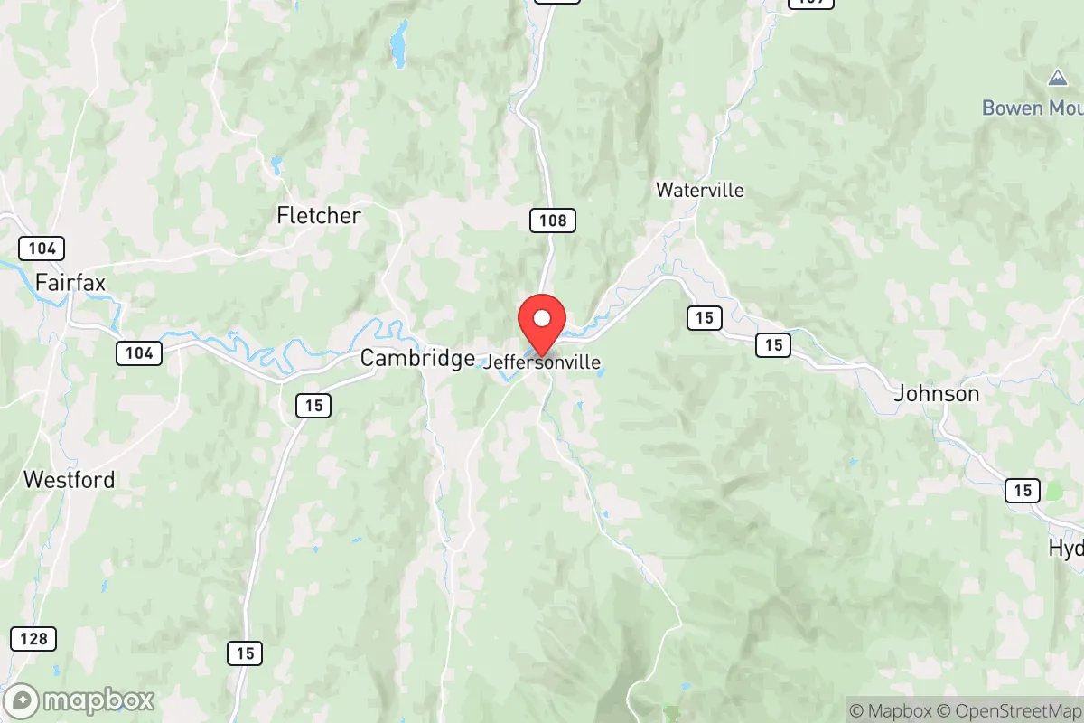
Jeffersonville sits in the Lamoille River Valley, flanked by the Green Mountains to the west and the Belvidere Mountains to the east. This positioning provides a natural defensive buffer against large-scale movement, as the only practical routes in and out are Vermont Route 108 (the Smugglers' Notch road, which is closed in winter) and Vermont Route 15. For a relocator, this chokepoint geography is a double-edged sword: it limits access for unwanted visitors, but it also means your own egress is severely constrained, especially during the six months of heavy snow. The town itself is small, with a year-round population under 700, meaning social cohesion is high and outsiders are immediately noticed. The surrounding forests and mountains offer ample cover and resources for those who know how to use them. The area's elevation (roughly 1,000 feet) and northern latitude mean cooler summers and harsh winters, which naturally discourages casual migration and provides a climate buffer against some of the more extreme heat-related scenarios seen elsewhere. The Lamoille River itself is a reliable water source, though it requires treatment. For the prepper, the key advantage here is low visibility and low desirability for looters or organized groups—Jeffersonville is not a strategic target for anyone seeking power, wealth, or infrastructure.
Risks, exposures, and proximity to fallout-relevant landmarks
The most significant strategic risk for Jeffersonville is its proximity to the Burlington-South Burlington metropolitan area, roughly 30 miles to the west. While 30 miles is a decent buffer, it is not insurmountable for a determined population fleeing a collapse or disaster in Vermont's largest city. The I-89 corridor, which connects Burlington to the rest of the state, passes within 15 miles of Jeffersonville, meaning refugee flow could easily spill into the Lamoille Valley. Additionally, the town is within 50 miles of the Vermont Yankee nuclear site (now decommissioned but still a spent fuel storage location) and within 100 miles of the Seabrook Station nuclear plant in New Hampshire. In a major radiological event, Jeffersonville could be in a downwind plume path depending on prevailing winds, which are typically from the west. The town itself has no major industrial or military targets, but the nearby Smugglers' Notch Resort is a seasonal tourist draw that could become a liability during a crisis, attracting transient populations with limited resources. The narrow valley also presents a flood risk from the Lamoille River during spring thaws or heavy rain events, which could cut off the town entirely. For the survivalist, the key takeaway is that Jeffersonville is not a hardened bunker location; it is a quiet, remote town that could become a pressure point if regional chaos erupts. Your plan must account for the possibility of being overrun by refugees from the west or being isolated by flood or snow for weeks at a time.
Practical resilience for a relocator: food, water, energy, and defensibility
For the individual or family looking to establish a self-sufficient homestead, Jeffersonville offers a mixed bag. The growing season is short (roughly 100-120 frost-free days), limiting large-scale agriculture to cold-hardy crops like potatoes, root vegetables, and some grains. The soil is rocky and acidic, typical of northern New England, so raised beds and soil amendment are necessary. Local hunting is viable—white-tailed deer, black bear, turkey, and small game are abundant—but requires a license and knowledge of the terrain. Fishing in the Lamoille River and nearby Lake Elmore is reliable for trout and bass. Water is plentiful from the river and numerous springs, but you must have a gravity-fed or hand-pump system as power outages are common in winter storms. The local power grid is served by Green Mountain Power, which has a mixed reliability record; tree falls and ice storms frequently knock out lines for days. Solar is viable but limited by heavy snow cover and short winter daylight hours; a backup generator with a large fuel cache is essential. Defensibility is moderate: the town is compact, with most homes clustered along Route 15 and a few side roads. The surrounding hills provide good observation points, but the valley floor itself is a kill zone if approached from the ridge lines. Neighbors are likely to be armed and self-reliant, which is a positive for mutual defense but also means you must integrate into the community to avoid being seen as a threat. The nearest hospital is Copley Hospital in Morrisville, 10 miles east, which is a small critical-access facility. For serious trauma or advanced care, you are looking at a 45-minute drive to the University of Vermont Medical Center in Burlington—a route that could be impassable in winter or during a crisis.
The overall strategic picture for Jeffersonville is one of calculated isolation with clear trade-offs. It is not a prepper's paradise with year-round growing seasons and easy resupply, but it is a genuine off-the-grid option for those willing to endure harsh winters and limited access. The town's small size and remote location are its greatest assets, but the proximity to Burlington and the vulnerability of the single road network are significant liabilities. For the conservative relocator who values community, self-reliance, and distance from federal overreach, Jeffersonville offers a viable base of operations—provided you arrive with a solid plan for food storage, water purification, and winter survival. This is a location for the serious prepper, not the weekend warrior. If you are looking for a place to ride out the storm with a low profile and a high degree of local knowledge, Jeffersonville deserves a spot on your short list. Just be sure you can handle the cold, the isolation, and the very real possibility that the road out may not be an option when you need it most.
* Values derived from national, state, county, city and local statistics and may differ in a specific area. Last updated: 2026-04-19T23:59:48.000Z
Narrative content on this page is AI-generated and may contain mistakes. Verify any details that matter before acting on them.
ReloMaps may earn a commission from affiliate links at no extra cost to you.