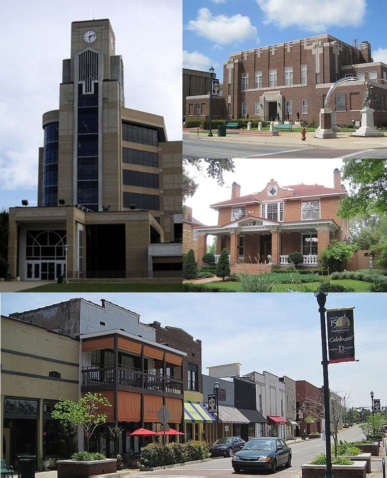

Photo: Wikipedia
Strategic Assessment of Jonesboro, AR
Workable tactical position. Some exposure to population density or targets, but generally defensible in a crisis.
What does the Strategic Assessment tell us?
Our Strategic Assessment grades tactical survivability of an area. Major population centers, military targets, fallout zones, natural disasters, and border exposure all drive risk — lower exposure means a more defensible position in a crisis.
This is heavily inspired by Joel Skousen's Strategic Relocation book. Highly recommended you checkout the book ($)What does this tell us?
Our Strategic Assessment grades tactical survivability of an area. Major population centers, military targets, fallout zones, natural disasters, and border exposure all drive risk — lower exposure means a more defensible position in a crisis.
This is heavily inspired by Joel Skousen's Strategic Relocation book. Highly recommended you checkout the book ($)Strategic Pillars

Key Distances
Regional Safe Places
Below is our recommended "safe zones" in Arkansas and the surrounding area based on our strategic heuristics. For most people, it's unrealistic to live in a “safe zone” full-time due to work, family or other personal reasons. They tend to be more rural. However, many of these areas are perfect for second homes and retreat properties that double as a vacation home or even a short-term rental.


Important Note: For informational purposes only. This does not mean nothing bad ever happens in the green zones. Please use common sense. This is based on public data and modeled with AI. We tried to take a conservative approach but mistakes happen. We update this regularly as new information becomes available.
Solar Generator Recommendations
Backup power matters more here than in safer locations. We've picked three solar generators across budgets and capacity tiers — start with the budget unit if you only need a few essentials, or step up if you want to run a fridge and HVAC for days at a time.

Jackery Portable Power Station Explorer 300
Budget OptionPower on the Go: Weighing only 11 lbs, it's convenient to set up and store with book-sized foldable solar panels

BLUETTI Portable Power Station AC180
Designed for both indoor and outdoor scenarios, AC180 is highly capable as it has a robost capacity and continuous output power.

EF ECOFLOW DELTA Pro Ultra Power Station
Upgraded PickEcoFlow DELTA Pro Ultra is a whole-home energy system designed to grow with your family. Integrated with the Smart Home Panel 2, it scales to meet your evolving energy needs — keeping your home powered, intelligent, and secure through every stage of life.
We earn a commission, at no additional cost to you.
Strategic Assessment Analysis
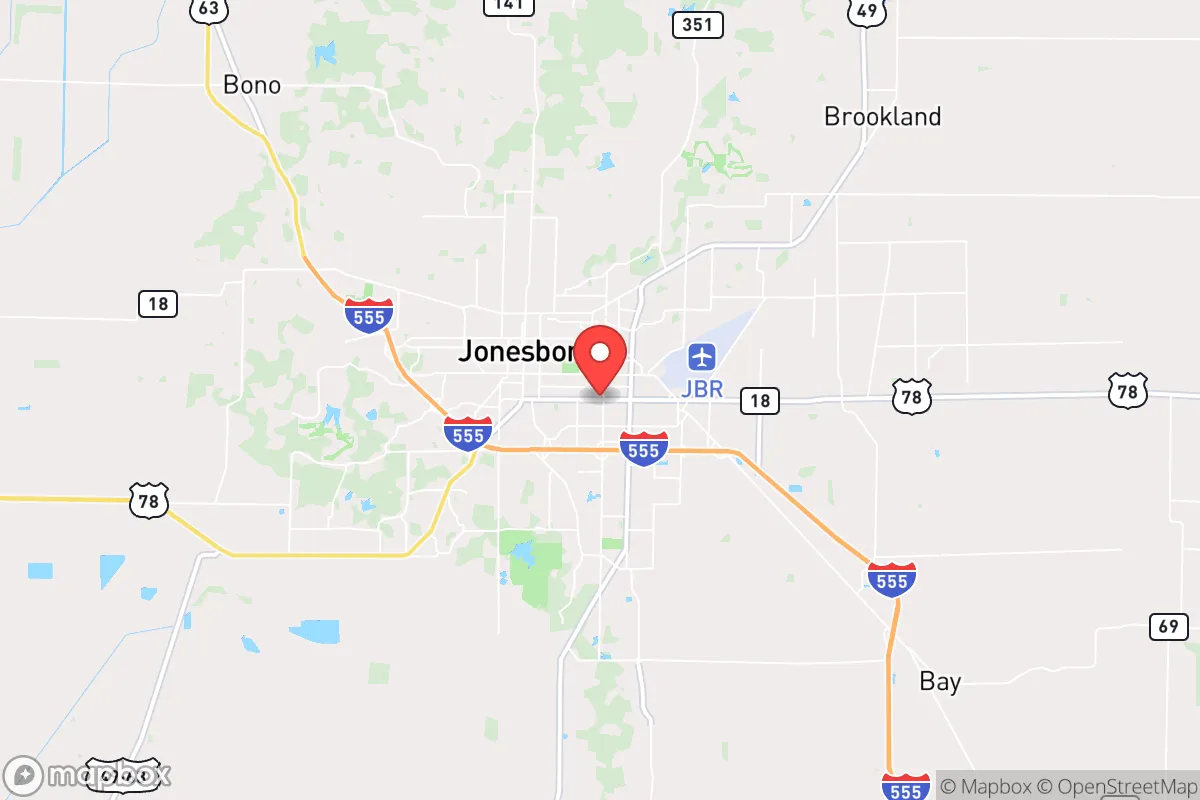
Jonesboro, Arkansas, sits in a sweet spot for the prepper-minded relocator: far enough from the nation's power centers to avoid the worst of any cascading collapse, yet close enough to the Mississippi River and Interstate 55 to maintain critical supply lines if the grid holds. This northeast Arkansas hub of roughly 80,000 people has grown steadily over the past decade, but it hasn't attracted the kind of explosive, unmanageable growth that strains infrastructure and invites chaos. For someone looking to plant roots in a place that can ride out a storm—literal or societal—Jonesboro offers a surprisingly solid foundation, with a low cost of living and a population that still largely values self-reliance over government dependency.
Geographic position and natural advantages for long-term stability
Jonesboro's location is its first and strongest card. It sits on Crowley's Ridge, a geological formation that rises 100 to 200 feet above the flat Mississippi Delta, giving it natural drainage advantages and slightly higher ground than the flood-prone farmlands to the east and west. That ridge also means the soil is loamy and well-drained, not the heavy clay that turns into a quagmire after a week of rain. The area is surrounded by hundreds of thousands of acres of agricultural land—rice, soybeans, corn, and cotton—which means local food production is not a theoretical backup plan but an ongoing reality. Within a 50-mile radius, you have the Mississippi River to the east, the White River to the west, and the St. Francis River to the south, providing multiple water sources for those who know how to treat and store it. The climate is humid subtropical, with hot summers and mild winters, so year-round gardening is feasible with some season extension. For a relocator thinking in decades, not just election cycles, this is a place where the land itself can sustain you if the supply chains falter.
Risks, exposures, and proximity to fallout-relevant landmarks
No place is a fortress, and Jonesboro has its vulnerabilities. The biggest concern is proximity to the New Madrid Seismic Zone, which runs roughly 100 miles to the east along the Mississippi River. A major earthquake there—and geologists say it's overdue for a 7.0+ event—would rattle Jonesboro with strong shaking and could disrupt rail lines, natural gas pipelines, and the river barge traffic that moves a huge portion of the nation's grain and fuel. The city itself is not in a floodplain, but the surrounding lowlands would be inundated if levees fail, potentially cutting off road access to Memphis (70 miles south) and St. Louis (180 miles north). On the human-caused risk side, Jonesboro is not near any major military installations, nuclear power plants, or obvious terrorist targets. The closest significant fallout-relevant landmark is the Arkansas Nuclear One plant near Russellville, about 150 miles west—far enough that a plume would be diluted before reaching Jonesboro, but close enough to monitor. The city's biggest exposure is its reliance on two major highways: US-63 and US-49. Both are two-lane roads in many stretches, and a single bridge failure or bottleneck could turn a bug-out scenario into a traffic nightmare. For the prepper, the takeaway is that Jonesboro is low-risk for direct attack but moderate-risk for natural disaster and infrastructure disruption—a trade-off that favors those who stock supplies and plan alternate routes.
Practical resilience for a relocator: food, water, energy, and defensibility
Jonesboro's practical resilience comes down to four pillars, and it scores well on three of them. Food is the strongest: the city is the commercial hub for the Arkansas Delta, one of the most productive agricultural regions in the country. Local farmers' markets operate from April through October, and the surrounding counties have dozens of u-pick operations for berries, peaches, and vegetables. For the serious prepper, buying a few acres just outside the city limits (prices are still under $5,000 per acre for raw land) puts you within walking distance of working farms. Water is adequate but requires planning. Jonesboro draws its municipal water from the Alluvial Aquifer and the Crowley's Ridge Aquifer, both of which are reliable but not infinite. A well on your property is the gold standard here, and drilling costs are reasonable—around $15-$25 per foot. Energy is a mixed bag. The grid is served by Entergy Arkansas and Craighead Electric, and outages happen during thunderstorms and ice storms, typically lasting a few hours to a day. Solar is viable (the area gets about 215 sunny days per year), but net metering policies are not as favorable as in states like Texas or Oklahoma. Defensibility is where Jonesboro shines for the solo relocator or small family. The city is compact—you can drive across it in 15 minutes—and the surrounding terrain is open farmland, which means long sightlines and few places for an organized threat to mass undetected. The local culture is still heavily rural and gun-friendly; Craighead County has a strong tradition of hunting and sport shooting, and there are multiple gun ranges and clubs within a 30-minute drive. For the prepper who values community over isolation, Jonesboro's population is small enough that you can know your neighbors but large enough that you're not a target for every passing stranger.
The overall strategic picture for Jonesboro is one of moderate risk with high self-reliance potential. It's not a bug-out location for a total societal collapse—the New Madrid fault and the reliance on a few highways are real liabilities—but for the relocator who wants to build a sustainable life while staying prepared for the worst, it offers a rare combination of affordable land, local food production, and a culture that still respects individual preparedness. The city's growth has been steady but not frantic, and the political climate in northeast Arkansas leans heavily conservative, which means local governance is unlikely to impose the kind of restrictions that hamper prepping activities. If you're looking for a place to hunker down and ride out the next decade of uncertainty, Jonesboro deserves a serious look—just make sure you've got a good well, a solid pantry, and a map of the back roads that bypass the main highways.
* Values derived from national, state, county, city and local statistics and may differ in a specific area. Last updated: 2026-04-30T01:04:32.000Z
Narrative content on this page is AI-generated and may contain mistakes. Verify any details that matter before acting on them.
ReloMaps may earn a commission from affiliate links at no extra cost to you.