Photo: Wikipedia
Strategic Assessment of Kenner, LA
Multiple tactical vulnerabilities. Population density, target proximity, or disaster risk are likely compounding. A retreat property and exit planning is required.
What does the Strategic Assessment tell us?
Our Strategic Assessment grades tactical survivability of an area. Major population centers, military targets, fallout zones, natural disasters, and border exposure all drive risk — lower exposure means a more defensible position in a crisis.
This is heavily inspired by Joel Skousen's Strategic Relocation book. Highly recommended you checkout the book ($)What does this tell us?
Our Strategic Assessment grades tactical survivability of an area. Major population centers, military targets, fallout zones, natural disasters, and border exposure all drive risk — lower exposure means a more defensible position in a crisis.
This is heavily inspired by Joel Skousen's Strategic Relocation book. Highly recommended you checkout the book ($)Strategic Pillars

Key Distances
Regional Safe Places
Below is our recommended "safe zones" in Louisiana and the surrounding area based on our strategic heuristics. For most people, it's unrealistic to live in a “safe zone” full-time due to work, family or other personal reasons. They tend to be more rural. However, many of these areas are perfect for second homes and retreat properties that double as a vacation home or even a short-term rental.

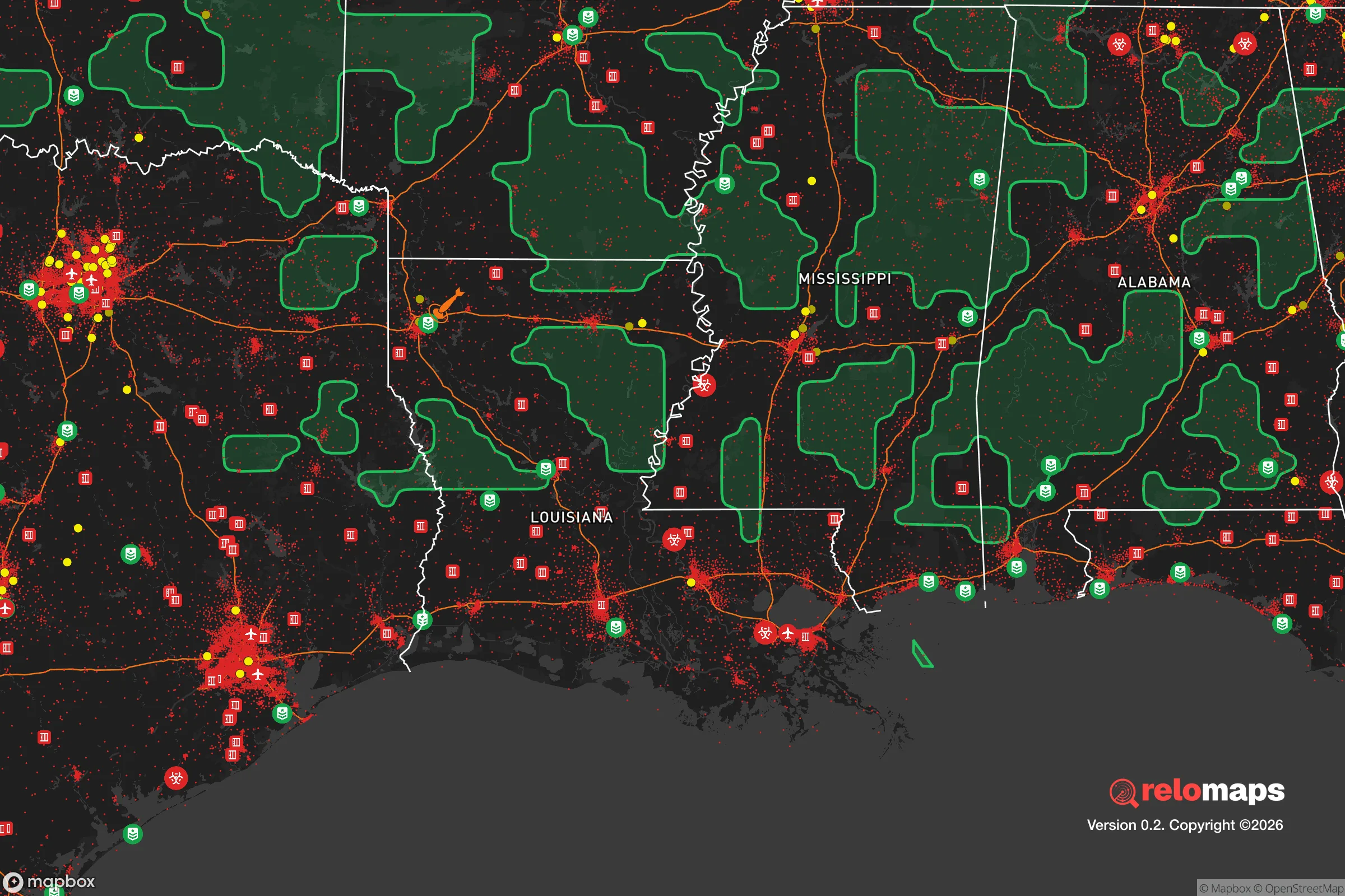
Important Note: For informational purposes only. This does not mean nothing bad ever happens in the green zones. Please use common sense. This is based on public data and modeled with AI. We tried to take a conservative approach but mistakes happen. We update this regularly as new information becomes available.
Solar Generator Recommendations
Backup power matters more here than in safer locations. We've picked three solar generators across budgets and capacity tiers — start with the budget unit if you only need a few essentials, or step up if you want to run a fridge and HVAC for days at a time.

Jackery Portable Power Station Explorer 300
Budget OptionPower on the Go: Weighing only 11 lbs, it's convenient to set up and store with book-sized foldable solar panels

BLUETTI Portable Power Station AC180
Designed for both indoor and outdoor scenarios, AC180 is highly capable as it has a robost capacity and continuous output power.

EF ECOFLOW DELTA Pro Ultra Power Station
Upgraded PickEcoFlow DELTA Pro Ultra is a whole-home energy system designed to grow with your family. Integrated with the Smart Home Panel 2, it scales to meet your evolving energy needs — keeping your home powered, intelligent, and secure through every stage of life.
We earn a commission, at no additional cost to you.
Strategic Assessment Analysis
Kenner, Louisiana, presents a complex strategic picture for the conservative prepper or survivalist. Its location directly adjacent to New Orleans and its international airport offers immediate access to resources, but that same proximity is a double-edged sword in a crisis. The city’s resilience is tied to its ability to function as a logistical node, yet its low elevation, flood risk, and position near high-value targets make it a location that demands serious, sober assessment rather than blind optimism. For the single individual or family looking to ride out a long-term disruption, Kenner is a place where you must be prepared to leave quickly or hunker down with a robust, self-sufficient plan.
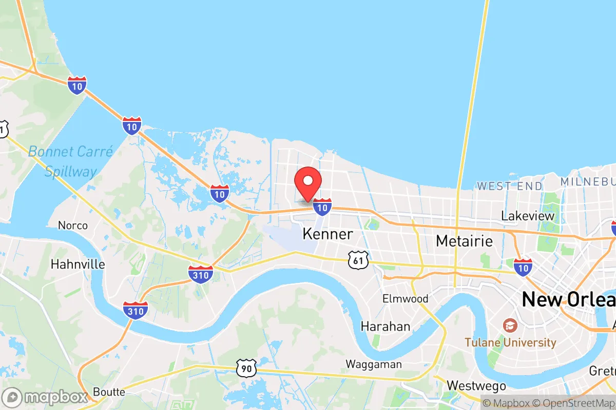
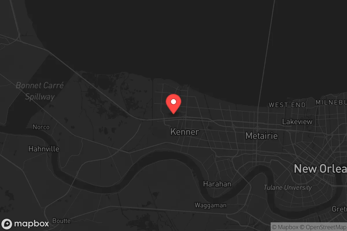
Geographic position and natural advantages for long-term survival
Kenner sits on the east bank of the Mississippi River, roughly 10 miles west of downtown New Orleans. This puts it in a unique position: it’s close enough to the economic engine of the region but far enough to avoid the worst of the urban core’s immediate chaos. The Mississippi River provides a massive, reliable water source—critical for filtration and transport if roads become impassable. The city’s grid is relatively flat and dense, which is a disadvantage for defensibility but an advantage for mobility via bike or on foot in a grid-down scenario. The nearby Bonnet Carré Spillway, about 15 miles upriver, is a critical flood-control structure that, if opened, can divert water away from Kenner, reducing catastrophic flood risk during a hurricane. However, the area’s natural advantages are limited. The soil is poor for agriculture, and the humid subtropical climate means heat, humidity, and mosquitoes are constant challenges. For a prepper, the river is the single greatest asset—it offers a route for evacuation or resupply that doesn’t rely on roads, and it’s a source of water that, with proper treatment, can sustain a household indefinitely.
Risks, exposures, and proximity to fallout-relevant landmarks
The most glaring risk for Kenner is its proximity to New Orleans and the Louis Armstrong New Orleans International Airport (MSY), which sits directly within the city limits. In a scenario involving civil unrest, a mass casualty event, or a coordinated attack, the airport becomes a primary target. A detonation or major incident there would create a fallout zone that could easily cover much of Kenner, depending on wind direction. The city is also within 20 miles of the Mississippi River’s industrial corridor—the “Chemical Corridor” between Baton Rouge and New Orleans—which is dotted with refineries, chemical plants, and storage facilities. A major industrial accident or sabotage at one of these sites could release toxic clouds or cause secondary explosions. Additionally, the city’s levee system, while improved after Hurricane Katrina, is still a single point of failure. A catastrophic levee breach during a hurricane or a deliberate act would flood large portions of Kenner within hours, turning streets into canals and making evacuation nearly impossible. For the survivalist, the key takeaway is that Kenner is within the blast radius—both literal and figurative—of multiple high-value targets. You are not in a remote, defensible position; you are in a suburban buffer zone that could become a disaster zone with little warning.
Practical resilience for a relocator: food, water, energy, and defensibility
For a relocator, Kenner’s practical resilience is a mixed bag. Water is abundant from the Mississippi, but it requires heavy filtration or chemical treatment—boiling alone won’t remove industrial contaminants. A Berkey or similar gravity-fed filter with a fluoride/chemical reduction element is non-negotiable. Food storage is challenging due to the humidity and heat; a basement is rare, so a cool, dry pantry or a root cellar is hard to achieve. You’ll need to rely on Mylar bags, oxygen absorbers, and a climate-controlled storage area. Local grocery stores are plentiful, but they’ll empty within hours of a crisis. Energy independence is difficult because the city is heavily grid-dependent. Solar panels are viable, but the frequent cloud cover and hurricane winds mean you need a robust battery bank and a backup generator with a fuel supply that won’t go bad in the heat. Natural gas is piped in, but a grid failure could cut that supply. Defensibility is poor in a standard suburban home. The lots are small, the houses are close together, and there are few natural chokepoints. A corner lot with a fence and a clear line of sight to the street is your best bet, but you’re still vulnerable to neighbors and passersby. The best strategy is to establish a “safe room” or a hardened interior space with supplies, and to have a pre-planned evacuation route to a secondary location—preferably north of Lake Pontchartrain or into rural Mississippi. Community resilience is weak in a transient, airport-adjacent suburb. You won’t find the tight-knit, self-reliant networks of a rural town. You’ll need to build your own network of like-minded individuals, which is possible but takes time and trust.
The overall strategic picture for Kenner is that it is a high-risk, moderate-reward location for a conservative prepper. It offers logistical advantages—proximity to the river, the airport, and major highways—but those same advantages make it a target and a chokepoint. If you are a single individual or a family with a strong plan, a well-stocked bug-out bag, and a secondary location ready, Kenner can work as a temporary base. But it is not a long-term survival haven. The city’s vulnerability to flooding, industrial accidents, and fallout from nearby targets means you are betting on being able to leave before the worst hits. For those who want to stay and defend, the lack of defensible terrain and the dense population make it a losing proposition. The smart play is to treat Kenner as a forward operating base—a place to work, build resources, and monitor the situation, but with a clear exit strategy. If you’re looking for a place to ride out the collapse of the system, look further north or west. Kenner is for those who want to be close to the action but smart enough to know when to get out.
* Values derived from national, state, county, city and local statistics and may differ in a specific area. Last updated: 2026-04-23T04:59:15.000Z
Narrative content on this page is AI-generated and may contain mistakes. Verify any details that matter before acting on them.
ReloMaps may earn a commission from affiliate links at no extra cost to you.