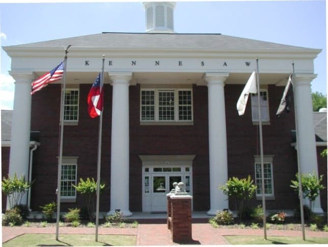
Photo: Wikipedia
Strategic Assessment of Kennesaw, GA
Meaningful friction. Expect exposure to either population pressure, blast zones, or natural disaster risk. Consider buying a retreat property.
What does the Strategic Assessment tell us?
Our Strategic Assessment grades tactical survivability of an area. Major population centers, military targets, fallout zones, natural disasters, and border exposure all drive risk — lower exposure means a more defensible position in a crisis.
This is heavily inspired by Joel Skousen's Strategic Relocation book. Highly recommended you checkout the book ($)What does this tell us?
Our Strategic Assessment grades tactical survivability of an area. Major population centers, military targets, fallout zones, natural disasters, and border exposure all drive risk — lower exposure means a more defensible position in a crisis.
This is heavily inspired by Joel Skousen's Strategic Relocation book. Highly recommended you checkout the book ($)Strategic Pillars

Key Distances
Regional Safe Places
Below is our recommended "safe zones" in Georgia and the surrounding area based on our strategic heuristics. For most people, it's unrealistic to live in a “safe zone” full-time due to work, family or other personal reasons. They tend to be more rural. However, many of these areas are perfect for second homes and retreat properties that double as a vacation home or even a short-term rental.


Important Note: For informational purposes only. This does not mean nothing bad ever happens in the green zones. Please use common sense. This is based on public data and modeled with AI. We tried to take a conservative approach but mistakes happen. We update this regularly as new information becomes available.
Solar Generator Recommendations
Backup power matters more here than in safer locations. We've picked three solar generators across budgets and capacity tiers — start with the budget unit if you only need a few essentials, or step up if you want to run a fridge and HVAC for days at a time.

Jackery Portable Power Station Explorer 300
Budget OptionPower on the Go: Weighing only 11 lbs, it's convenient to set up and store with book-sized foldable solar panels

BLUETTI Portable Power Station AC180
Designed for both indoor and outdoor scenarios, AC180 is highly capable as it has a robost capacity and continuous output power.

EF ECOFLOW DELTA Pro Ultra Power Station
Upgraded PickEcoFlow DELTA Pro Ultra is a whole-home energy system designed to grow with your family. Integrated with the Smart Home Panel 2, it scales to meet your evolving energy needs — keeping your home powered, intelligent, and secure through every stage of life.
We earn a commission, at no additional cost to you.
Strategic Assessment Analysis
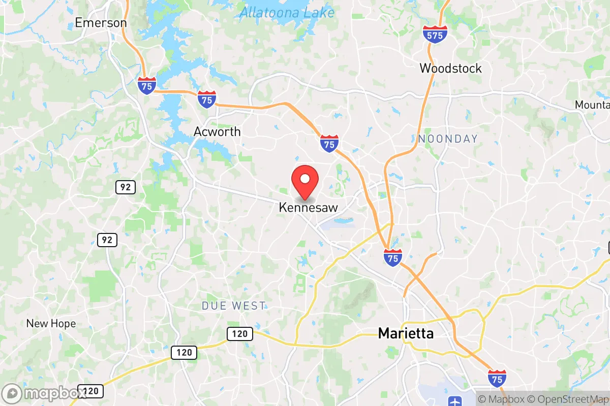
Kennesaw, Georgia, sits in a strategic sweet spot that few metro-adjacent towns can claim: close enough to Atlanta’s economic engine to sustain a robust local economy, yet far enough from the urban core to offer genuine resilience in a crisis. The city’s location in Cobb County, roughly 25 miles northwest of downtown Atlanta, places it outside the immediate blast radius of any major target, while still providing access to the logistical corridors of I-75 and I-575. For a relocator thinking in terms of long-term survival—whether from civil unrest, supply chain collapse, or a mass casualty event—Kennesaw’s geographic position, local governance, and community character offer a defensible base of operations that many other suburban towns simply cannot match.
Geographic position and natural advantages for long-term stability
Kennesaw’s most underrated asset is its topography. The city sits on the southern edge of the Appalachian foothills, with Kennesaw Mountain rising 1,808 feet above sea level. This elevation provides natural observation points and a degree of physical separation from the flatter, more exposed areas south toward Atlanta. The surrounding terrain is a mix of hardwood forest, rolling hills, and small creeks—ideal for watershed management and off-grid water sourcing. The area receives roughly 52 inches of rain annually, well above the national average, which means surface water and groundwater recharge are reliable even during drought years. For a prepper, that translates to fewer worries about well depletion or catchment failure. The local geology is predominantly granite and gneiss, which supports stable building foundations and limits the risk of landslides or sinkholes common in other parts of the Southeast. Additionally, the region sits outside the primary hurricane strike zone; while remnants of tropical systems can bring heavy rain, Kennesaw is over 200 miles from the Gulf Coast and 150 miles from the Atlantic, drastically reducing the risk of catastrophic wind damage or storm surge. The climate is humid subtropical, with mild winters and hot summers—growing seasons run from March to October, allowing for serious gardening and food production.
Risks, exposures, and proximity to fallout-relevant landmarks
No location is without vulnerabilities, and Kennesaw has a few that demand honest assessment. The most obvious risk is its proximity to Atlanta, a Tier 1 target for any adversary considering a strategic strike. Dobbins Air Reserve Base in Marietta, just 10 miles south, is a major logistics hub for the U.S. Air Force Reserve and houses the 94th Airlift Wing. Lockheed Martin’s Marietta facility, which builds the C-130 Hercules and performs F-35 sustainment work, sits less than 8 miles from Kennesaw’s city limits. Both are high-value military-industrial targets. A ground burst or airburst over either would likely produce fallout that could reach Kennesaw within hours, depending on wind direction. The prevailing winds in north Georgia are from the west and southwest, meaning a strike on Atlanta proper or Dobbins would push contamination northeast—away from Kennesaw in most scenarios. However, a strike on Lockheed or Dobbins with a southwest wind would be a different story. The city is also within 30 miles of two nuclear power plants: Plant Hatch (Baxley, GA) and Plant Vogtle (Waynesboro, GA) are farther out, but Plant Hatch is roughly 180 miles southeast—outside the immediate danger zone but worth noting for long-term fallout patterns. On the civil unrest front, Kennesaw’s location along I-75 means it sits on a primary evacuation route out of Atlanta. In a mass casualty event or major riot, that highway could become a choke point or a vector for looting. The city’s police department is well-funded and has a reputation for proactive enforcement, but a determined mob moving up from the city would still pose a threat. The 2016 and 2020 unrest in Atlanta demonstrated that spillover into Cobb County is possible, though Kennesaw itself remained largely quiet.
Practical resilience for a relocator: food, water, energy, and defensibility
For someone serious about self-sufficiency, Kennesaw offers a mix of suburban convenience and rural-adjacent capability. The city’s water supply comes from the Cobb County-Marietta Water Authority, which draws from the Chattahoochee River and Allatoona Lake. Allatoona Lake, about 10 miles north, is a 12,000-acre reservoir with a capacity of over 100 billion gallons—enough to sustain the region for months even in a drought. For a prepper, this means a well on your property is a smart backup, but even without one, the proximity to a major surface water source provides a fallback for filtration and purification. The local power grid is served by Georgia Power, which has a mixed generation portfolio including coal, natural gas, nuclear (Plant Vogtle), and hydro. Grid reliability is above average for the Southeast, but a determined adversary could still take out substations. Solar is viable: Kennesaw averages 218 sunny days per year, and net metering is available through Georgia Power, though the rates are not as favorable as in some western states. Battery storage and a backup generator are strongly recommended. Food production is feasible on standard suburban lots. The soil in Cobb County is primarily clay-based, which requires amendment for serious gardening, but raised beds and container gardening work well. The city’s zoning allows for backyard chickens and small livestock in most residential areas, though pigs and goats require more acreage. The local farmers’ market operates year-round, and there are multiple feed-and-seed stores within a 15-minute drive. For defensibility, Kennesaw’s layout is a mix of older neighborhoods with mature trees and newer subdivisions with cul-de-sacs. The older areas near the mountain offer better natural cover and more limited access points, making them easier to secure. The city’s gun culture is strong—Kennesaw famously passed a city ordinance in 1982 requiring heads of households to own a firearm, a law that remains on the books (though unenforced). This signals a community that takes personal defense seriously, which in a collapse scenario means neighbors are more likely to be armed and capable than in a typical suburban enclave.
The overall strategic picture for Kennesaw is one of calculated advantage. It is not a remote survivalist retreat—you will have neighbors, traffic, and the occasional noise from I-75. But for a relocator who wants to maintain a professional career while building a resilient home base, it strikes a rare balance. The risks from Atlanta’s target density are real but manageable with proper planning: a basement or interior safe room for fallout, a well-stocked pantry, and a bug-out route north toward the Blue Ridge Mountains. The community’s political leanings are reliably conservative—Cobb County voted +14 R in the 2024 presidential election—and local governance is generally pro-business and pro-Second Amendment. If the country faces a prolonged period of instability, Kennesaw offers a foothold in the Georgia Piedmont that is defensible, resource-rich, and connected enough to remain viable. It is not a bunker, but it is a solid base camp for the uncertain decades ahead.
* Values derived from national, state, county, city and local statistics and may differ in a specific area. Last updated: 2026-04-30T05:58:06.000Z
Narrative content on this page is AI-generated and may contain mistakes. Verify any details that matter before acting on them.
ReloMaps may earn a commission from affiliate links at no extra cost to you.