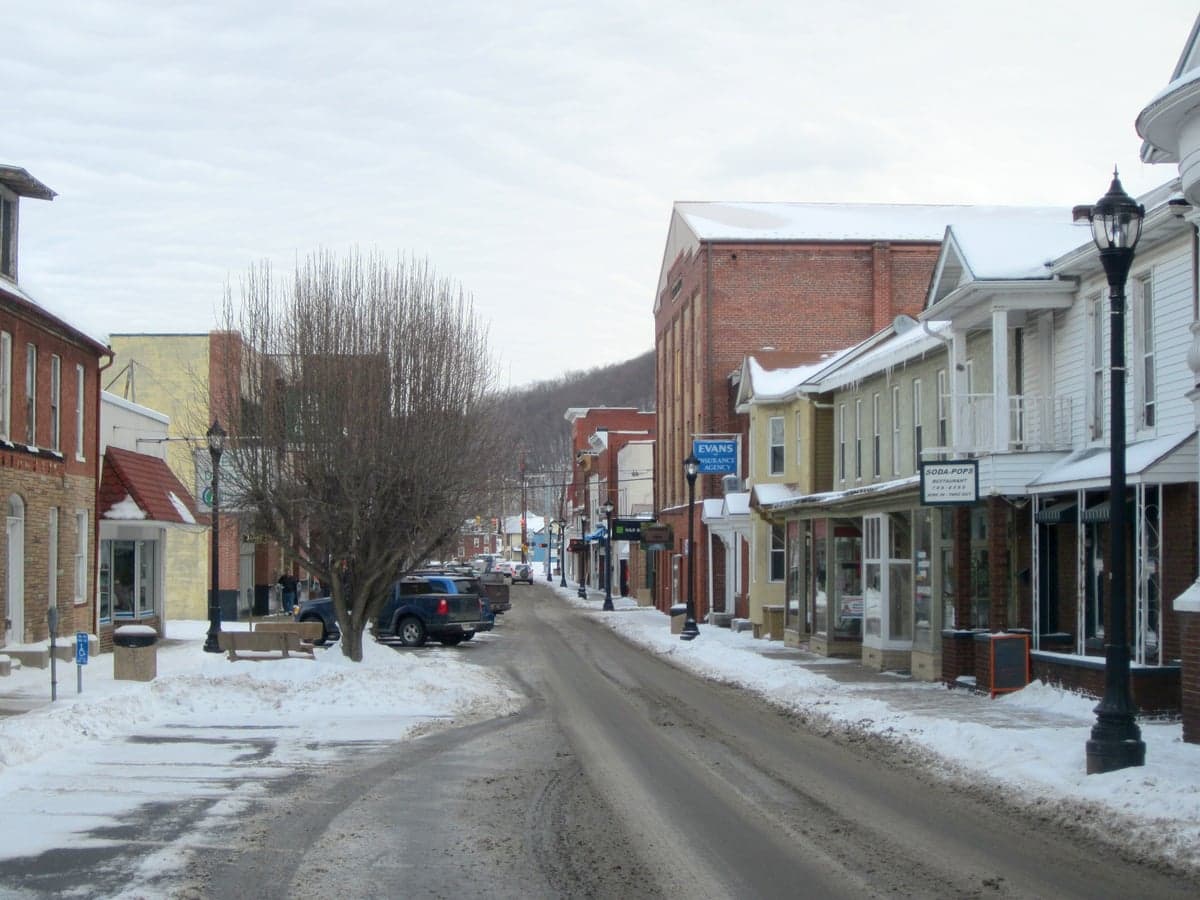
Photo: Wikipedia
Strategic Assessment of Keyser, WV
Meaningful friction. Expect exposure to either population pressure, blast zones, or natural disaster risk. Consider buying a retreat property.
What does the Strategic Assessment tell us?
Our Strategic Assessment grades tactical survivability of an area. Major population centers, military targets, fallout zones, natural disasters, and border exposure all drive risk — lower exposure means a more defensible position in a crisis.
This is heavily inspired by Joel Skousen's Strategic Relocation book. Highly recommended you checkout the book ($)What does this tell us?
Our Strategic Assessment grades tactical survivability of an area. Major population centers, military targets, fallout zones, natural disasters, and border exposure all drive risk — lower exposure means a more defensible position in a crisis.
This is heavily inspired by Joel Skousen's Strategic Relocation book. Highly recommended you checkout the book ($)Strategic Pillars

Key Distances
Regional Safe Places
Below is our recommended "safe zones" in West Virginia and the surrounding area based on our strategic heuristics. For most people, it's unrealistic to live in a “safe zone” full-time due to work, family or other personal reasons. They tend to be more rural. However, many of these areas are perfect for second homes and retreat properties that double as a vacation home or even a short-term rental.


Important Note: For informational purposes only. This does not mean nothing bad ever happens in the green zones. Please use common sense. This is based on public data and modeled with AI. We tried to take a conservative approach but mistakes happen. We update this regularly as new information becomes available.
Solar Generator Recommendations
Backup power matters more here than in safer locations. We've picked three solar generators across budgets and capacity tiers — start with the budget unit if you only need a few essentials, or step up if you want to run a fridge and HVAC for days at a time.

Jackery Portable Power Station Explorer 300
Budget OptionPower on the Go: Weighing only 11 lbs, it's convenient to set up and store with book-sized foldable solar panels

BLUETTI Portable Power Station AC180
Designed for both indoor and outdoor scenarios, AC180 is highly capable as it has a robost capacity and continuous output power.

EF ECOFLOW DELTA Pro Ultra Power Station
Upgraded PickEcoFlow DELTA Pro Ultra is a whole-home energy system designed to grow with your family. Integrated with the Smart Home Panel 2, it scales to meet your evolving energy needs — keeping your home powered, intelligent, and secure through every stage of life.
We earn a commission, at no additional cost to you.
Strategic Assessment Analysis
Keyser, West Virginia, sits in a narrow valley where the North Branch of the Potomac River cuts through the Allegheny Front, and its strategic value for a relocator with a prepper mindset comes down to one word: position. This is not a place that will ever be a target, a logistics hub, or a population magnet. It’s a hardscrabble former railroad town of roughly 5,000 people that has been economically irrelevant for decades, and that irrelevance is precisely its strength. For someone looking to ride out the next decade of potential civic unrest, supply chain collapse, or mass casualty events, Keyser offers a combination of geographic isolation, natural water, and low visibility that is increasingly rare east of the Mississippi. The trade-off is real: you are trading convenience and economic opportunity for a buffer zone that most Americans don’t even know exists.
Geographic position and natural defensive advantages of the Potomac Highlands
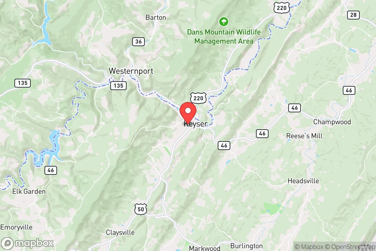
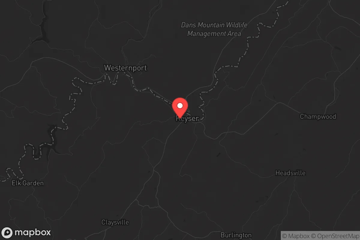
Keyser’s location is the single most important factor in its favor. It sits in Mineral County, hard against the Maryland border, roughly 130 miles west of Washington, D.C., and 60 miles south of the Pittsburgh metro area. That sounds close, but the terrain changes everything. The town is wedged into a valley surrounded by the Allegheny Mountains, with the only practical road access coming via U.S. Route 220 and West Virginia Route 46. Both are two-lane roads that wind through steep ridges and narrow hollows. In a scenario where major interstates like I-68 or I-81 become clogged or contested, Keyser is effectively a dead end. The mountains create a natural funnel: anyone approaching from the east has to cross the Savage River State Forest and the Dan’s Mountain Wildlife Management Area, which are essentially roadless wilderness. From the west, the approach is equally constrained by the Green Ridge State Forest. This makes the town inherently defensible against large-scale movement, whether that’s a refugee flow, a military convoy, or a roving group. The downside is that you are also constrained; resupply and evacuation are difficult. But for a prepared individual or family, that constraint is a feature, not a bug. The surrounding national forests—George Washington and Monongahela—provide a massive buffer zone of public land that is unlikely to see significant development or population pressure even in a crisis.
Risks, exposures, and proximity to fallout-relevant landmarks
No location is risk-free, and Keyser has specific vulnerabilities that a relocator must account for. The most obvious is the proximity to the Washington, D.C. metro area. While 130 miles is a significant distance, it is not far enough to be out of the fallout zone for a major nuclear event targeting the capital. Prevailing winds in this region are generally west-to-east, which means that a ground burst on D.C. would push fallout east toward the Atlantic, not west into the mountains. However, a high-altitude airburst or a secondary strike on the Fort Detrick biodefense labs in Frederick, Maryland (about 70 miles east) could produce unpredictable patterns. The real concern is not direct fallout but the secondary effects: a mass exodus from the Baltimore-Washington corridor would likely push up I-68 and U.S. 220, and Keyser sits right on that potential flow. The town has no infrastructure to handle a sudden population surge, and the local hospital, Potomac Valley Hospital, is a small critical-access facility with limited capacity. There is also the issue of the nearby Mount Storm Power Station, a coal-fired plant about 30 miles south. While not a nuclear facility, it is a large industrial target in its own right, and its coal ash ponds have been a long-standing environmental concern. On the plus side, there are no major military bases, nuclear power plants, or chemical storage facilities within a 50-mile radius. The closest nuclear plant is the now-closed Three Mile Island, over 100 miles northeast. For a prepper, the risk profile is manageable: the primary threat is human movement, not direct destruction.
Practical resilience for a relocator: food, water, energy, and defensibility
Keyser’s practical resilience is mixed, and you need to go in with eyes open. Water is the strongest asset. The North Branch Potomac River runs right through town, and the surrounding mountains are riddled with springs and small streams. The local water utility draws from the river, but any prepper should have a plan for independent water collection and filtration. The area receives roughly 40 inches of rain per year, and the forested slopes provide natural catchment. Food is a harder problem. Mineral County is not agricultural country; the soil is thin and rocky, and the growing season is short (roughly 140 frost-free days). You will not be self-sufficient on a suburban lot. The best strategy is to establish relationships with local farmers in the more fertile areas of the South Branch Valley, about 20 miles south, or to stockpile long-term storage food. The local grocery options are limited to a Food Lion and a Save-A-Lot; supply chain disruptions will hit these stores hard and fast. Energy is workable. The area has abundant hardwood for heating, and the mountainous terrain is suitable for small-scale hydro or solar, though winter cloud cover can reduce solar output significantly. Most homes in the area still use oil or propane for heating, so a prepper should plan for a wood stove as a primary backup. Defensibility is excellent at the micro level. The town itself is compact, with a few main roads and many dead-end side streets. The surrounding hollows offer numerous retreat properties that are invisible from any main road. The local population is small, aging, and generally self-reliant; there is a strong culture of hunting and firearms ownership. The Mineral County Sheriff’s Office is understaffed, so in a prolonged crisis, you are largely on your own. That is either a comfort or a concern, depending on your mindset.
The overall strategic picture for Keyser is that of a quiet, low-signature location that offers genuine geographic protection but demands serious self-sufficiency. It is not a place to wait out a short-term emergency; it is a place to relocate to if you believe the next decade will bring sustained instability. The isolation that makes it attractive also means you will have limited access to medical care, specialized supplies, and economic opportunity. For a single individual or a family willing to put in the work—learning to hunt, process firewood, maintain a well, and store a year’s worth of food—Keyser provides a defensible base of operations that is close enough to the Eastern Seaboard to monitor events but far enough to avoid the initial shockwave. The conservative, rural culture is a genuine match for the prepper ethos: people keep to themselves, mind their own business, and are generally armed. If your goal is to be off the grid and off the radar, this is one of the better options in the Mid-Atlantic. Just don’t expect any help to arrive quickly. That’s the point.
* Values derived from national, state, county, city and local statistics and may differ in a specific area. Last updated: 2026-05-01T05:18:21.000Z
Narrative content on this page is AI-generated and may contain mistakes. Verify any details that matter before acting on them.
ReloMaps may earn a commission from affiliate links at no extra cost to you.