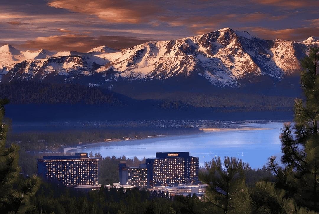
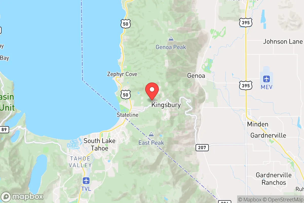
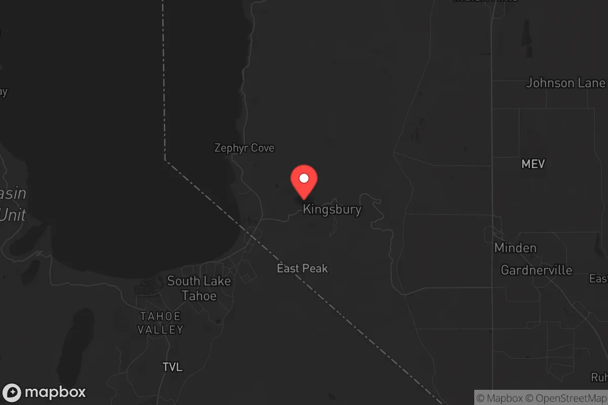
Strategic Assessment of Kingsbury, NV
Workable tactical position. Some exposure to population density or targets, but generally defensible in a crisis.
What does the Strategic Assessment tell us?
Our Strategic Assessment grades tactical survivability of an area. Major population centers, military targets, fallout zones, natural disasters, and border exposure all drive risk — lower exposure means a more defensible position in a crisis.
This is heavily inspired by Joel Skousen's Strategic Relocation book. Highly recommended you checkout the book ($)What does this tell us?
Our Strategic Assessment grades tactical survivability of an area. Major population centers, military targets, fallout zones, natural disasters, and border exposure all drive risk — lower exposure means a more defensible position in a crisis.
This is heavily inspired by Joel Skousen's Strategic Relocation book. Highly recommended you checkout the book ($)Strategic Pillars

Key Distances
Regional Safe Places
Below is our recommended "safe zones" in Nevada and the surrounding area based on our strategic heuristics. For most people, it's unrealistic to live in a “safe zone” full-time due to work, family or other personal reasons. They tend to be more rural. However, many of these areas are perfect for second homes and retreat properties that double as a vacation home or even a short-term rental.
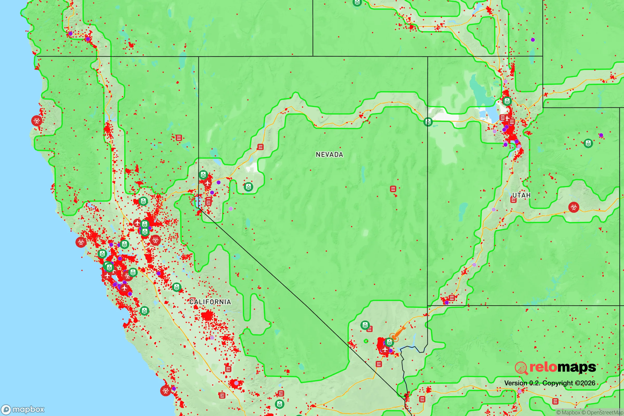
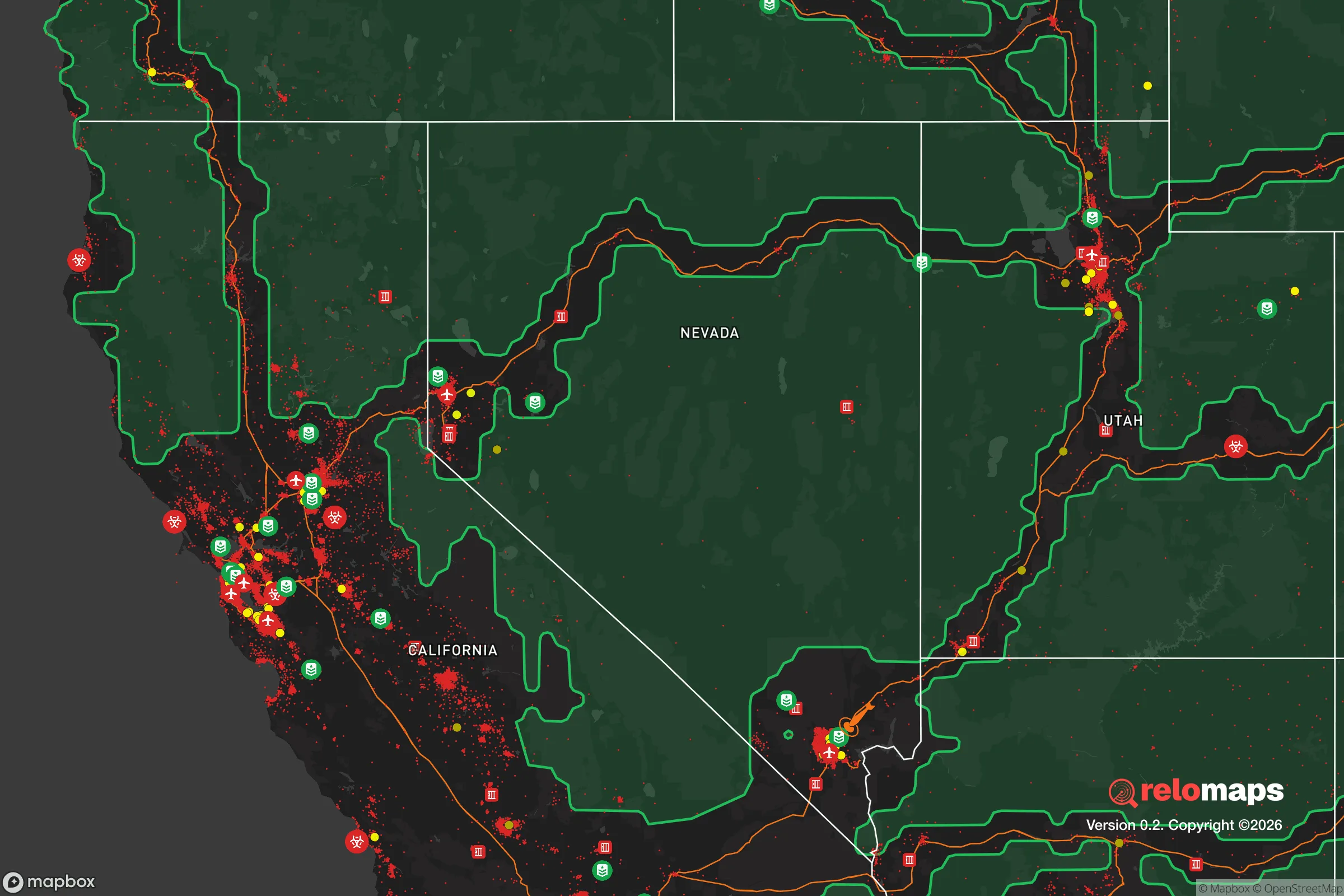
Important Note: For informational purposes only. This does not mean nothing bad ever happens in the green zones. Please use common sense. This is based on public data and modeled with AI. We tried to take a conservative approach but mistakes happen. We update this regularly as new information becomes available.
Solar Generator Recommendations
Backup power matters more here than in safer locations. We've picked three solar generators across budgets and capacity tiers — start with the budget unit if you only need a few essentials, or step up if you want to run a fridge and HVAC for days at a time.

Jackery Portable Power Station Explorer 300
Budget OptionPower on the Go: Weighing only 11 lbs, it's convenient to set up and store with book-sized foldable solar panels

BLUETTI Portable Power Station AC180
Designed for both indoor and outdoor scenarios, AC180 is highly capable as it has a robost capacity and continuous output power.

EF ECOFLOW DELTA Pro Ultra Power Station
Upgraded PickEcoFlow DELTA Pro Ultra is a whole-home energy system designed to grow with your family. Integrated with the Smart Home Panel 2, it scales to meet your evolving energy needs — keeping your home powered, intelligent, and secure through every stage of life.
We earn a commission, at no additional cost to you.
Strategic Assessment Analysis
Kingsbury, Nevada, sits in a narrow band of high-desert terrain that offers a rare combination of strategic depth and practical defensibility, making it a serious option for those thinking through long-term resilience in an unstable world. Located on the eastern slope of the Sierra Nevada range, roughly 10 miles south of South Lake Tahoe and 60 miles north of Carson City, this unincorporated community benefits from elevation, limited access points, and a low population density that naturally filters casual traffic. For a relocator prioritizing distance from urban collapse zones while maintaining access to critical supply routes, Kingsbury presents a compelling, if nuanced, case.
Geographic position and natural advantages for long-term security
Kingsbury’s primary strategic asset is its position along the Carson Range, with the community straddling U.S. Route 50 and Nevada State Route 207. The area sits at roughly 7,000 feet elevation, which provides natural surveillance over the valley below and forces any approaching traffic through a limited number of chokepoints. The surrounding Humboldt-Toiyabe National Forest and Lake Tahoe Basin Management Unit create a buffer of public land that is difficult to traverse quickly, reducing the likelihood of mass movement through the area during a crisis. Water is the single most critical resource in any survival scenario, and Kingsbury has an edge here: the community draws from groundwater wells and is adjacent to the Upper Truckee River watershed, with multiple small creeks and springs in the nearby backcountry. Snowmelt from the Sierra Nevada provides a reliable annual recharge, which is more than can be said for most of the Great Basin. The climate is four-season, with cold winters that naturally discourage transient populations and hot, dry summers that reduce mold and pest issues in stored supplies. For a prepper, the ability to control access, observe approaching threats, and secure a renewable water source is the foundation of any viable retreat location.
Risks, exposures, and proximity to fallout-relevant landmarks
No location is without vulnerabilities, and Kingsbury has several that demand honest assessment. The most obvious risk is its proximity to the Lake Tahoe Basin, a major tourist and second-home destination that swells to over 250,000 visitors during peak seasons. If a mass evacuation event occurs—whether from a Cascadia subduction zone earthquake, a major wildfire, or a coordinated attack on the West Coast—U.S. Route 50 and Interstate 80 become instant choke points. Kingsbury sits directly on one of the primary east-west corridors out of California, meaning that any large-scale exodus from the Sacramento or San Francisco Bay areas will push tens of thousands of people through the community’s front yard. The 2021 Caldor Fire evacuation demonstrated this reality: over 50,000 people were ordered to leave the Tahoe basin, and traffic on Route 50 was gridlocked for hours. Kingsbury itself was under evacuation warning, and the fire came within a few miles of the community. Beyond natural disasters, the area’s proximity to the Nevada National Security Site (formerly the Nevada Test Site), roughly 90 miles southeast, and the Hawthorne Army Depot, about 100 miles east, introduces a low-probability but high-consequence risk of fallout or secondary effects from a major incident at those facilities. The prevailing winds in the region are from the west and southwest, which means that any airborne contamination from the test site would generally move northeast, away from Kingsbury, but a shift in weather patterns or a ground-level release could change that calculus. For the serious prepper, the takeaway is that Kingsbury is not a remote bunker—it is a defensible position on a likely evacuation route, which requires a plan for managing transient populations and potential civil unrest during the first 72 hours of any major event.
Practical resilience for a relocator: food, water, energy, and defensibility
For someone looking to establish a long-term resilient household in Kingsbury, the practical considerations break down into four categories. Water is the strongest suit: private wells in the area typically produce at 5–15 gallons per minute from the underlying volcanic and granitic aquifers, and the annual snowpack provides a natural storage mechanism. A household with a 1,000-gallon cistern and a hand pump can secure a six-month supply without relying on municipal infrastructure. Food is a challenge. The growing season is short—roughly 90 days between last and first frost—and the soil is thin, rocky, and acidic. Raised beds with imported soil and a greenhouse are essentially mandatory for any serious gardening effort. Local game includes mule deer, black bear, and small game, but hunting pressure is moderate and regulations are strict. The nearest major grocery is a Safeway in South Lake Tahoe, 10 miles away, which is vulnerable to supply chain disruptions. Stockpiling a 12-month supply of shelf-stable food is the baseline recommendation. Energy is favorable: Kingsbury averages over 300 sunny days per year, and solar panels with battery storage are a viable primary power source. The area is not in a high-wind zone, so wind turbines are less practical. Wood heating is common, and the surrounding national forest provides a legal source of firewood with a permit. Defensibility is mixed. The community is laid out along a few main roads with numerous dead-end side streets, which limits approach vectors but also creates potential ambush points. Homes on the eastern slope have clear sightlines over the Carson Valley, allowing early warning of vehicle traffic approaching from below. However, the forested terrain provides cover for foot traffic, and a determined group could approach from multiple directions. A perimeter security plan—motion sensors, trail cameras, and a clear field of fire—is more important here than in open desert locations. The local law enforcement presence is Douglas County Sheriff’s Office, which has a substation in nearby Gardnerville but is stretched thin across a large rural county. Response times during a widespread event would likely be measured in hours, not minutes.
The overall strategic picture for Kingsbury is one of high potential paired with specific, manageable risks. It is not a place for someone seeking complete isolation—the proximity to the Tahoe tourist economy and the major evacuation corridor means that a relocator must be prepared for temporary influxes of people and the associated security challenges. But for a disciplined prepper who can secure water, store food, and harden a home against both weather and human threats, Kingsbury offers a defensible position with excellent natural resources and a climate that supports year-round habitation. The key is to treat it as a forward operating base, not a final redoubt: have a secondary plan for a deeper retreat into the interior of Nevada or Idaho if the West Coast corridor becomes permanently compromised. Kingsbury buys you time, elevation, and water—three things that are hard to find in combination anywhere else in the Great Basin.
* Values derived from national, state, county, city and local statistics and may differ in a specific area. Last updated: 2026-04-23T04:22:10.000Z
Narrative content on this page is AI-generated and may contain mistakes. Verify any details that matter before acting on them.
ReloMaps may earn a commission from affiliate links at no extra cost to you.