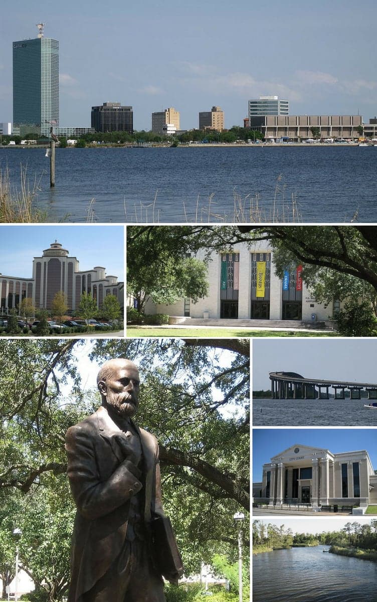
Photo: Wikipedia
Strategic Assessment of Lake Charles, LA
Meaningful friction. Expect exposure to either population pressure, blast zones, or natural disaster risk. Consider buying a retreat property.
What does the Strategic Assessment tell us?
Our Strategic Assessment grades tactical survivability of an area. Major population centers, military targets, fallout zones, natural disasters, and border exposure all drive risk — lower exposure means a more defensible position in a crisis.
This is heavily inspired by Joel Skousen's Strategic Relocation book. Highly recommended you checkout the book ($)What does this tell us?
Our Strategic Assessment grades tactical survivability of an area. Major population centers, military targets, fallout zones, natural disasters, and border exposure all drive risk — lower exposure means a more defensible position in a crisis.
This is heavily inspired by Joel Skousen's Strategic Relocation book. Highly recommended you checkout the book ($)Strategic Pillars

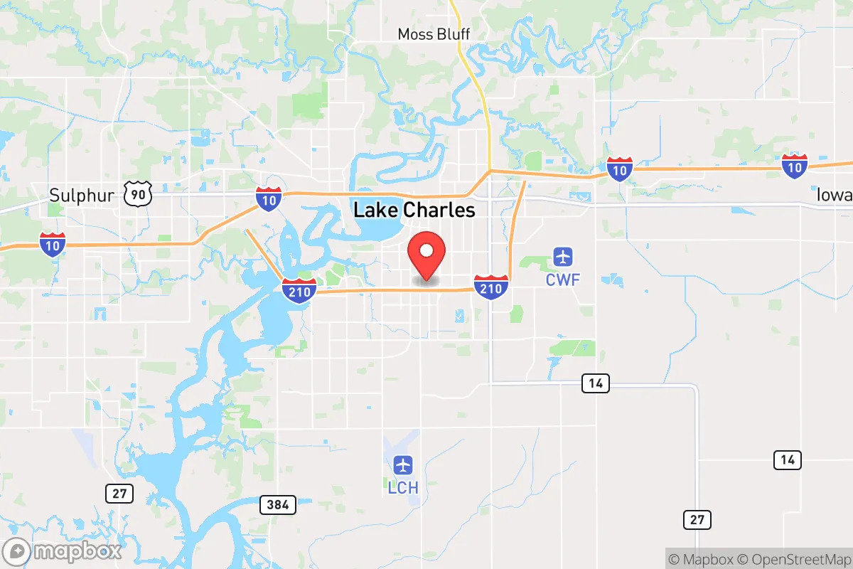
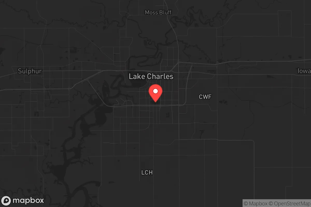
Key Distances
Regional Safe Places
Below is our recommended "safe zones" in Louisiana and the surrounding area based on our strategic heuristics. For most people, it's unrealistic to live in a “safe zone” full-time due to work, family or other personal reasons. They tend to be more rural. However, many of these areas are perfect for second homes and retreat properties that double as a vacation home or even a short-term rental.

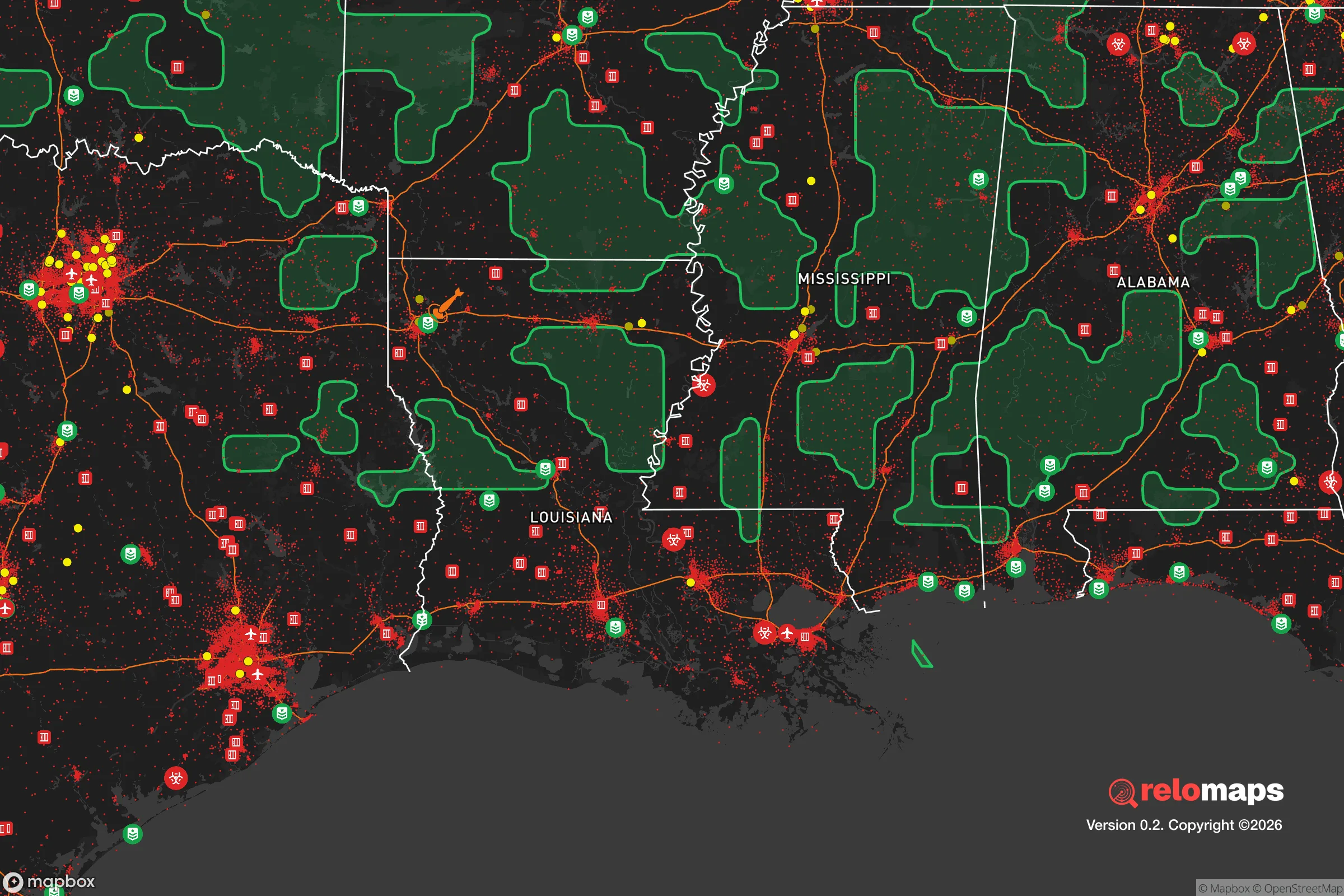
Important Note: For informational purposes only. This does not mean nothing bad ever happens in the green zones. Please use common sense. This is based on public data and modeled with AI. We tried to take a conservative approach but mistakes happen. We update this regularly as new information becomes available.
Solar Generator Recommendations
Backup power matters more here than in safer locations. We've picked three solar generators across budgets and capacity tiers — start with the budget unit if you only need a few essentials, or step up if you want to run a fridge and HVAC for days at a time.

Jackery Portable Power Station Explorer 300
Budget OptionPower on the Go: Weighing only 11 lbs, it's convenient to set up and store with book-sized foldable solar panels

BLUETTI Portable Power Station AC180
Designed for both indoor and outdoor scenarios, AC180 is highly capable as it has a robost capacity and continuous output power.

EF ECOFLOW DELTA Pro Ultra Power Station
Upgraded PickEcoFlow DELTA Pro Ultra is a whole-home energy system designed to grow with your family. Integrated with the Smart Home Panel 2, it scales to meet your evolving energy needs — keeping your home powered, intelligent, and secure through every stage of life.
We earn a commission, at no additional cost to you.
Strategic Assessment Analysis
Lake Charles, Louisiana, offers a surprisingly resilient strategic position for those prioritizing self-sufficiency and distance from major population centers, though it carries distinct trade-offs. Located roughly 125 miles east of Houston and 200 miles west of New Orleans, this city of roughly 78,000 sits in a sweet spot—close enough to access major medical and supply hubs in a crisis, yet far enough to avoid the immediate chaos of a metropolitan collapse. The area’s industrial backbone, centered on petrochemical refining and liquefied natural gas (LNG) export, provides a local energy surplus that few small cities can match, but the same infrastructure creates a unique set of exposure risks that demand careful consideration.
Geographic position and natural advantages for long-term stability
Lake Charles’s location in southwestern Louisiana, near the Texas border, places it in a corridor that has historically been a secondary evacuation route for Gulf Coast storms, which means road infrastructure is better than in many rural areas. The city sits on the Calcasieu River, a navigable waterway that connects to the Gulf Intracoastal Waterway, offering a potential supply chain alternative if trucking or rail are disrupted. The surrounding terrain is flat and marshy, which limits agricultural self-sufficiency but provides natural barriers to large-scale movement—swamps and bayous to the south and east act as chokepoints for anyone approaching from those directions. The climate is humid subtropical, with a growing season of roughly 250 days, allowing for year-round gardening if you can manage the heat and pests. For a relocator, the key advantage is the region’s low population density outside the city limits: Calcasieu Parish has about 205,000 people spread over 1,094 square miles, meaning you can find rural acreage within a 20-minute drive of town while still having access to a regional hospital (Lake Charles Memorial Health System) and a major airport (Lake Charles Regional Airport) for emergency extraction.
Risks, exposures, and proximity to fallout-relevant landmarks
The most significant strategic liability is the concentration of heavy industry within the city limits. Lake Charles is home to multiple petrochemical plants, including Sasol’s massive ethane cracker and LNG export terminal, as well as Phillips 66’s refinery and a cluster of chemical storage facilities. In a scenario involving civil unrest or a coordinated attack, these sites are obvious targets. A worst-case release of toxic chemicals—like chlorine or hydrogen fluoride—could render large portions of the city uninhabitable for days or weeks, depending on wind direction. The Calcasieu Ship Channel, which runs through the heart of the industrial corridor, is a potential chokepoint that could be sabotaged to disrupt barge traffic. Additionally, the city is only 30 miles from the Cameron LNG terminal on the coast, a high-value energy export facility that would be a prime target in any conflict involving energy infrastructure. For a prepper, the rule is simple: you want to live upwind and upstream of the industrial zone, ideally in the northern or western parts of the parish. The area is also in Hurricane Alley—Hurricane Laura (2020) and Hurricane Delta (2020) caused catastrophic damage, with Laura’s 150-mph winds leveling entire neighborhoods. Flooding is a perennial concern, with the Calcasieu River prone to overtopping its banks during heavy rain events. FEMA flood maps show that much of the city south of I-10 is in a 100-year floodplain, so any property purchase requires careful elevation review.
Practical resilience for a relocator: food, water, energy, and defensibility
On the energy front, Lake Charles is arguably one of the best-positioned small cities in the country. The local grid is fed by natural gas plants and has redundant connections to the Texas grid (ERCOT) and the Eastern Interconnection, meaning power outages from regional failures are less likely than in isolated rural areas. The abundance of natural gas means that a relocator with a backup generator and a propane tank can maintain indefinite off-grid power, and the local climate allows for solar panels to produce meaningful output even in winter (average 5.2 peak sun hours per day). Water is a mixed bag: the Calcasieu River provides a surface water source, but it’s brackish downstream from the saltwater intrusion line, so well water is preferable. The area sits atop the Chicot Aquifer, a large freshwater source that supplies most rural homes, but well depths of 200-400 feet are typical, and drilling costs run $5,000-$10,000. For food, the local agricultural scene is limited—rice, soybeans, and crawfish are the main crops—but the proximity to the Gulf means seafood is abundant and cheap if you’re willing to fish or trap. The city has a strong hunting culture (deer, waterfowl, wild hogs), and public land access is available through the Sabine National Wildlife Refuge and the Kisatchie National Forest, both within an hour’s drive. Defensibility is the weak point: the flat terrain offers no natural high ground, and the dense tree cover along waterways provides cover for anyone approaching. A rural property with a clear field of fire and a single access road is ideal, but such parcels are rare and expensive (expect $5,000-$10,000 per acre for improved land). The local law enforcement presence is thin—Calcasieu Parish Sheriff’s Office has about 200 deputies for the entire parish, meaning response times in rural areas can exceed 30 minutes. Community resilience is decent: the area has a strong Cajun culture of mutual aid and self-reliance, and there are active prepper and survivalist groups in the region, though they tend to be low-key and invitation-only.
The overall strategic picture for Lake Charles is one of high potential reward paired with equally high risk. For a relocator willing to invest in a property outside the industrial plume zone and above the floodplain, the area offers a rare combination of energy independence, water access, and proximity to major supply routes without the population density that makes a city a target. The petrochemical infrastructure is a double-edged sword—it provides local jobs and energy security but also creates a single point of failure that could turn a regional crisis into a local catastrophe. If you can stomach the hurricane risk and the industrial exposure, Lake Charles is a viable long-term base for someone who wants to be within a day’s drive of Houston and New Orleans but not close enough to be caught in the initial wave of unrest. The key is to treat the city as a supply hub, not a refuge—live rural, stockpile for 90 days, and have a bug-out plan for the coast if a storm or industrial accident forces a temporary evacuation. For the conservative prepper looking for a balance between isolation and access, this is a solid B+ option—not perfect, but workable with the right preparation.
* Values derived from national, state, county, city and local statistics and may differ in a specific area. Last updated: 2026-04-23T05:00:08.000Z
Narrative content on this page is AI-generated and may contain mistakes. Verify any details that matter before acting on them.
ReloMaps may earn a commission from affiliate links at no extra cost to you.