Photo: Wikipedia
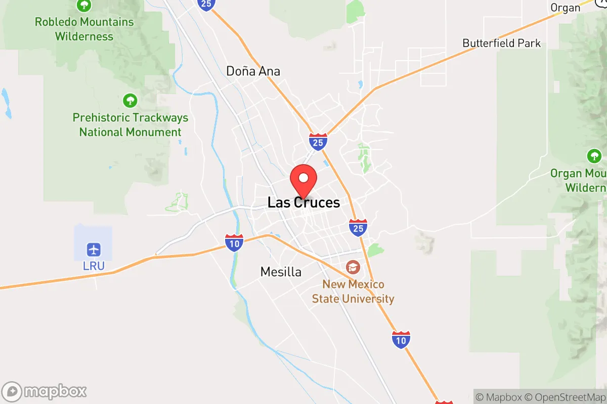
Strategic Assessment of Las Cruces, NM
Meaningful friction. Expect exposure to either population pressure, blast zones, or natural disaster risk. Consider buying a retreat property.
What does the Strategic Assessment tell us?
Our Strategic Assessment grades tactical survivability of an area. Major population centers, military targets, fallout zones, natural disasters, and border exposure all drive risk — lower exposure means a more defensible position in a crisis.
This is heavily inspired by Joel Skousen's Strategic Relocation book. Highly recommended you checkout the book ($)What does this tell us?
Our Strategic Assessment grades tactical survivability of an area. Major population centers, military targets, fallout zones, natural disasters, and border exposure all drive risk — lower exposure means a more defensible position in a crisis.
This is heavily inspired by Joel Skousen's Strategic Relocation book. Highly recommended you checkout the book ($)Strategic Pillars

Key Distances
Regional Safe Places
Below is our recommended "safe zones" in New Mexico and the surrounding area based on our strategic heuristics. For most people, it's unrealistic to live in a “safe zone” full-time due to work, family or other personal reasons. They tend to be more rural. However, many of these areas are perfect for second homes and retreat properties that double as a vacation home or even a short-term rental.

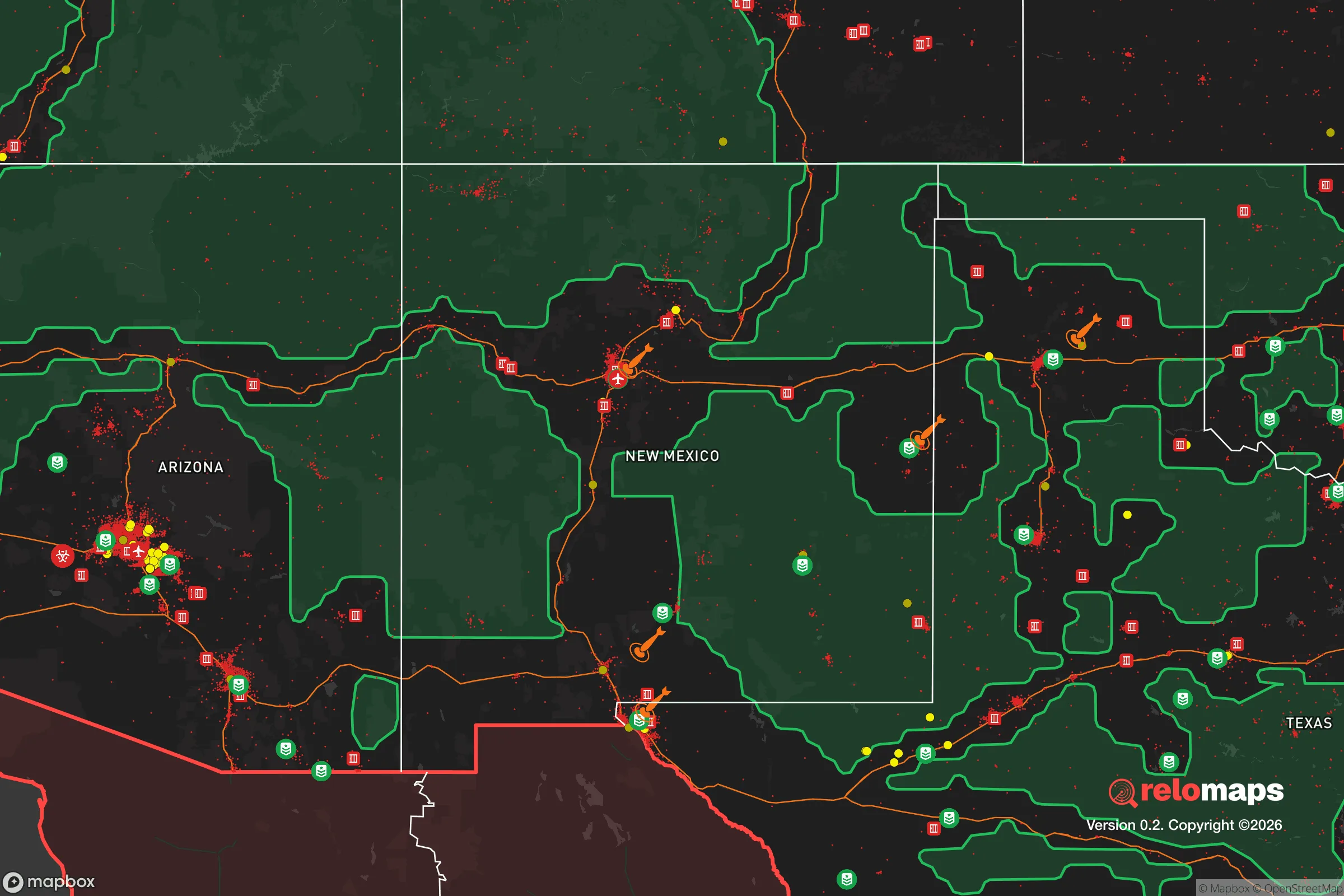
Important Note: For informational purposes only. This does not mean nothing bad ever happens in the green zones. Please use common sense. This is based on public data and modeled with AI. We tried to take a conservative approach but mistakes happen. We update this regularly as new information becomes available.
Solar Generator Recommendations
Backup power matters more here than in safer locations. We've picked three solar generators across budgets and capacity tiers — start with the budget unit if you only need a few essentials, or step up if you want to run a fridge and HVAC for days at a time.

Jackery Portable Power Station Explorer 300
Budget OptionPower on the Go: Weighing only 11 lbs, it's convenient to set up and store with book-sized foldable solar panels

BLUETTI Portable Power Station AC180
Designed for both indoor and outdoor scenarios, AC180 is highly capable as it has a robost capacity and continuous output power.

EF ECOFLOW DELTA Pro Ultra Power Station
Upgraded PickEcoFlow DELTA Pro Ultra is a whole-home energy system designed to grow with your family. Integrated with the Smart Home Panel 2, it scales to meet your evolving energy needs — keeping your home powered, intelligent, and secure through every stage of life.
We earn a commission, at no additional cost to you.
Strategic Assessment Analysis
Las Cruces, New Mexico, offers a surprisingly resilient strategic position for those prioritizing long-term security and self-sufficiency, sitting at the crossroads of the southern Rio Grande Valley and the Chihuahuan Desert. Its location—roughly 40 miles from the U.S.-Mexico border and 225 miles from both El Paso and Albuquerque—provides a buffer from the immediate chaos of major urban centers while still granting access to critical infrastructure. The city’s low population density (roughly 113,000 residents in the metro area) and arid climate reduce the risks of cascading failures common in dense, humid regions, making it a viable option for relocators seeking a defensible, resource-conscious base in an increasingly unstable national landscape.
Geographic position and natural advantages for long-term security
Las Cruces sits in the Mesilla Valley, flanked by the Organ Mountains to the east and the Rio Grande to the west, creating a natural choke point that limits approach vectors for potential threats. The surrounding terrain—open desert, rugged foothills, and agricultural bottomlands—offers multiple escape routes into the vast, sparsely populated expanses of southern New Mexico and West Texas. The region’s elevation (3,900 feet) and low humidity reduce the risk of flooding, hurricanes, and tornadoes, while the 350+ days of sunshine per year support off-grid solar energy generation. The Rio Grande, though heavily managed, provides a reliable surface water source for irrigation and basic needs, and the area’s deep aquifers (the Mesilla Basin) offer groundwater access for those willing to drill. For a relocator, this means a location that is naturally defensible, climatically stable, and resource-accessible—key traits for weathering prolonged disruptions.
Risks, exposures, and proximity to fallout-relevant landmarks
The most significant strategic liability is Las Cruces’ proximity to White Sands Missile Range (WSMR), located just 30 miles east. WSMR is a major Department of Defense facility involved in missile testing, space launch operations, and weapons development—including hypersonic and nuclear-related research. In a conflict scenario, this makes the area a potential target for kinetic or cyber attacks, though the range’s remote location and hardened infrastructure mitigate some risk. Additionally, the city lies within 50 miles of the U.S.-Mexico border, which introduces risks related to cartel activity, human trafficking, and sudden border closures that could disrupt supply chains. The nearby El Paso–Juárez metroplex (population 2.7 million) is a high-density, high-crime zone that could become a source of refugee flows or civil unrest. On the positive side, Las Cruces is far from major nuclear power plants (the nearest is Palo Verde in Arizona, 350 miles away) and large-scale chemical facilities, reducing the risk of industrial accidents or fallout. The area’s low seismic activity and minimal wildfire risk (due to sparse vegetation) further lower the probability of natural disasters. For a prepper, the calculus is clear: the military and border risks are real but manageable with proper planning, while the absence of dense urban targets and industrial hazards is a net positive.
Practical resilience for a relocator: food, water, energy, and defensibility
Las Cruces is one of the few places in the Southwest where a relocator can realistically achieve a degree of food and water independence. The Mesilla Valley is a major agricultural hub, producing pecans, chiles, onions, and cotton, with local farmers’ markets and co-ops providing direct access to fresh produce. The city’s water supply comes from the Rio Grande Project and the Mesilla Basin aquifer, both of which are managed by the Elephant Butte Irrigation District—a system that has operated for over a century. For off-grid setups, rainwater harvesting is feasible (average 9 inches of annual rainfall), and shallow wells can tap into the aquifer at depths of 100–300 feet. Solar energy is abundant: the region averages 5.5–6.0 peak sun hours per day, making it one of the best locations in the U.S. for photovoltaic systems. Battery storage and backup generators are recommended due to occasional grid strain from summer heat waves. Defensibility is strong: the city’s layout is spread out, with many neighborhoods on the outskirts offering clear sightlines and limited access points. The surrounding mountains (Organ Mountains-Desert Peaks National Monument) provide natural barriers and observation points, while the open desert to the east and south offers few hiding places for hostile actors. For a single individual or family, a rural property on the city’s fringe—say, near the town of Mesilla or along the Rio Grande—can be secured with basic perimeter measures and maintained with minimal outside support.
The overall strategic picture for Las Cruces is one of calculated trade-offs. It is not a bunker location—it has real exposure to military and border risks that require active mitigation, such as maintaining a go-bag, establishing a communication plan with trusted contacts, and diversifying supply routes. However, for a conservative-leaning relocator who values self-reliance, low population density, and access to natural resources, it offers a far more sustainable foundation than the coastal megacities or the politically volatile urban corridors of the interior. The city’s culture is a mix of traditional Southwestern independence and a growing libertarian streak, with a significant veteran and retiree population that tends to keep to themselves. The key is to treat Las Cruces as a base of operations, not a fortress: a place where you can build a resilient homestead, store supplies, and maintain a low profile while staying connected to regional networks in El Paso, Albuquerque, and the broader Southwest. In a world of increasing uncertainty, that kind of strategic flexibility—combined with the area’s natural advantages—makes Las Cruces a serious contender for anyone prioritizing long-term survival over short-term convenience.
* Values derived from national, state, county, city and local statistics and may differ in a specific area. Last updated: 2026-04-19T11:34:06.000Z
Narrative content on this page is AI-generated and may contain mistakes. Verify any details that matter before acting on them.
ReloMaps may earn a commission from affiliate links at no extra cost to you.