Photo: Wikipedia
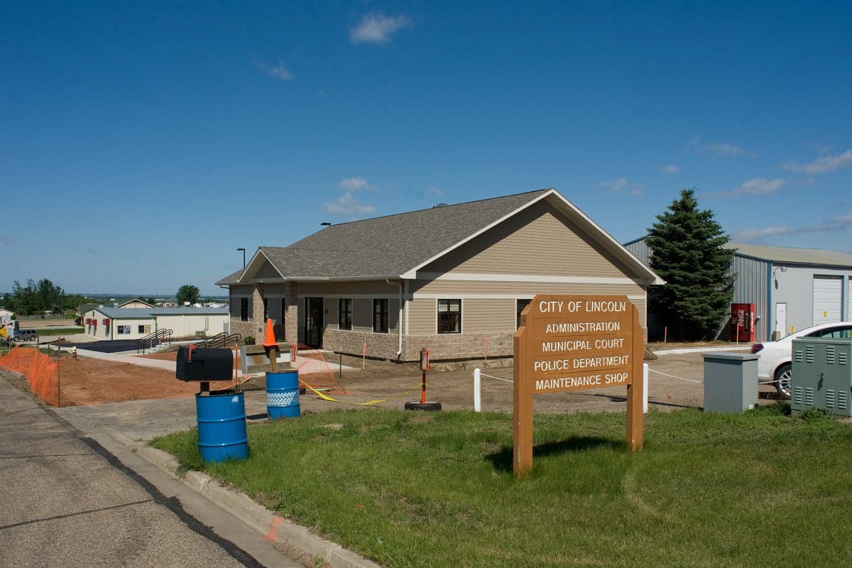
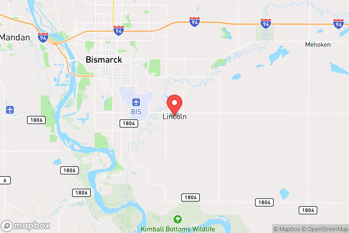
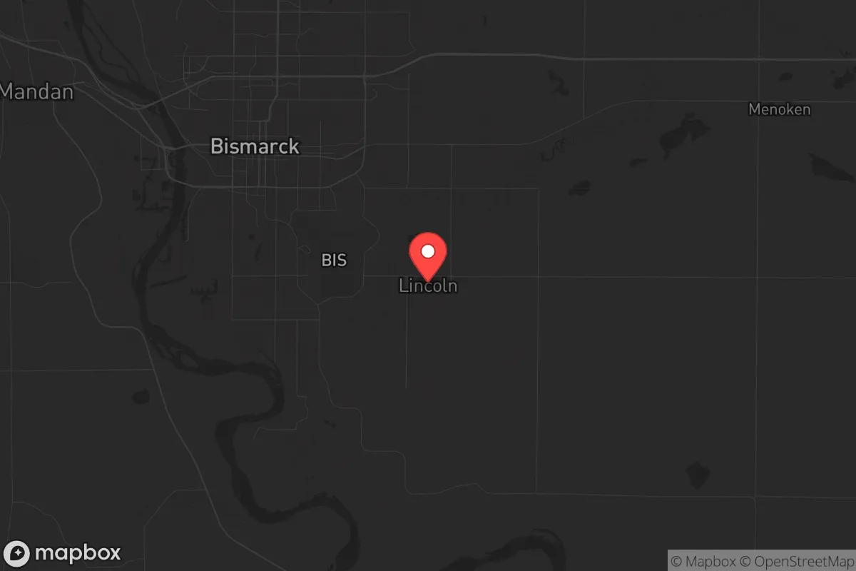
Strategic Assessment of Lincoln, ND
Workable tactical position. Some exposure to population density or targets, but generally defensible in a crisis.
What does the Strategic Assessment tell us?
Our Strategic Assessment grades tactical survivability of an area. Major population centers, military targets, fallout zones, natural disasters, and border exposure all drive risk — lower exposure means a more defensible position in a crisis.
This is heavily inspired by Joel Skousen's Strategic Relocation book. Highly recommended you checkout the book ($)What does this tell us?
Our Strategic Assessment grades tactical survivability of an area. Major population centers, military targets, fallout zones, natural disasters, and border exposure all drive risk — lower exposure means a more defensible position in a crisis.
This is heavily inspired by Joel Skousen's Strategic Relocation book. Highly recommended you checkout the book ($)Strategic Pillars

Key Distances
Regional Safe Places
Below is our recommended "safe zones" in North Dakota and the surrounding area based on our strategic heuristics. For most people, it's unrealistic to live in a “safe zone” full-time due to work, family or other personal reasons. They tend to be more rural. However, many of these areas are perfect for second homes and retreat properties that double as a vacation home or even a short-term rental.
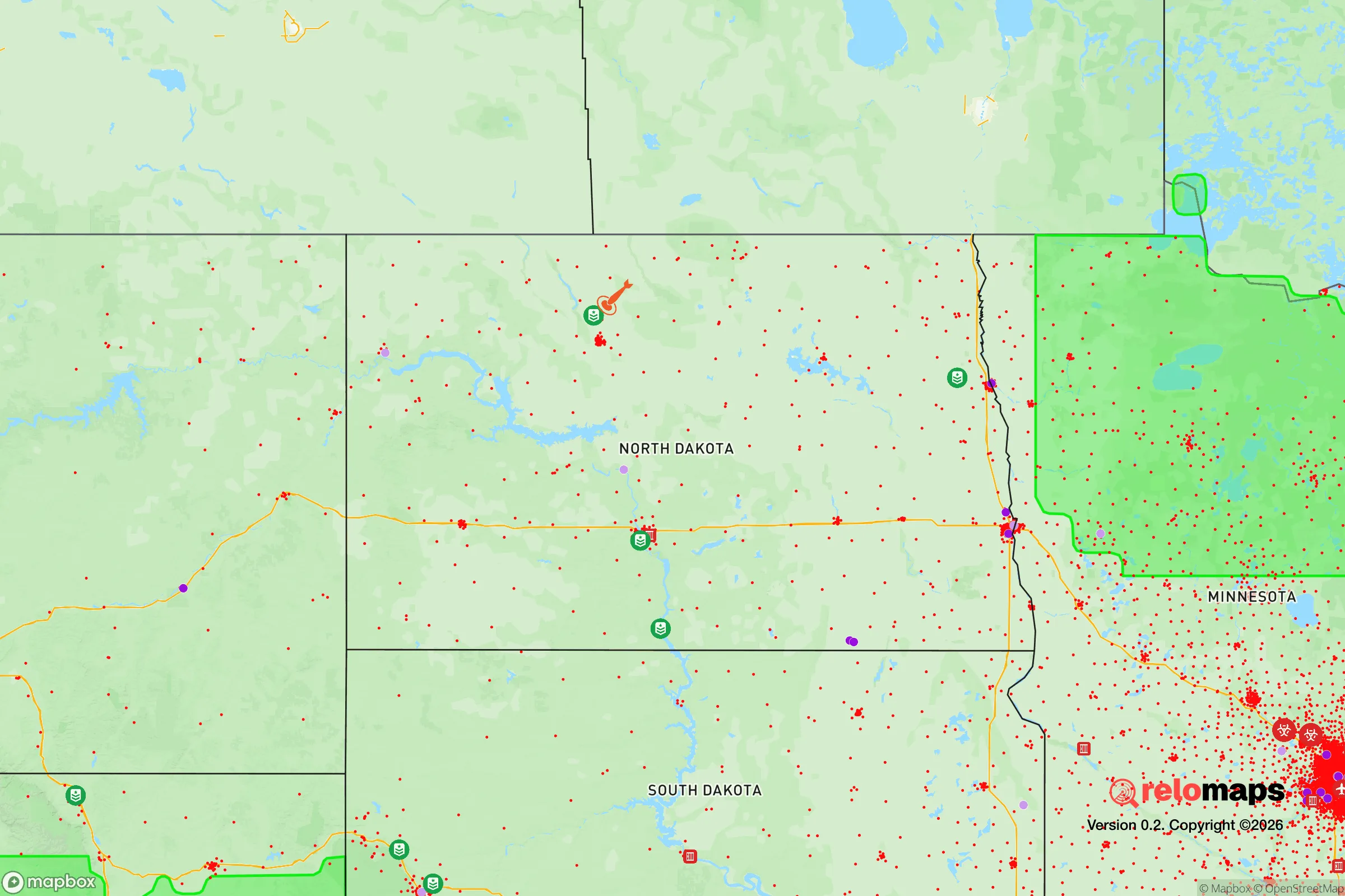
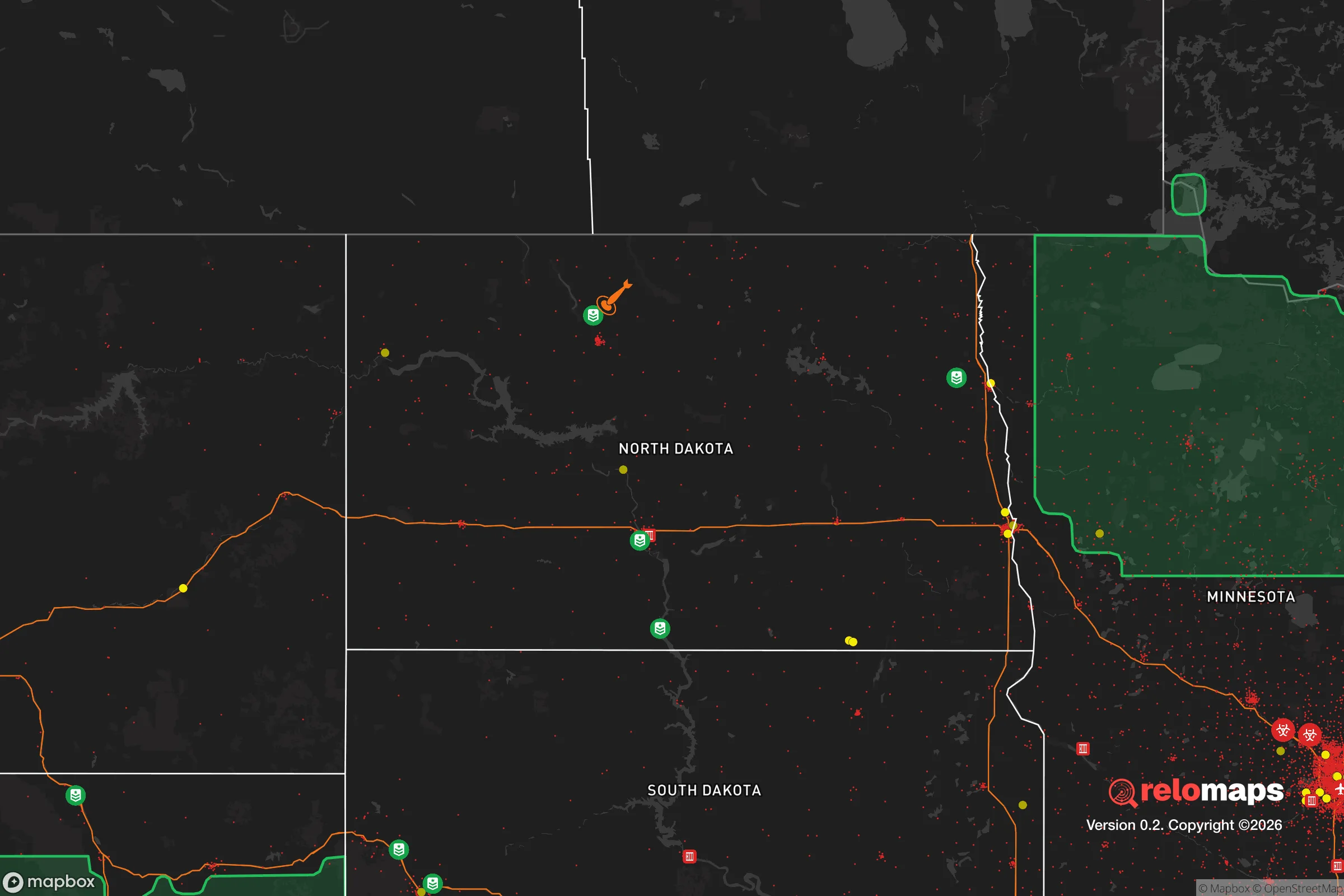
Important Note: For informational purposes only. This does not mean nothing bad ever happens in the green zones. Please use common sense. This is based on public data and modeled with AI. We tried to take a conservative approach but mistakes happen. We update this regularly as new information becomes available.
Solar Generator Recommendations
Backup power matters more here than in safer locations. We've picked three solar generators across budgets and capacity tiers — start with the budget unit if you only need a few essentials, or step up if you want to run a fridge and HVAC for days at a time.

Jackery Portable Power Station Explorer 300
Budget OptionPower on the Go: Weighing only 11 lbs, it's convenient to set up and store with book-sized foldable solar panels

BLUETTI Portable Power Station AC180
Designed for both indoor and outdoor scenarios, AC180 is highly capable as it has a robost capacity and continuous output power.

EF ECOFLOW DELTA Pro Ultra Power Station
Upgraded PickEcoFlow DELTA Pro Ultra is a whole-home energy system designed to grow with your family. Integrated with the Smart Home Panel 2, it scales to meet your evolving energy needs — keeping your home powered, intelligent, and secure through every stage of life.
We earn a commission, at no additional cost to you.
Strategic Assessment Analysis
Lincoln, North Dakota, sits in a position that demands a hard look from anyone serious about long-term preparedness. Its resilience isn't built on flashy infrastructure or dense population, but on a combination of low strategic value to adversaries, a sparse surrounding landscape, and a community that still remembers how to work with its hands. For a relocator thinking about civic unrest, mass casualty events, or systemic collapse, this area offers a genuine buffer—provided you understand its limits and plan accordingly.
Geographic position and natural advantages for long-term survival
Lincoln’s location in Burleigh County, roughly 10 miles south of Bismarck, is its primary strategic asset. The area sits on the eastern edge of the Missouri Plateau, where the rolling plains begin to break into the badlands to the west. This isn't prime agricultural land—it's short-grass prairie and mixed-grass pasture, which means lower population density and fewer competing claims on resources. The Missouri River runs just west of town, providing a reliable surface water source that doesn't depend on fragile municipal pumping systems. The region’s elevation, around 1,700 feet, offers decent drainage and avoids the floodplain issues that plague river towns further downstream. Winters are brutal—average January highs hover around 20°F—but that cold acts as a natural deterrent to transient populations and limits the spread of vector-borne diseases. The growing season is short, roughly 120 days, but that’s enough for cold-hardy crops like potatoes, kale, and root vegetables if you’re planning a garden. The surrounding landscape is open enough to provide good lines of sight for security, yet broken enough with coulees and draws to offer cover for movement. For a prepper, this is a terrain that rewards situational awareness and punishes complacency.
Risks, exposures, and proximity to fallout-relevant landmarks
The biggest risk factor here is proximity to Bismarck, a city of about 75,000 people that sits just north of Lincoln. In a mass casualty event or civil unrest scenario, that population could become a liability. Bismarck is a state capital, which means it holds political targets—the capitol building, state offices, and the North Dakota Highway Patrol headquarters. A coordinated attack or riot aimed at disrupting government functions would likely center there, and Lincoln is close enough to feel the secondary effects: refugees, roadblocks, and potential contamination from fires or chemical releases. The Missouri River is a double-edged sword; it’s a water source, but it’s also a vector for downstream contamination if upstream infrastructure fails. The Garrison Dam, about 80 miles north, is a critical piece of energy and flood-control infrastructure. A catastrophic failure there—whether from sabotage, earthquake, or neglect—would send a wall of water down the Missouri Valley, inundating Bismarck and Lincoln within hours. That’s a low-probability, high-consequence event, but it’s real. On the positive side, Lincoln is far from any major military installations, nuclear power plants, or chemical storage facilities. The nearest nuclear reactor is the Monticello plant in Minnesota, over 300 miles east. There are no major refineries or ports within 200 miles. For fallout from a nuclear exchange, the prevailing westerlies would carry contamination eastward, meaning Lincoln is in a relatively clean airshed compared to the East Coast or Midwest. The primary exposure risk is not direct blast or fallout, but the cascading effects of a disrupted national supply chain—fuel shortages, food distribution failures, and medical supply gaps.
Practical resilience for a relocator: food, water, energy, and defensibility
If you’re moving here with a prepper mindset, you need to think in terms of self-sufficiency, not just stockpiling. The local water table is accessible; many rural properties have private wells, and the Missouri River is a backup if you have filtration and pumping capability. Municipal water in Lincoln comes from the Missouri, treated at the city’s plant, but that plant is vulnerable to power loss and chemical shortages. A hand-pump or solar-powered well is a smart investment. Food production is viable but not easy. The soil is alkaline and low in organic matter, so raised beds with imported topsoil or compost are almost mandatory for serious gardening. Local hunting is decent—deer, pheasant, and waterfowl are common—but you’ll need to be proficient with a rifle and understand the regulations. Fishing in the Missouri can supplement protein, but pressure from Bismarck anglers means you’ll need to know the less-traveled banks. Energy is a mixed bag. Natural gas is available in town, but rural properties rely on propane or electric. Solar works here—the region gets about 200 sunny days per year—but winter production drops sharply. A small wind turbine paired with battery storage is a more reliable year-round option, given the consistent prairie winds. Defensibility is decent. The town itself is laid out in a grid with a few choke points on the main roads leading in. The surrounding farmland offers open fields of fire, but also means you’re visible from a distance. A rural property with a long driveway and a good fence is far more defensible than a suburban lot. The local culture is still rooted in farming and ranching, which means neighbors are generally self-reliant and suspicious of outsiders. That’s a double-edged sword: it means less crime and more mutual aid in a crisis, but also that you’ll need to earn trust before expecting help. The Burleigh County Sheriff’s Office is professional but thinly stretched—about 40 deputies for the entire county. In a widespread emergency, you’re on your own for the first 72 hours, at least.
The overall strategic picture for Lincoln is one of moderate resilience with clear trade-offs. It’s not a fortress, and it’s not a remote bunker in the mountains. What it offers is a position that is far enough from major targets to avoid the worst of a cascading collapse, yet close enough to Bismarck to access medical care, hardware stores, and a regional airport if you need to bug out further. The climate is harsh, the growing season is short, and the local economy is tied to oil and agriculture—both volatile. But for a single individual or a family willing to put in the work—digging a well, building a greenhouse, learning to shoot and hunt, and establishing relationships with neighbors—Lincoln provides a solid foundation. The key is to treat it as a base of operations, not a final destination. Have a plan for the first 30 days after a major event, and a separate plan for the first year. If you do that, this area will serve you well. If you don’t, the prairie will remind you that nature doesn’t care about your preparations.
* Values derived from national, state, county, city and local statistics and may differ in a specific area. Last updated: 2026-04-19T05:50:54.000Z
Narrative content on this page is AI-generated and may contain mistakes. Verify any details that matter before acting on them.
ReloMaps may earn a commission from affiliate links at no extra cost to you.