Photo: Wikipedia
Strategic Assessment of Lindenhurst, NY
High tactical risk. This location is likely close to major population centers, strategic targets, or sits in a high-disaster corridor. A retreat property and careful exit planning is required.
What does the Strategic Assessment tell us?
Our Strategic Assessment grades tactical survivability of an area. Major population centers, military targets, fallout zones, natural disasters, and border exposure all drive risk — lower exposure means a more defensible position in a crisis.
This is heavily inspired by Joel Skousen's Strategic Relocation book. Highly recommended you checkout the book ($)What does this tell us?
Our Strategic Assessment grades tactical survivability of an area. Major population centers, military targets, fallout zones, natural disasters, and border exposure all drive risk — lower exposure means a more defensible position in a crisis.
This is heavily inspired by Joel Skousen's Strategic Relocation book. Highly recommended you checkout the book ($)Strategic Pillars

Key Distances
Regional Safe Places
Below is our recommended "safe zones" in New York and the surrounding area based on our strategic heuristics. For most people, it's unrealistic to live in a “safe zone” full-time due to work, family or other personal reasons. They tend to be more rural. However, many of these areas are perfect for second homes and retreat properties that double as a vacation home or even a short-term rental.


Important Note: For informational purposes only. This does not mean nothing bad ever happens in the green zones. Please use common sense. This is based on public data and modeled with AI. We tried to take a conservative approach but mistakes happen. We update this regularly as new information becomes available.
Solar Generator Recommendations
Backup power matters more here than in safer locations. We've picked three solar generators across budgets and capacity tiers — start with the budget unit if you only need a few essentials, or step up if you want to run a fridge and HVAC for days at a time.

Jackery Portable Power Station Explorer 300
Budget OptionPower on the Go: Weighing only 11 lbs, it's convenient to set up and store with book-sized foldable solar panels

BLUETTI Portable Power Station AC180
Designed for both indoor and outdoor scenarios, AC180 is highly capable as it has a robost capacity and continuous output power.

EF ECOFLOW DELTA Pro Ultra Power Station
Upgraded PickEcoFlow DELTA Pro Ultra is a whole-home energy system designed to grow with your family. Integrated with the Smart Home Panel 2, it scales to meet your evolving energy needs — keeping your home powered, intelligent, and secure through every stage of life.
We earn a commission, at no additional cost to you.
Strategic Assessment Analysis
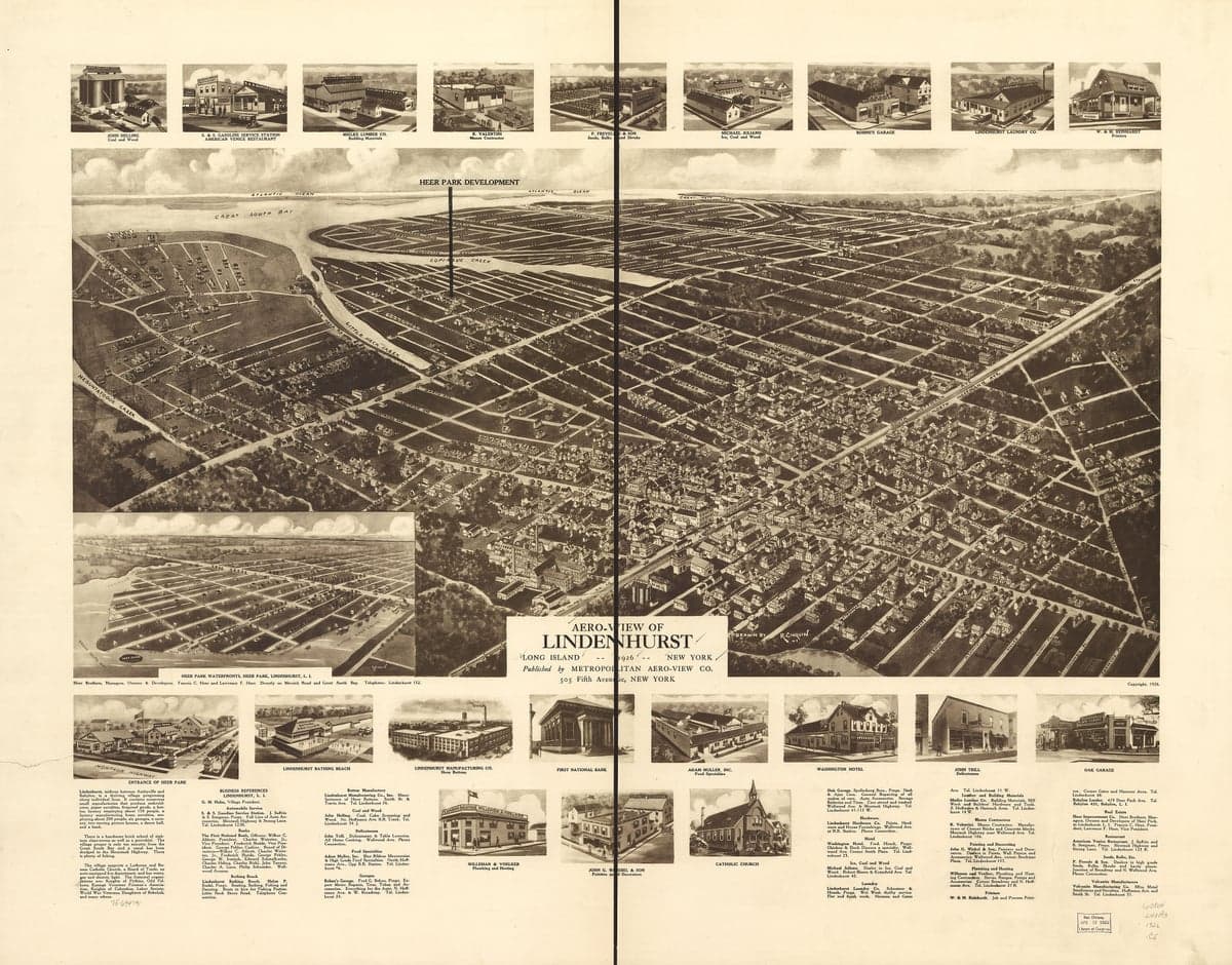
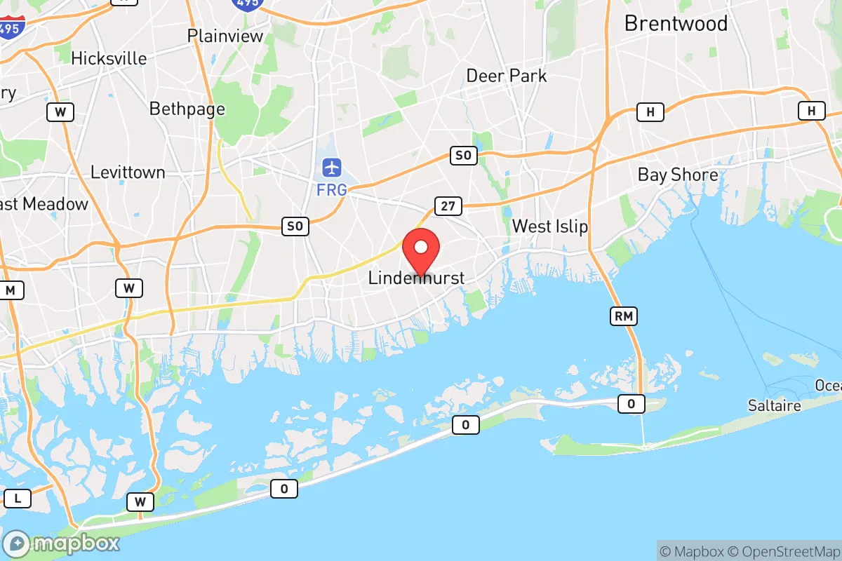
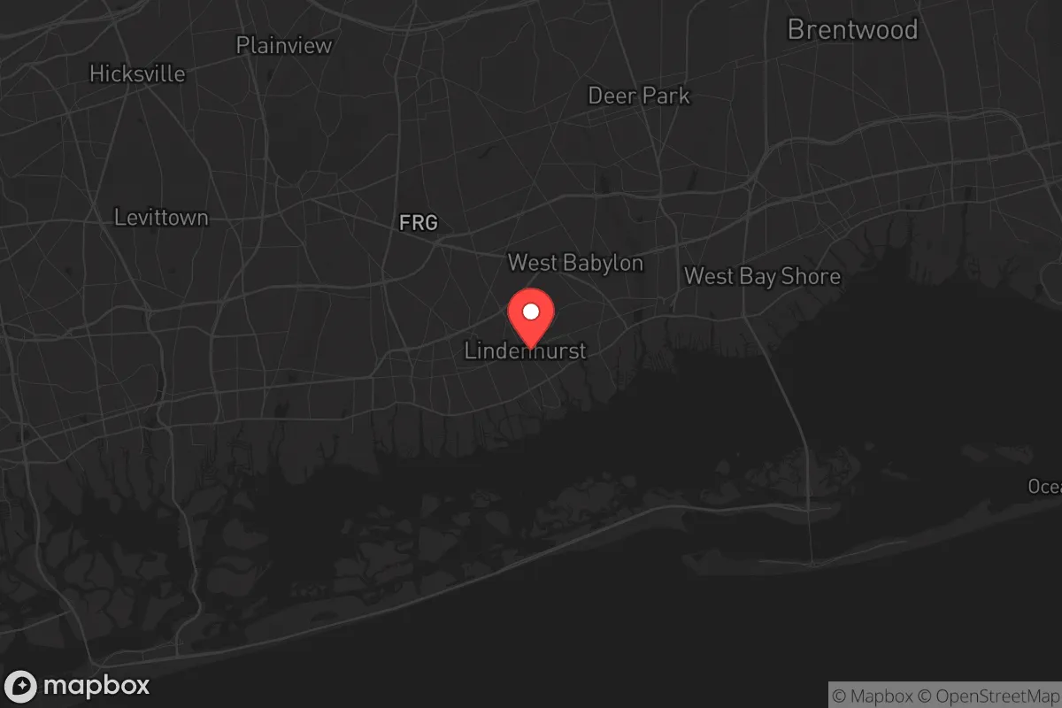
Lindenhurst, New York, presents a mixed strategic picture for the conservative prepper. Its primary resilience advantage is its location on the South Shore of Long Island, offering direct access to the Great South Bay and the Atlantic Ocean, which provides a potential retreat corridor by water if land routes become compromised. However, its proximity to New York City—roughly 35 miles east—and its dense suburban character introduce significant vulnerabilities that a survival-minded relocator must weigh carefully. The town’s history of storm damage and its position within a high-population corridor make it a location that demands constant vigilance rather than offering inherent security.
Geographic position and natural advantages for a prepper
Lindenhurst sits on a barrier-island-like geography, with the town itself on the mainland but bordering the Great South Bay. This offers a unique natural buffer: the bay and the barrier beaches to the south (like Jones Beach Island) create a physical separation from the open ocean, which can slow approach by sea and provide some early warning of maritime threats. The area’s extensive network of canals and waterways—Lindenhurst is known for its “canal district”—provides multiple egress points by boat, a critical asset if roadways become clogged during an evacuation. The town’s elevation is low, averaging around 10 feet above sea level, which is a double-edged sword: it offers no defensive high ground but does mean the terrain is flat and easily traversable on foot or by bike. The surrounding pine barrens and wetlands to the east, particularly the 100,000-acre Long Island Central Pine Barrens, offer a potential wilderness retreat zone within a 20-mile drive, though access is limited by state regulations. For a relocator, the key natural advantage is the ability to move by water—a skill that becomes a force multiplier in a grid-down scenario.
Risks, exposures, and proximity to fallout-relevant landmarks
The most glaring risk for Lindenhurst is its proximity to New York City, a prime target for any large-scale attack or civil unrest event. The town lies within the blast and fallout radius of a nuclear detonation in Manhattan—depending on yield, fallout could reach Lindenhurst within hours, carried by prevailing westerly winds. Additionally, the town is adjacent to the Long Island Rail Road’s Babylon Branch, a critical transit artery that would become a choke point during an evacuation, potentially turning the area into a bottleneck. Other nearby fallout-relevant landmarks include the Brookhaven National Laboratory (about 15 miles east), a research facility with nuclear materials, and the John F. Kennedy International Airport (about 20 miles west), a high-value target for terrorism. The area’s dense population—Lindenhurst itself has roughly 27,000 residents, but it’s part of a continuous suburban sprawl of over 1.5 million people in Nassau and Suffolk Counties—means that any localized disaster (chemical spill, power grid failure, civil unrest) would cascade rapidly due to the lack of buffer zones. The town’s low-lying geography also makes it vulnerable to storm surge from hurricanes, as demonstrated by Superstorm Sandy in 2012, which flooded large portions of the canal district with several feet of water. For the prepper, these risks mean that Lindenhurst is not a retreat location but a forward operating base that requires a robust plan for rapid extraction.
Practical resilience for a relocator: food, water, energy, and defensibility
For a relocator setting up in Lindenhurst, practical resilience hinges on self-sufficiency within a suburban footprint. The town’s water supply comes from the Long Island aquifer, which is generally clean but vulnerable to saltwater intrusion and contamination from the nearby landfill (the former Town of Babylon landfill at the edge of the Great South Bay). A prepper should invest in a high-quality Berkey or similar gravity-fed filter, plus a backup supply of purification tablets, as municipal water treatment could fail during a prolonged outage. Food resilience is limited: Lindenhurst has a few small grocery stores (e.g., Stop & Shop on Wellwood Avenue), but these would be stripped within hours of a crisis. The town’s residential lots are small—typically 40x100 feet—so gardening space is minimal, though community gardens exist at the Lindenhurst Memorial Library and local churches. For energy, the area is served by PSEG Long Island, which has a mixed reliability record; during Sandy, some areas were without power for weeks. Solar panels with battery storage (e.g., Tesla Powerwall) are a viable investment, but homeowners must navigate local zoning and HOA restrictions. Defensibility is the weakest point: the town’s grid-like street layout, with main arteries like Wellwood Avenue and Montauk Highway, offers no natural chokepoints, and the dense housing means neighbors are within earshot. A single-family home with a fenced yard and reinforced doors provides basic security, but a determined group could easily overwhelm it. The best defensive strategy is to cultivate a tight-knit network of like-minded neighbors—Lindenhurst has a strong volunteer fire department and an active American Legion post, which can serve as community anchors. For long-term resilience, a relocator should consider a secondary property in the Pine Barrens or upstate New York, using Lindenhurst as a coastal outpost for fishing and water access.
The overall strategic picture for Lindenhurst is one of calculated risk. It offers genuine advantages in water-based mobility and proximity to natural resources like the bay and the Pine Barrens, but these are offset by extreme vulnerability to fallout, storm surge, and population density. For the conservative prepper who values community ties and has a solid extraction plan, Lindenhurst can function as a viable coastal node—but it is not a standalone survival location. The town’s best use is as part of a layered strategy: a primary retreat in a lower-risk area (e.g., the Adirondacks or Pennsylvania) with Lindenhurst serving as a secondary base for maritime operations and resupply. If you are committed to living here, prioritize a boat with a shallow draft, a well-stocked bug-out bag, and a mutual-aid agreement with neighbors who share your mindset. In a crisis, the first 48 hours will determine whether Lindenhurst becomes a trap or a launch point—plan accordingly.
* Values derived from national, state, county, city and local statistics and may differ in a specific area. Last updated: 2026-05-01T07:38:38.000Z
Narrative content on this page is AI-generated and may contain mistakes. Verify any details that matter before acting on them.
ReloMaps may earn a commission from affiliate links at no extra cost to you.