Photo: Gabriel Griego via Unsplash
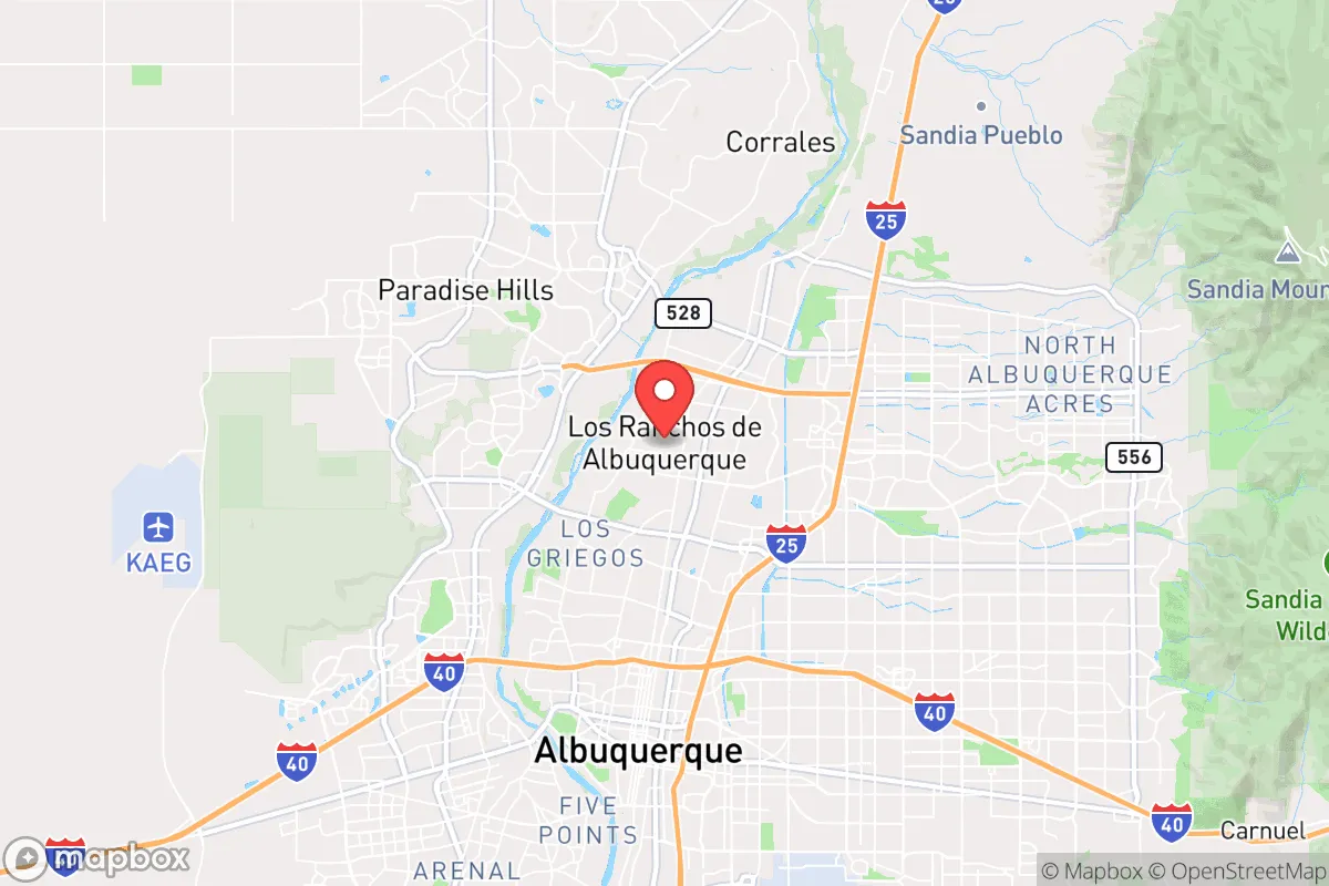
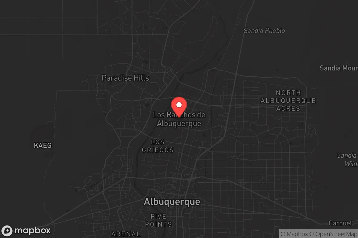
Strategic Assessment of Los Ranchos De Albuquerque, NM
Multiple tactical vulnerabilities. Population density, target proximity, or disaster risk are likely compounding. A retreat property and exit planning is required.
What does the Strategic Assessment tell us?
Our Strategic Assessment grades tactical survivability of an area. Major population centers, military targets, fallout zones, natural disasters, and border exposure all drive risk — lower exposure means a more defensible position in a crisis.
This is heavily inspired by Joel Skousen's Strategic Relocation book. Highly recommended you checkout the book ($)What does this tell us?
Our Strategic Assessment grades tactical survivability of an area. Major population centers, military targets, fallout zones, natural disasters, and border exposure all drive risk — lower exposure means a more defensible position in a crisis.
This is heavily inspired by Joel Skousen's Strategic Relocation book. Highly recommended you checkout the book ($)Strategic Pillars

Key Distances
Regional Safe Places
Below is our recommended "safe zones" in New Mexico and the surrounding area based on our strategic heuristics. For most people, it's unrealistic to live in a “safe zone” full-time due to work, family or other personal reasons. They tend to be more rural. However, many of these areas are perfect for second homes and retreat properties that double as a vacation home or even a short-term rental.

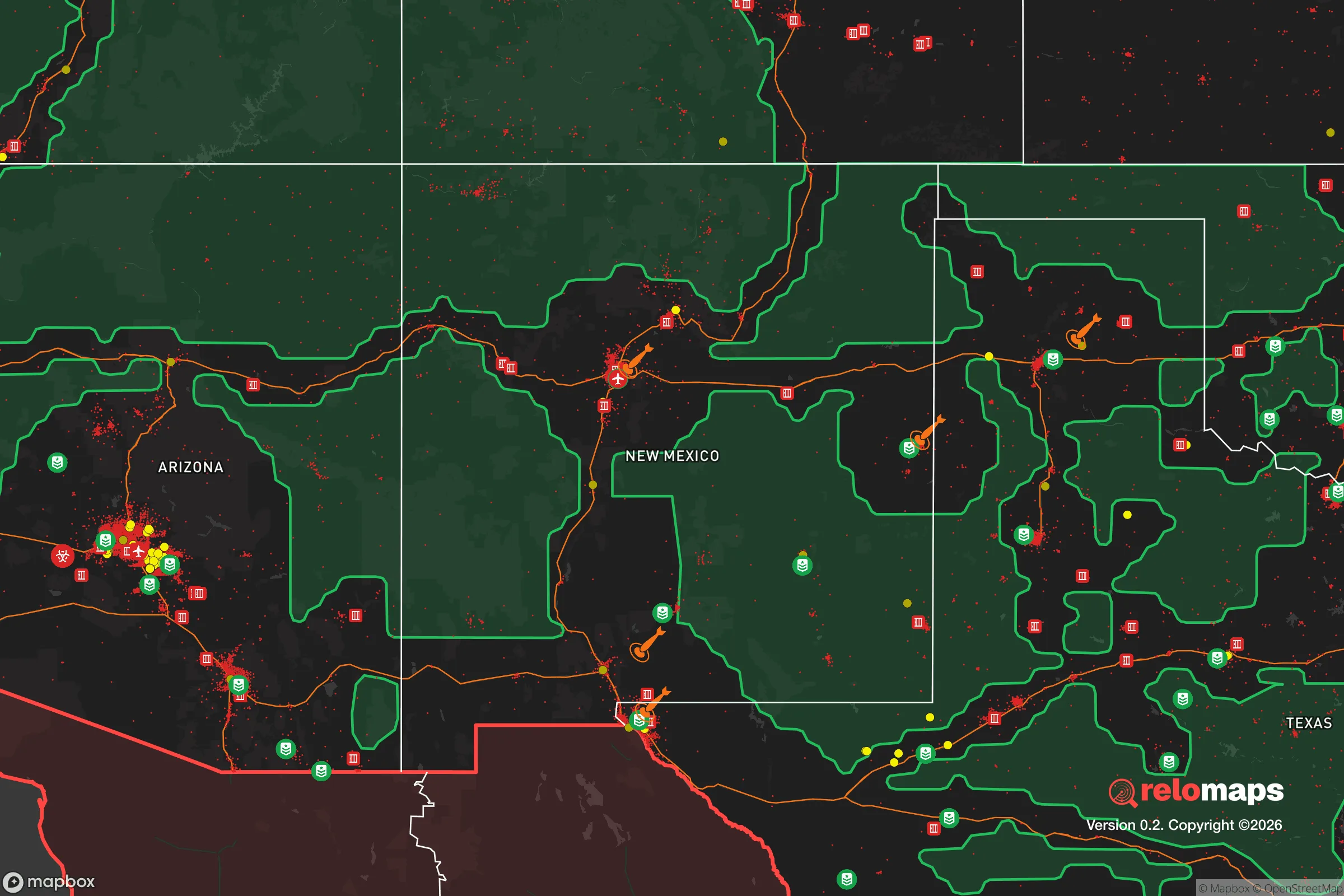
Important Note: For informational purposes only. This does not mean nothing bad ever happens in the green zones. Please use common sense. This is based on public data and modeled with AI. We tried to take a conservative approach but mistakes happen. We update this regularly as new information becomes available.
Solar Generator Recommendations
Backup power matters more here than in safer locations. We've picked three solar generators across budgets and capacity tiers — start with the budget unit if you only need a few essentials, or step up if you want to run a fridge and HVAC for days at a time.

Jackery Portable Power Station Explorer 300
Budget OptionPower on the Go: Weighing only 11 lbs, it's convenient to set up and store with book-sized foldable solar panels

BLUETTI Portable Power Station AC180
Designed for both indoor and outdoor scenarios, AC180 is highly capable as it has a robost capacity and continuous output power.

EF ECOFLOW DELTA Pro Ultra Power Station
Upgraded PickEcoFlow DELTA Pro Ultra is a whole-home energy system designed to grow with your family. Integrated with the Smart Home Panel 2, it scales to meet your evolving energy needs — keeping your home powered, intelligent, and secure through every stage of life.
We earn a commission, at no additional cost to you.
Strategic Assessment Analysis
Los Ranchos De Albuquerque offers a deceptive mix of strategic advantages and glaring vulnerabilities for a relocator with a prepper mindset. Nestled along the Rio Grande between the Sandia Mountains and the West Mesa, this incorporated village sits just north of Albuquerque’s city limits, giving it a buffer from the worst urban chaos while still being close enough to major infrastructure to be a liability. For a conservative-leaning individual or family looking to weather civic unrest, natural disasters, or societal breakdown, the area’s resilience hinges on its ability to leverage natural resources and defensible geography—but its proximity to a major population center and key fallout-relevant landmarks cannot be ignored.
Geographic position and natural advantages for long-term survival
Los Ranchos sits at roughly 5,000 feet elevation in the Middle Rio Grande Valley, a position that provides a moderate climate with four distinct seasons—hot, dry summers and cold, occasionally snowy winters—which is manageable for off-grid living without extreme temperature swings. The village’s location along the Rio Grande gives direct access to a perennial water source, a critical asset in a grid-down scenario where municipal water systems fail. The surrounding acequia network, centuries-old irrigation ditches, offers a decentralized water distribution system that could be maintained by a prepared community. The Sandia Mountains to the east provide a natural barrier against eastward threats and offer escape routes into national forest land, while the West Mesa to the west creates a visual and physical buffer from the more densely populated West Side of Albuquerque. The area’s agricultural zoning—Los Ranchos is known for its farms and nurseries—means that many properties already have soil suitable for food production, and the growing season runs from April to October, allowing for significant subsistence gardening. The village’s low population density (roughly 6,000 residents spread over 4 square miles) reduces the risk of rapid disease transmission and resource competition compared to the city proper. However, the flat valley floor offers little natural cover from aerial surveillance or ground-based threats, and the open terrain could become a kill zone if civil conflict spills north from Albuquerque.
Risks, exposures, and proximity to fallout-relevant landmarks
The single biggest strategic weakness of Los Ranchos is its proximity to Albuquerque, a city of over 560,000 people that is a prime target for civil unrest, mass casualty events, and potential nuclear fallout. Albuquerque is home to Kirtland Air Force Base, a major nuclear weapons storage and research facility (the Manzano Base and the Sandia National Laboratories are adjacent), making it a high-priority target in any conflict involving nuclear weapons. A detonation at Kirtland would put Los Ranchos within the moderate-to-severe fallout zone, depending on wind direction—prevailing winds from the southwest would carry radioactive debris directly over the village. Additionally, the nearby Petroglyph National Monument and the West Mesa contain known volcanic features and fault lines, though seismic risk is low. The Rio Grande itself is a double-edged sword: it provides water but also serves as a natural corridor for refugees fleeing Albuquerque during a collapse, potentially bringing disease, violence, and resource strain. The village’s main thoroughfares—4th Street and Rio Grande Boulevard—are direct routes from Albuquerque’s North Valley, meaning that any mass evacuation or riot from the city will funnel people through Los Ranchos. The presence of the Albuquerque International Sunport (airport) just 10 miles south adds another layer of risk, as it could become a staging area for federal forces or a target for sabotage. The area’s reliance on the Middle Rio Grande Conservancy District for flood control means that a failure of the system—whether from cyberattack, neglect, or sabotage—could lead to catastrophic flooding during spring snowmelt or monsoon season.
Practical resilience for a relocator: food, water, energy, and defensibility
For a relocator serious about self-sufficiency, Los Ranchos offers a mixed bag. Water is the strongest asset: the shallow aquifer (typically 50-100 feet deep) means that a well can be drilled for a few thousand dollars, and the acequia system provides surface water rights for irrigation—though these rights are tied to specific properties and require annual maintenance. Rainwater harvesting is viable, with the area averaging 9-10 inches of precipitation annually, but that’s not enough for full self-sufficiency without storage. Food production is feasible: the soil is sandy loam with good drainage, and local farmers grow chile, corn, squash, and fruit trees. A family could realistically produce a significant portion of their calories on a half-acre lot, but the growing season is short, and winter storage of root vegetables and preserved goods is essential. Energy is a challenge: the grid is reliable but vulnerable to wildfire-related outages and rolling blackouts during peak summer demand. Solar is viable—the area averages 280 sunny days per year—but net metering policies in New Mexico are favorable only for grid-tied systems; off-grid battery storage is expensive but doable. Natural gas is widely available for heating and cooking, but a pipeline disruption would leave residents reliant on propane or wood. Defensibility is the weakest link: the village is flat, open, and crisscrossed by irrigation ditches that provide some cover but also create choke points. A prepared household would need to harden their property with reinforced fencing, security cameras, and a plan for perimeter defense. The local police force is small (about 12 officers), and response times during a citywide emergency would be measured in hours, not minutes. The nearest hospital is Presbyterian Rust Medical Center in Rio Rancho, 15 miles away, but it would be overwhelmed in a mass casualty event. The best strategy is to build a tight-knit network of like-minded neighbors—Los Ranchos has a strong community identity and a history of mutual aid, which is a force multiplier in a crisis.
The overall strategic picture for Los Ranchos De Albuquerque is one of calculated risk. It offers genuine advantages in water access, agricultural potential, and a buffer from the worst of Albuquerque’s urban decay, but it sits too close to a major city with high-value military and nuclear targets to be considered a safe haven in a full-scale collapse. For a conservative relocator who wants to be prepared for localized unrest, economic disruption, or a natural disaster, the village provides a viable base of operations—provided you invest in hardening your property, building community ties, and having a bug-out plan for the mountains. If you’re looking for a remote, off-grid retreat far from any fallout zone, this isn’t it. But if you want a place where you can live a semi-self-sufficient life while still having access to Albuquerque’s resources (for now), and you’re willing to accept the risks that come with that proximity, Los Ranchos is a defensible, water-rich option that demands serious preparation but rewards it with a resilient lifestyle. Just don’t expect to be able to ride out a nuclear event or a full-scale societal collapse here—the Sandias are your real fallback, and you need a plan to get there fast.
* Values derived from national, state, county, city and local statistics and may differ in a specific area. Last updated: 2026-04-19T19:31:06.000Z
Narrative content on this page is AI-generated and may contain mistakes. Verify any details that matter before acting on them.
ReloMaps may earn a commission from affiliate links at no extra cost to you.