Photo: Wikipedia
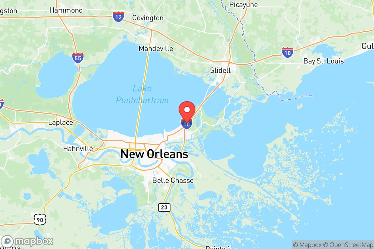
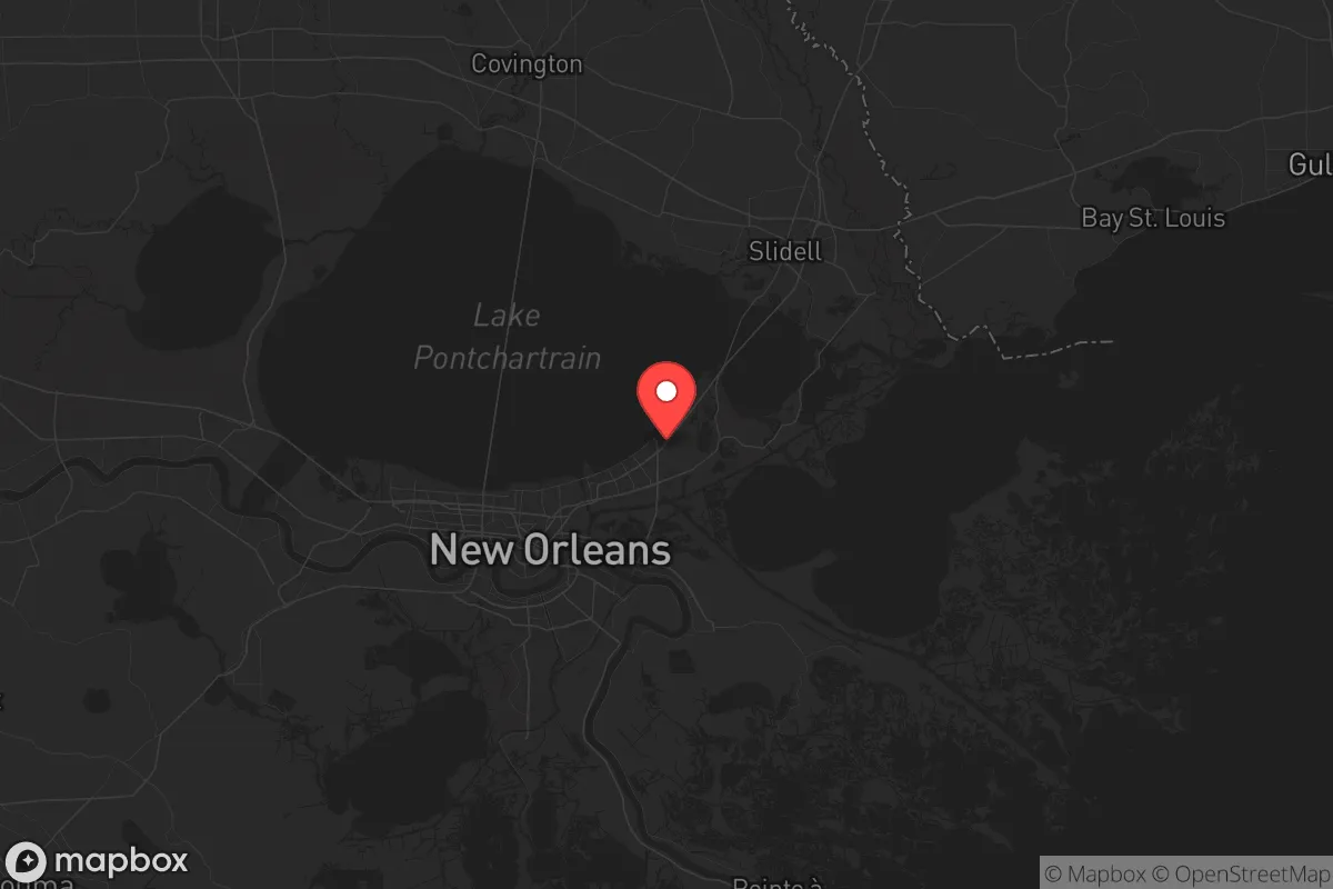
Strategic Assessment of Orleans County
Multiple tactical vulnerabilities. Population density, target proximity, or disaster risk are likely compounding. A retreat property and exit planning is required.
What does the Strategic Assessment tell us?
Our Strategic Assessment grades tactical survivability of an area. Major population centers, military targets, fallout zones, natural disasters, and border exposure all drive risk — lower exposure means a more defensible position in a crisis.
This is heavily inspired by Joel Skousen's Strategic Relocation book. Highly recommended you checkout the book ($)What does this tell us?
Our Strategic Assessment grades tactical survivability of an area. Major population centers, military targets, fallout zones, natural disasters, and border exposure all drive risk — lower exposure means a more defensible position in a crisis.
This is heavily inspired by Joel Skousen's Strategic Relocation book. Highly recommended you checkout the book ($)Strategic Pillars

Key Distances
Strategic Assessment Analysis
Let’s cut through the hype: Orleans Parish – what most people call New Orleans – sits in a strategic paradox that any serious prepper needs to weigh before moving there. The city’s location on the Mississippi River offers unmatched water access and a deep history of trade, but that same geography makes it a magnet for natural disasters and a likely second- or third-order target in any major disruption. For the conservative-minded relocator focused on self-reliance and staying off the grid of crisis, Orleans Parish presents a mixed bag: some genuine resilience advantages, several glaring vulnerabilities, and an urban density that cuts against any notion of easy defensibility.
Geographic position and natural advantages for long-term self-sufficiency
Orleans Parish sits at the mouth of America’s inland waterway system, giving residents direct access to the Mississippi River, Lake Pontchartrain, and the Gulf of Mexico. For a prepper focused on food and transport independence, that’s not nothing. The Gulf offers year-round fishing, crabbing, and shrimping – a protein source that doesn’t rely on grocery store supply chains. The Mississippi River itself is a massive freshwater resource, though treating it for drinking requires filtering and boiling given industrial runoff upstream. The city’s elevation is the obvious problem: most of Orleans Parish sits below sea level, protected by a levee system that was tested – and failed – during Hurricane Katrina. That same levee network, maintained by the Army Corps of Engineers, has been upgraded significantly since 2005, but no structure eliminates the risk of catastrophic flooding in a major hurricane or a deliberate breach scenario. The Lake Pontchartrain Causeway, one of the longest bridges in the world, provides a single evacuation route north, but that chokepoint is a double-edged sword: great for controlling access in a crisis, terrible if you need to leave in a hurry.
Major risks, exposures, and proximity to fallout-relevant landmarks
This is where the strategic picture gets uncomfortable for anyone thinking about grid-down or civil unrest scenarios. Orleans Parish is surrounded by some of the most concentrated industrial and military infrastructure in the country. The Chalmette Refinery, located just downriver in St. Bernard Parish, is one of the largest oil refineries on the Gulf Coast – a prime target for any adversary or a significant accident risk. The Port of New Orleans handles massive volumes of container traffic, chemicals, and agricultural goods, making it a high-value node in national logistics. Within the parish itself, the NASA Michoud Assembly Facility in eastern New Orleans builds rocket stages for the Space Launch System – a symbolic target that could draw unwanted attention. The Industrial Canal connects the Mississippi to Lake Pontchartrain and is lined with grain elevators and chemical terminals; a release or explosion there would affect a huge part of the city. Add the Louis Armstrong New Orleans International Airport as a likely FEMA staging point and potential target, and the picture is clear: anyone living in Orleans Parish is within the blast or fallout radius of multiple high-consequence sites. For a conservative-leaning relocator who values staying under the radar, this is a hard negative.
Practical daily resilience: food, water, energy, and defensibility
On the plus side, a self-reliant resident in Orleans Parish can tap into the Gulf for seafood, grow vegetables in the subtropical climate (nearly year-round growing season), and harvest rainwater from the heavy annual rainfall. The Mississippi River provides endless raw water, but it requires serious treatment – expect to stockpile filters and bleach. Energy is a weak point: the local grid run by Entergy is vulnerable to hurricane outages and has a history of slow restoration. Natural gas is widely available, but pipelines could be interdicted. For defensibility, the city’s dense urban layout works against you. Street grids, shotgun houses, and canal-lined neighborhoods create ambush points and make it nearly impossible to secure a perimeter. Some historic neighborhoods like Algiers Point (across the river) offer slightly better natural chokepoints with the river at their back, but they’re still inside the urban footprint. The French Quarter and CBD would become a no-go zone in any major unrest scenario due to looting and crowd concentration. If you’re looking for a parcel of land with defensible boundaries, Orleans Parish is not it. For the prepper who insists on being here, the best strategy is to live on the eastern edge near the Bayou Sauvage National Wildlife Refuge where lower density and marsh access provide some buffer, but even that area is flood-prone and close to the Michoud facility.
The overall strategic picture for Orleans Parish is clear: it offers genuine resilience advantages in water and food access, but those come at the cost of being inside a high-target urban environment with catastrophic hurricane risk and industrial exposure. For the conservative relocator who values quiet self-sufficiency and the ability to ride out a long-term disruption, Orleans Parish is probably not the first choice – the combination of flood danger, symbolic vulnerability, and limited defensibility outweighs the natural bounty. If you’re already anchored here by family or job, focus on hardening a property in a low-density pocket, building a robust water treatment system, and maintaining a go-bag for the inevitable evacuation. For everyone else, the parishes north of Lake Pontchartrain or west toward Acadiana offer better ground for a serious preparedness plan.
* Values derived from national, state, county, city and local statistics and may differ in a specific area. Last updated: 2026-06-01T12:06:48.000Z
Narrative content on this page is AI-generated and may contain mistakes. Verify any details that matter before acting on them.
ReloMaps may earn a commission from affiliate links at no extra cost to you.