
Photo: Ulrike R. Donohue via Unsplash
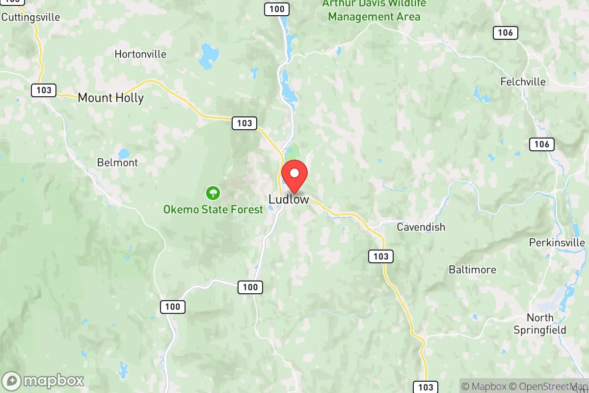
Strategic Assessment of Ludlow, VT
Meaningful friction. Expect exposure to either population pressure, blast zones, or natural disaster risk. Consider buying a retreat property.
What does the Strategic Assessment tell us?
Our Strategic Assessment grades tactical survivability of an area. Major population centers, military targets, fallout zones, natural disasters, and border exposure all drive risk — lower exposure means a more defensible position in a crisis.
This is heavily inspired by Joel Skousen's Strategic Relocation book. Highly recommended you checkout the book ($)What does this tell us?
Our Strategic Assessment grades tactical survivability of an area. Major population centers, military targets, fallout zones, natural disasters, and border exposure all drive risk — lower exposure means a more defensible position in a crisis.
This is heavily inspired by Joel Skousen's Strategic Relocation book. Highly recommended you checkout the book ($)Strategic Pillars

Key Distances
Regional Safe Places
Below is our recommended "safe zones" in Vermont and the surrounding area based on our strategic heuristics. For most people, it's unrealistic to live in a “safe zone” full-time due to work, family or other personal reasons. They tend to be more rural. However, many of these areas are perfect for second homes and retreat properties that double as a vacation home or even a short-term rental.


Important Note: For informational purposes only. This does not mean nothing bad ever happens in the green zones. Please use common sense. This is based on public data and modeled with AI. We tried to take a conservative approach but mistakes happen. We update this regularly as new information becomes available.
Solar Generator Recommendations
Backup power matters more here than in safer locations. We've picked three solar generators across budgets and capacity tiers — start with the budget unit if you only need a few essentials, or step up if you want to run a fridge and HVAC for days at a time.

Jackery Portable Power Station Explorer 300
Budget OptionPower on the Go: Weighing only 11 lbs, it's convenient to set up and store with book-sized foldable solar panels

BLUETTI Portable Power Station AC180
Designed for both indoor and outdoor scenarios, AC180 is highly capable as it has a robost capacity and continuous output power.

EF ECOFLOW DELTA Pro Ultra Power Station
Upgraded PickEcoFlow DELTA Pro Ultra is a whole-home energy system designed to grow with your family. Integrated with the Smart Home Panel 2, it scales to meet your evolving energy needs — keeping your home powered, intelligent, and secure through every stage of life.
We earn a commission, at no additional cost to you.
Strategic Assessment Analysis
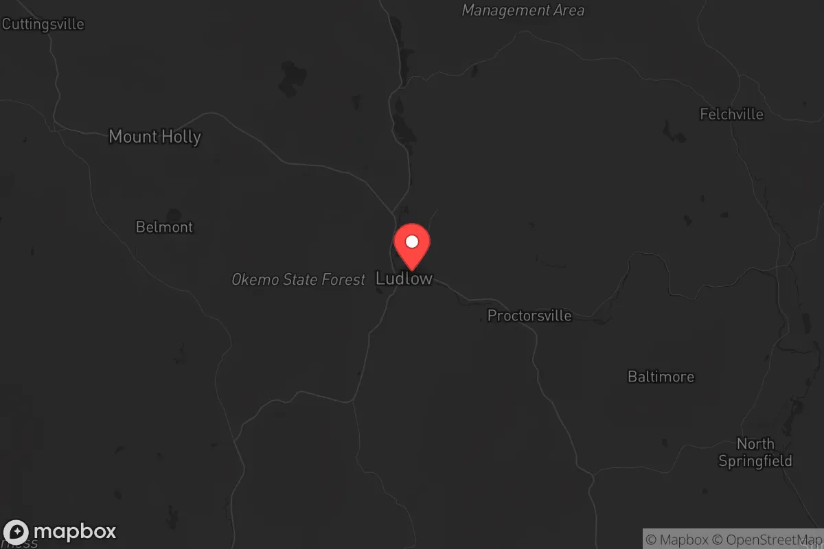
Ludlow, Vermont, offers a surprisingly robust strategic position for those prioritizing resilience, sitting in a rural valley that buffers it from the chaos of major metropolitan collapse while still providing access to essential supply routes. Its location in south-central Vermont, roughly 30 miles from the New Hampshire border and 40 miles from the Massachusetts line, places it within a day’s drive of the Northeast’s major population centers—but far enough into the Green Mountains to avoid the immediate fallout of urban unrest. For a relocator with a prepper mindset, Ludlow’s combination of natural barriers, a working-class economy, and a low-profile community makes it a viable fallback position, though not without its own vulnerabilities.
Geographic position and natural advantages for long-term survival
Ludlow’s geography is its strongest asset. The town sits at the base of Okemo Mountain, part of the Green Mountain range, which provides natural defensibility through steep terrain and dense forest cover. The area’s elevation—around 1,000 feet in the village, rising to over 3,000 feet on the mountain—offers a tactical advantage: higher ground for observation and communication, with multiple escape routes into the surrounding national forest. The Green Mountain National Forest surrounds Ludlow on three sides, giving residents access to over 400,000 acres of public land for hunting, foraging, and off-grid retreat. This forested buffer also means that any large-scale movement of people or vehicles would be funneled through a handful of narrow roads, making the town inherently easier to monitor and defend. The Black River runs through the center of Ludlow, providing a reliable surface water source, and the area’s annual snowfall of over 100 inches ensures ample meltwater in spring. For a relocator, these natural features mean that Ludlow is not just a scenic ski town—it’s a location where you can realistically sustain yourself if supply chains falter.
Risks, exposures, and proximity to fallout-relevant landmarks
No location is perfect, and Ludlow has its share of strategic liabilities. The most immediate concern is its proximity to Interstate 91, which runs about 15 miles east of town. I-91 is a major north-south corridor connecting the Canadian border to southern New England, and in a crisis, it would become a primary evacuation route for millions of people from Boston, Hartford, and New York. While Ludlow itself is off the interstate, the town is connected to it via Route 103, a two-lane road that could become clogged with refugees or military convoys. Another risk is the Vermont Yankee Nuclear Power Plant, located about 30 miles south in Vernon, Vermont. Though the plant ceased operations in 2014, the spent fuel remains on-site in dry cask storage. A catastrophic event—whether natural or man-made—could release radiation that would drift northward, potentially contaminating the Ludlow area depending on wind patterns. Additionally, the town’s reliance on tourism means that during peak ski season, the population swells from roughly 1,800 year-round residents to over 10,000 visitors. This influx creates a temporary vulnerability: a sudden collapse during winter would leave thousands of unprepared tourists competing for limited resources. For a conservative prepper, these factors mean that Ludlow requires careful timing and a plan for self-sufficiency during the high-traffic months.
Practical resilience for a relocator: food, water, energy, and defensibility
When it comes to day-to-day survival logistics, Ludlow scores well on water and energy but requires work on food security. The Black River and its tributaries provide year-round water, but you’ll need a reliable filtration system—the river carries runoff from agricultural land upstream and ski resort chemicals. Most homes in the area use private wells, which are generally safe but require a hand pump or generator backup for power outages. On the energy front, Ludlow’s rural character means that many properties already have wood stoves or pellet boilers, and the surrounding forest offers an essentially unlimited fuel supply for heating. Solar potential is moderate—the valley gets about 160 sunny days per year, less than the national average—but south-facing slopes on Okemo can support off-grid solar arrays with battery storage. The town’s electrical grid is maintained by Green Mountain Power, which has a history of storm-related outages; a backup generator is non-negotiable. Food security is the weak point. Ludlow has one small grocery store (Shaw’s) and a handful of convenience markets, but the nearest major supermarket is in Rutland, 20 miles north. Local agriculture is limited to small farms and a few community gardens; you cannot rely on the area for bulk food production. A serious prepper would need to stockpile at least six months of non-perishables, establish a greenhouse, and learn to hunt the abundant deer and turkey populations. Defensibility is strong: the town’s layout—a compact village surrounded by forested hills—means that a small, organized group could control access points with minimal effort. The local police force is small (about six officers), so in a prolonged crisis, you would be largely on your own. That’s not necessarily a negative for those who prefer self-reliance over government dependency.
The overall strategic picture for a conservative relocator
Ludlow presents a mixed but workable strategic picture for someone serious about long-term preparedness. Its strengths—natural barriers, water access, defensible terrain, and a low year-round population—make it a solid choice for a retreat location, especially if you’re willing to invest in off-grid infrastructure and food storage. The weaknesses—proximity to a major evacuation corridor, a decommissioned nuclear site, and seasonal population surges—are manageable with proper planning and situational awareness. For a conservative audience concerned with the state of the country, Ludlow offers a middle ground: it’s not as remote as northern Vermont or New Hampshire, but it’s far enough from the urban centers of the Northeast to avoid the worst of civil unrest or mass casualty events. The local culture leans independent and self-sufficient, with a strong hunting and outdoor recreation tradition that aligns with a prepper mindset. If you’re looking for a place to ride out the coming instability without completely cutting ties to civilization, Ludlow is worth a serious look. Just don’t expect to walk in unprepared—this is a location that rewards those who do their homework and bring their own supplies.
* Values derived from national, state, county, city and local statistics and may differ in a specific area. Last updated: 2026-05-01T14:09:12.000Z
Narrative content on this page is AI-generated and may contain mistakes. Verify any details that matter before acting on them.
ReloMaps may earn a commission from affiliate links at no extra cost to you.