Strategic Assessment of Lyman, WY
Strong survivability profile. Good buffer from population centers, with manageable environmental and tactical risks.
What does the Strategic Assessment tell us?
Our Strategic Assessment grades tactical survivability of an area. Major population centers, military targets, fallout zones, natural disasters, and border exposure all drive risk — lower exposure means a more defensible position in a crisis.
This is heavily inspired by Joel Skousen's Strategic Relocation book. Highly recommended you checkout the book ($)What does this tell us?
Our Strategic Assessment grades tactical survivability of an area. Major population centers, military targets, fallout zones, natural disasters, and border exposure all drive risk — lower exposure means a more defensible position in a crisis.
This is heavily inspired by Joel Skousen's Strategic Relocation book. Highly recommended you checkout the book ($)Strategic Pillars

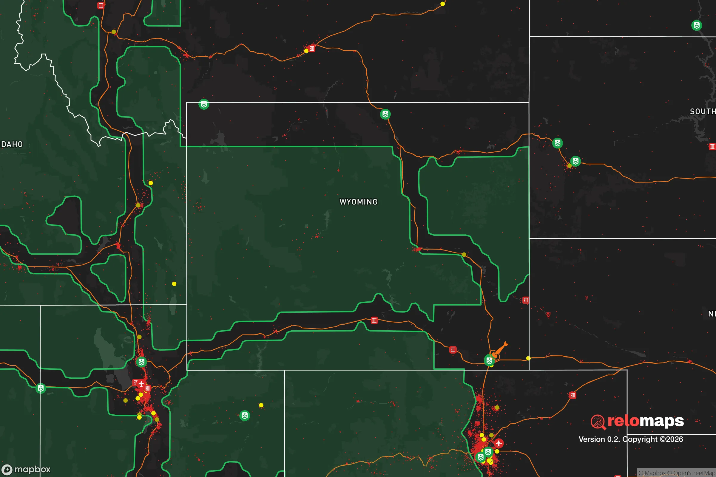
Key Distances
Regional Safe Places
Below is our recommended "safe zones" in Wyoming and the surrounding area based on our strategic heuristics. For most people, it's unrealistic to live in a “safe zone” full-time due to work, family or other personal reasons. They tend to be more rural. However, many of these areas are perfect for second homes and retreat properties that double as a vacation home or even a short-term rental.
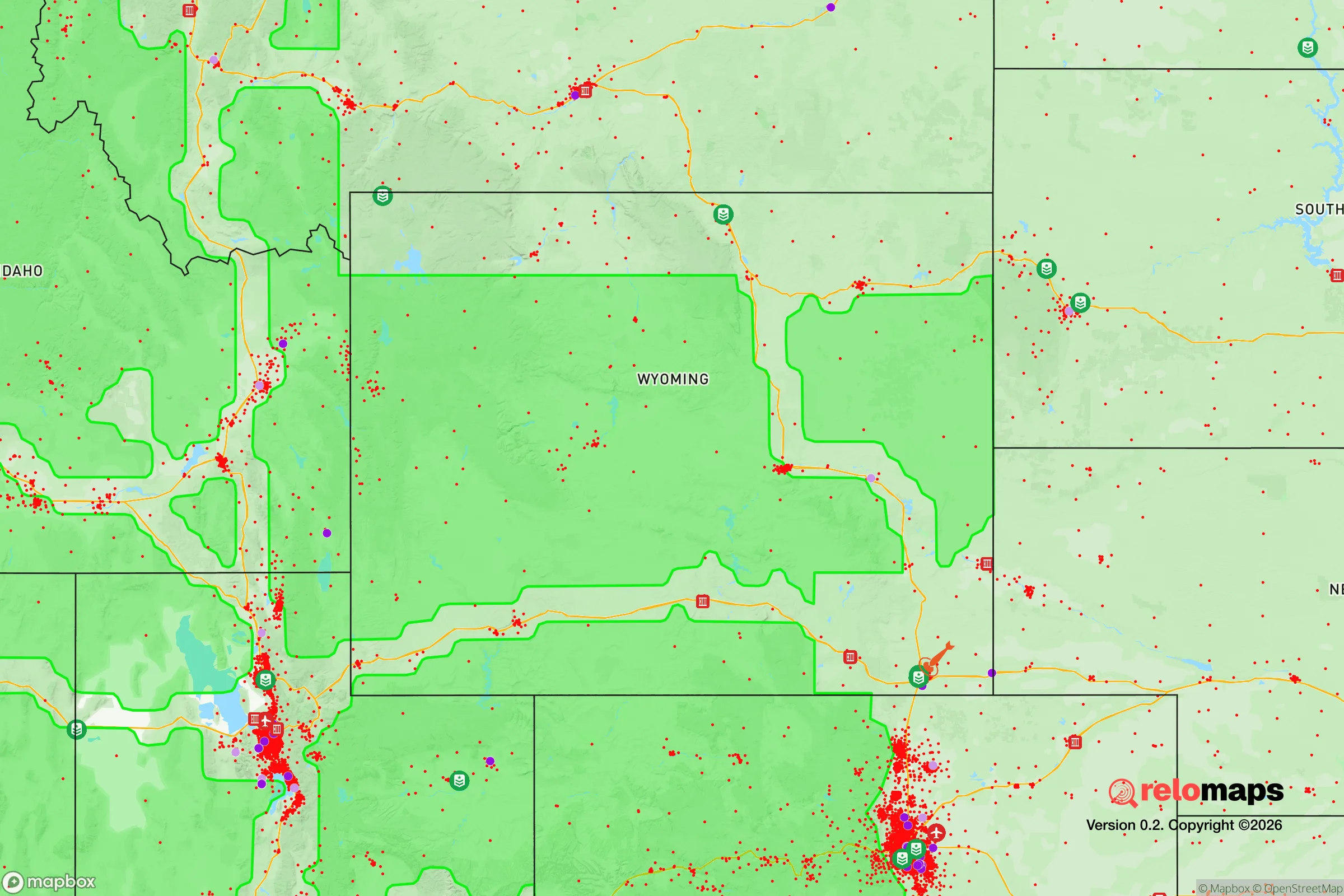
Important Note: For informational purposes only. This does not mean nothing bad ever happens in the green zones. Please use common sense. This is based on public data and modeled with AI. We tried to take a conservative approach but mistakes happen. We update this regularly as new information becomes available.
Solar Generator Recommendations
Backup power matters more here than in safer locations. We've picked three solar generators across budgets and capacity tiers — start with the budget unit if you only need a few essentials, or step up if you want to run a fridge and HVAC for days at a time.

Jackery Portable Power Station Explorer 300
Budget OptionPower on the Go: Weighing only 11 lbs, it's convenient to set up and store with book-sized foldable solar panels

BLUETTI Portable Power Station AC180
Designed for both indoor and outdoor scenarios, AC180 is highly capable as it has a robost capacity and continuous output power.

EF ECOFLOW DELTA Pro Ultra Power Station
Upgraded PickEcoFlow DELTA Pro Ultra is a whole-home energy system designed to grow with your family. Integrated with the Smart Home Panel 2, it scales to meet your evolving energy needs — keeping your home powered, intelligent, and secure through every stage of life.
We earn a commission, at no additional cost to you.
Strategic Assessment Analysis
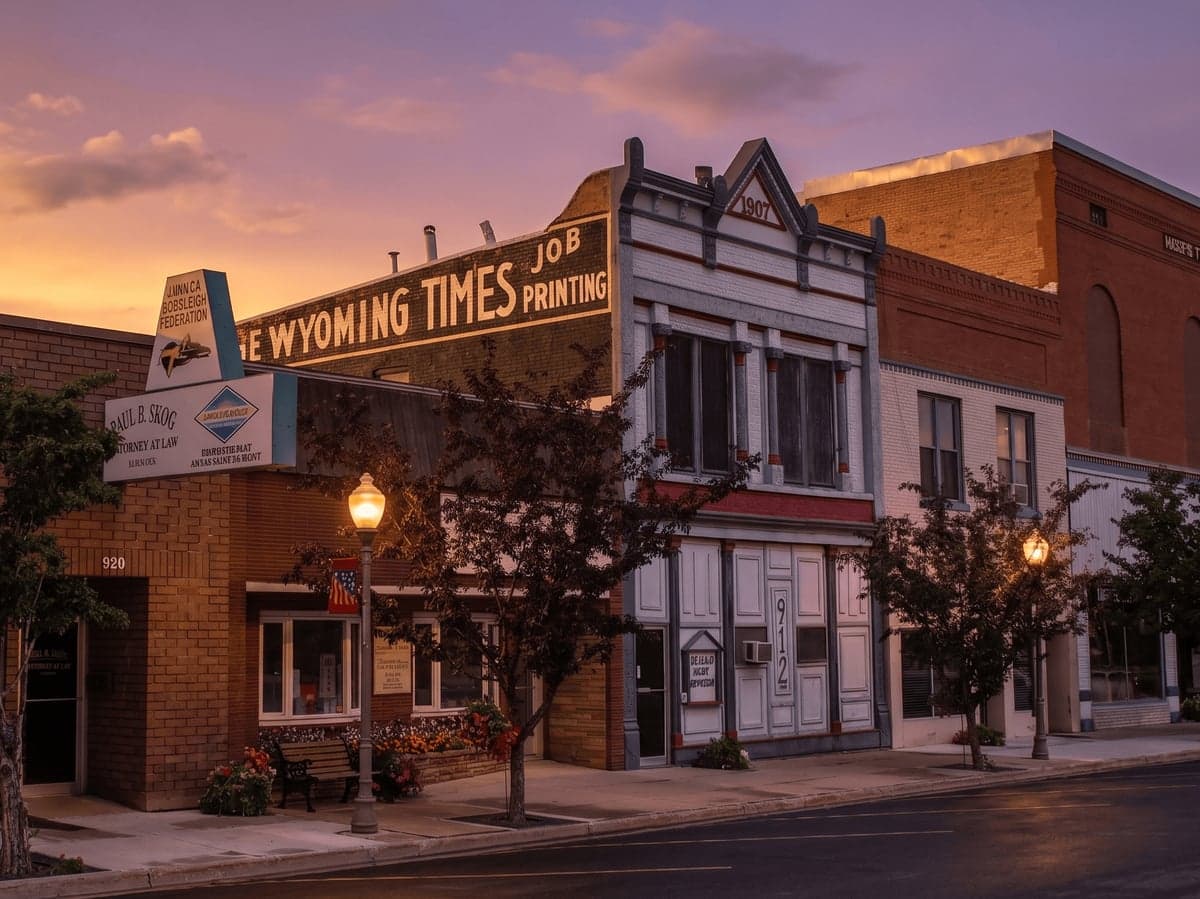
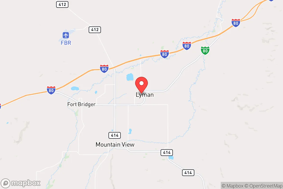
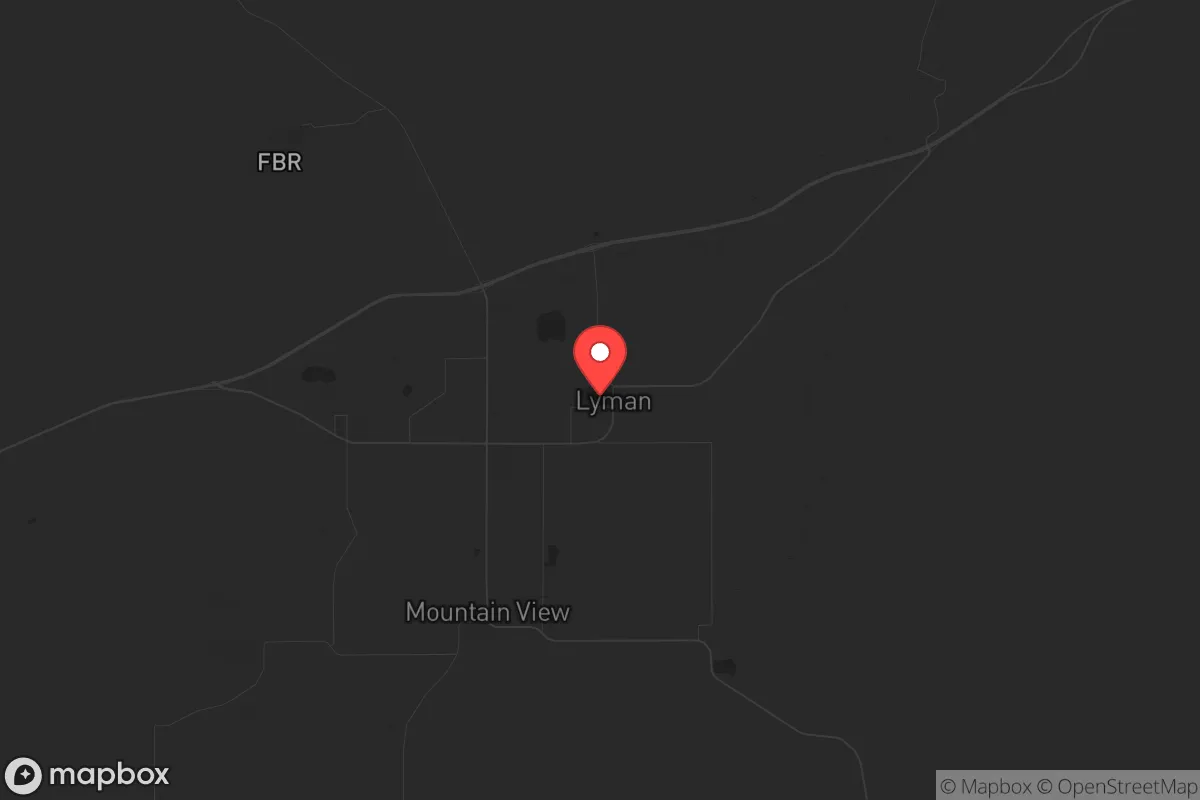
Lyman, Wyoming, sits in a sweet spot for those serious about resilience: far enough from the major corridors of chaos to offer genuine buffer, yet close enough to essential resources and escape routes to make daily life practical. This small town in Uinta County, roughly 15 miles east of the Utah line and 50 miles from Evanston, anchors a region where the land itself provides natural advantages—high desert terrain, limited through-traffic, and a population density that means your nearest neighbor isn't an immediate concern. For a relocator thinking about civic unrest, mass casualty events, or systemic collapse, Lyman presents a strategic base that doesn't scream "prepper compound" but quietly checks the boxes that matter.
Geographic position and natural advantages for long-term security
Lyman's location is its primary asset. Sitting at roughly 6,700 feet elevation on the edge of the Bridger Valley, the town is cradled by the Uinta Mountains to the south and the Wyoming Range to the north. This isn't flat, exposed prairie—it's broken terrain that naturally channels movement and limits visibility. The Green River flows about 10 miles west, providing a reliable freshwater source that doesn't depend on municipal infrastructure. Interstate 80 runs just north of town, offering a direct east-west route, but Lyman itself sits off the main drag, meaning you're not on the natural path of any fleeing population from Salt Lake City (120 miles southwest) or Rock Springs (40 miles east). The nearest city of any real size is Evanston, population ~12,000, which is small enough to be manageable but large enough to have a hospital and supply chain. For a survivalist mindset, the key takeaway is this: Lyman is close enough to civilization to access what you need, but far enough that you won't be overrun when things go sideways. The surrounding Uinta County has a population density of about 6 people per square mile—that's buffer you can't buy.
Risks, exposures, and proximity to fallout-relevant landmarks
No location is without vulnerabilities, and Lyman has a few that demand attention. The most obvious is Interstate 80 itself—a major transcontinental artery that, in a crisis, could become a highway of desperation. If a mass evacuation from the Wasatch Front (Salt Lake City metro, ~2.5 million people) occurs, I-80 would be the primary route east. Lyman sits about 10 miles south of the interstate, which provides some separation, but you'd still be within earshot of any chaos. The Union Pacific rail line also runs parallel to I-80, carrying freight that could include hazardous materials—a derailment or targeted disruption could create localized contamination. Further out, the closest significant industrial target is the Chevron refinery in North Salt Lake, roughly 110 miles southwest. That's outside the immediate fallout zone for a conventional attack or accident, but prevailing winds from the southwest could carry particulate matter into the region. On the plus side, there are no nuclear power plants within 200 miles, no major military installations closer than Hill Air Force Base (100 miles southwest), and no large-scale chemical storage facilities in Uinta County. The biggest practical risk is winter: Lyman averages 50+ inches of snow annually, and blizzards can shut down roads for days. For a prepper, that means your vehicle prep and food stores need to account for being snowed in, not just bugging out.
Practical resilience for a relocator: food, water, energy, and defensibility
This is where Lyman shines for the serious relocator. Water is the non-negotiable, and the area delivers. The Green River watershed provides surface water that's treatable with basic filtration, and groundwater in the Bridger Valley is accessible via wells at 100-300 feet. Many existing homes in the area already have private wells, and the water table is stable. For food, Uinta County has a short growing season (last frost mid-May, first frost mid-September), but the valley's volcanic soils are fertile enough for potatoes, root vegetables, and cold-hardy greens. Local ranchers run cattle and sheep, and there's a working agricultural community—meaning you can buy direct from producers without relying on grocery supply chains. The energy picture is strong: Wyoming is a net energy exporter, and Lyman is served by Rocky Mountain Power, which draws from a mix of coal, natural gas, and hydro. For off-grid capability, the area has excellent solar potential (over 300 sunny days per year) and wind resources that could support small turbines. Defensibility is where the terrain does the work. The town itself is laid out on a grid with wide streets and limited entry points—only three main roads lead into Lyman from the surrounding area. The surrounding BLM and state land (over 60% of Uinta County is public land) means you can establish a retreat outside town limits without being hemmed in by development. For a single individual or family, the practical calculus is simple: you can secure water, grow food, generate power, and control access to your property in a way that's nearly impossible in suburban or urban settings.
The overall strategic picture for Lyman is one of calculated trade-offs. You're trading away the convenience of urban amenities for a position that's defensible, resource-rich, and far enough from the major flashpoints to give you time to react. The proximity to I-80 is a double-edged sword—it's your lifeline for supplies and medical care in normal times, but it's also the most likely vector for trouble in a crisis. The climate is harsh, the growing season is short, and you'll need to invest in winter-ready infrastructure. But for a relocator who values independence and is willing to put in the work, Lyman offers a base that's not just survivable but sustainable. It's not a bug-out location for a weekend—it's a place to build a life that doesn't depend on systems that are increasingly fragile. If your concern is the state of the country and the world, and you want a spot where you can ride out the storm without being a target, Lyman deserves a serious look.
* Values derived from national, state, county, city and local statistics and may differ in a specific area. Last updated: 2026-04-21T11:32:46.000Z
Narrative content on this page is AI-generated and may contain mistakes. Verify any details that matter before acting on them.
ReloMaps may earn a commission from affiliate links at no extra cost to you.