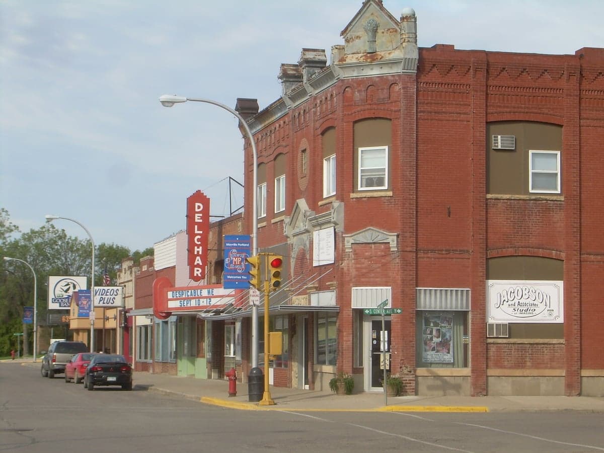
Photo: Wikipedia
Strategic Assessment of Mayville, ND
Strong survivability profile. Good buffer from population centers, with manageable environmental and tactical risks.
What does the Strategic Assessment tell us?
Our Strategic Assessment grades tactical survivability of an area. Major population centers, military targets, fallout zones, natural disasters, and border exposure all drive risk — lower exposure means a more defensible position in a crisis.
This is heavily inspired by Joel Skousen's Strategic Relocation book. Highly recommended you checkout the book ($)What does this tell us?
Our Strategic Assessment grades tactical survivability of an area. Major population centers, military targets, fallout zones, natural disasters, and border exposure all drive risk — lower exposure means a more defensible position in a crisis.
This is heavily inspired by Joel Skousen's Strategic Relocation book. Highly recommended you checkout the book ($)Strategic Pillars

Key Distances
Regional Safe Places
Below is our recommended "safe zones" in North Dakota and the surrounding area based on our strategic heuristics. For most people, it's unrealistic to live in a “safe zone” full-time due to work, family or other personal reasons. They tend to be more rural. However, many of these areas are perfect for second homes and retreat properties that double as a vacation home or even a short-term rental.
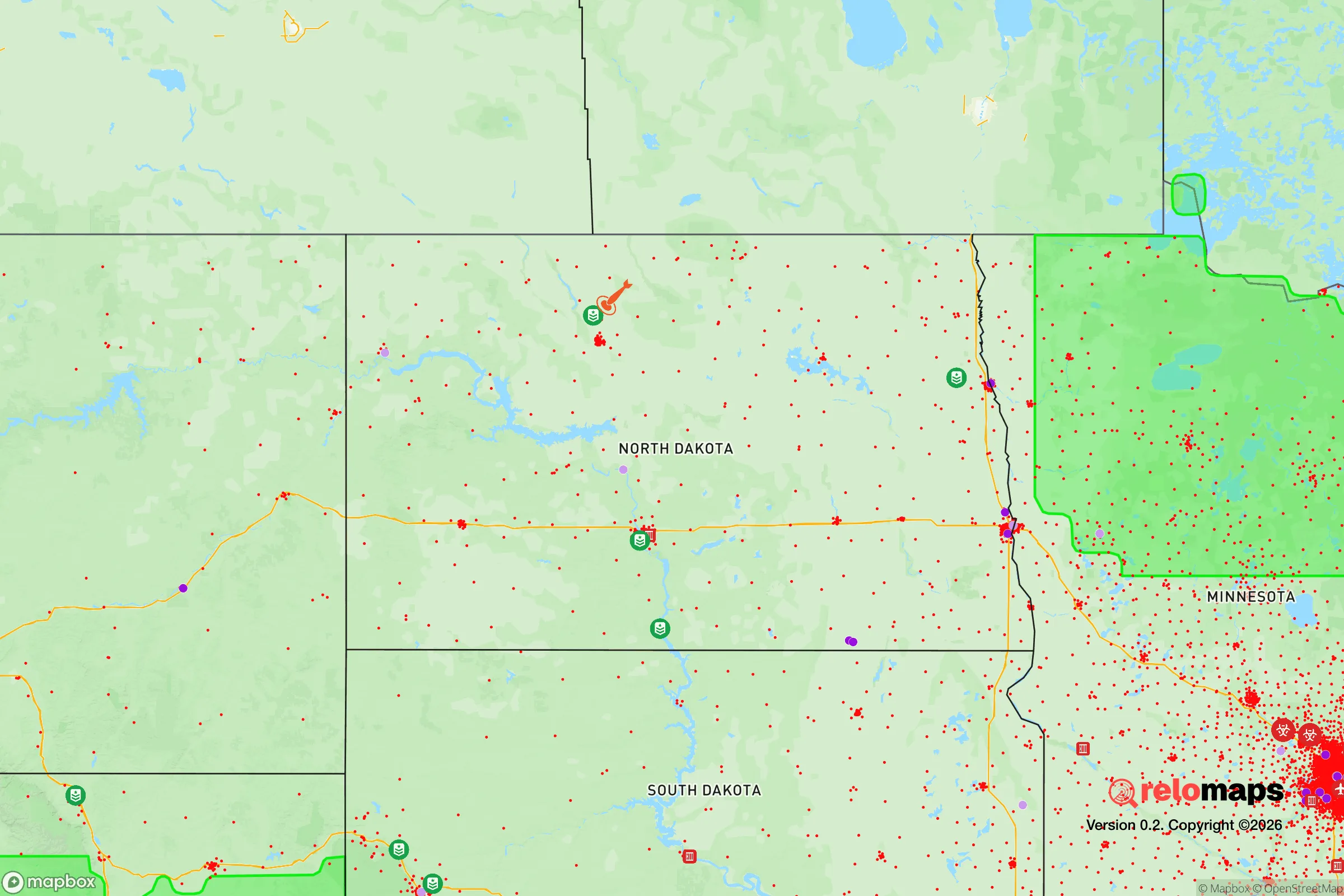
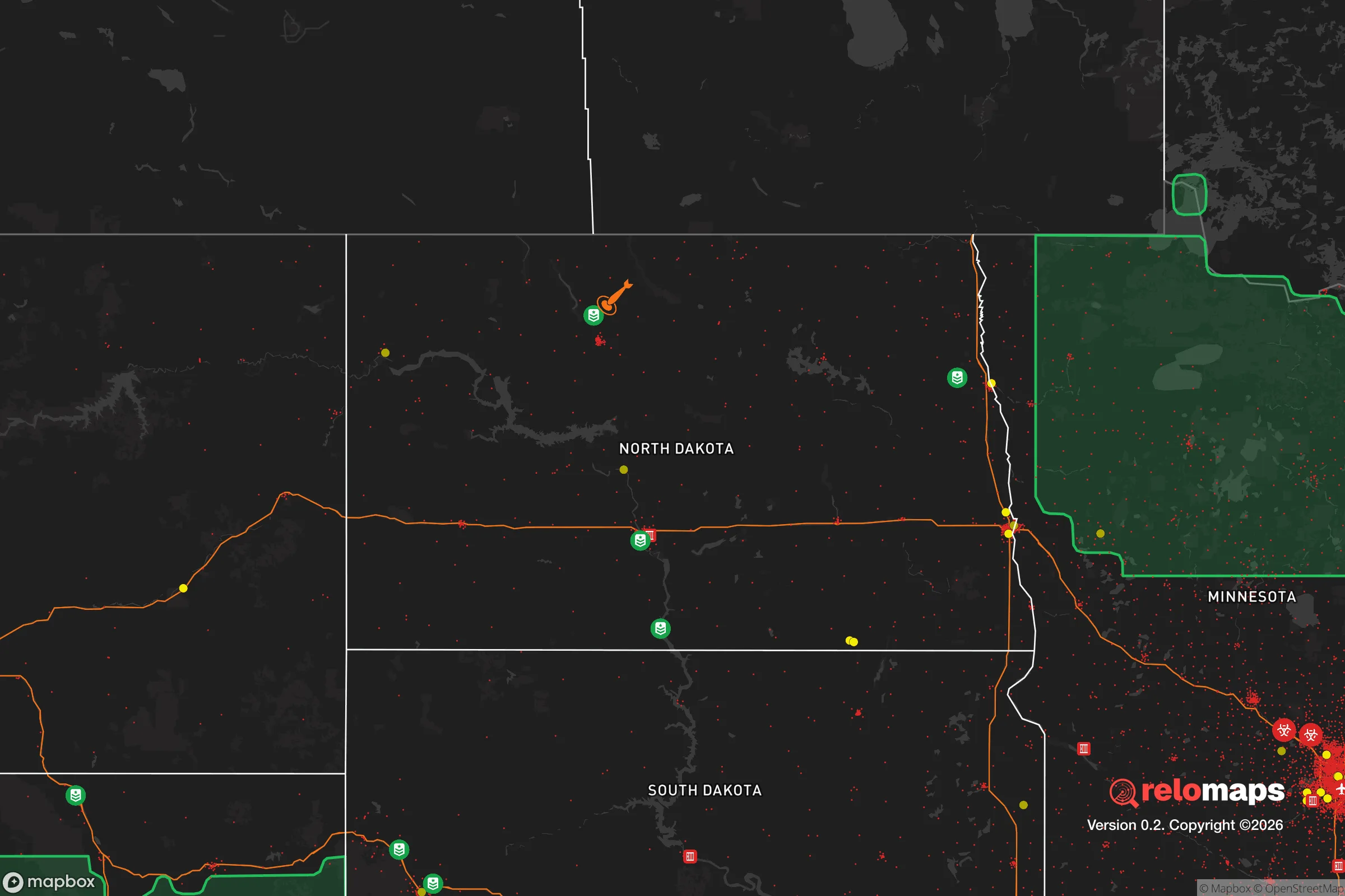
Important Note: For informational purposes only. This does not mean nothing bad ever happens in the green zones. Please use common sense. This is based on public data and modeled with AI. We tried to take a conservative approach but mistakes happen. We update this regularly as new information becomes available.
Solar Generator Recommendations
Backup power matters more here than in safer locations. We've picked three solar generators across budgets and capacity tiers — start with the budget unit if you only need a few essentials, or step up if you want to run a fridge and HVAC for days at a time.

Jackery Portable Power Station Explorer 300
Budget OptionPower on the Go: Weighing only 11 lbs, it's convenient to set up and store with book-sized foldable solar panels

BLUETTI Portable Power Station AC180
Designed for both indoor and outdoor scenarios, AC180 is highly capable as it has a robost capacity and continuous output power.

EF ECOFLOW DELTA Pro Ultra Power Station
Upgraded PickEcoFlow DELTA Pro Ultra is a whole-home energy system designed to grow with your family. Integrated with the Smart Home Panel 2, it scales to meet your evolving energy needs — keeping your home powered, intelligent, and secure through every stage of life.
We earn a commission, at no additional cost to you.
Strategic Assessment Analysis
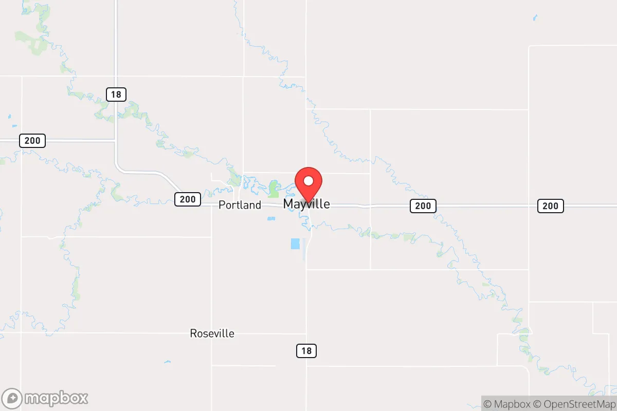
Mayville, North Dakota, presents a compelling case for the strategic relocator, offering a blend of geographic isolation and functional infrastructure that is increasingly rare in the Lower 48. Its position in the Red River Valley, roughly 45 miles from the Canadian border and 50 miles from Grand Forks, places it far from the primary corridors of national unrest while still providing access to regional medical and supply hubs. The town’s population of roughly 1,000 residents, combined with a low crime rate and a strong agricultural economy, creates a baseline of stability that many preppers find attractive. However, the area’s flat terrain and proximity to a major missile field require careful consideration for anyone serious about long-term resilience.
Geographic position and natural advantages for long-term security
Mayville’s location in the northeastern corner of North Dakota offers several distinct advantages for those prioritizing strategic depth. The town sits on the eastern edge of the Drift Prairie, a region of gently rolling hills and fertile soil, but the immediate area is predominantly flat, open farmland. This provides excellent long-range visibility—a key defensive asset—but also means limited natural cover. The Red River, which forms the border with Minnesota, is roughly 20 miles to the east, offering a reliable freshwater source and a natural boundary that could slow movement from that direction. The Canadian border, a 45-minute drive north, provides an additional buffer zone and a potential escape route if conditions deteriorate. Critically, Mayville is over 100 miles from the nearest major population center (Fargo), placing it well outside the likely chaos zones of a major urban collapse. The area’s low population density—Traill County has fewer than 8,000 people total—means fewer competition for resources and a tighter-knit community that can be vetted for trustworthiness. The climate is harsh, with winter lows often below -20°F, but this also acts as a natural filter, deterring unprepared transient populations and reducing the viability of large-scale migration into the region during a crisis.
Risks, exposures, and proximity to fallout-relevant landmarks
No strategic assessment is complete without a sober look at the threats, and Mayville has a few that demand attention. The most significant is its proximity to the Grand Forks Air Force Base, located about 50 miles to the north. This base is a key hub for drone operations and missile defense, making it a potential high-value target in a conflict scenario. While 50 miles provides some standoff distance, prevailing winds from the north could carry fallout or secondary effects southward. Additionally, the region lies within the broader footprint of the Minot Air Force Base’s missile field, which extends across much of north-central North Dakota. The actual silos are scattered and hardened, but a direct strike on the base itself could produce a significant electromagnetic pulse (EMP) or fallout plume. The flat terrain offers no natural shielding from blast effects or radiation, so a basement or reinforced shelter is non-negotiable for anyone serious about surviving a nuclear exchange. On the plus side, Mayville is far from any major chemical plants, nuclear power reactors, or large-scale industrial targets. The nearest refinery is in St. Paul Park, Minnesota, over 250 miles away. The risk of civil unrest is minimal given the small population and strong local law enforcement presence, but the town’s location on a state highway (ND-200) means it could see through-traffic from Fargo or Grand Forks if those cities experience a breakdown in order. The lack of a major interstate nearby (I-29 is 30 miles west) actually works in your favor, as it reduces the likelihood of large-scale refugee flows.
Practical resilience for a relocator: food, water, energy, and defensibility
For the individual or family looking to establish a self-sufficient homestead, Mayville offers a strong foundation. The surrounding farmland is some of the most productive in the nation, with wheat, soybeans, and corn as the primary crops. Local farmers are generally open to barter arrangements for bulk grains or livestock, and the town’s agricultural co-op provides a ready source of seeds, tools, and animal feed. Water is abundant via the Red River and the underlying Dakota Aquifer, but surface water requires filtration due to agricultural runoff. A deep well is the preferred solution, and drilling costs in the area are reasonable—typically $15–$30 per foot. The flat terrain makes solar panel installation straightforward, though winter snow cover and short daylight hours mean you’ll need a backup generator or wind turbine. Natural gas is available in town, but rural properties rely on propane or heating oil. Defensibility is a mixed bag: the open fields offer clear sightlines but little cover, so a perimeter fence and a good pair of binoculars are essential. The town itself is compact and walkable, with a single main street, which simplifies neighborhood watch and mutual aid. The local hospital, though small, is staffed and equipped for basic emergencies, and the county sheriff’s office is responsive. For those with a prepper mindset, the key is to build relationships with neighbors before a crisis—the community is tight-knit and suspicious of outsiders, but once accepted, you’ll find a network of skilled tradespeople, hunters, and farmers who can share knowledge and resources.
The overall strategic picture for Mayville is one of calculated trade-offs. You gain exceptional isolation, a productive agricultural base, and a low-risk profile for most man-made and natural disasters. You accept a harsh climate, limited natural cover, and a non-trivial proximity to military targets that could become liabilities in a full-scale conflict. For the conservative-leaning relocator who values self-reliance, community cohesion, and distance from the chaos of urban centers, Mayville is a strong candidate—provided you invest in a solid basement, a reliable heating system, and a good set of neighbors. It’s not a bug-out location for a weekend; it’s a place to build a life that can withstand the shocks ahead. The flat fields and cold winters will test your resolve, but for those who can endure, the rewards are genuine security and a future that doesn’t depend on the stability of distant cities.
* Values derived from national, state, county, city and local statistics and may differ in a specific area. Last updated: 2026-04-19T05:18:50.000Z
Narrative content on this page is AI-generated and may contain mistakes. Verify any details that matter before acting on them.
ReloMaps may earn a commission from affiliate links at no extra cost to you.