
Photo: Wikipedia
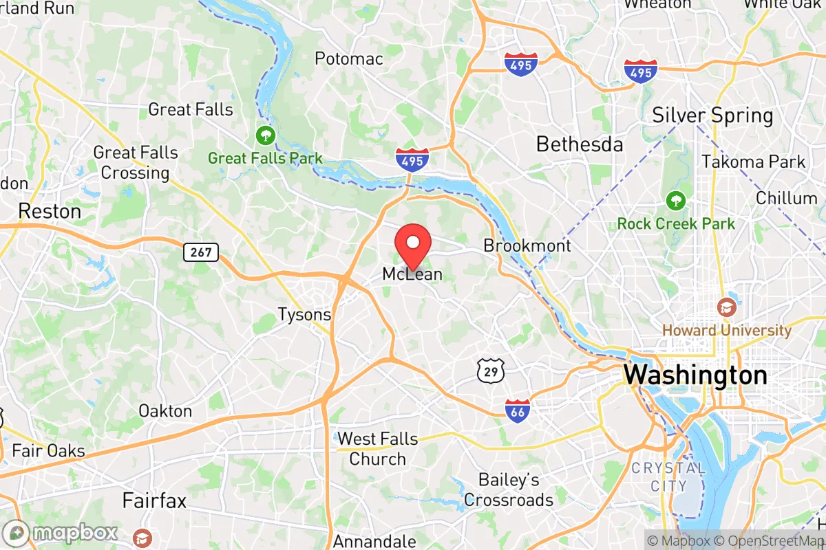
Strategic Assessment of McLean, VA
Meaningful friction. Expect exposure to either population pressure, blast zones, or natural disaster risk. Consider buying a retreat property.
What does the Strategic Assessment tell us?
Our Strategic Assessment grades tactical survivability of an area. Major population centers, military targets, fallout zones, natural disasters, and border exposure all drive risk — lower exposure means a more defensible position in a crisis.
This is heavily inspired by Joel Skousen's Strategic Relocation book. Highly recommended you checkout the book ($)What does this tell us?
Our Strategic Assessment grades tactical survivability of an area. Major population centers, military targets, fallout zones, natural disasters, and border exposure all drive risk — lower exposure means a more defensible position in a crisis.
This is heavily inspired by Joel Skousen's Strategic Relocation book. Highly recommended you checkout the book ($)Strategic Pillars

Key Distances
Regional Safe Places
Below is our recommended "safe zones" in Virginia and the surrounding area based on our strategic heuristics. For most people, it's unrealistic to live in a “safe zone” full-time due to work, family or other personal reasons. They tend to be more rural. However, many of these areas are perfect for second homes and retreat properties that double as a vacation home or even a short-term rental.


Important Note: For informational purposes only. This does not mean nothing bad ever happens in the green zones. Please use common sense. This is based on public data and modeled with AI. We tried to take a conservative approach but mistakes happen. We update this regularly as new information becomes available.
Solar Generator Recommendations
Backup power matters more here than in safer locations. We've picked three solar generators across budgets and capacity tiers — start with the budget unit if you only need a few essentials, or step up if you want to run a fridge and HVAC for days at a time.

Jackery Portable Power Station Explorer 300
Budget OptionPower on the Go: Weighing only 11 lbs, it's convenient to set up and store with book-sized foldable solar panels

BLUETTI Portable Power Station AC180
Designed for both indoor and outdoor scenarios, AC180 is highly capable as it has a robost capacity and continuous output power.

EF ECOFLOW DELTA Pro Ultra Power Station
Upgraded PickEcoFlow DELTA Pro Ultra is a whole-home energy system designed to grow with your family. Integrated with the Smart Home Panel 2, it scales to meet your evolving energy needs — keeping your home powered, intelligent, and secure through every stage of life.
We earn a commission, at no additional cost to you.
Strategic Assessment Analysis
McLean, Virginia offers a paradox for the strategic relocator: it sits in the bullseye of the nation’s power grid, yet its specific geography and infrastructure provide a resilience profile that few other D.C.-adjacent suburbs can match. For the conservative-minded individual or family who prioritizes preparedness without abandoning professional or political proximity to the capital, McLean presents a calculated trade-off. The area’s elevation along the Potomac River, its concentration of defense and intelligence professionals, and its relatively robust local supply chains create a foundation that can be hardened—but only if you understand the risks baked into its location.
Geographic position and natural advantages for long-term stability
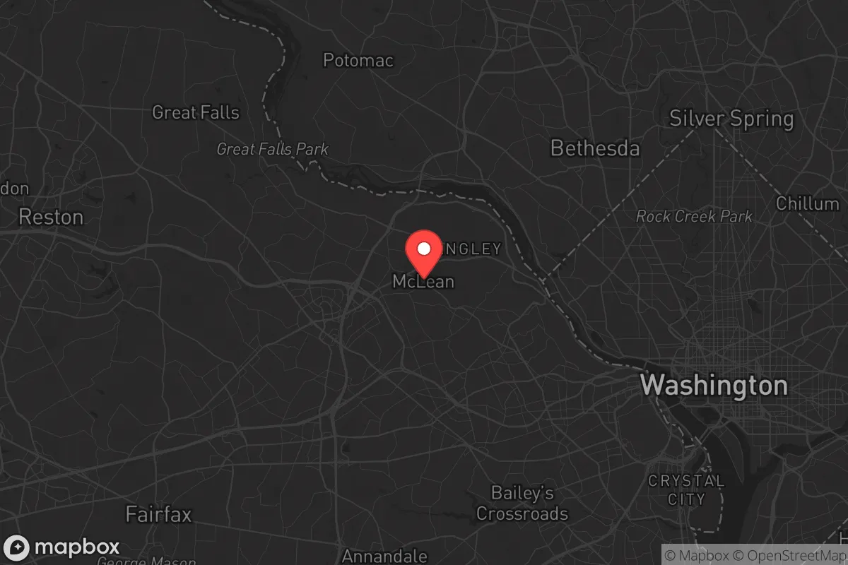
McLean sits on the Virginia side of the Potomac, roughly 12 miles northwest of the White House, but its topography offers more than just a scenic view. The area is characterized by rolling hills, mature hardwood forests, and a network of creeks feeding into the Potomac—features that provide natural cover, drainage, and defensible terrain compared to the flat, flood-prone zones closer to the river’s tidal basin. The elevation ranges from about 100 to 400 feet above sea level, which means McLean is largely outside the 100-year floodplain, a practical advantage if regional infrastructure fails during a prolonged crisis. The tree canopy is dense enough to obscure movement from aerial observation, yet the road network—anchored by the George Washington Memorial Parkway, I-495, and the Dulles Toll Road—offers multiple egress routes. For a relocator thinking in terms of bug-out corridors, McLean’s position gives you access to the western escape routes toward the Blue Ridge Mountains and the Shenandoah Valley, while still being close enough to monitor the pulse of the federal government. The Potomac itself is a reliable water source, though you’d need filtration and purification gear, as the river carries runoff from upstream agriculture and suburban development.
Risks, exposures, and proximity to fallout-relevant landmarks
Let’s be direct: McLean’s greatest vulnerability is its proximity to high-value targets. The Central Intelligence Agency headquarters is in Langley, literally within McLean’s postal boundaries. The Pentagon is 8 miles southeast. The White House, Capitol, and State Department are all within a 20-minute drive under normal traffic. In a scenario involving a mass casualty event, electromagnetic pulse (EMP) attack, or large-scale civil unrest, McLean sits in the primary blast and fallout zone for any coordinated strike on the D.C. metro area. The area is also directly under the flight paths for Reagan National and Dulles International airports, meaning any airborne threat—whether a hijacked commercial jet or a drone swarm—would pass overhead. Additionally, the region’s power grid is heavily dependent on overhead transmission lines that run through wooded corridors; a coordinated sabotage campaign could knock out electricity for weeks. The water supply comes from the Potomac via the D.C. Water system, which is a single-point-of-failure vulnerability. If the treatment plants at the Dalecarlia or McMillan reservoirs are compromised, McLean’s taps go dry. The soil is primarily clay-based, which means septic systems and private wells are uncommon in the denser neighborhoods—most homes rely on municipal water and sewer, creating a dependency that a prepper must account for. On the positive side, the presence of so many federal facilities means that McLean is likely to receive priority for emergency response and power restoration compared to outlying suburbs, but that also means it could be cordoned off or locked down during a crisis.
Practical resilience for a relocator: food, water, energy, and defensibility
For a family or individual looking to establish a resilient household in McLean, the starting point is understanding that you cannot rely on the local government for anything beyond the first 72 hours. The area’s grocery stores—Giant, Safeway, and the upscale Balducci’s—are well-stocked under normal conditions, but they empty within hours of any regional panic, as seen during the COVID-19 runs. The best strategy is to build a 90-day food supply in a basement or climate-controlled storage room; basements are common in McLean’s older homes but less so in newer luxury builds, so check the foundation type before buying. Water storage is more challenging: a typical household needs at least 55 gallons per person for a two-week supply, and most McLean homes lack the space for that volume without a dedicated utility room. A better approach is to invest in a high-capacity Berkey filter or a countertop reverse osmosis system, plus a few 5-gallon collapsible containers that can be filled from the Potomac or a neighbor’s pool. For energy, solar panels with battery backup are increasingly common in McLean’s upper-bracket homes, but the tree cover can reduce yield; a dual-fuel generator running on propane or natural gas is more reliable, especially since natural gas lines are widespread in the area and tend to stay pressurized even during grid failures. Defensibility is mixed: the wealthier neighborhoods like Langley and the areas near the CIA have private security patrols and gated entrances, which can deter low-level looting but won’t stop a determined mob. The street layouts are winding and often dead-end, which is good for creating choke points but bad for rapid escape. A practical relocator should identify two primary bug-out routes: one west on Route 123 toward Great Falls and the Potomac crossings into Maryland, and one southwest on the Toll Road toward the rural areas of Loudoun County. McLean’s local police and fire response times are excellent—typically under 5 minutes—but in a widespread event, those resources will be stretched thin or redirected to protect federal assets.
Overall, McLean is a strategic location for the conservative prepper who needs to stay close to the levers of power but is willing to invest heavily in hardening a single property. It is not a retreat; it is a forward operating base. The area’s natural advantages—elevation, tree cover, multiple egress routes, and a Potomac water source—are real, but they are offset by the extreme risk of being in the primary target zone for any attack on the federal government. If your plan is to ride out a short-term disruption (under two weeks) while maintaining your career and social connections, McLean can work with the right preparations. If you are planning for a long-term collapse or a nuclear exchange, you are better off 100 miles west in the Shenandoah Valley. For the single professional or family who wants to be prepared without going off-grid, McLean offers a defensible compromise—but only if you treat it as a high-risk, high-reward position that demands constant vigilance and a fully stocked basement.
* Values derived from national, state, county, city and local statistics and may differ in a specific area. Last updated: 2026-04-27T14:48:07.000Z
Narrative content on this page is AI-generated and may contain mistakes. Verify any details that matter before acting on them.
ReloMaps may earn a commission from affiliate links at no extra cost to you.