Photo: Wikipedia
Strategic Assessment of Meriden, CT
Multiple tactical vulnerabilities. Population density, target proximity, or disaster risk are likely compounding. A retreat property and exit planning is required.
What does the Strategic Assessment tell us?
Our Strategic Assessment grades tactical survivability of an area. Major population centers, military targets, fallout zones, natural disasters, and border exposure all drive risk — lower exposure means a more defensible position in a crisis.
This is heavily inspired by Joel Skousen's Strategic Relocation book. Highly recommended you checkout the book ($)What does this tell us?
Our Strategic Assessment grades tactical survivability of an area. Major population centers, military targets, fallout zones, natural disasters, and border exposure all drive risk — lower exposure means a more defensible position in a crisis.
This is heavily inspired by Joel Skousen's Strategic Relocation book. Highly recommended you checkout the book ($)Strategic Pillars

Key Distances
Regional Safe Places
Below is our recommended "safe zones" in Connecticut and the surrounding area based on our strategic heuristics. For most people, it's unrealistic to live in a “safe zone” full-time due to work, family or other personal reasons. They tend to be more rural. However, many of these areas are perfect for second homes and retreat properties that double as a vacation home or even a short-term rental.


Important Note: For informational purposes only. This does not mean nothing bad ever happens in the green zones. Please use common sense. This is based on public data and modeled with AI. We tried to take a conservative approach but mistakes happen. We update this regularly as new information becomes available.
Solar Generator Recommendations
Backup power matters more here than in safer locations. We've picked three solar generators across budgets and capacity tiers — start with the budget unit if you only need a few essentials, or step up if you want to run a fridge and HVAC for days at a time.

Jackery Portable Power Station Explorer 300
Budget OptionPower on the Go: Weighing only 11 lbs, it's convenient to set up and store with book-sized foldable solar panels

BLUETTI Portable Power Station AC180
Designed for both indoor and outdoor scenarios, AC180 is highly capable as it has a robost capacity and continuous output power.

EF ECOFLOW DELTA Pro Ultra Power Station
Upgraded PickEcoFlow DELTA Pro Ultra is a whole-home energy system designed to grow with your family. Integrated with the Smart Home Panel 2, it scales to meet your evolving energy needs — keeping your home powered, intelligent, and secure through every stage of life.
We earn a commission, at no additional cost to you.
Strategic Assessment Analysis
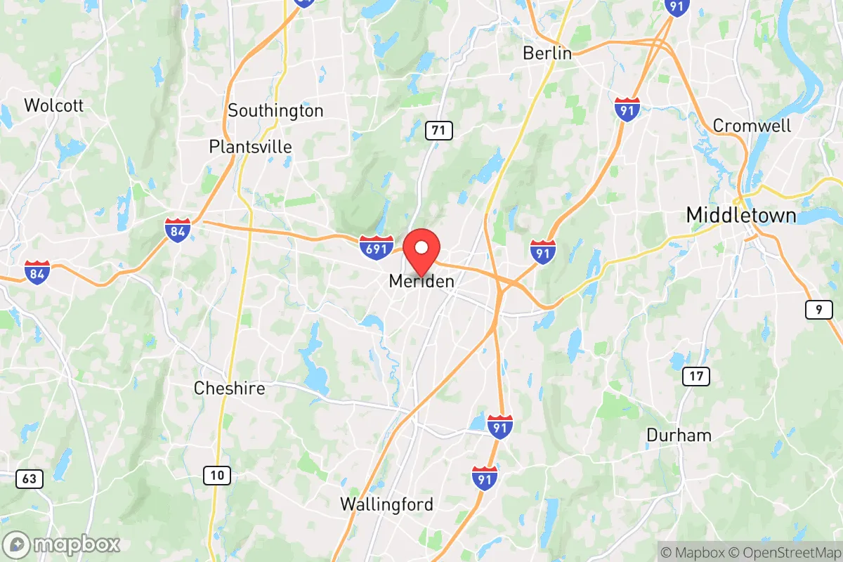
Meriden, Connecticut, sits in a precarious but potentially workable position for the prepper or survivalist looking at the Northeast corridor. Its central location in the state offers a mix of proximity to critical resources and exposure to the very urban chaos you are trying to avoid. The city’s resilience is a double-edged sword: it has the bones of an old industrial hub with decent infrastructure, but it is also a stone’s throw from the I-91 and I-84 corridors, which would become chokepoints or escape routes in a crisis. For a relocator weighing the trade-offs between isolation and access, Meriden is a middle-ground option that demands a clear-eyed assessment of its strategic liabilities and assets.
Geographic position and natural advantages for long-term survival
Meriden’s geography is defined by its position in the central Connecticut River Valley, flanked by the traprock ridges of the Hanging Hills and the Metacomet Ridge. This terrain offers a few genuine advantages. The Hanging Hills, including West Peak and East Peak, provide elevated vantage points that could be used for observation or a bug-out location, though they are not remote enough for a permanent retreat. The city sits on the Quinnipiac River, a modest water source that, while not a major river like the Connecticut, could support small-scale fishing and irrigation if treated properly. The surrounding hardwood forests offer decent cover and potential for foraging, but the land is heavily fragmented by suburban development. For a prepper, the key natural asset here is the varied topography that creates natural defensible positions in the ridges and valleys, but you would need to secure a property with direct access to these features, as public trails are heavily trafficked and would be compromised in a collapse scenario. The soil in the valley is decent for small-scale agriculture, but the growing season is short (roughly 150 days) and the climate is trending toward wetter, more erratic weather patterns.
Risks, exposures, and proximity to fallout-relevant landmarks
This is where the analysis gets uncomfortable for the conservative prepper. Meriden’s location is a liability in terms of proximity to high-value targets and population centers. The city is roughly 20 miles from Hartford, the state capital and a major insurance and government hub, which would be a primary target for civil unrest, cyberattacks, or even a kinetic event. It is also about 30 miles from New Haven, a port city with a major university (Yale) and a concentration of medical and research facilities that could become targets for looting or worse. The I-91 corridor runs directly through Meriden, connecting it to Hartford and New Haven, meaning any mass evacuation or refugee flow from those cities would funnel through the area. The Bradley International Airport (about 25 miles north) is a potential staging ground for FEMA or military operations, which could bring unwanted attention. Additionally, the Seabrook Nuclear Power Plant in New Hampshire is about 120 miles away, but prevailing winds from the west mean a plume from a coastal incident could still affect the region. The Millstone Nuclear Power Station in Waterford, CT, is about 40 miles southeast, which is uncomfortably close for a fallout scenario. Meriden itself has no major military bases or government bunkers, but its industrial history means there are old manufacturing sites with potential environmental hazards (brownfields) that could complicate post-disaster recovery.
Practical resilience for a relocator: food, water, energy, and defensibility
For a single individual or family looking to set up a resilient household in Meriden, the practical considerations are mixed. Water is a moderate concern: the city draws from the Meriden Water System, which relies on reservoirs in the surrounding hills (e.g., Broad Brook Reservoir). In a grid-down scenario, these reservoirs could be accessed with a gravity-fed system if you have the right property, but most homes are on municipal water, which would fail without power. You would need a backup well or a rainwater catchment system to be self-sufficient, and the local geology (trap rock and clay) makes drilling a well expensive and uncertain. Food resilience is poor for the average suburban lot; most homes in Meriden have small yards, so you would need to rely on community gardens or a rural property outside the city limits. The local farmers' markets (e.g., the Meriden Farmers' Market) are seasonal and would collapse in a crisis. Energy is a bright spot: Connecticut has decent solar potential, and the state offers net metering and incentives, but the grid is aging and prone to outages from storms. A solar array with battery backup is a solid investment here, but you would need to harden it against vandalism or theft. Defensibility is the weakest link. Meriden is a dense, older city with a mix of single-family homes and multi-family units. Most neighborhoods lack the standoff distance and natural barriers needed for a secure perimeter. The best option would be a property on the outskirts near the Hanging Hills or in the more rural sections of the city (e.g., near the Meriden-Wallingford line), but even then, you are within walking distance of major roads. For a family, the schools are a concern: Meriden Public Schools are underfunded and have struggled with performance metrics, which could be a red flag for parents looking for stability in a deteriorating system.
The overall strategic picture for Meriden is that it is a compromise location. It offers proximity to the resources of the Northeast (medical centers, supply chains, and potential trade routes) but at the cost of being within the blast radius of urban collapse. For a prepper who cannot afford rural land in Vermont or New Hampshire, Meriden provides a foothold with decent terrain and water access, but it requires a high level of preparation and a willingness to bug out if the situation deteriorates. The city’s central location means you are never more than an hour from a major population center, which is both a curse and a potential asset for barter or information gathering. However, for the conservative relocator seeking true independence and security, Meriden is a stepping stone, not a destination. The smart play here is to use it as a base for building skills and resources while actively scouting a more defensible property in the Litchfield Hills or the Berkshires. If you are set on staying, focus on hardening a single-family home with off-grid water, solar, and a well-stocked pantry, and establish a network of like-minded neighbors in the more rural pockets of the city. The Hanging Hills will not save you from a mob, but they can buy you time if you know the trails. In short, Meriden is a viable option for the prepared individual who understands that survival in the Northeast means being ready to move, not just hunker down.
* Values derived from national, state, county, city and local statistics and may differ in a specific area. Last updated: 2026-04-19T06:54:05.000Z
Narrative content on this page is AI-generated and may contain mistakes. Verify any details that matter before acting on them.
ReloMaps may earn a commission from affiliate links at no extra cost to you.