Photo: Wikipedia
Strategic Assessment of Harrison County
Meaningful friction. Expect exposure to either population pressure, blast zones, or natural disaster risk. Consider buying a retreat property.
What does the Strategic Assessment tell us?
Our Strategic Assessment grades tactical survivability of an area. Major population centers, military targets, fallout zones, natural disasters, and border exposure all drive risk — lower exposure means a more defensible position in a crisis.
This is heavily inspired by Joel Skousen's Strategic Relocation book. Highly recommended you checkout the book ($)What does this tell us?
Our Strategic Assessment grades tactical survivability of an area. Major population centers, military targets, fallout zones, natural disasters, and border exposure all drive risk — lower exposure means a more defensible position in a crisis.
This is heavily inspired by Joel Skousen's Strategic Relocation book. Highly recommended you checkout the book ($)Strategic Pillars

Key Distances
Strategic Assessment Analysis
Harrison County, Mississippi, delivers a hard-nosed strategic baseline for the relocator who takes self-reliance seriously. Its position on the Gulf Coast offers both a maritime lifeline and a glaring exposure to storm surge, military-target density, and industrial fallout corridors. For the prepper weighing civic unrest, mass-casualty scenarios, or broader national collapse, this slice of the Coast demands clear-eyed math: the advantages in water access, community grit, and Mississippi’s permissive legal climate must be balanced against the targets sitting right next door. The following assessment unpacks what a conservative-leaning, survival-minded individual or family should know before betting on this piece of real estate.
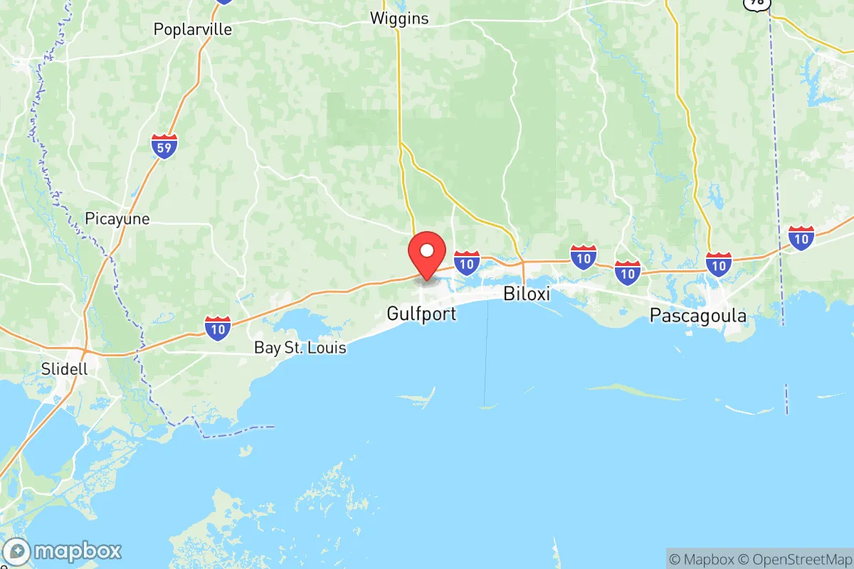
Harrison County’s geographic position and natural advantages on the Gulf Coast
Harrison County runs along roughly 40 miles of Mississippi Sound, anchored by the twin cities of Gulfport and Biloxi. To the south, the barrier islands — Deer Island, Ship Island, and others — act as a first-line wave buffer, though they’re no substitute for structural hardening. The Intracoastal Waterway cuts east-west through the county, giving a protected artery for small-boat movement and supply runs if road networks go down. North of Interstate 10, the terrain rises gently into pine savannah and mixed hardwood forest, offering rural pockets in communities like Saucier and Lyman that sit 15–25 miles inland. That inland strip is where the serious prepper will want to focus: lower population density, better groundwater potential, and a buffer from storm surge. The county also sits within a 90-minute drive of two major fresh-water sources — the Pascagoula River basin to the east and the Pearl River system to the west — both of which maintain flow even in drought. For a relocator starting from scratch, water will be simpler to secure here than in arid western states.
Risks, exposures, and proximity to fallout-relevant landmarks on the Mississippi Coast
Harrison County has a target-rich environment that any threat-mapping prepper should flag immediately. Keesler Air Force Base, located in Biloxi, is a primary training center for electronics and cyber operations. In a major conflict or national emergency, Keesler is a high-probability kinetic target — and that puts the eastern half of the county inside a pre-designated blast and fallout zone. Just east of Harrison County, in Pascagoula, Ingalls Shipbuilding builds and refuels nuclear-powered aircraft carriers and submarines for the U.S. Navy. That facility, along with the Chevron Pascagoula Refinery — one of the largest on the Gulf Coast — creates a secondary risk corridor for chemical release, targeted attack, or secondary industrial accidents. The Port of Gulfport handles container shipping and military cargo, making it another potential choke point. Additionally, Harrison County sits less than 100 miles east of New Orleans, a major urban center that could generate refugee flows, resource competition, and cascading infrastructure failures after any mass-casualty event. On the meteorological front, the county faces a direct hurricane strike every 10–15 years on average, and storm surge can push 20 feet into low-lying areas near the coast. Anyone relocating here must plan for a 100-mile bug-out route inland — at least to the Hattiesburg area — or harden their home to Category 4 standards.
Practical resilience for a relocator: food, water, energy, and defensibility in Harrison County
On the plus side, Mississippi is one of the most relaxed states in the Union for self-reliance. Constitutional carry, no permit needed for open or concealed carry, and minimal building code overhead in unincorporated areas give preppers a wide berth. Mississippi now has a broad Right-to-Farm law that shields agricultural operations from nuisance lawsuits, important if you plan to raise livestock or crops. Water wells are permissible without state permitting for domestic use in most of the county, though a licensed driller is recommended for depth. Average rainfall is about 63 inches per year, meaning rainwater catchment is viable nine months out of twelve. For energy, the local electric co-op (Coast Electric Power Association) serves most rural areas, but solar panels are a practical supplement: the county averages 215 sunny days per year, and net metering is allowed for systems up to 20 kW. Growing season runs from March into November — serious gardeners can put up three harvests of greens and root crops in a good year. Defensibility is the weak link: the coastal terrain is flat, with shallow drainages and pine thickets. A rural property with a cleared 100-yard perimeter and a well-placed driveway choke point is possible in the Saucier or Bond areas, but the county as a whole lacks natural vertical cover. Group-oriented preppers should consider forming a neighborhood watch or cooperative agreement with like-minded landowners; law enforcement response times in rural Harrison County can exceed 45 minutes.
The strategic picture for Harrison County is one of high-risk tolerance rewarded by resource richness. For the single individual or parent who can live with hurricane seasons and the proximity of major military-industrial targets, the county offers excellent growing conditions, permissive gun laws, a strong local food economy (Gulf seafood, local produce stands), and a working-class population that generally leans conservative and self-reliant. The wildcard remains Keesler Air Force Base and the Port of Gulfport — both serious liabilities in any national-level calamity. If the relocator is willing to locate 25 miles inland, maintain a 100-mile bug-out vehicle ready, and join a local prepper or firearms club for mutual support, Harrison County can serve as a functional base of operations. But it’s not a remote fortress. It’s a working coast where you’ll need to stay awake, stay armed, and stay flexible.
* Values derived from national, state, county, city and local statistics and may differ in a specific area. Last updated: 2026-05-28T14:06:42.000Z
Narrative content on this page is AI-generated and may contain mistakes. Verify any details that matter before acting on them.
ReloMaps may earn a commission from affiliate links at no extra cost to you.