
Photo: Wikipedia
Strategic Assessment of Lee County
Workable tactical position. Some exposure to population density or targets, but generally defensible in a crisis.
What does the Strategic Assessment tell us?
Our Strategic Assessment grades tactical survivability of an area. Major population centers, military targets, fallout zones, natural disasters, and border exposure all drive risk — lower exposure means a more defensible position in a crisis.
This is heavily inspired by Joel Skousen's Strategic Relocation book. Highly recommended you checkout the book ($)What does this tell us?
Our Strategic Assessment grades tactical survivability of an area. Major population centers, military targets, fallout zones, natural disasters, and border exposure all drive risk — lower exposure means a more defensible position in a crisis.
This is heavily inspired by Joel Skousen's Strategic Relocation book. Highly recommended you checkout the book ($)Strategic Pillars

Key Distances
Strategic Assessment Analysis
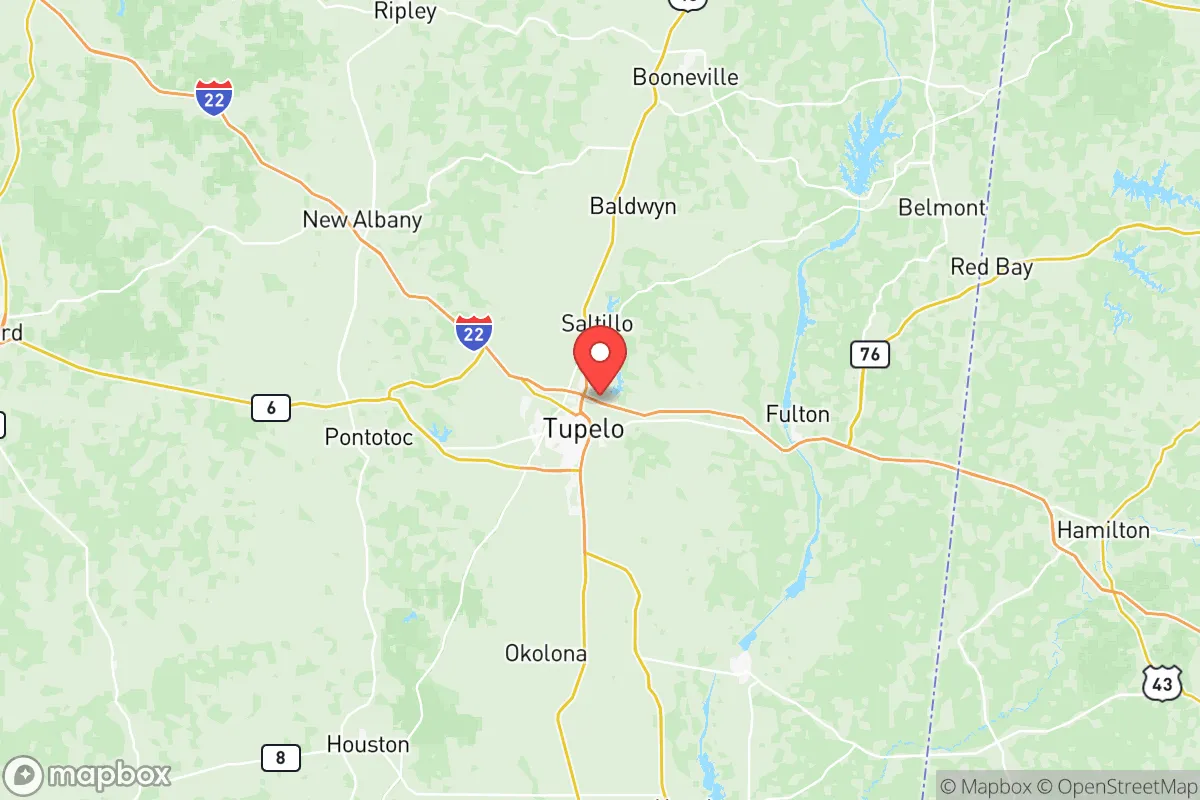
Lee County, Mississippi, offers a strategic relocation option for those prioritizing resilience and self-sufficiency, balancing rural accessibility with proximity to regional infrastructure. Anchored by the city of Tupelo, the county sits at the intersection of major highways (U.S. 78 and the future I-22 corridor) and is roughly equidistant from Memphis, Birmingham, and Huntsville, providing a buffer from major metropolitan vulnerabilities while retaining access to their resources. The area’s economic and logistical stability, rooted in manufacturing and healthcare, provides a baseline of preparedness that appeals to conservative-minded individuals and families seeking a defensible, lower-profile lifestyle.
Geographic position and natural advantages for long-term stability
Lee County’s location in the northeastern hills of Mississippi offers distinct geographic advantages for resilience. The terrain is gently rolling, with elevations ranging from 250 to 500 feet, which reduces the risk of flooding compared to the Delta region or coastal areas. The county is part of the Tennessee-Tombigbee Waterway system, with the Tombigbee River forming its eastern border near the town of Fulton. This waterway provides a navigable route to the Gulf of Mexico, a logistical asset for transport and potential supply chains in a disruption scenario. The area is also rich in hardwood forests, offering natural resources for fuel, construction, and foraging. Unlike the flat, open farmland of the Mississippi Delta, Lee County’s wooded hills provide natural cover and defensible terrain, a factor often overlooked in relocation assessments. The local climate is humid subtropical, with mild winters and hot summers, supporting a long growing season for food production—typically from April through October. This agricultural potential is a key advantage for those aiming for self-sufficiency, as the county’s soil, primarily silt loam over clay, is suitable for row crops, orchards, and pasture. The presence of the Natchez Trace Parkway, a federally protected corridor running through the county’s western edge, also preserves a green buffer zone that limits dense development and maintains wildlife corridors.
Risk exposure and proximity to fallout-relevant landmarks
While Lee County is not a primary target for large-scale industrial or military strikes, it is not entirely insulated from man-made risks. The most significant nearby landmark is the Tennessee Valley Authority’s (TVA) Yellow Creek Port facility in nearby Iuka, about 30 miles east, which handles coal and other bulk commodities. Further east, the Browns Ferry Nuclear Plant in Alabama (approximately 60 miles) is a potential fallout concern, though prevailing winds typically carry any release away from Lee County. The county itself hosts several industrial sites, including the Cooper Tire & Rubber plant in Tupelo and the Toyota Mississippi assembly plant in Blue Springs (just south of Tupelo), which could be secondary targets or sources of hazardous material releases. However, these are not high-value strategic targets like the refineries along the Gulf Coast or the military installations at Fort Campbell or Redstone Arsenal. The nearest major military base is the Mississippi Army Ammunition Plant in Stennis Space Center (far south), but more relevant is the presence of the Columbus Air Force Base (about 50 miles southeast), which trains pilots and could be a secondary target in a conflict. For a relocator, the primary risk is not direct attack but the potential for cascading effects from disruptions to the regional power grid, which is served by TVA and is vulnerable to both cyberattacks and physical sabotage. The county’s position along the I-22 corridor also means it could become a chokepoint for refugee movement from Memphis or Birmingham in a crisis, potentially straining local resources. Natural disaster risks are moderate: tornadoes are the primary threat, with Lee County lying in the Dixie Alley region, and the 2014 EF-3 tornado that struck Tupelo is a reminder of the need for storm shelters and preparedness plans. Flooding is localized along the Tombigbee and its tributaries, but most of the county’s developed areas are on higher ground.
Practical resilience for a relocator: food, water, energy, and defensibility
For those serious about self-sufficiency, Lee County offers a practical mix of resources and infrastructure. Water availability is strong: the county sits atop the Eutaw-McShan aquifer, which provides abundant groundwater for wells, and surface water from the Tombigbee River and numerous creeks (such as Town Creek and Old Town Creek) offers redundancy. The Tupelo Water & Light Department maintains a robust municipal system, but rural properties can easily drill private wells at depths of 100-300 feet. Food production is viable: the county has a strong agricultural tradition, with row crops (soybeans, corn, cotton) and livestock operations. The Lee County Farmers Market in Tupelo is one of the largest in the region, and local feed stores and co-ops (like the Tupelo Farm Supply) provide seeds, tools, and livestock supplies. For those raising animals, the county’s zoning is generally permissive for small-scale farming, even on residential lots in unincorporated areas. Energy resilience is moderate: TVA provides reliable grid power, but the area is not a priority for restoration after a major outage. Solar potential is good, with an average of 5.0 peak sun hours per day, and local installers are available. Wood heating is practical given the forest cover, and propane is widely available for backup. Defensibility is a mixed picture: the county’s population density is low (about 85 people per square mile), and rural properties in the eastern and northern parts of the county (near the towns of Saltillo and Guntown) offer good standoff distance from main roads. The terrain provides natural chokepoints and observation points, but the lack of natural barriers (like mountains or large rivers) means that a determined group could approach from multiple directions. The local law enforcement presence is adequate but not overwhelming; the Lee County Sheriff’s Department and Tupelo Police Department are professional but would be stretched thin in a widespread crisis. The county’s strong community ties and conservative culture are assets for mutual aid and neighborhood watch efforts, but newcomers should invest in building relationships before a crisis hits.
Overall, Lee County presents a balanced strategic picture for the resilience-minded relocator. It avoids the high-risk zones of coastal hurricanes, major industrial corridors, and primary military targets while retaining access to regional healthcare (North Mississippi Medical Center in Tupelo is the largest private hospital in the state) and supply chains. The county’s greatest strengths are its water resources, agricultural potential, and moderate population density, which together support a sustainable, low-profile lifestyle. Its weaknesses are the moderate tornado risk, the potential for refugee flow along I-22, and the lack of natural defensive barriers. For a family or individual willing to invest in a well, solar panels, and a storm shelter, Lee County offers a defensible, resource-rich base that balances isolation with connectivity—a pragmatic choice for those who want to be prepared without living off the grid entirely.

* Values derived from national, state, county, city and local statistics and may differ in a specific area. Last updated: 2026-08-16T15:10:34.000Z
Narrative content on this page is AI-generated and may contain mistakes. Verify any details that matter before acting on them.
ReloMaps may earn a commission from affiliate links at no extra cost to you.

