
Photo: Wikipedia
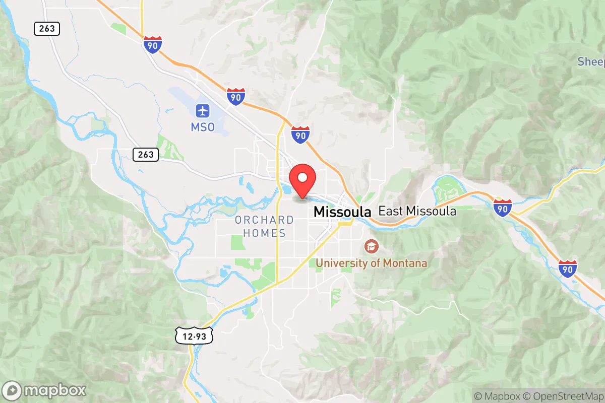
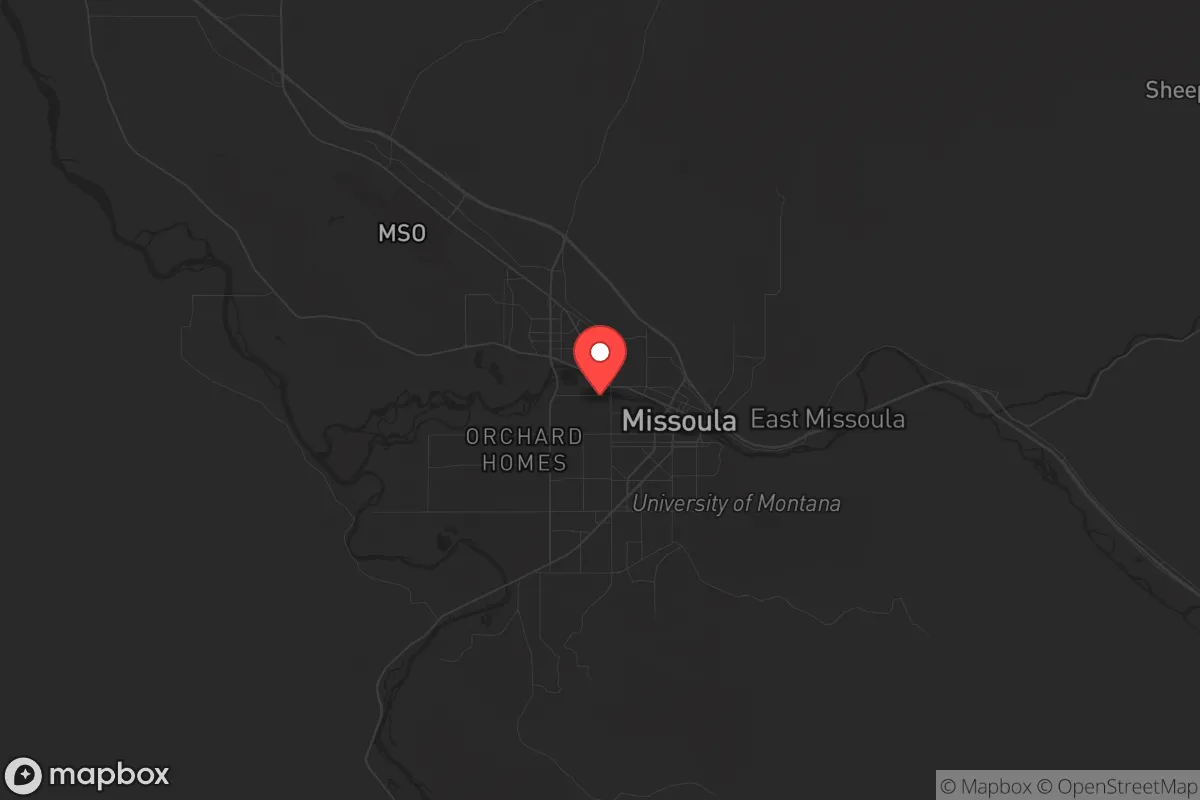
Strategic Assessment of Missoula, MT
Workable tactical position. Some exposure to population density or targets, but generally defensible in a crisis.
What does the Strategic Assessment tell us?
Our Strategic Assessment grades tactical survivability of an area. Major population centers, military targets, fallout zones, natural disasters, and border exposure all drive risk — lower exposure means a more defensible position in a crisis.
This is heavily inspired by Joel Skousen's Strategic Relocation book. Highly recommended you checkout the book ($)What does this tell us?
Our Strategic Assessment grades tactical survivability of an area. Major population centers, military targets, fallout zones, natural disasters, and border exposure all drive risk — lower exposure means a more defensible position in a crisis.
This is heavily inspired by Joel Skousen's Strategic Relocation book. Highly recommended you checkout the book ($)Strategic Pillars

Key Distances
Regional Safe Places
Below is our recommended "safe zones" in Montana and the surrounding area based on our strategic heuristics. For most people, it's unrealistic to live in a “safe zone” full-time due to work, family or other personal reasons. They tend to be more rural. However, many of these areas are perfect for second homes and retreat properties that double as a vacation home or even a short-term rental.
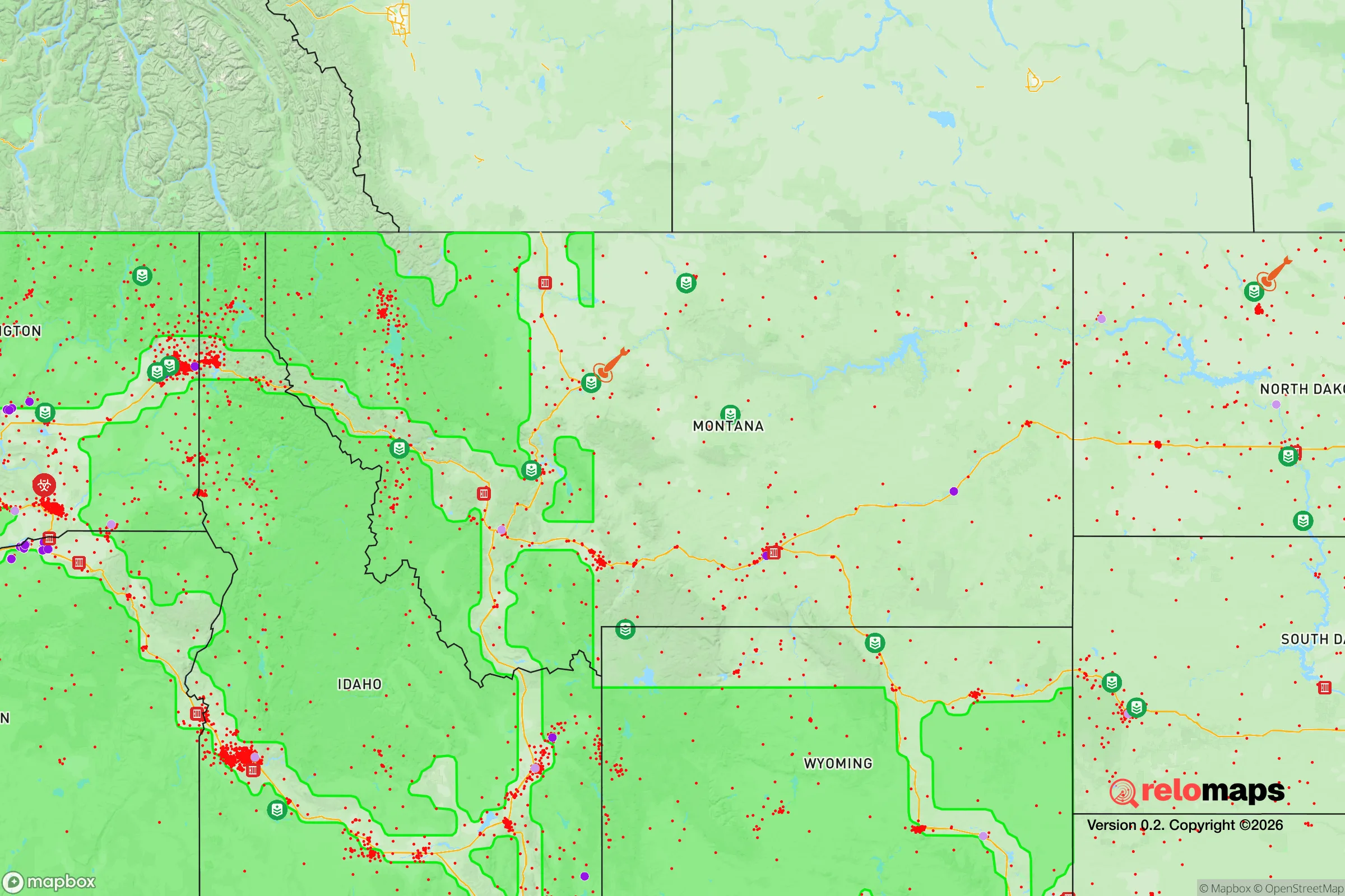

Important Note: For informational purposes only. This does not mean nothing bad ever happens in the green zones. Please use common sense. This is based on public data and modeled with AI. We tried to take a conservative approach but mistakes happen. We update this regularly as new information becomes available.
Solar Generator Recommendations
Backup power matters more here than in safer locations. We've picked three solar generators across budgets and capacity tiers — start with the budget unit if you only need a few essentials, or step up if you want to run a fridge and HVAC for days at a time.

Jackery Portable Power Station Explorer 300
Budget OptionPower on the Go: Weighing only 11 lbs, it's convenient to set up and store with book-sized foldable solar panels

BLUETTI Portable Power Station AC180
Designed for both indoor and outdoor scenarios, AC180 is highly capable as it has a robost capacity and continuous output power.

EF ECOFLOW DELTA Pro Ultra Power Station
Upgraded PickEcoFlow DELTA Pro Ultra is a whole-home energy system designed to grow with your family. Integrated with the Smart Home Panel 2, it scales to meet your evolving energy needs — keeping your home powered, intelligent, and secure through every stage of life.
We earn a commission, at no additional cost to you.
Strategic Assessment Analysis
Missoula, Montana, sits in a valley where five mountain ranges converge, offering a blend of natural barriers and resource access that makes it a serious contender for those prioritizing long-term resilience. Its location along Interstate 90 and the Clark Fork River provides a strategic corridor for movement and supply, yet the surrounding Bitterroot, Sapphire, and Rattler mountain ranges create natural chokepoints that can be defended or used to limit unwanted access. For a relocator thinking about civic unrest, mass casualty events, or systemic collapse, Missoula’s geographic position offers a rare combination of isolation and connectivity—close enough to tap into regional resources, far enough from major population centers to avoid the worst fallout.
Geographic position and natural advantages for long-term survival
Missoula’s primary strategic asset is its location in a high-mountain valley with multiple egress routes, yet limited entry points. The city is roughly 120 miles from the nearest major population center—Spokane, Washington—and over 350 miles from Seattle, Portland, or Salt Lake City. This buffer zone means that in a scenario of mass urban evacuation, Missoula would be among the last areas to see spillover chaos, if at all. The surrounding national forests—Lolo, Bitterroot, and Flathead—provide vast tracts of undeveloped land for hunting, foraging, and retreat. The Clark Fork River, which runs through the city, is a reliable water source, and the region’s annual rainfall of around 15 inches supports dryland farming and grazing without the flood risks of wetter climates. The valley’s elevation (3,200 feet) and cold winters naturally deter large-scale transient populations, and the local topography—steep ridges and narrow canyons—offers defensible positions for those willing to scout them. For a prepper, the ability to control access to the valley via Highway 93 south or I-90 east and west is a tactical advantage that few mid-sized towns can match.
Risks, exposures, and proximity to fallout-relevant landmarks
No location is without vulnerabilities, and Missoula has several that demand attention. The most immediate risk is wildfire: the valley is surrounded by dense conifer forests, and the 2017 Lolo Peak Fire and 2021 Richard Spring Fire both came within miles of the city limits. A major fire event could cut off evacuation routes and degrade air quality for weeks. Earthquake risk is moderate—the area sits near the Intermountain Seismic Belt, but major quakes are rare. More concerning for the prepper mindset is Missoula’s proximity to critical infrastructure that could become targets in a national crisis. The city is roughly 100 miles from the Malmstrom Air Force Base silo fields in central Montana, which house Minuteman III nuclear missiles. While not a direct fallout zone, a strike on those silos could produce radioactive plumes that drift eastward, potentially affecting Missoula depending on wind patterns. Additionally, the city’s reliance on I-90 as a primary supply corridor means that a single bridge failure or blockade could isolate the valley. The University of Montana, with its 10,000 students, represents a concentrated population that could become a liability during a pandemic or civil unrest—universities are often flashpoints for ideological conflict. Finally, the nearby Flathead Indian Reservation and the city’s progressive local government (Missoula County voted +28 Democratic in 2024) mean that political tensions could surface if resources become scarce. For a conservative relocator, this is not a dealbreaker, but it’s a factor to monitor.
Practical resilience for a relocator: food, water, energy, and defensibility
On the practical side, Missoula offers a solid foundation for self-sufficiency, but it requires effort. The growing season is short—roughly 100 frost-free days—but the valley’s alluvial soils support productive gardens if you use cold frames or greenhouses. Local farmers’ markets and the Western Montana Growers Cooperative provide access to fresh produce and seeds, and the surrounding public lands offer elk, deer, and grouse for protein. Water is abundant from the Clark Fork and its tributaries, but municipal supply is treated and vulnerable to contamination; a well or rainwater catchment system is advisable. Energy infrastructure is mixed: NorthWestern Energy provides grid power, but outages are common during winter storms. Solar potential is moderate—the valley gets about 200 sunny days per year—but winter cloud cover can reduce output significantly. Wood heating is the most reliable backup, and firewood permits on national forest land are cheap and accessible. Defensibility is where Missoula shines for a small group or family. The valley’s natural bottlenecks—the Hellgate Canyon to the east, the Evaro Hill to the north, and the Lolo Pass to the southwest—can be monitored or blocked with minimal effort. The city itself is compact (population ~75,000), meaning that a perimeter defense is feasible for a coordinated community. However, the local gun culture is strong but not extreme; Montana is a constitutional carry state, and firearms are common, but Missoula’s city council has passed some local restrictions on open carry in public buildings. For a relocator, the key is to secure property outside the city limits—ideally in the Bitterroot Valley to the south or the Seeley Lake area to the northeast—where zoning is lax and neighbors are likelier to share your mindset.
The overall strategic picture for Missoula is one of high potential tempered by real trade-offs. It offers a defensible valley with reliable water, abundant public land, and a buffer from major urban centers that few other locations in the lower 48 can match. The risks—wildfire, political friction, and proximity to missile silos—are manageable with proper planning and a low-profile approach. For a single individual or family willing to invest in off-grid infrastructure and build local relationships, Missoula provides a viable base for weathering the kind of systemic shocks that concern preppers. It is not a bunker, but it is a stronghold—one that rewards preparation and punishes complacency. If you are looking for a place where you can stand your ground without being on the front lines, Missoula deserves a serious look.
* Values derived from national, state, county, city and local statistics and may differ in a specific area. Last updated: 2026-04-23T04:42:42.000Z
Narrative content on this page is AI-generated and may contain mistakes. Verify any details that matter before acting on them.
ReloMaps may earn a commission from affiliate links at no extra cost to you.