Photo: Wikipedia
Strategic Assessment of Jackson County
Meaningful friction. Expect exposure to either population pressure, blast zones, or natural disaster risk. Consider buying a retreat property.
What does the Strategic Assessment tell us?
Our Strategic Assessment grades tactical survivability of an area. Major population centers, military targets, fallout zones, natural disasters, and border exposure all drive risk — lower exposure means a more defensible position in a crisis.
This is heavily inspired by Joel Skousen's Strategic Relocation book. Highly recommended you checkout the book ($)What does this tell us?
Our Strategic Assessment grades tactical survivability of an area. Major population centers, military targets, fallout zones, natural disasters, and border exposure all drive risk — lower exposure means a more defensible position in a crisis.
This is heavily inspired by Joel Skousen's Strategic Relocation book. Highly recommended you checkout the book ($)Strategic Pillars

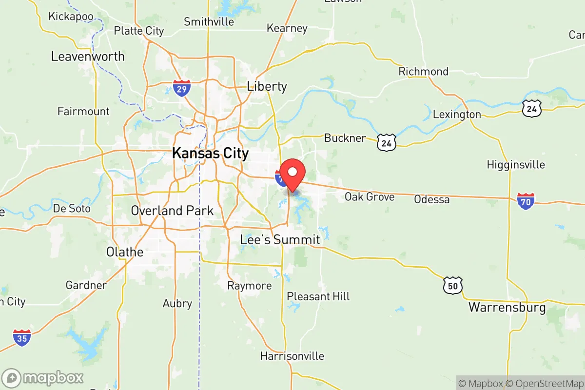
Key Distances
Strategic Assessment Analysis
Jackson County, Missouri, presents a mixed bag for the conservative prepper or strategic relocator. On one hand, its central location in the American heartland offers genuine logistical resilience—far from coastal hurricane zones and major seismic faults. On the other, it sits directly adjacent to Kansas City, a major urban center that, in a crisis, becomes a liability. The county’s real strategic value lies in its ability to serve as a staging ground or a fallback position, provided you pick your specific patch of ground carefully and understand the risks baked into the local geography.
Geographic position and natural advantages for long-term stability
Jackson County’s primary asset is its position within the Missouri River Valley. The river itself is a double-edged sword—it provides a reliable freshwater source and historical transportation corridor, but it also defines the county’s floodplains. The better ground for a resilient setup lies south of the river, in the rolling hills and wooded areas around Lee’s Summit and Blue Springs. These areas sit on higher elevation, with better drainage and more natural cover than the flat, exposed farmland north of the river. The county’s climate is four-season continental, which means you’ll deal with real winters and hot summers, but it’s not prone to the catastrophic weather events that plague the Gulf Coast or Tornado Alley’s core farther west. The growing season is long enough for serious gardening, and the soil in the southern half of the county is decent for subsistence agriculture if you amend it properly. For a relocator, the key takeaway is that the southern and eastern edges of Jackson County offer defensible terrain with water access, while the northern floodplains and western urban fringe are liabilities.
Risks, exposures, and proximity to fallout-relevant landmarks
Here’s where the analysis gets serious. Jackson County’s biggest vulnerability is its proximity to Kansas City, which sits directly to the west and north. In any major civil unrest, economic collapse, or mass casualty event, Kansas City’s population of nearly 500,000 (metro area over 2 million) will become a massive humanitarian and security problem. The county is also bisected by Interstate 70 and Interstate 435, major east-west and circumferential highways that will become choke points or refugee corridors in a crisis. On the fallout-relevant front, Jackson County is within 150 miles of Whiteman Air Force Base (home to B-2 stealth bombers) in Johnson County, Missouri, and roughly 200 miles from Fort Riley in Kansas. While not direct targets, these military installations could become secondary objectives or staging areas in a conflict, drawing military traffic and potential collateral risks. Closer to home, the county has several industrial sites—including chemical storage and rail yards in Independence and Sugar Creek—that could become hazardous if infrastructure fails. The Missouri River bridges at Independence and Kansas City are obvious single points of failure; if they go down, the county is effectively split in half. For a prepper, the smart move is to locate at least 15-20 miles from any major highway interchange and at least 10 miles from the river’s industrial corridors.
Practical resilience for a relocator: food, water, energy, and defensibility
Let’s break down the practicalities. Water: The Missouri River is the obvious source, but it’s heavily polluted and requires serious filtration. Better options are the smaller tributaries—the Blue River and Little Blue River—which run through the southern part of the county and are less contaminated. Well water is common in rural areas south of Grain Valley, but you’ll need to test for agricultural runoff. Food: The county has good agricultural land, but it’s mostly industrial corn and soy. For a relocator, the best bet is to connect with the local farming community around Oak Grove and Lone Jack, where smaller operations still exist. The Kansas City Food Hub network is active, but in a crisis, you’ll want your own garden and livestock. Energy: The grid is reliable in normal times, but Jackson County is served by Evergy, which relies on a mix of coal, natural gas, and renewables. For off-grid capability, solar is viable (the area gets about 200 sunny days per year), but you’ll need battery storage for winter. Wood heating is practical in the southern wooded areas. Defensibility: The terrain is not mountainous, but the rolling hills and tree lines south of I-70 provide decent cover. The best defensive properties are those with a single access road, good sightlines, and natural barriers like creeks or bluffs. Avoid properties near the Kansas City International Airport flight path or within 5 miles of any major rail line—those are noise and security liabilities. The county’s gun laws are Missouri-friendly (constitutional carry, no state-level registration), which is a plus for the prepper mindset.
The overall strategic picture for Jackson County is one of cautious opportunity. It’s not a bug-out paradise—you’re still within a day’s walk of a major urban center, and the river valley creates natural corridors for movement that you can’t control. But for a relocator willing to put in the work, the southern half of the county offers a realistic balance of access to resources (water, farmland, building materials) and relative isolation from the worst of the coastal and urban collapse scenarios. The key is to treat Jackson County as a semi-rural buffer zone, not a final redoubt. Have a secondary location farther west or south (think the Ozarks or the Flint Hills of Kansas) as a deeper fallback. If you pick your spot south of I-70, away from the river and the highways, and build genuine relationships with the local farming community, you can carve out a resilient life here. But never forget that Kansas City is a shadow over everything—and in a crisis, that shadow gets very long, very fast.
* Values derived from national, state, county, city and local statistics and may differ in a specific area. Last updated: 2026-05-28T12:11:10.000Z
Narrative content on this page is AI-generated and may contain mistakes. Verify any details that matter before acting on them.
ReloMaps may earn a commission from affiliate links at no extra cost to you.