

Photo: Wikipedia
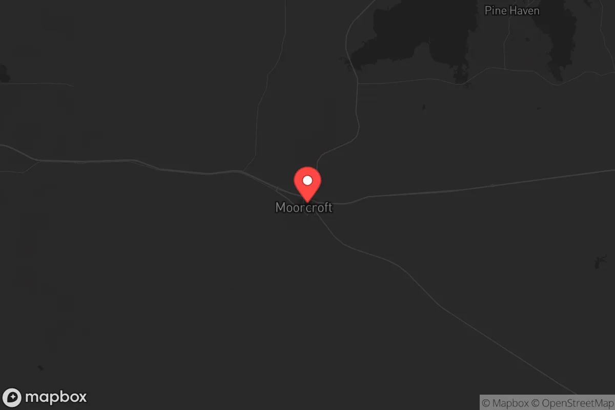
Strategic Assessment of Moorcroft, WY
Strong survivability profile. Good buffer from population centers, with manageable environmental and tactical risks.
What does the Strategic Assessment tell us?
Our Strategic Assessment grades tactical survivability of an area. Major population centers, military targets, fallout zones, natural disasters, and border exposure all drive risk — lower exposure means a more defensible position in a crisis.
This is heavily inspired by Joel Skousen's Strategic Relocation book. Highly recommended you checkout the book ($)What does this tell us?
Our Strategic Assessment grades tactical survivability of an area. Major population centers, military targets, fallout zones, natural disasters, and border exposure all drive risk — lower exposure means a more defensible position in a crisis.
This is heavily inspired by Joel Skousen's Strategic Relocation book. Highly recommended you checkout the book ($)Strategic Pillars

Key Distances
Regional Safe Places
Below is our recommended "safe zones" in Wyoming and the surrounding area based on our strategic heuristics. For most people, it's unrealistic to live in a “safe zone” full-time due to work, family or other personal reasons. They tend to be more rural. However, many of these areas are perfect for second homes and retreat properties that double as a vacation home or even a short-term rental.
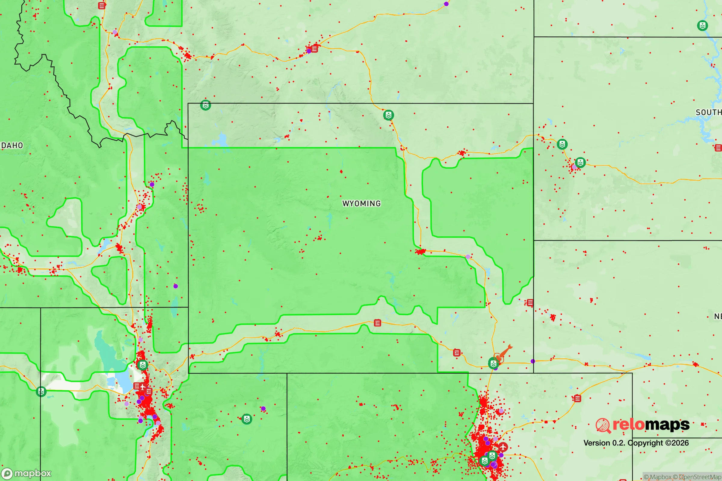
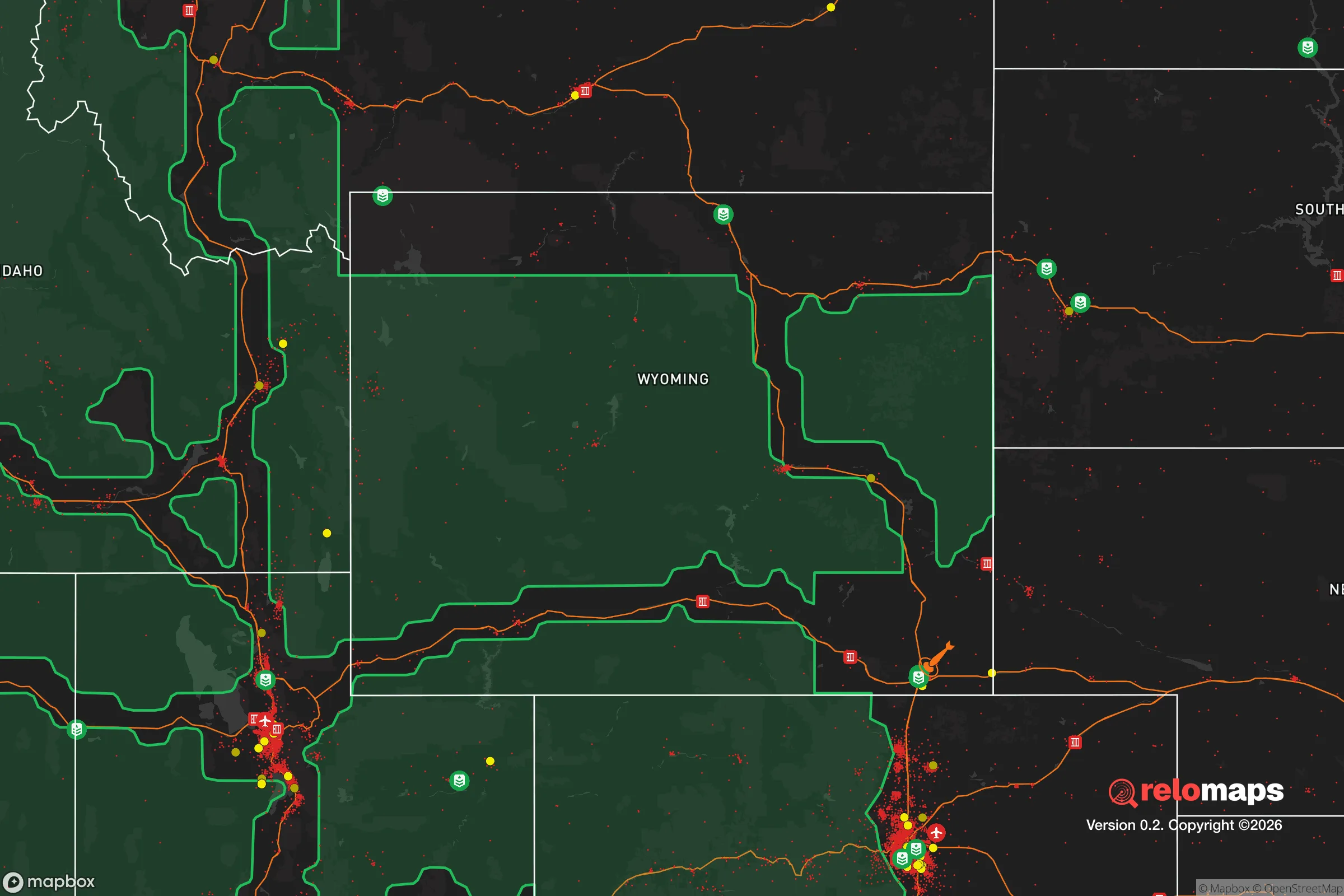
Important Note: For informational purposes only. This does not mean nothing bad ever happens in the green zones. Please use common sense. This is based on public data and modeled with AI. We tried to take a conservative approach but mistakes happen. We update this regularly as new information becomes available.
Solar Generator Recommendations
Backup power matters more here than in safer locations. We've picked three solar generators across budgets and capacity tiers — start with the budget unit if you only need a few essentials, or step up if you want to run a fridge and HVAC for days at a time.

Jackery Portable Power Station Explorer 300
Budget OptionPower on the Go: Weighing only 11 lbs, it's convenient to set up and store with book-sized foldable solar panels

BLUETTI Portable Power Station AC180
Designed for both indoor and outdoor scenarios, AC180 is highly capable as it has a robost capacity and continuous output power.

EF ECOFLOW DELTA Pro Ultra Power Station
Upgraded PickEcoFlow DELTA Pro Ultra is a whole-home energy system designed to grow with your family. Integrated with the Smart Home Panel 2, it scales to meet your evolving energy needs — keeping your home powered, intelligent, and secure through every stage of life.
We earn a commission, at no additional cost to you.
Strategic Assessment Analysis
Moorcroft, Wyoming, sits in a sweet spot for anyone serious about resilience: far enough from major population centers to avoid the chaos of a collapse, but close enough to I-90 and the BNSF Railway to keep supply lines open if things hold together. This town of roughly 1,000 people in Crook County offers a combination of low population density, harsh winters that filter out the unprepared, and a geographic position that puts it outside the immediate blast zones of any high-value targets. For a relocator thinking in terms of decades, not just next year, Moorcroft provides a foundation that’s hard to beat in the lower 48.
Geographic position and natural advantages for long-term security
Moorcroft’s location is its primary strategic asset. It sits in the northeastern corner of Wyoming, roughly 60 miles from the Montana line and 50 miles from South Dakota, placing it in a region with some of the lowest population densities in the continental United States. Crook County has about 7,000 residents spread over 2,865 square miles—that’s roughly 2.4 people per square mile. The nearest city of any real size is Gillette, about 50 miles west, which itself is a mid-sized energy hub (population ~33,000) and a potential target for disruption due to its coal and oil infrastructure. But Moorcroft is far enough removed that you’re not in the immediate fallout zone, yet close enough to access supplies or medical care if the system holds. The area is also adjacent to the Black Hills and the Bear Lodge Mountains, offering rugged terrain for retreat, hunting, and water catchment. The Belle Fourche River runs through town, providing a surface water source that can be developed with filtration. The local geology includes aquifers that support wells, and the surrounding ranchland means neighbors are used to self-sufficiency—not suburban dependence on grocery stores.
Risks, exposures, and proximity to fallout-relevant landmarks
No location is risk-free, and Moorcroft has its share of exposures that a prepper needs to account for. The biggest concern is the proximity to Gillette’s energy infrastructure—coal-fired power plants, coal mines, and natural gas processing facilities. In a major grid-down or EMP scenario, those facilities could become targets for sabotage or simply fail catastrophically, potentially releasing toxic byproducts or drawing desperate crowds. The BNSF rail line that runs through Moorcroft is a double-edged sword: it’s a lifeline for resupply in a functioning economy, but in a breakdown, it’s a vector for refugees moving west from the Dakotas or east from the Powder River Basin. The town itself is small enough that it wouldn’t be a primary target for any military strike, but the nearby I-90 corridor could become a chokepoint for movement if civil unrest spreads. There’s also the risk of severe winter storms—Moorcroft averages 50 inches of snow per year, with temps dropping to -20°F or lower. That’s a natural filter that keeps out the unprepared, but it also means you need serious cold-weather gear, backup heating, and food stores that can last through a week-long blizzard. No nuclear plants within 200 miles, no major military bases, and no major ports—so the big-ticket fallout risks are minimal compared to living near Cheyenne or Denver.
Practical resilience for a relocator: food, water, energy, and defensibility
For someone looking to set up a long-term resilient homestead, Moorcroft offers a workable baseline. Water is the first priority: the Belle Fourche River is reliable but requires treatment—think sand filtration, UV, or boiling. Many properties in the area have existing wells, and the water table is generally accessible at 50-150 feet. Drilling a new well runs about $15-$25 per foot in 2025, so budget accordingly. For food, the growing season is short (about 110 frost-free days), but cold-hardy crops like potatoes, carrots, kale, and squash do well. The surrounding ranchland means you can source livestock—cattle, goats, chickens—from neighbors, and hunting is excellent for deer, elk, and antelope. The Black Hills National Forest is a 30-minute drive east, offering public land for foraging and hunting. Energy is where Moorcroft shines: the area has strong wind resources (average 12-15 mph), and solar works even in winter if you account for snow cover. Off-grid setups are common, and the local county government is generally hands-off about permits for solar panels, wind turbines, or wood stoves. Defensibility is decent—the town is compact, with a few main roads in and out, and the surrounding terrain is open enough to see threats coming from a distance. But you’re not in a mountain fortress; you’d need to harden your own property with fencing, lighting, and a good relationship with neighbors. The local sheriff’s office is small (about 10 deputies for the whole county), so in a breakdown, you’re largely on your own. That’s a feature, not a bug, for those who prefer self-reliance over government dependency.
The overall strategic picture for Moorcroft is one of calculated trade-offs. You trade away the convenience of urban amenities and the safety net of dense infrastructure for a position that’s hard to disrupt, easy to defend, and rich in natural resources. The town’s isolation is its greatest strength—it’s not on anyone’s list of primary targets, and the harsh climate ensures that only serious people will stick around. For a conservative-leaning relocator who values independence, community cohesion (Crook County voted +72 for Trump in 2020), and the ability to ride out a crisis without relying on a broken supply chain, Moorcroft is a solid bet. It’s not a paradise—you’ll work for every meal and every gallon of water—but it’s a place where preparation actually pays off. If you’re looking for a bug-out location that can become a permanent home, this corner of Wyoming deserves a hard look.
* Values derived from national, state, county, city and local statistics and may differ in a specific area. Last updated: 2026-04-21T11:34:17.000Z
Narrative content on this page is AI-generated and may contain mistakes. Verify any details that matter before acting on them.
ReloMaps may earn a commission from affiliate links at no extra cost to you.