Photo: Wikipedia
Strategic Assessment of Murrysville, PA
Meaningful friction. Expect exposure to either population pressure, blast zones, or natural disaster risk. Consider buying a retreat property.
What does the Strategic Assessment tell us?
Our Strategic Assessment grades tactical survivability of an area. Major population centers, military targets, fallout zones, natural disasters, and border exposure all drive risk — lower exposure means a more defensible position in a crisis.
This is heavily inspired by Joel Skousen's Strategic Relocation book. Highly recommended you checkout the book ($)What does this tell us?
Our Strategic Assessment grades tactical survivability of an area. Major population centers, military targets, fallout zones, natural disasters, and border exposure all drive risk — lower exposure means a more defensible position in a crisis.
This is heavily inspired by Joel Skousen's Strategic Relocation book. Highly recommended you checkout the book ($)Strategic Pillars

Key Distances
Regional Safe Places
Below is our recommended "safe zones" in Pennsylvania and the surrounding area based on our strategic heuristics. For most people, it's unrealistic to live in a “safe zone” full-time due to work, family or other personal reasons. They tend to be more rural. However, many of these areas are perfect for second homes and retreat properties that double as a vacation home or even a short-term rental.


Important Note: For informational purposes only. This does not mean nothing bad ever happens in the green zones. Please use common sense. This is based on public data and modeled with AI. We tried to take a conservative approach but mistakes happen. We update this regularly as new information becomes available.
Solar Generator Recommendations
Backup power matters more here than in safer locations. We've picked three solar generators across budgets and capacity tiers — start with the budget unit if you only need a few essentials, or step up if you want to run a fridge and HVAC for days at a time.

Jackery Portable Power Station Explorer 300
Budget OptionPower on the Go: Weighing only 11 lbs, it's convenient to set up and store with book-sized foldable solar panels

BLUETTI Portable Power Station AC180
Designed for both indoor and outdoor scenarios, AC180 is highly capable as it has a robost capacity and continuous output power.

EF ECOFLOW DELTA Pro Ultra Power Station
Upgraded PickEcoFlow DELTA Pro Ultra is a whole-home energy system designed to grow with your family. Integrated with the Smart Home Panel 2, it scales to meet your evolving energy needs — keeping your home powered, intelligent, and secure through every stage of life.
We earn a commission, at no additional cost to you.
Strategic Assessment Analysis
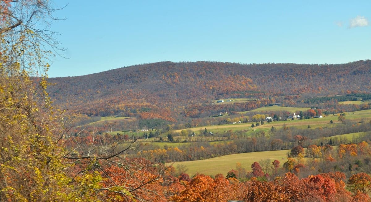
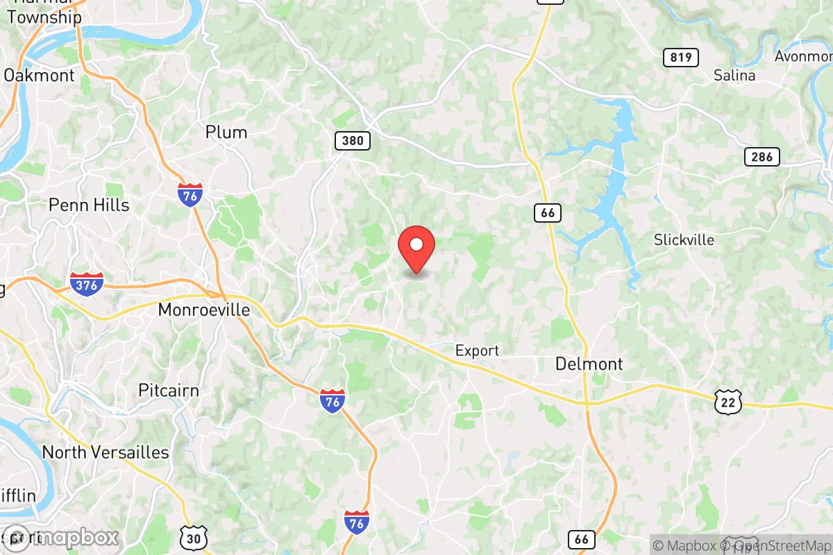
Murrysville, Pennsylvania, offers a compelling strategic position for those prioritizing resilience and self-sufficiency, sitting roughly 20 miles east of Pittsburgh while remaining firmly outside the immediate blast and fallout zones of a major metropolitan target. Its location in Westmoreland County places it in a corridor that balances rural access with the logistical advantages of proximity to Interstate 76 (the Pennsylvania Turnpike) and Route 22, providing multiple egress routes that are critical during a crisis. For a relocator with a prepper mindset, the town’s topography—rolling hills, dense woodlands, and a network of small streams—creates natural defensibility and resource availability that many suburban communities lack. The area’s historical resilience, rooted in its coal and gas industry heritage, also means a local population that is less dependent on fragile urban supply chains, a key factor when assessing long-term survivability.
Geographic position and natural advantages for long-term survival
Murrysville sits on the Allegheny Plateau, a region characterized by steep ridges and valleys that provide natural barriers against both human and environmental threats. The town’s elevation—averaging around 1,100 feet—offers vantage points for observation and reduces flood risk compared to lower-lying areas near Pittsburgh’s rivers. The surrounding Laurel Highlands, just to the east, serve as a buffer zone and a potential retreat area if conditions deteriorate further. Water access is a standout feature: the area is dotted with small creeks like Turtle Creek and its tributaries, plus the nearby Loyalhanna Creek and the Youghiogheny River within a 20-minute drive, all of which offer reliable surface water for filtration and irrigation. The region’s abundant hardwood forests—oak, maple, and hickory—provide fuel, building materials, and game habitat, making it feasible to sustain a semi-off-grid lifestyle. For a conservative audience concerned with federal overreach or societal collapse, the relative isolation of Murrysville’s outlying subdivisions and farmlands allows for low-profile living, with neighbors who are generally self-reliant and suspicious of outside interference.
Risks, exposures, and proximity to fallout-relevant landmarks
The primary strategic liability is Murrysville’s 20-mile distance from Pittsburgh, a city that ranks as a high-probability target for a nuclear strike or major civil unrest due to its industrial infrastructure, healthcare hubs, and transportation corridors. In the event of a detonation, prevailing winds from the west would carry fallout directly over Murrysville within hours, making a basement or underground shelter a non-negotiable requirement. The nearby Westinghouse nuclear facility in Madison (about 15 miles south) and the Beaver Valley Nuclear Power Station (roughly 40 miles northwest) are additional concerns, though the latter is far enough that a meltdown scenario would likely only affect Murrysville via secondary contamination. On the conventional threat side, the Pennsylvania Turnpike (I-76) runs just south of the town, creating a chokepoint for refugee flow during a crisis; during the 2020 civil unrest, Pittsburgh saw significant protests, and Murrysville’s position along Route 22 means it could become a transit corridor for displaced populations. The area’s natural gas infrastructure—including compressor stations and pipelines—presents a minor explosion risk but also offers a local energy source that could be leveraged for off-grid power. Overall, the risk profile is moderate: not a safe zone, but far better than suburban Pittsburgh or the urban core.
Practical resilience for a relocator: food, water, energy, and defensibility
For a single individual or family looking to establish a resilient homestead, Murrysville’s practical assets are strong. The soil in the region is primarily silt loam, suitable for gardening with amendment, and the growing season (roughly 150 frost-free days) supports staples like potatoes, beans, and squash. Local farmers’ markets and the nearby East End Food Co-op in Pittsburgh provide backup sourcing, but the real value is in the area’s hunting and foraging potential: white-tailed deer, turkey, and small game are abundant, and wild edibles like ramps, morels, and blackberries are common. Water resilience is excellent—most homes have private wells, and the municipal supply from the Municipal Authority of Westmoreland County is drawn from the Beaver Run Reservoir, a protected source that is less vulnerable to contamination than surface water intakes near industrial sites. Energy-wise, the region’s natural gas deposits mean that propane and methane are locally available, and solar potential is decent (about 4.5 peak sun hours per day), though tree cover in the hollows can limit panel placement. Defensibility is aided by the terrain: many homes sit on dead-end roads or cul-de-sacs with limited access, and the surrounding hills create natural sightlines. The local police force is small (around 20 officers) and response times in rural parts can exceed 15 minutes, so a well-stocked armory and a neighborhood watch network are practical investments. The community itself is politically mixed but leans conservative, with a strong volunteer fire department and a culture of mutual aid among long-term residents—valuable for building a support network without drawing unwanted attention.
The overall strategic picture for Murrysville is one of calculated risk: it offers a defensible, resource-rich base that is close enough to Pittsburgh to access medical and supply networks in normal times, but far enough to avoid the worst of a collapse scenario. The key trade-off is the fallout exposure from a Pittsburgh strike, which demands a hardened shelter and a pre-planned evacuation route east into the Laurel Highlands or deeper into rural Pennsylvania. For a conservative relocator who values self-reliance, community cohesion, and low visibility, Murrysville ranks as a solid B+ option—not a bug-out paradise, but a viable long-term holding position with the infrastructure to weather a decade of instability. The smart move is to secure a property with a basement, a well, and southern solar exposure, then integrate with local gun clubs and gardening groups to build redundancy. In a world where the federal government is increasingly viewed as unreliable, Murrysville’s mix of natural advantages and practical resilience makes it a location worth serious consideration for those preparing for the long haul.
* Values derived from national, state, county, city and local statistics and may differ in a specific area. Last updated: 2026-05-01T08:37:54.000Z
Narrative content on this page is AI-generated and may contain mistakes. Verify any details that matter before acting on them.
ReloMaps may earn a commission from affiliate links at no extra cost to you.