
Photo: Wikipedia
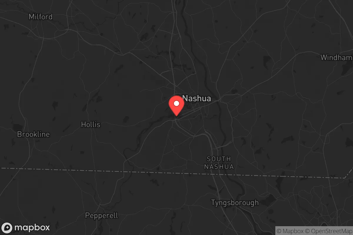
Strategic Assessment of Nashua, NH
Multiple tactical vulnerabilities. Population density, target proximity, or disaster risk are likely compounding. A retreat property and exit planning is required.
What does the Strategic Assessment tell us?
Our Strategic Assessment grades tactical survivability of an area. Major population centers, military targets, fallout zones, natural disasters, and border exposure all drive risk — lower exposure means a more defensible position in a crisis.
This is heavily inspired by Joel Skousen's Strategic Relocation book. Highly recommended you checkout the book ($)What does this tell us?
Our Strategic Assessment grades tactical survivability of an area. Major population centers, military targets, fallout zones, natural disasters, and border exposure all drive risk — lower exposure means a more defensible position in a crisis.
This is heavily inspired by Joel Skousen's Strategic Relocation book. Highly recommended you checkout the book ($)Strategic Pillars

Key Distances
Regional Safe Places
Below is our recommended "safe zones" in New Hampshire and the surrounding area based on our strategic heuristics. For most people, it's unrealistic to live in a “safe zone” full-time due to work, family or other personal reasons. They tend to be more rural. However, many of these areas are perfect for second homes and retreat properties that double as a vacation home or even a short-term rental.


Important Note: For informational purposes only. This does not mean nothing bad ever happens in the green zones. Please use common sense. This is based on public data and modeled with AI. We tried to take a conservative approach but mistakes happen. We update this regularly as new information becomes available.
Solar Generator Recommendations
Backup power matters more here than in safer locations. We've picked three solar generators across budgets and capacity tiers — start with the budget unit if you only need a few essentials, or step up if you want to run a fridge and HVAC for days at a time.

Jackery Portable Power Station Explorer 300
Budget OptionPower on the Go: Weighing only 11 lbs, it's convenient to set up and store with book-sized foldable solar panels

BLUETTI Portable Power Station AC180
Designed for both indoor and outdoor scenarios, AC180 is highly capable as it has a robost capacity and continuous output power.

EF ECOFLOW DELTA Pro Ultra Power Station
Upgraded PickEcoFlow DELTA Pro Ultra is a whole-home energy system designed to grow with your family. Integrated with the Smart Home Panel 2, it scales to meet your evolving energy needs — keeping your home powered, intelligent, and secure through every stage of life.
We earn a commission, at no additional cost to you.
Strategic Assessment Analysis
Nashua, New Hampshire, sits in a strategic position that offers genuine resilience advantages for those thinking long-term about safety and stability, but it is not without significant trade-offs. Located in southern New Hampshire along the Massachusetts border, Nashua provides a buffer from the densest population centers of the Northeast while still being close enough to major infrastructure to matter in a crisis. For a relocator with a prepper or survivalist mindset, the city’s location near the Merrimack River, its distance from primary fallout targets, and its access to rural escape routes make it a viable base of operations—provided you understand the risks baked into its geography and proximity to Boston.
Geographic position and natural advantages for long-term stability
Nashua’s location at the junction of the Merrimack and Nashua Rivers gives it a reliable freshwater source, a critical asset for any long-term resilience plan. The city sits roughly 40 miles northwest of Boston, placing it outside the immediate blast and thermal zones of a major nuclear event targeting that metro area, but still within a zone that would see significant fallout drift depending on wind patterns. The surrounding terrain is a mix of low hills, forested areas, and agricultural land, offering multiple avenues for retreat into central New Hampshire’s more sparsely populated regions. The area’s natural advantages include a temperate climate with four distinct seasons, which supports subsistence gardening and small-scale farming, though the growing season is short (roughly 140 days). The Merrimack River watershed is substantial, and groundwater availability is generally good, though municipal water systems would be vulnerable to contamination or disruption. For a relocator, the key takeaway is that Nashua offers a defensible perimeter—you can move north or west into the White Mountains or Vermont if needed, but you’re not so remote that supply runs or medical access become impossible in normal times.
Risks, exposures, and proximity to fallout-relevant landmarks
The most serious risk for a Nashua-based prepper is its proximity to Boston, a Tier 1 target in any major conflict scenario. Boston’s port, Logan Airport, financial district, and research institutions (including MIT and Harvard) make it a high-value strike location. Nashua is roughly 40 miles from downtown Boston—close enough that prevailing westerly winds could carry fallout across southern New Hampshire within hours. The city is also within 20 miles of the Portsmouth Naval Shipyard (a submarine repair facility) and within 30 miles of Hanscom Air Force Base, both of which are secondary targets. Additionally, the Seabrook Nuclear Power Station sits about 30 miles southeast of Nashua, along the coast. A catastrophic failure or strike at Seabrook would pose a direct radiological hazard, with the prevailing winds pushing contamination inland toward Nashua. On the civil unrest front, Nashua’s population of roughly 90,000 is small enough to avoid the worst of urban chaos, but its position as a commuter hub for Boston means that any mass evacuation or panic from the metro area would funnel through Nashua’s highways (especially I-93 and the Everett Turnpike), creating choke points and potential conflict zones. The city’s own infrastructure—bridges over the Merrimack, the downtown core, and the major retail corridors—would become natural bottlenecks in a crisis.
Practical resilience for a relocator: food, water, energy, and defensibility
For a relocator serious about self-sufficiency, Nashua offers a mixed bag. The city has a robust local food scene with farmers’ markets, community gardens, and nearby agricultural operations in Hollis, Milford, and Amherst. However, the region is not a major grain or livestock producer; most staple foods come from outside the state. A prudent prepper would need to establish a home garden, secure a reliable seed bank, and consider partnerships with local farms for barter or purchase. Water is the stronger asset: the Merrimack River is a reliable surface water source, but it requires filtration and treatment (industrial runoff and upstream pollution are concerns). Well water is available in the more rural parts of the city and surrounding towns, but drilling a new well can cost $5,000–$15,000. Energy resilience is a weak point. Nashua’s grid is tied to the ISO New England system, which has faced strain during winter storms and heat waves. Natural gas is the primary heating fuel, and a prolonged grid outage would leave most homes without heat. Solar with battery backup is feasible but requires significant upfront investment; the region gets about 200 sunny days per year, which is adequate but not ideal. Defensibility is moderate. Nashua is a compact city with a mix of suburban neighborhoods and rural pockets. The best defensive positions are in the northern and western parts of the city, where larger lots, tree cover, and limited road access provide natural security. The downtown area and major commercial strips (like Daniel Webster Highway) would be high-traffic, high-risk zones during unrest. A relocator should prioritize a property with a well, septic, and a wood-burning heat source, ideally on a dead-end road or cul-de-sac with multiple egress routes.
The overall strategic picture for Nashua is one of calculated risk. It is not a hardened bunker location, nor is it a remote mountain retreat. What it offers is a balance: proximity to medical and supply infrastructure during stable times, a strong water source, and a geographic position that puts you outside the immediate blast radius of Boston while still being close enough to monitor events. The downsides are real—fallout risk from Seabrook and Boston, highway choke points during evacuation, and a reliance on external food and energy systems. For a conservative-leaning relocator who values community, local governance, and the ability to build a resilient household without going fully off-grid, Nashua is a viable option. But it demands preparation: a solid bug-out plan for moving north into the Lakes Region or White Mountains, a home setup that can run independently for at least 30 days, and a network of like-minded neighbors. The city’s political leanings are moderate to liberal, but the surrounding towns (Hollis, Brookline, Mason) lean more conservative and offer a better cultural fit for those seeking like-minded community. In short, Nashua works as a forward operating base—not a final redoubt, but a place to build capability and options while staying connected to the broader region.
* Values derived from national, state, county, city and local statistics and may differ in a specific area. Last updated: 2026-05-02T04:10:00.000Z
Narrative content on this page is AI-generated and may contain mistakes. Verify any details that matter before acting on them.
ReloMaps may earn a commission from affiliate links at no extra cost to you.