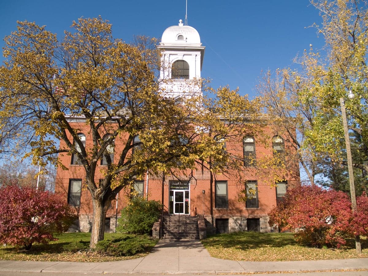
Photo: Wikipedia
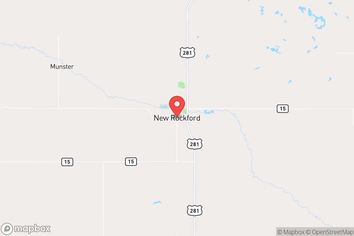
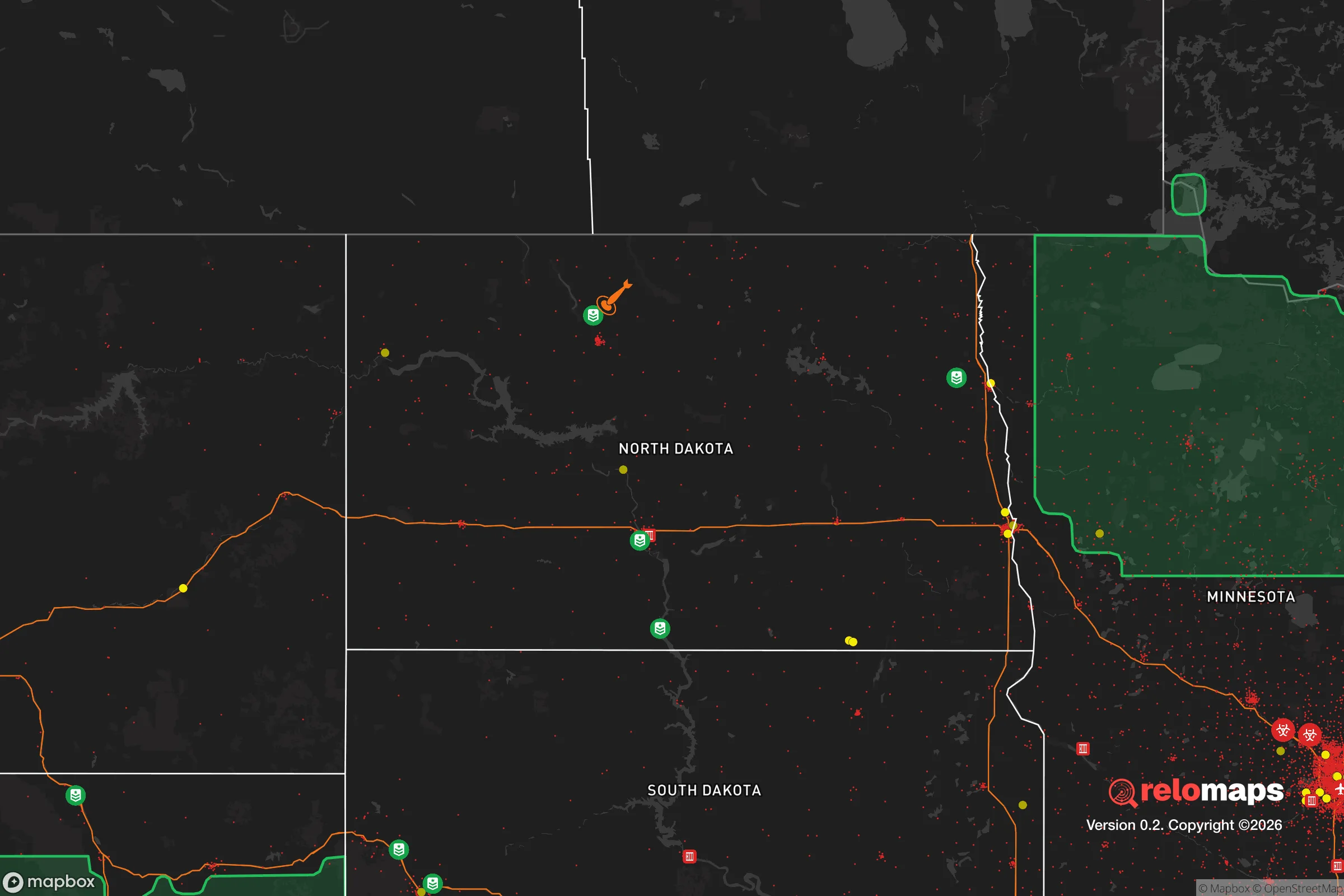
Strategic Assessment of New Rockford, ND
Strong survivability profile. Good buffer from population centers, with manageable environmental and tactical risks.
What does the Strategic Assessment tell us?
Our Strategic Assessment grades tactical survivability of an area. Major population centers, military targets, fallout zones, natural disasters, and border exposure all drive risk — lower exposure means a more defensible position in a crisis.
This is heavily inspired by Joel Skousen's Strategic Relocation book. Highly recommended you checkout the book ($)What does this tell us?
Our Strategic Assessment grades tactical survivability of an area. Major population centers, military targets, fallout zones, natural disasters, and border exposure all drive risk — lower exposure means a more defensible position in a crisis.
This is heavily inspired by Joel Skousen's Strategic Relocation book. Highly recommended you checkout the book ($)Strategic Pillars

Key Distances
Regional Safe Places
Below is our recommended "safe zones" in North Dakota and the surrounding area based on our strategic heuristics. For most people, it's unrealistic to live in a “safe zone” full-time due to work, family or other personal reasons. They tend to be more rural. However, many of these areas are perfect for second homes and retreat properties that double as a vacation home or even a short-term rental.
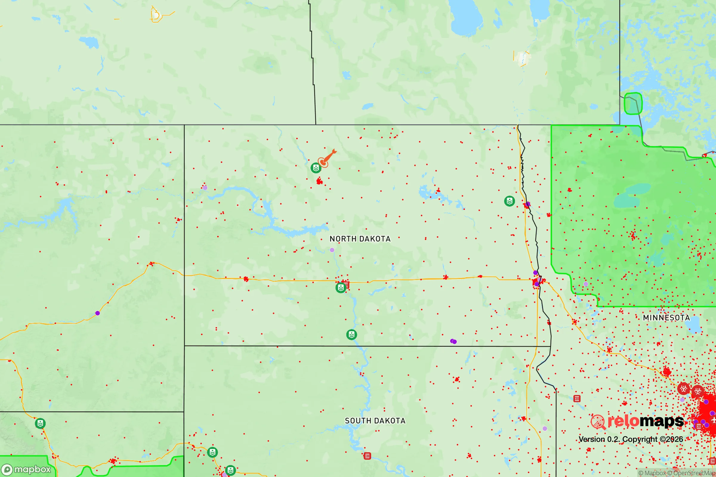
Important Note: For informational purposes only. This does not mean nothing bad ever happens in the green zones. Please use common sense. This is based on public data and modeled with AI. We tried to take a conservative approach but mistakes happen. We update this regularly as new information becomes available.
Solar Generator Recommendations
Backup power matters more here than in safer locations. We've picked three solar generators across budgets and capacity tiers — start with the budget unit if you only need a few essentials, or step up if you want to run a fridge and HVAC for days at a time.

Jackery Portable Power Station Explorer 300
Budget OptionPower on the Go: Weighing only 11 lbs, it's convenient to set up and store with book-sized foldable solar panels

BLUETTI Portable Power Station AC180
Designed for both indoor and outdoor scenarios, AC180 is highly capable as it has a robost capacity and continuous output power.

EF ECOFLOW DELTA Pro Ultra Power Station
Upgraded PickEcoFlow DELTA Pro Ultra is a whole-home energy system designed to grow with your family. Integrated with the Smart Home Panel 2, it scales to meet your evolving energy needs — keeping your home powered, intelligent, and secure through every stage of life.
We earn a commission, at no additional cost to you.
Strategic Assessment Analysis
New Rockford, North Dakota, offers a compelling strategic position for those prioritizing resilience and self-sufficiency, sitting roughly 100 miles from the Canadian border and 90 miles from the nearest interstate highway (I-94). This small city of about 1,300 people in Eddy County is far removed from major population centers like Fargo (160 miles southeast) and Minot (120 miles northwest), which significantly reduces exposure to the cascading effects of urban unrest, supply chain disruptions, or mass casualty events. The area’s low population density—roughly 3 people per square mile in the county—combined with its agricultural base and distance from strategic military or industrial targets, makes it a viable location for a long-term preparedness strategy focused on isolation and local resource reliance.
Geographic position and natural advantages for long-term security
New Rockford sits on the eastern edge of the Drift Prairie, a region characterized by flat to gently rolling terrain that supports extensive grain farming and cattle ranching. The James River runs through the city, providing a reliable surface water source, and the area’s aquifer systems offer groundwater potential for well drilling—critical for off-grid water security. The climate is harsh, with winter temperatures frequently dropping below -20°F and annual snowfall averaging 40 inches, which acts as a natural deterrent to transient populations and limits the viability of large-scale refugee movement from southern or coastal regions during a crisis. The nearest major military installation is Grand Forks Air Force Base (about 100 miles northeast), which is a potential target but far enough away that fallout risks are minimal, especially given prevailing westerly winds that would carry contamination eastward. The absence of nuclear power plants, major chemical facilities, or large-scale energy infrastructure within a 50-mile radius further reduces exposure to industrial accidents or targeted attacks.
Risks, exposures, and proximity to fallout-relevant landmarks
The primary risk in New Rockford is its location within the “Northern Plains” corridor, which includes the Minot Air Force Base (home to nuclear-capable B-52 bombers) roughly 120 miles west-northwest. While this distance provides a buffer, a worst-case scenario involving a ground burst at Minot could produce fallout that reaches Eddy County within 6–12 hours under typical wind patterns, depending on the season. The city’s position along U.S. Highway 281, a north-south route connecting Canada to Texas, could become a chokepoint for evacuation or supply movement during a national emergency, but also a vector for transient populations fleeing southward. The nearest major rail line is the BNSF Northern Transcon, about 30 miles south, which carries hazardous materials and could be a target for sabotage. However, the area’s low population and lack of high-value infrastructure make it unlikely to be a primary target for any coordinated attack. The biggest practical risk is the extreme cold, which can kill unprepared individuals within hours if heating fails—a scenario that demands robust backup systems for any relocator.
Practical resilience for a relocator: food, water, energy, and defensibility
For a relocator focused on self-sufficiency, New Rockford’s agricultural environment is a major asset. The surrounding county has over 200,000 acres of cropland, primarily wheat, barley, and sunflowers, with a strong cattle and hog farming presence. This means local food production is viable, and the city’s grain elevators and co-ops provide bulk purchasing options for long-term storage. Water access is straightforward: the James River runs through town, and many rural properties have existing wells with depths of 100–300 feet, yielding reliable water even during drought years. Energy resilience requires planning—the local grid is served by Northern Plains Electric Cooperative, which is susceptible to ice storms and winter outages. Solar panels are less effective in winter due to low sun angles and snow cover, so a propane or diesel generator with a 500-gallon tank is a practical baseline, supplemented by wood stoves for heating (the area has abundant shelterbelts and windbreaks for firewood). Defensibility is high due to the open terrain: any approach by vehicle or foot can be seen from miles away, and the city’s small size means a tight-knit community where outsiders are immediately noticed. The nearest law enforcement is the Eddy County Sheriff’s Office (based in New Rockford), with backup from the North Dakota Highway Patrol, but response times to rural properties can exceed 30 minutes. For a single individual or family, a rural property 5–10 miles outside town offers the best balance of isolation and access to supplies, with the ability to fortify a homestead against opportunistic threats.
The overall strategic picture for New Rockford is one of trade-offs: extreme isolation and harsh winters provide a natural security buffer, but demand significant upfront investment in infrastructure and skills. For a conservative-leaning relocator concerned with civic unrest, mass casualty events, or societal collapse, this area offers a low-profile, resource-rich environment where a prepared individual can achieve a high degree of self-reliance. The lack of nearby urban centers, military targets, or industrial hazards reduces the likelihood of being caught in a cascading disaster, while the agricultural base and water access provide the essentials for long-term survival. The key is to arrive with a realistic plan for winter heating, water storage, and community integration—because in a place this remote, your neighbors are your first line of defense, and the weather is your most persistent adversary.
* Values derived from national, state, county, city and local statistics and may differ in a specific area. Last updated: 2026-04-19T08:20:33.000Z
Narrative content on this page is AI-generated and may contain mistakes. Verify any details that matter before acting on them.
ReloMaps may earn a commission from affiliate links at no extra cost to you.