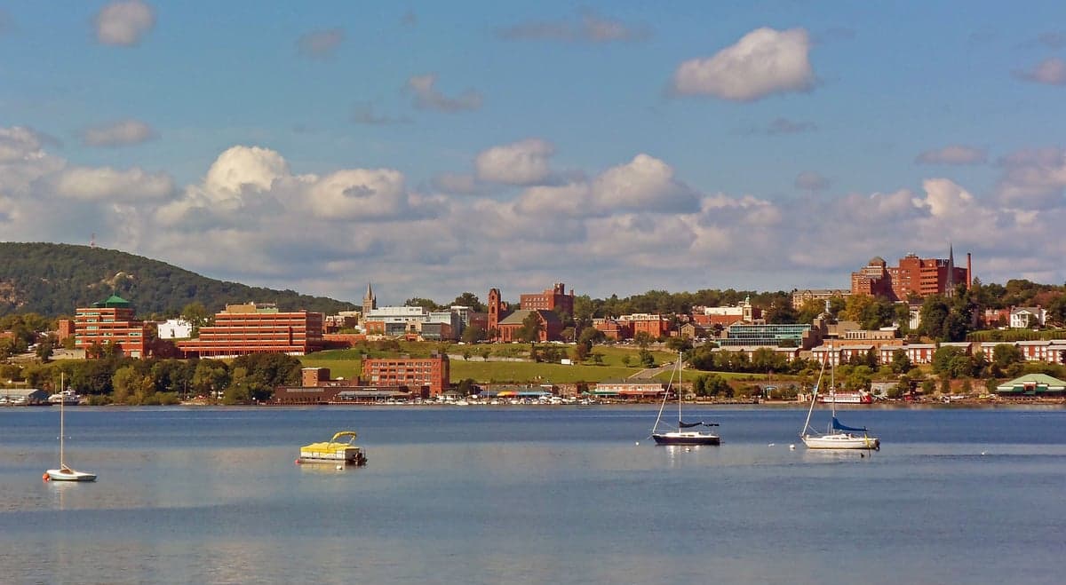
Photo: Wikipedia
Strategic Assessment of Newburgh, NY
Multiple tactical vulnerabilities. Population density, target proximity, or disaster risk are likely compounding. A retreat property and exit planning is required.
What does the Strategic Assessment tell us?
Our Strategic Assessment grades tactical survivability of an area. Major population centers, military targets, fallout zones, natural disasters, and border exposure all drive risk — lower exposure means a more defensible position in a crisis.
This is heavily inspired by Joel Skousen's Strategic Relocation book. Highly recommended you checkout the book ($)What does this tell us?
Our Strategic Assessment grades tactical survivability of an area. Major population centers, military targets, fallout zones, natural disasters, and border exposure all drive risk — lower exposure means a more defensible position in a crisis.
This is heavily inspired by Joel Skousen's Strategic Relocation book. Highly recommended you checkout the book ($)Strategic Pillars

Key Distances
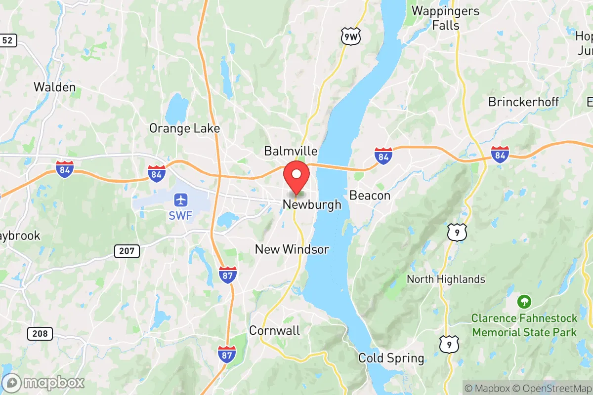
Regional Safe Places
Below is our recommended "safe zones" in New York and the surrounding area based on our strategic heuristics. For most people, it's unrealistic to live in a “safe zone” full-time due to work, family or other personal reasons. They tend to be more rural. However, many of these areas are perfect for second homes and retreat properties that double as a vacation home or even a short-term rental.


Important Note: For informational purposes only. This does not mean nothing bad ever happens in the green zones. Please use common sense. This is based on public data and modeled with AI. We tried to take a conservative approach but mistakes happen. We update this regularly as new information becomes available.
Solar Generator Recommendations
Backup power matters more here than in safer locations. We've picked three solar generators across budgets and capacity tiers — start with the budget unit if you only need a few essentials, or step up if you want to run a fridge and HVAC for days at a time.

Jackery Portable Power Station Explorer 300
Budget OptionPower on the Go: Weighing only 11 lbs, it's convenient to set up and store with book-sized foldable solar panels

BLUETTI Portable Power Station AC180
Designed for both indoor and outdoor scenarios, AC180 is highly capable as it has a robost capacity and continuous output power.

EF ECOFLOW DELTA Pro Ultra Power Station
Upgraded PickEcoFlow DELTA Pro Ultra is a whole-home energy system designed to grow with your family. Integrated with the Smart Home Panel 2, it scales to meet your evolving energy needs — keeping your home powered, intelligent, and secure through every stage of life.
We earn a commission, at no additional cost to you.
Strategic Assessment Analysis
Newburgh, New York, sits in a precarious but potentially strategic position along the Hudson River, roughly 60 miles north of Manhattan. Its resilience profile is a mixed bag: the city itself has struggled with crime and economic decline for decades, but the surrounding Orange County offers rural buffer zones, access to the Hudson River watershed, and a location that is far enough from NYC to avoid the worst of a metropolitan collapse, yet close enough to monitor or exploit regional supply chains. For a relocator with a prepper mindset, Newburgh is less a destination and more a staging ground—a place to assess before committing to deeper, more defensible positions in the Catskills or the Shawangunk Ridge.
Geographic position and natural advantages for long-term survival
Newburgh’s primary strategic asset is its position on the west bank of the Hudson River, at the natural narrowing of the river valley where the Highlands begin. This choke point historically controlled river traffic, and in a grid-down scenario, it still offers a defensible corridor. The surrounding terrain includes the Hudson Highlands to the south, the Shawangunk Ridge to the west, and the Catskill Mountains to the north—all providing natural barriers against mass movement from the NYC metro area. The city itself sits on a bluff, giving elevated sightlines over the river and the eastern bank. The region’s water supply is robust: the Hudson is tidal but treatable, and numerous smaller streams and reservoirs (like the nearby Chadwick Lake and the Catskill Aqueduct system) offer redundancy. Soils in the surrounding valleys are fertile enough for small-scale agriculture, and the growing season (roughly 150 frost-free days) supports staple crops like corn, beans, and squash. For a relocator, the key takeaway is that Newburgh’s geography gives you options—you can hold the high ground, control the river crossing, and retreat west into the mountains if needed.
Risks, exposures, and proximity to fallout-relevant landmarks
The downsides are significant and cannot be ignored. Newburgh is only 60 miles from New York City, the single largest target for any coordinated attack, whether nuclear, biological, or economic. In a mass casualty event or civil unrest scenario, the city would be a primary funnel for refugees fleeing north along I-87 and the Metro-North rail line. The Stewart International Airport (SWF), located just west of the city, is a dual-use civilian and military airfield (home to the 105th Airlift Wing of the New York Air National Guard). In a crisis, this base becomes a high-value target for both enemy action and desperate crowds seeking evacuation. Additionally, the nearby Indian Point nuclear plant (though decommissioned in 2021) still houses spent fuel in dry casks, and the broader Hudson Valley is dotted with industrial sites (chemical plants, oil terminals) that could become secondary hazards. The city itself has a high crime rate—violent crime per capita is roughly three times the national average—meaning that in a breakdown of civil order, you’d face threats from both external refugees and local actors. The Newburgh-Beacon Bridge and the I-84 corridor are natural chokepoints that would become impassable in a panic, trapping you on the wrong side of the river.
Practical resilience for a relocator: food, water, energy, and defensibility
For a serious prepper, Newburgh is not a bug-out location but a potential resupply and information hub. The city has multiple grocery stores (ShopRite, Price Chopper) and big-box retailers (Walmart, Home Depot) that would be looted within hours of a crisis, so you cannot rely on them. Instead, focus on the surrounding rural areas: the towns of Montgomery, Walden, and Pine Bush offer farmland, well water, and lower population density. The Catskill Aqueduct, which runs through the region, provides gravity-fed water from the Ashokan Reservoir—if you can tap into it legally or discreetly, you have a near-infinite supply. Energy-wise, the Hudson Valley has decent solar potential (about 4.5 peak sun hours per day), and the wooded terrain offers ample biomass for heating. Defensibility is moderate: the rolling hills and river bluffs provide natural cover, but the area is crisscrossed by major highways (I-87, I-84, NY-17) that make it hard to secure a perimeter. A better play is to use Newburgh as a forward observation post—rent a cheap apartment or storage unit there to monitor news, stockpile supplies, and maintain a vehicle, while your primary retreat is 30-40 miles west in the Shawangunks or north in the Catskills. That way, you can assess the situation before committing to a move, and you have a fallback if the city becomes too hot.
The overall strategic picture for conservative-minded relocators
Newburgh is a classic “gray zone” location—neither safe enough to live in full-time nor useless as a strategic asset. For a conservative-leaning individual or family concerned about societal collapse, the calculus is simple: the Hudson Valley offers excellent natural resources and defensible terrain, but Newburgh itself is a liability due to its proximity to NYC, its crime issues, and its status as a refugee funnel. The smart move is to treat it as a secondary node—a place to maintain a low-profile presence, gather intelligence, and access river transport, while your primary homestead is in a more remote, defensible location like the western Catskills or the Pennsylvania border region. If you’re looking for a single location to ride out a long-term crisis, look elsewhere. But if you’re building a network of safe houses and supply caches, Newburgh’s position on the Hudson, its rail and highway connections, and its mix of urban and rural zones make it a useful piece of the puzzle. Just don’t plan to stay there when the lights go out.
* Values derived from national, state, county, city and local statistics and may differ in a specific area. Last updated: 2026-05-01T05:31:15.000Z
Narrative content on this page is AI-generated and may contain mistakes. Verify any details that matter before acting on them.
ReloMaps may earn a commission from affiliate links at no extra cost to you.