Photo: Wikipedia
Strategic Assessment of North Bennington, VT
Meaningful friction. Expect exposure to either population pressure, blast zones, or natural disaster risk. Consider buying a retreat property.
What does the Strategic Assessment tell us?
Our Strategic Assessment grades tactical survivability of an area. Major population centers, military targets, fallout zones, natural disasters, and border exposure all drive risk — lower exposure means a more defensible position in a crisis.
This is heavily inspired by Joel Skousen's Strategic Relocation book. Highly recommended you checkout the book ($)What does this tell us?
Our Strategic Assessment grades tactical survivability of an area. Major population centers, military targets, fallout zones, natural disasters, and border exposure all drive risk — lower exposure means a more defensible position in a crisis.
This is heavily inspired by Joel Skousen's Strategic Relocation book. Highly recommended you checkout the book ($)Strategic Pillars

Key Distances
Regional Safe Places
Below is our recommended "safe zones" in Vermont and the surrounding area based on our strategic heuristics. For most people, it's unrealistic to live in a “safe zone” full-time due to work, family or other personal reasons. They tend to be more rural. However, many of these areas are perfect for second homes and retreat properties that double as a vacation home or even a short-term rental.


Important Note: For informational purposes only. This does not mean nothing bad ever happens in the green zones. Please use common sense. This is based on public data and modeled with AI. We tried to take a conservative approach but mistakes happen. We update this regularly as new information becomes available.
Solar Generator Recommendations
Backup power matters more here than in safer locations. We've picked three solar generators across budgets and capacity tiers — start with the budget unit if you only need a few essentials, or step up if you want to run a fridge and HVAC for days at a time.

Jackery Portable Power Station Explorer 300
Budget OptionPower on the Go: Weighing only 11 lbs, it's convenient to set up and store with book-sized foldable solar panels

BLUETTI Portable Power Station AC180
Designed for both indoor and outdoor scenarios, AC180 is highly capable as it has a robost capacity and continuous output power.

EF ECOFLOW DELTA Pro Ultra Power Station
Upgraded PickEcoFlow DELTA Pro Ultra is a whole-home energy system designed to grow with your family. Integrated with the Smart Home Panel 2, it scales to meet your evolving energy needs — keeping your home powered, intelligent, and secure through every stage of life.
We earn a commission, at no additional cost to you.
Strategic Assessment Analysis
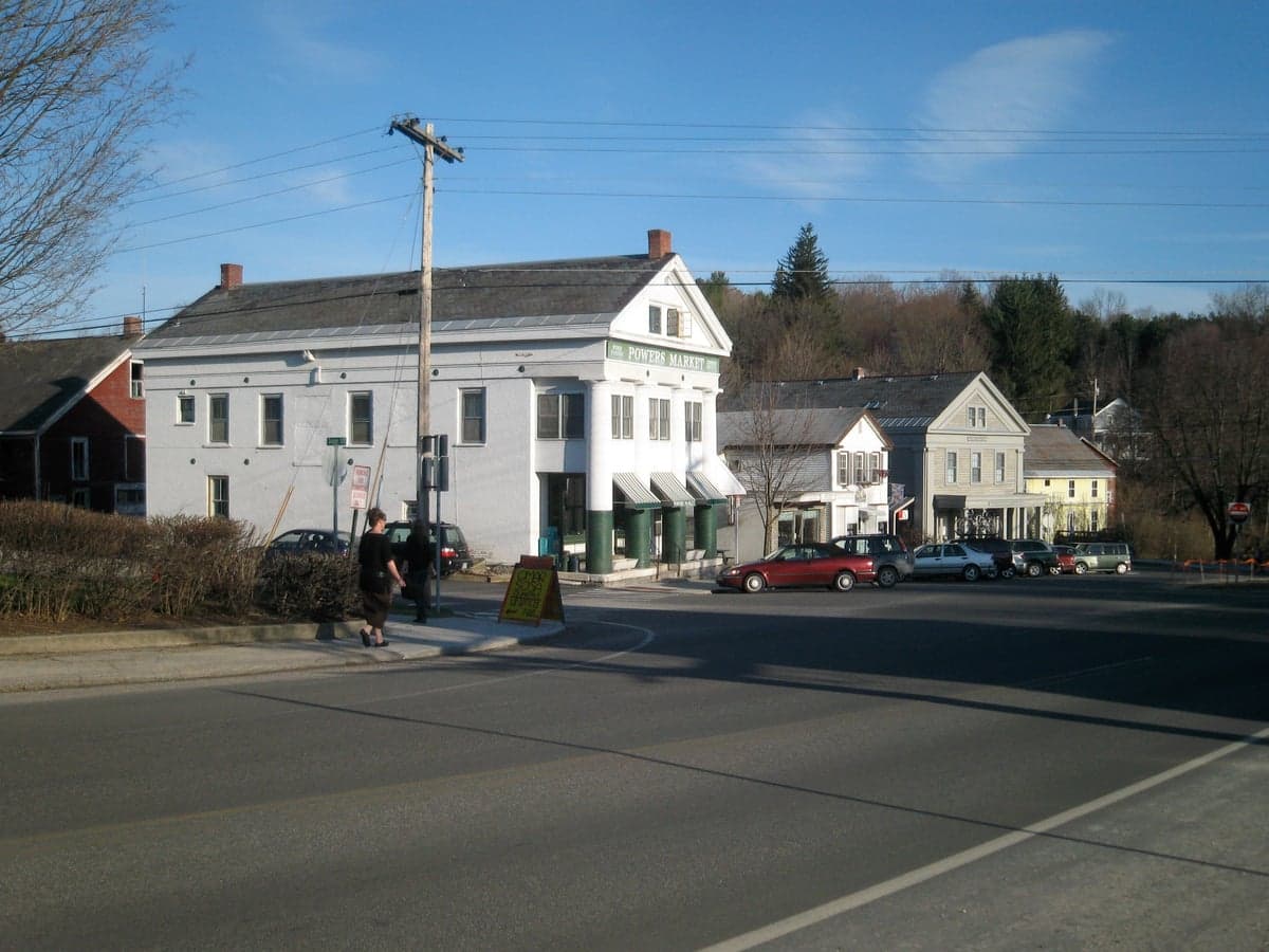
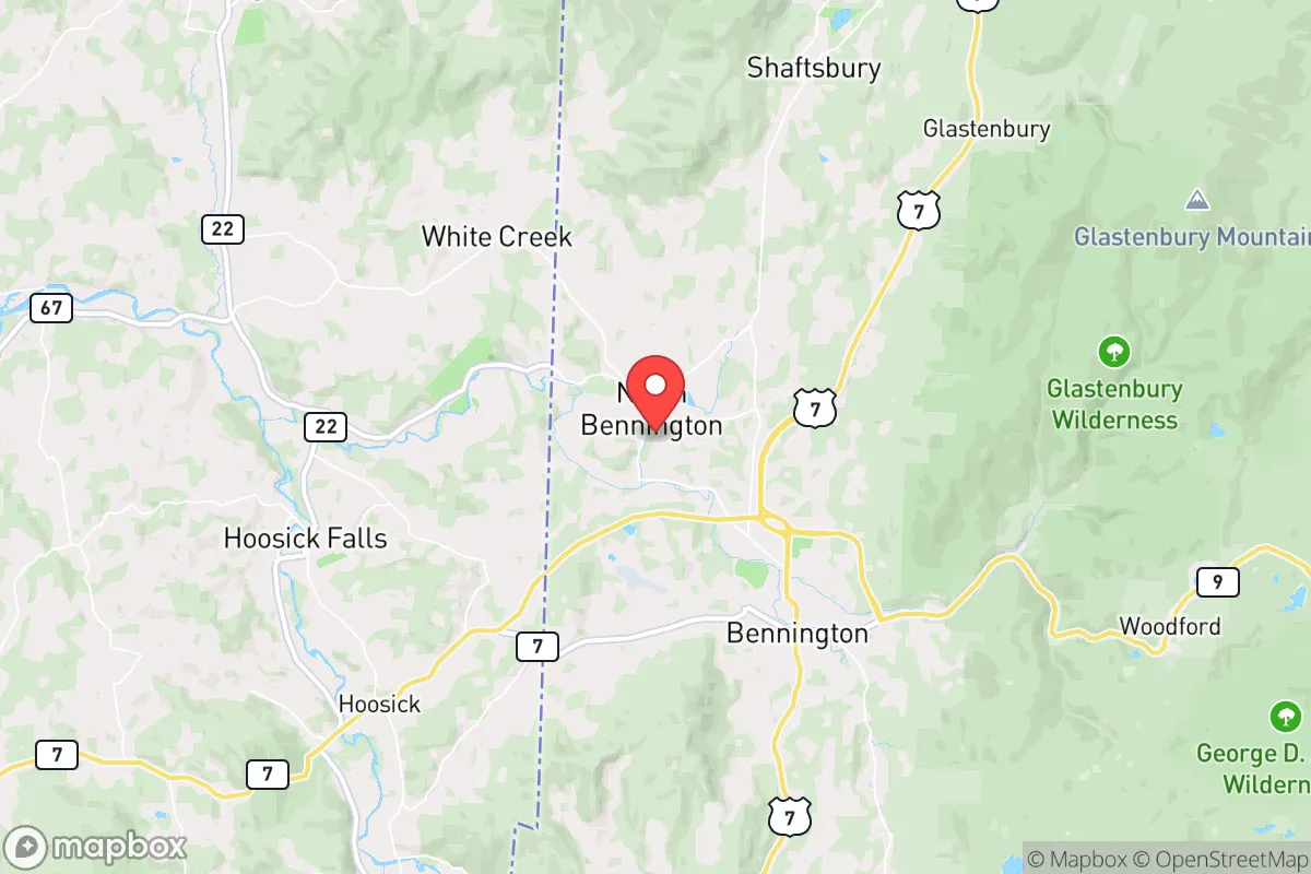
North Bennington, Vermont, offers a strategic paradox for the conservative prepper: it sits close enough to major infrastructure to be practical, yet far enough from the primary blast zones and population centers to provide a genuine survival buffer. This small village in the southwestern corner of the Green Mountain State benefits from the natural shielding of the Taconic and Green Mountain ranges, which disrupt line-of-sight for both conventional threats and electromagnetic pulse (EMP) effects. Its location along the Walloomsac River provides a reliable water source, while the surrounding forestland offers cover, game, and timber for long-term subsistence. For a relocator weighing resilience against accessibility, North Bennington presents a defensible niche that avoids the worst of the Northeast Corridor’s vulnerabilities.
Geographic position and natural advantages for long-term survival
North Bennington’s position at the intersection of Vermont, New York, and Massachusetts gives it a strategic depth that few small towns can match. The village is nestled in a valley between the Taconic Range to the west and the Green Mountains to the east, creating a natural funnel that channels movement and limits approach vectors. This terrain makes it difficult for large groups to approach undetected, and the surrounding hills offer excellent observation points for early warning. The Walloomsac River, a tributary of the Hoosic River, flows through the village year-round, providing a consistent surface water source that can be filtered or boiled. The area’s elevation—roughly 680 feet—keeps it above the worst valley fog and flood risks, while the dense hardwood forests offer ample firewood, building material, and cover for game like white-tailed deer and turkey. The proximity to the Green Mountain National Forest, about 15 miles east, adds a vast backup zone for hunting, foraging, and retreat if the village itself becomes compromised. For a relocator, this geography means you can hold a position, observe threats from a distance, and fall back into deeper wilderness if needed—all within a short radius.
Risks, exposures, and proximity to fallout-relevant landmarks
The primary strategic weakness of North Bennington is its proximity to several high-value targets that could draw secondary effects during a major conflict or collapse. The village lies roughly 30 miles east of Albany, New York—a major transportation hub with an international airport, rail yards, and a significant state government presence. Albany is a plausible target for a conventional strike or cyberattack on infrastructure, and any fallout from a nuclear event there would drift east-northeast with prevailing winds, potentially affecting the Bennington area. Closer still is the Vermont Yankee nuclear power plant in Vernon, about 40 miles south, which, while decommissioned, still stores spent fuel on site—a potential radiological hazard if the facility were struck or sabotaged. The village itself is not a primary target, but its location along Route 7, a major north-south corridor, means it could see refugee flow or military movement during a crisis. The Bennington Battle Monument, a 306-foot stone obelisk, is a visible landmark that could draw attention from looters or reconnaissance. On the positive side, the area has no major military bases, no large-scale industrial complexes, and no significant population centers within 20 miles. The nearest city of any size is Bennington proper, about 3 miles south, which has roughly 15,000 people—small enough to be manageable but large enough to pose a looting or disease risk if services collapse. For a prepper, the calculus is clear: you are close enough to threats to need a plan, but far enough that a well-stocked homestead with good situational awareness can ride out the initial chaos.
Practical resilience for a relocator: food, water, energy, and defensibility
North Bennington’s practical resilience hinges on its natural resources and the existing infrastructure that a relocator can adapt. The Walloomsac River is the obvious water source, but it requires treatment—boiling, filtration, or chemical purification—as upstream agricultural runoff and occasional sewage overflows from Bennington can contaminate it. A deep well on your property is the gold standard here, and many older homes in the village have them. For food, the surrounding farmland in the Hoosic Valley supports dairy, hay, and some vegetable operations, but local agriculture is not intensive enough to feed a displaced population. A prepper should plan to supplement with hunting, trapping, and a substantial garden; the growing season is short (roughly 120 frost-free days), so cold frames or a greenhouse are essential. The area’s forest offers abundant edible plants like ramps, morels, and berries, but these are seasonal and require knowledge to harvest safely. Energy resilience is mixed: the grid is rural and prone to outages from ice storms and wind, but solar potential is decent—the region averages about 160 sunny days per year, with good winter insolation on south-facing slopes. Wood heat is the default backup, and most homes have fireplaces or wood stoves; the local firewood supply is plentiful if you have a chainsaw and a truck. Defensibility is the village’s strongest suit. The terrain limits approach routes, and the village’s layout—a compact historic center with scattered homes on dead-end roads—makes it easy to establish checkpoints and observation posts. The local population is small (roughly 1,500 in the village proper) and generally self-reliant, with a strong tradition of hunting and outdoor skills. The downside is that the community is not uniformly aligned with a prepper mindset; many residents are seasonal or remote workers who may not have supplies or skills. A relocator should plan to keep a low profile, build relationships selectively, and avoid drawing attention to their stockpile.
Overall, North Bennington presents a viable but not ideal strategic picture for the conservative prepper. It offers genuine natural advantages—terrain, water, forest cover, and a low population density—that make it a defensible fallback position in a regional crisis. Its proximity to Albany and the Vermont Yankee site introduces real risks, but these are manageable with proper planning, including a radiation detection kit, a pre-planned evacuation route east into the Green Mountains, and a cache of supplies at a secondary location. The village’s small size and rural character mean that a determined relocator can integrate without standing out, provided they respect local norms and avoid overt political signaling. The bottom line: North Bennington is a solid B-tier relocation option for someone who wants to be within striking distance of the Northeast’s resources but not caught in the blast radius. It is not a bug-out paradise, but it is a place where a prepared individual can hold ground, adapt, and outlast the worst of what’s coming.
* Values derived from national, state, county, city and local statistics and may differ in a specific area. Last updated: 2026-04-30T03:08:52.000Z
Narrative content on this page is AI-generated and may contain mistakes. Verify any details that matter before acting on them.
ReloMaps may earn a commission from affiliate links at no extra cost to you.