
Photo: Wikipedia
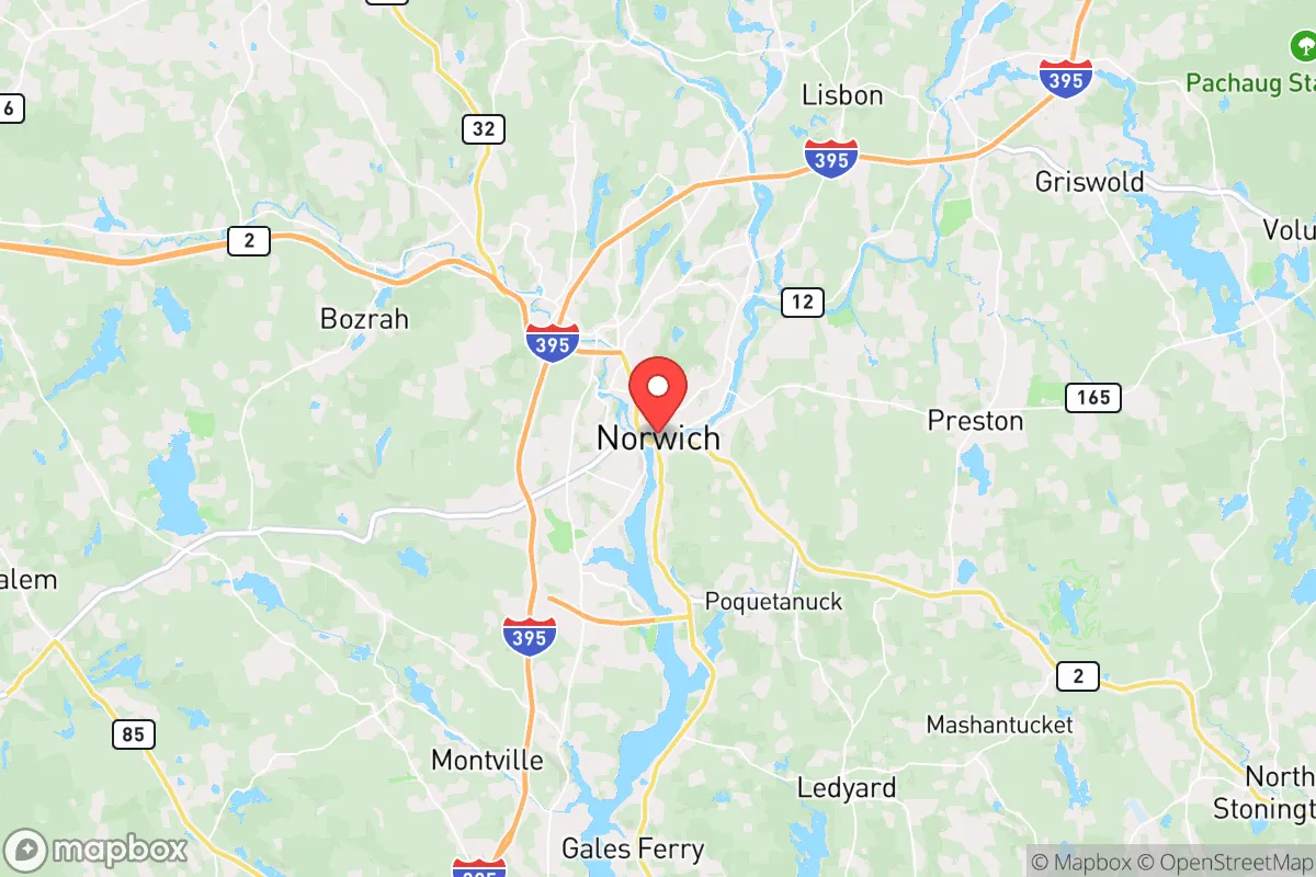
Strategic Assessment of Norwich, CT
Multiple tactical vulnerabilities. Population density, target proximity, or disaster risk are likely compounding. A retreat property and exit planning is required.
What does the Strategic Assessment tell us?
Our Strategic Assessment grades tactical survivability of an area. Major population centers, military targets, fallout zones, natural disasters, and border exposure all drive risk — lower exposure means a more defensible position in a crisis.
This is heavily inspired by Joel Skousen's Strategic Relocation book. Highly recommended you checkout the book ($)What does this tell us?
Our Strategic Assessment grades tactical survivability of an area. Major population centers, military targets, fallout zones, natural disasters, and border exposure all drive risk — lower exposure means a more defensible position in a crisis.
This is heavily inspired by Joel Skousen's Strategic Relocation book. Highly recommended you checkout the book ($)Strategic Pillars

Key Distances
Regional Safe Places
Below is our recommended "safe zones" in Connecticut and the surrounding area based on our strategic heuristics. For most people, it's unrealistic to live in a “safe zone” full-time due to work, family or other personal reasons. They tend to be more rural. However, many of these areas are perfect for second homes and retreat properties that double as a vacation home or even a short-term rental.


Important Note: For informational purposes only. This does not mean nothing bad ever happens in the green zones. Please use common sense. This is based on public data and modeled with AI. We tried to take a conservative approach but mistakes happen. We update this regularly as new information becomes available.
Solar Generator Recommendations
Backup power matters more here than in safer locations. We've picked three solar generators across budgets and capacity tiers — start with the budget unit if you only need a few essentials, or step up if you want to run a fridge and HVAC for days at a time.

Jackery Portable Power Station Explorer 300
Budget OptionPower on the Go: Weighing only 11 lbs, it's convenient to set up and store with book-sized foldable solar panels

BLUETTI Portable Power Station AC180
Designed for both indoor and outdoor scenarios, AC180 is highly capable as it has a robost capacity and continuous output power.

EF ECOFLOW DELTA Pro Ultra Power Station
Upgraded PickEcoFlow DELTA Pro Ultra is a whole-home energy system designed to grow with your family. Integrated with the Smart Home Panel 2, it scales to meet your evolving energy needs — keeping your home powered, intelligent, and secure through every stage of life.
We earn a commission, at no additional cost to you.
Strategic Assessment Analysis
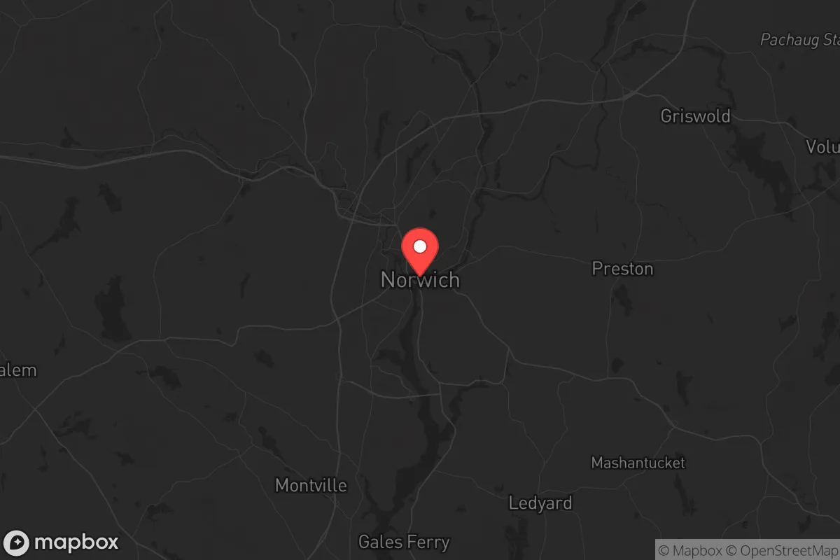
Norwich, Connecticut, offers a strategic paradox for the conservative prepper: it sits within striking distance of major population centers that could become chaos zones, yet its own geography and infrastructure provide a surprisingly resilient fallback position. The city’s location at the confluence of the Thames, Yantic, and Shetucket rivers gives it a natural moat and a historical role as a regional hub, but that same water access makes it a potential chokepoint. For a relocator thinking about long-term stability, Norwich is less a fortress and more a well-positioned forward operating base—close enough to monitor threats, far enough to avoid the initial blast wave of urban collapse.
Geographic position and natural advantages for long-term security
Norwich’s position in southeastern Connecticut places it roughly 45 miles from Hartford, 50 miles from Providence, and 90 miles from Boston—close enough to be affected by those cities’ problems, but far enough that a determined relocator can establish a buffer. The city itself sits on a series of hills rising from the river valleys, offering natural elevation advantages for observation and drainage. The surrounding landscape is a mix of second-growth forest, farmland, and wetlands, which provides cover, fuel, and potential hunting grounds. The Thames River, while navigable, is not a major industrial waterway like the Connecticut River, meaning less barge traffic and fewer eyes on your movements. The area’s glacial till soils are poor for large-scale agriculture but adequate for small, hidden garden plots. The real advantage is the abundance of freshwater: the three rivers, plus numerous ponds and streams in the surrounding towns of Bozrah, Sprague, and Lisbon, mean you’re unlikely to go thirsty even if municipal systems fail. The proximity to the Long Island Sound (about 15 miles south) also opens up maritime escape routes or resupply via small craft, a factor often overlooked in inland-focused prepper analyses.
Risks, exposures, and proximity to fallout-relevant landmarks
Norwich’s biggest liability is its proximity to critical infrastructure that could become targets or fallout sources. The Millstone Nuclear Power Station in Waterford is only 12 miles south—a prime target for any state-level actor or terrorist group looking to cripple the Northeast grid. A conventional strike or sabotage at Millstone could render large swaths of southeastern Connecticut uninhabitable for decades, and Norwich sits squarely in the prevailing wind pattern that would carry fallout inland. Additionally, the city is within 30 miles of the Naval Submarine Base New London in Groton, a high-value military asset that would be a priority for any adversary. In a mass casualty event or civil unrest scenario, the base could become a magnet for federal forces, refugees, or looters. The Interstate 395 corridor, which runs through Norwich, is a double-edged sword: it provides quick egress but also a direct route for urban refugees fleeing Hartford or New London. The city’s own population of roughly 40,000 is dense enough to create resource competition in a crisis, but not so dense that you can’t find a quiet corner. The real risk is the bridge chokepoints: all major routes in and out of Norwich cross one of the three rivers, meaning a single bridge failure (or intentional blocking) could trap you or cut off supply lines.
Practical resilience for a relocator: food, water, energy, and defensibility
For the individual or family looking to hunker down, Norwich offers a mixed bag. Water is the strongest asset: the rivers are perennial and, with proper filtration, provide an unlimited supply. The city’s municipal water comes from the Deep River Reservoir system, but in a grid-down scenario, you’ll want to rely on surface water or a private well—properties in the outer neighborhoods like Occum or Taftville often have older wells that can be reactivated. Food security is weaker. The surrounding farmland is mostly dairy and hay, not row crops, and the growing season is short (roughly 150 days). You’ll need to stockpile grains, legumes, and canned goods, or plan for greenhouse production. Local hunting is viable for deer and small game, but pressure from other preppers will be high. Energy is a bright spot: Norwich has a municipal electric utility, Norwich Public Utilities, which is more responsive than private companies and has a good track record for storm restoration. In a long-term outage, the rivers offer micro-hydro potential, and the hilly terrain is suitable for small wind turbines. Defensibility is the weak link. The city’s layout is a classic New England grid with narrow streets and dense housing in the downtown core—a nightmare for perimeter security. The better bet is to secure a property on the outskirts, preferably on a dead-end road with river or forest on one side. The Yantic River valley offers several such pockets, with limited access points that can be monitored. The local police force is small (about 80 officers) and would be overwhelmed in a major event, so you are your own first responder. The presence of the Mohegan Tribe’s reservation and casino complex (just west of the city) adds an unpredictable variable—tribal sovereignty means they operate under their own law enforcement and could become either a neutral zone or a contested resource.
The overall strategic picture for Norwich is one of calculated risk. It is not a remote survivalist paradise—you are still within a day’s walk of half a million people. But for the relocator who wants to stay connected to the Northeast corridor while maintaining a credible fallback position, it offers a rare combination of water abundance, elevation, and multiple escape routes. The key is to treat Norwich as a staging area, not a final redoubt. Stock your supplies, build relationships with the local farming community (the Grange is still active in nearby Lebanon), and have a plan to move north into the quieter hills of Windham County or east into Rhode Island’s Washington County if the situation deteriorates. The city’s history as a submarine-building center and a transportation hub means it will always be on someone’s map—but for the prepared conservative relocator, that’s exactly why it’s worth a hard look. You can’t hide from the world’s problems, but you can position yourself to survive them.
* Values derived from national, state, county, city and local statistics and may differ in a specific area. Last updated: 2026-04-19T05:39:21.000Z
Narrative content on this page is AI-generated and may contain mistakes. Verify any details that matter before acting on them.
ReloMaps may earn a commission from affiliate links at no extra cost to you.