Photo: Jakob Rosen via Unsplash
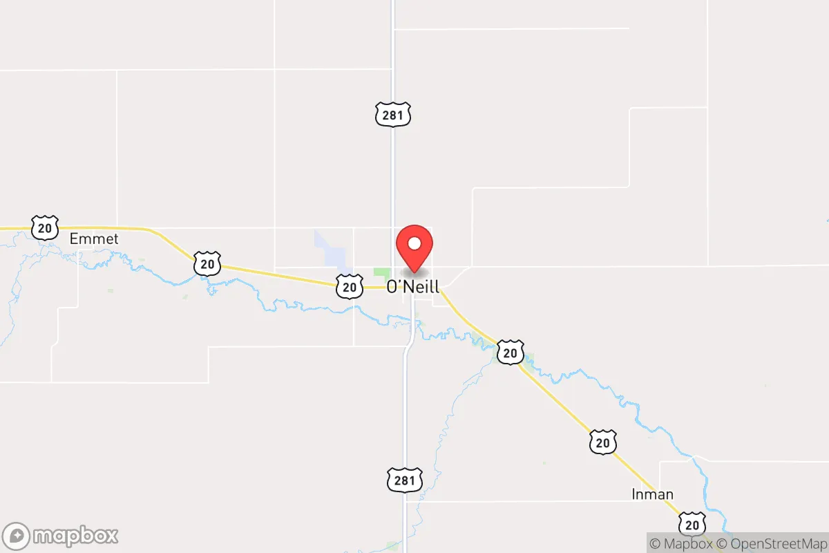
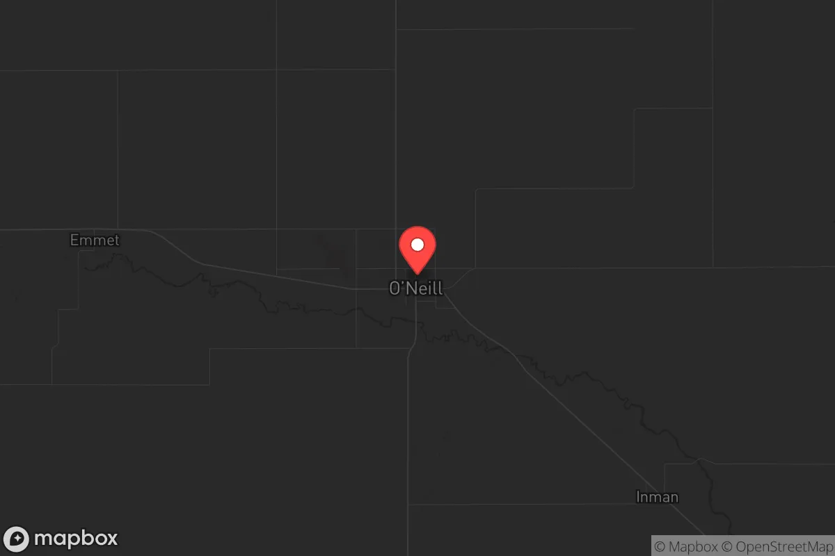
Strategic Assessment of Oneill, NE
Strong survivability profile. Good buffer from population centers, with manageable environmental and tactical risks.
What does the Strategic Assessment tell us?
Our Strategic Assessment grades tactical survivability of an area. Major population centers, military targets, fallout zones, natural disasters, and border exposure all drive risk — lower exposure means a more defensible position in a crisis.
This is heavily inspired by Joel Skousen's Strategic Relocation book. Highly recommended you checkout the book ($)What does this tell us?
Our Strategic Assessment grades tactical survivability of an area. Major population centers, military targets, fallout zones, natural disasters, and border exposure all drive risk — lower exposure means a more defensible position in a crisis.
This is heavily inspired by Joel Skousen's Strategic Relocation book. Highly recommended you checkout the book ($)Strategic Pillars

Key Distances
Regional Safe Places
Below is our recommended "safe zones" in Nebraska and the surrounding area based on our strategic heuristics. For most people, it's unrealistic to live in a “safe zone” full-time due to work, family or other personal reasons. They tend to be more rural. However, many of these areas are perfect for second homes and retreat properties that double as a vacation home or even a short-term rental.
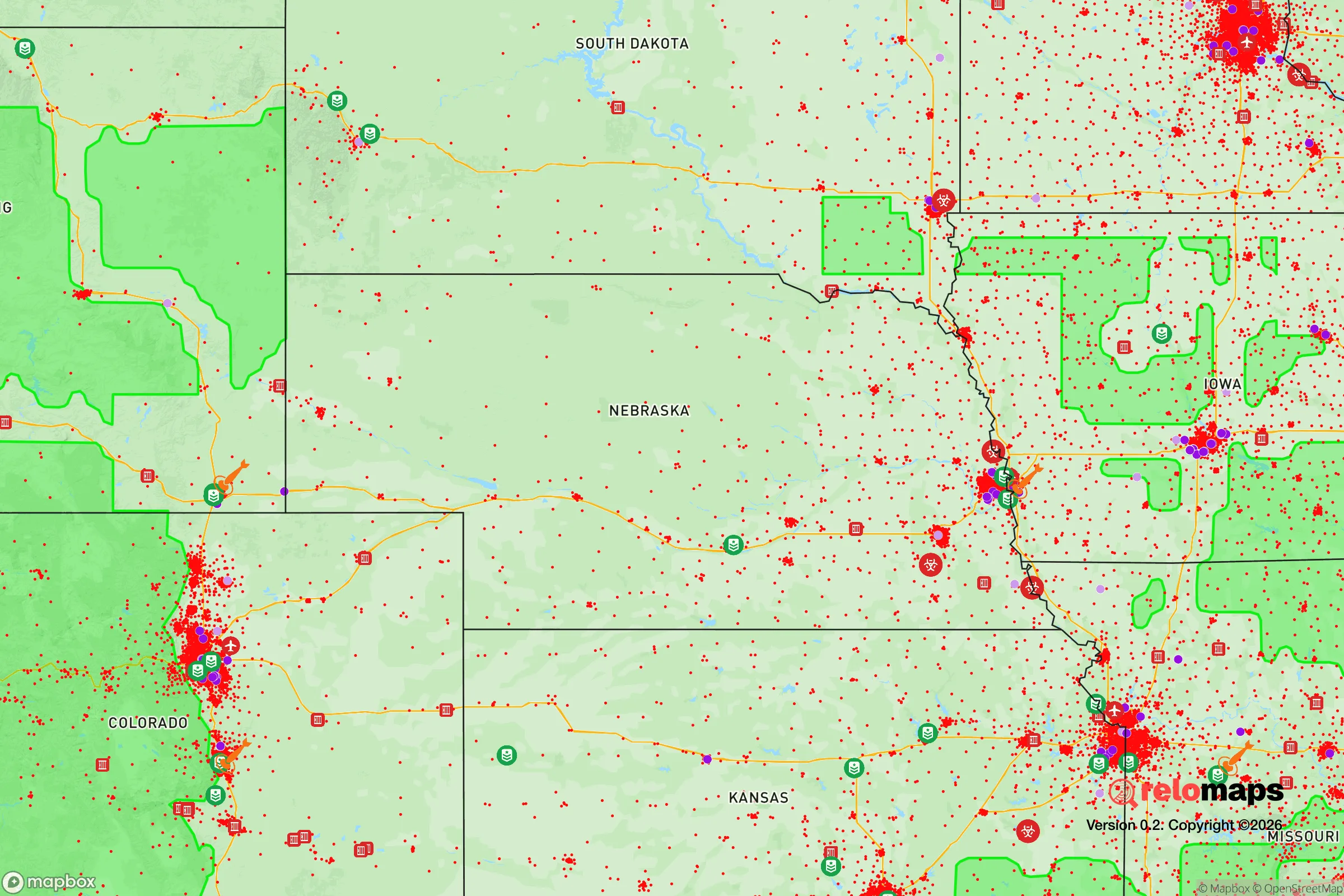
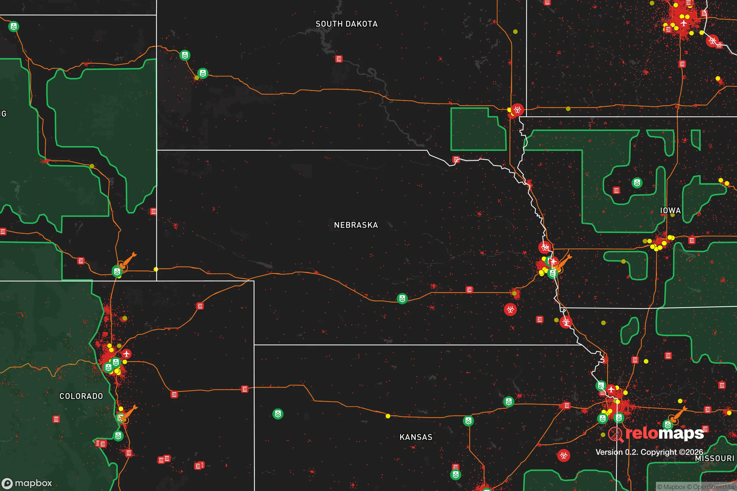
Important Note: For informational purposes only. This does not mean nothing bad ever happens in the green zones. Please use common sense. This is based on public data and modeled with AI. We tried to take a conservative approach but mistakes happen. We update this regularly as new information becomes available.
Solar Generator Recommendations
Backup power matters more here than in safer locations. We've picked three solar generators across budgets and capacity tiers — start with the budget unit if you only need a few essentials, or step up if you want to run a fridge and HVAC for days at a time.

Jackery Portable Power Station Explorer 300
Budget OptionPower on the Go: Weighing only 11 lbs, it's convenient to set up and store with book-sized foldable solar panels

BLUETTI Portable Power Station AC180
Designed for both indoor and outdoor scenarios, AC180 is highly capable as it has a robost capacity and continuous output power.

EF ECOFLOW DELTA Pro Ultra Power Station
Upgraded PickEcoFlow DELTA Pro Ultra is a whole-home energy system designed to grow with your family. Integrated with the Smart Home Panel 2, it scales to meet your evolving energy needs — keeping your home powered, intelligent, and secure through every stage of life.
We earn a commission, at no additional cost to you.
Strategic Assessment Analysis
O'Neill, Nebraska, sits as a quiet outlier in the American heartland, offering a strategic blend of isolation and functional connectivity that appeals to those prioritizing long-term resilience. With a population hovering around 3,500 and a location roughly 150 miles northwest of Omaha and 120 miles southwest of Sioux Falls, this small town avoids the immediate blast zones and population chokepoints of major urban centers while still maintaining practical access to supply chains and medical facilities. The area's agricultural base, low population density, and strong community networks create a foundation for weathering both natural disasters and man-made disruptions, though no location is without its vulnerabilities.
Geographic position and natural advantages for long-term security
O'Neill's position in Holt County places it within the Nebraska Sandhills region, a landscape of rolling grass-covered dunes that offers both defensive and agricultural benefits. The town sits near the Elkhorn River, providing a reliable freshwater source, while the surrounding terrain is largely open ranchland with limited tree cover—reducing wildfire risk compared to forested regions but also limiting concealment options. The area's elevation, roughly 2,000 feet above sea level, keeps it above major floodplains, and the region experiences fewer tornadoes than areas further east in Nebraska, though severe thunderstorms remain a seasonal reality. The nearest interstate highway, I-80, is about 90 miles south, meaning O'Neill avoids the traffic congestion and strategic targeting risks of major transportation corridors while still being within a two-hour drive of regional distribution hubs. For a relocator, this balance of remoteness and accessibility is a key advantage: you're far enough from population centers to avoid the initial chaos of a major event, but close enough to reach supplies or medical care if roads remain passable.
Risks, exposures, and proximity to fallout-relevant landmarks
The primary risk for O'Neill is its distance from critical infrastructure that could become targets during a major conflict or terrorist event. The nearest significant military installation is Offutt Air Force Base near Omaha, roughly 150 miles southeast—well outside the immediate blast radius of a conventional strike, but within the fallout zone of a nuclear event depending on wind patterns. The town is also about 200 miles from the Strategic Air Command's former headquarters and current U.S. Strategic Command facilities, which would be high-priority targets. Additionally, the Keystone XL pipeline route, while not operational, passes through the region, and existing natural gas pipelines crisscross the area, presenting potential secondary hazards during civil unrest or sabotage. On the natural disaster front, the primary threats are blizzards and ice storms, which can isolate the town for days or weeks, and the occasional drought that stresses local agriculture. The area's low crime rate—Holt County consistently ranks among Nebraska's safest—means that civil unrest is unlikely to originate locally, but the town could see an influx of refugees from larger cities during a crisis, straining resources. For a prepper, the key takeaway is that O'Neill avoids the worst of the fallout risks but isn't immune to secondary effects; stockpiling supplies and having a plan for potential population displacement are essential.
Practical resilience for a relocator: food, water, energy, and defensibility
O'Neill's agricultural economy is its strongest resilience asset. The surrounding area is dominated by cattle ranching and row crops like corn and soybeans, meaning local food production is robust and diversified. The town itself has a small but functional grocery store, a farm supply co-op, and several local producers selling meat and eggs directly. For water, the Elkhorn River and the underlying Ogallala Aquifer provide abundant groundwater, though well drilling and treatment would be necessary for off-grid living. The region's energy infrastructure is a mixed bag: the local power grid is served by the Nebraska Public Power District, which relies heavily on coal and nuclear sources (the nearest nuclear plant is Fort Calhoun, near Omaha, about 130 miles away), but the area has growing wind energy capacity, and solar installations are feasible given the region's 220+ sunny days per year. Defensibility is moderate—the open terrain makes it difficult to approach unseen, but also leaves a property exposed. The town's layout, with a compact downtown and scattered rural homesteads, allows for both community-based defense and isolated living. The local sheriff's office is responsive but small, so self-reliance is the norm. For a relocator, the practical steps are clear: invest in a well and backup power, build relationships with local farmers, and secure a property with natural barriers like creek beds or tree lines. The community itself is tight-knit and conservative-leaning, which can be a double-edged sword—it fosters mutual aid but also means newcomers are scrutinized before being accepted.
The overall strategic picture for O'Neill is one of calculated trade-offs. It offers genuine advantages in terms of isolation, local food production, and water access, while avoiding the immediate dangers of urban proximity and high-value military targets. However, it is not a fortress—the region's weather extremes, reliance on distant infrastructure, and potential for refugee influxes require active preparation rather than passive assumption of safety. For a conservative-leaning individual or family looking to step off the grid of vulnerability without stepping off the map entirely, O'Neill represents a solid middle-ground option: remote enough to matter, connected enough to function, and grounded in a community that values self-sufficiency. The key is to arrive with skills, supplies, and a willingness to integrate—because in a crisis, the people around you are your most important resource, and O'Neill's people are its strongest asset.
* Values derived from national, state, county, city and local statistics and may differ in a specific area. Last updated: 2026-05-01T05:25:59.000Z
Narrative content on this page is AI-generated and may contain mistakes. Verify any details that matter before acting on them.
ReloMaps may earn a commission from affiliate links at no extra cost to you.