Photo: Wikipedia
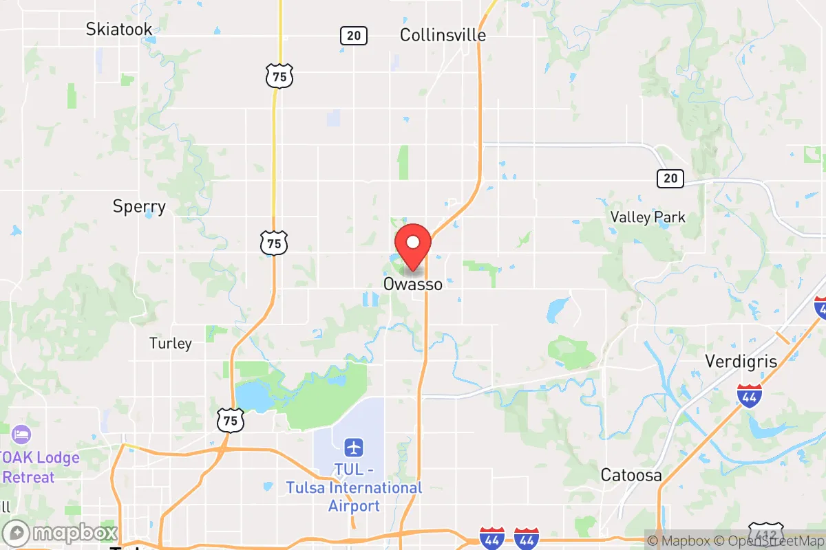
Strategic Assessment of Owasso, OK
Multiple tactical vulnerabilities. Population density, target proximity, or disaster risk are likely compounding. A retreat property and exit planning is required.
What does the Strategic Assessment tell us?
Our Strategic Assessment grades tactical survivability of an area. Major population centers, military targets, fallout zones, natural disasters, and border exposure all drive risk — lower exposure means a more defensible position in a crisis.
This is heavily inspired by Joel Skousen's Strategic Relocation book. Highly recommended you checkout the book ($)What does this tell us?
Our Strategic Assessment grades tactical survivability of an area. Major population centers, military targets, fallout zones, natural disasters, and border exposure all drive risk — lower exposure means a more defensible position in a crisis.
This is heavily inspired by Joel Skousen's Strategic Relocation book. Highly recommended you checkout the book ($)Strategic Pillars

Key Distances
Regional Safe Places
Below is our recommended "safe zones" in Oklahoma and the surrounding area based on our strategic heuristics. For most people, it's unrealistic to live in a “safe zone” full-time due to work, family or other personal reasons. They tend to be more rural. However, many of these areas are perfect for second homes and retreat properties that double as a vacation home or even a short-term rental.
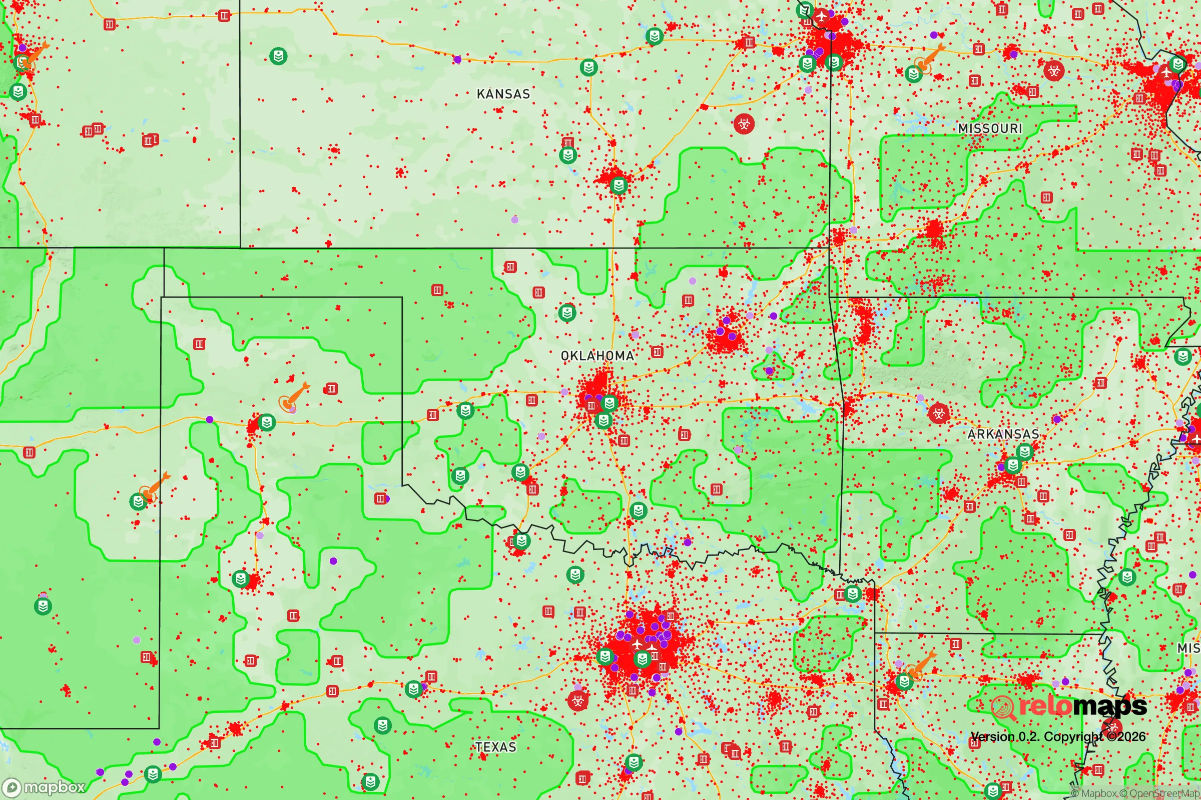
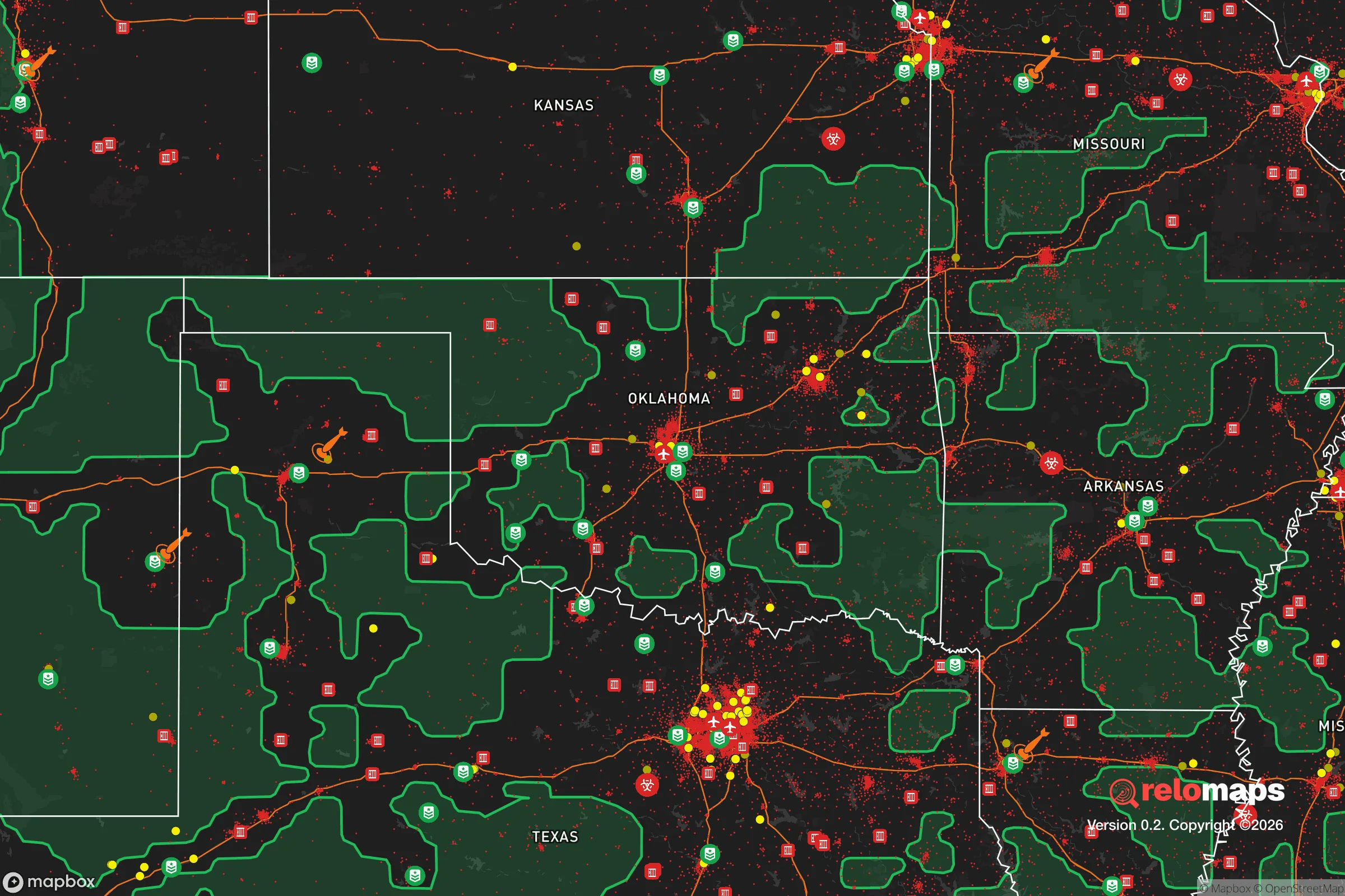
Important Note: For informational purposes only. This does not mean nothing bad ever happens in the green zones. Please use common sense. This is based on public data and modeled with AI. We tried to take a conservative approach but mistakes happen. We update this regularly as new information becomes available.
Solar Generator Recommendations
Backup power matters more here than in safer locations. We've picked three solar generators across budgets and capacity tiers — start with the budget unit if you only need a few essentials, or step up if you want to run a fridge and HVAC for days at a time.

Jackery Portable Power Station Explorer 300
Budget OptionPower on the Go: Weighing only 11 lbs, it's convenient to set up and store with book-sized foldable solar panels

BLUETTI Portable Power Station AC180
Designed for both indoor and outdoor scenarios, AC180 is highly capable as it has a robost capacity and continuous output power.

EF ECOFLOW DELTA Pro Ultra Power Station
Upgraded PickEcoFlow DELTA Pro Ultra is a whole-home energy system designed to grow with your family. Integrated with the Smart Home Panel 2, it scales to meet your evolving energy needs — keeping your home powered, intelligent, and secure through every stage of life.
We earn a commission, at no additional cost to you.
Strategic Assessment Analysis
Owasso, Oklahoma, sits in a strategic sweet spot that few relocators fully appreciate: close enough to Tulsa’s infrastructure to matter, far enough from its collapse scenarios to survive. The city’s post-2000 growth—from roughly 15,000 to over 38,000 residents—reflects not just suburban sprawl but a deliberate migration pattern of families and individuals seeking buffer from the volatility of larger metros. For the prepper or survivalist, Owasso offers a rare combination of economic stability, geographic insulation, and community cohesion that makes it a viable long-term base of operations in an increasingly uncertain national landscape.
Geographic position and natural advantages for long-term security
Owasso’s location at the intersection of US-169 and OK-20 places it roughly 15 miles northeast of downtown Tulsa, but the practical distance feels greater. The city sits on the southern edge of the Osage Hills, a region of rolling terrain, mixed hardwood forests, and limestone bluffs that provide natural cover and defensible positions. Unlike the flat, exposed expanses of central Oklahoma, this area offers multiple egress routes: north toward Bartlesville and the Kansas line, east toward the Ozark foothills, and west toward the open prairie. The Verdigris River and Bird Creek watersheds run through the area, providing surface water sources that are less likely to be contested than municipal supplies. The region’s elevation—roughly 650 to 900 feet above sea level—keeps it above most floodplain risks while still benefiting from the Arkansas River Valley’s moderate climate. For a relocator thinking in decades, not years, Owasso’s position outside the Tornado Alley bullseye (the city averages fewer direct tornado hits than Moore or Edmond) and its distance from major fault lines make it a lower-maintenance survival hub than many western or southern alternatives.
Risks, exposures, and proximity to fallout-relevant landmarks
No location is immune, and Owasso has specific vulnerabilities that a serious prepper must account for. The most immediate concern is proximity to Tulsa’s critical infrastructure: the Port of Catoosa (a major inland waterway hub for grain and fertilizer), Tulsa International Airport (a potential FEMA staging point), and the numerous refineries along the Arkansas River corridor. In a mass casualty event or civil unrest scenario, these become both targets and chokepoints. The city’s growth has also brought suburban sprawl that reduces rural buffer—Owasso now abuts Collinsville to the north and unincorporated Tulsa County to the south, meaning a collapse in Tulsa could push displaced populations directly into Owasso’s neighborhoods within hours. Additionally, the Keystone Pipeline system runs through the region, and while pipeline ruptures are rare, the environmental and security implications of a coordinated attack on energy infrastructure are non-trivial. Owasso’s water supply comes from Lake Yahola and the Tulsa water system, which means a contamination event upstream (e.g., at the Port of Catoosa or the Verdigris River industrial corridor) could cut municipal supply. The city’s power grid is tied to the Southwest Power Pool, which has shown strain during winter storms (see 2021’s Uri). For the relocator, these risks are manageable with planning—but they require acknowledging that Owasso is not a remote bunker; it’s a suburban node with exposure to regional failure points.
Practical resilience for a relocator: food, water, energy, and defensibility
For the individual or family looking to establish a self-sufficient base, Owasso’s practical resilience metrics are mixed but promising. Food security is the strongest asset: the surrounding Rogers County and Tulsa County agricultural belt produces wheat, soybeans, corn, and cattle, with farmers’ markets in Owasso (the Owasso Farmers Market runs May–October) and direct-from-farm purchasing options within a 20-minute drive. The city’s zoning allows for backyard chickens and small livestock in most residential areas, and the soil quality in the Bird Creek bottomlands is suitable for vegetable gardening. Water is the critical vulnerability. Municipal water is treated and reliable in normal times, but a prepper should plan for at least two weeks of stored water per person, plus a backup filtration system (Berkey or Sawyer) for surface water from Bird Creek or the Verdigris. Energy resilience is achievable: the region has good solar insolation (averaging 4.5–5.0 peak sun hours per day), and off-grid solar with battery storage is feasible for a suburban lot. Natural gas is widely available for heating and cooking, and propane delivery is common in the outlying areas. Defensibility is where Owasso’s suburban character cuts both ways. The city’s grid-like street layout and cul-de-sac neighborhoods are easy to patrol but also easy to penetrate. The Owasso Police Department maintains a ratio of roughly 1.8 officers per 1,000 residents, which is below the national average but above many rural alternatives. For a relocator, the best strategy is to choose a property on the northern or eastern fringe—closer to the Osage Hills, with a single access road and natural barriers (creeks, tree lines) that slow approach. The local gun culture is strong, with multiple ranges and gun shops within 10 miles, and Oklahoma’s constitutional carry law (effective since 2019) means no permit is needed for concealed carry. Community resilience is harder to quantify but arguably more important: Owasso’s churches, civic groups, and neighborhood associations provide a social fabric that can be activated in a crisis. The city’s emergency management office runs a CERT (Community Emergency Response Team) program, and the Rogers County Emergency Management coordinates with local ham radio operators—a signal that the area takes preparedness seriously.
The overall strategic picture for Owasso is one of calculated trade-offs. It is not a remote retreat—you will have neighbors, traffic, and the hum of a growing suburb. But for the relocator who wants to be near enough to a regional economy (Tulsa’s job market, healthcare, and supply chains) while maintaining the ability to bug in or bug out with minimal friction, Owasso works. The city’s demographic profile—predominantly white, middle-class, and politically conservative—aligns with the values of self-reliance and community defense that underpin the prepper mindset. The key takeaway: Owasso is a base camp, not a fortress. It gives you a platform to build skills, store supplies, and network with like-minded individuals, while keeping you within striking distance of the resources you’ll need in a prolonged crisis. If you’re looking for a place to ride out the next decade of uncertainty without going full off-grid, this corner of northeastern Oklahoma deserves a hard look. Just don’t expect to be alone—and plan accordingly.
* Values derived from national, state, county, city and local statistics and may differ in a specific area. Last updated: 2026-04-19T08:21:21.000Z
Narrative content on this page is AI-generated and may contain mistakes. Verify any details that matter before acting on them.
ReloMaps may earn a commission from affiliate links at no extra cost to you.