
Photo: Wikipedia
Strategic Assessment of Paragould, AR
Workable tactical position. Some exposure to population density or targets, but generally defensible in a crisis.
What does the Strategic Assessment tell us?
Our Strategic Assessment grades tactical survivability of an area. Major population centers, military targets, fallout zones, natural disasters, and border exposure all drive risk — lower exposure means a more defensible position in a crisis.
This is heavily inspired by Joel Skousen's Strategic Relocation book. Highly recommended you checkout the book ($)What does this tell us?
Our Strategic Assessment grades tactical survivability of an area. Major population centers, military targets, fallout zones, natural disasters, and border exposure all drive risk — lower exposure means a more defensible position in a crisis.
This is heavily inspired by Joel Skousen's Strategic Relocation book. Highly recommended you checkout the book ($)Strategic Pillars

Key Distances
Regional Safe Places
Below is our recommended "safe zones" in Arkansas and the surrounding area based on our strategic heuristics. For most people, it's unrealistic to live in a “safe zone” full-time due to work, family or other personal reasons. They tend to be more rural. However, many of these areas are perfect for second homes and retreat properties that double as a vacation home or even a short-term rental.


Important Note: For informational purposes only. This does not mean nothing bad ever happens in the green zones. Please use common sense. This is based on public data and modeled with AI. We tried to take a conservative approach but mistakes happen. We update this regularly as new information becomes available.
Solar Generator Recommendations
Backup power matters more here than in safer locations. We've picked three solar generators across budgets and capacity tiers — start with the budget unit if you only need a few essentials, or step up if you want to run a fridge and HVAC for days at a time.

Jackery Portable Power Station Explorer 300
Budget OptionPower on the Go: Weighing only 11 lbs, it's convenient to set up and store with book-sized foldable solar panels

BLUETTI Portable Power Station AC180
Designed for both indoor and outdoor scenarios, AC180 is highly capable as it has a robost capacity and continuous output power.

EF ECOFLOW DELTA Pro Ultra Power Station
Upgraded PickEcoFlow DELTA Pro Ultra is a whole-home energy system designed to grow with your family. Integrated with the Smart Home Panel 2, it scales to meet your evolving energy needs — keeping your home powered, intelligent, and secure through every stage of life.
We earn a commission, at no additional cost to you.
Strategic Assessment Analysis
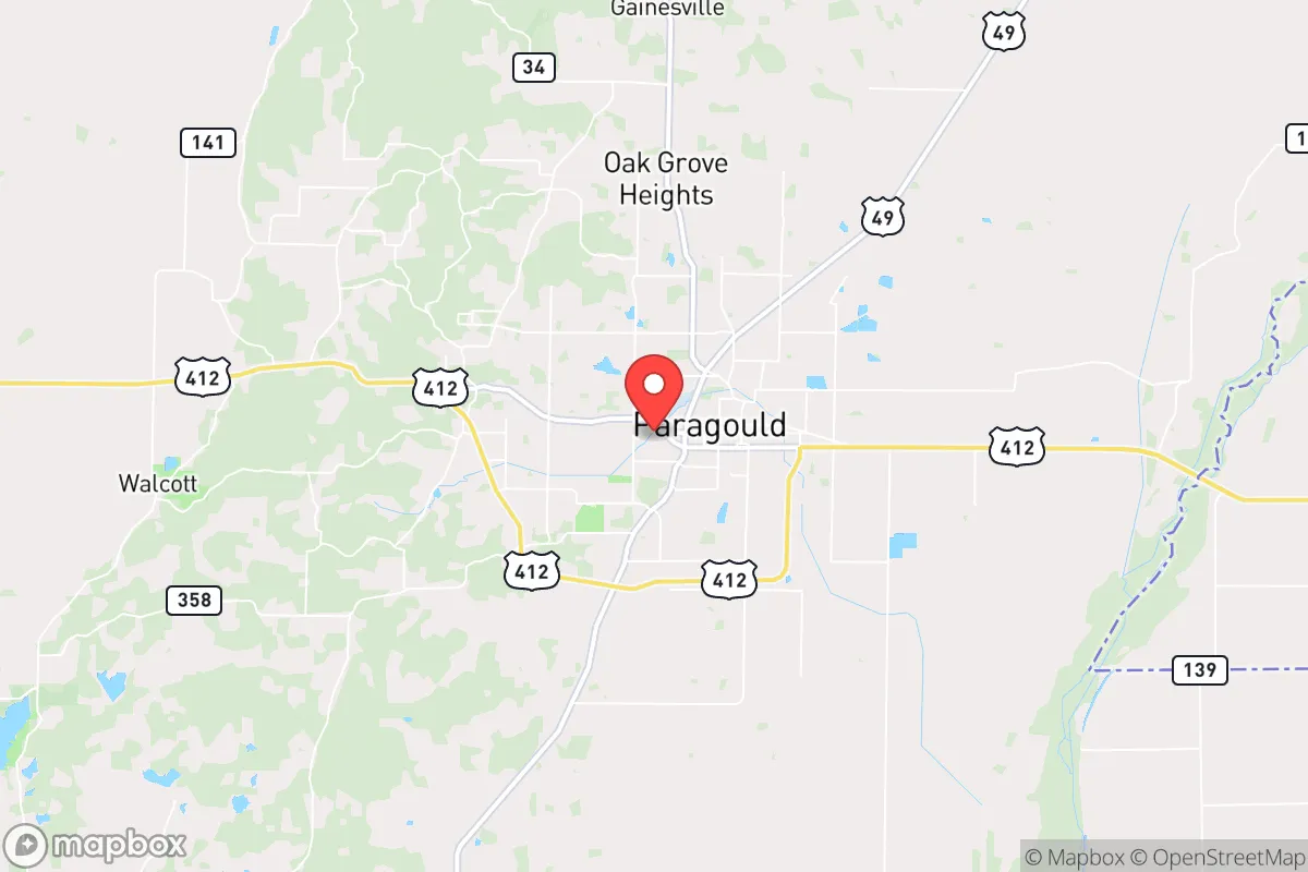
Paragould, Arkansas, sits in the state’s northeastern corner, roughly 15 miles from the Missouri line and 140 miles from Memphis, Tennessee. Its strategic value for a prepper or survivalist lies in its relative isolation from major metropolitan blast zones while still offering access to regional supply chains and medical infrastructure. The city’s population hovers around 30,000, and the surrounding Greene County is predominantly rural, with a strong agricultural base that provides a buffer against the chaos of larger urban centers. For someone looking to ride out civic unrest, mass casualty events, or natural disasters, Paragould offers a low-profile, defensible position with a community that leans heavily conservative and self-reliant.
Geographic position and natural advantages for long-term survival
Paragould’s location in the Arkansas Delta gives it a mix of flat, fertile farmland and scattered hardwood forests, which translates into several practical advantages. The area sits atop the Mississippi Embayment aquifer, one of the most productive groundwater sources in the country, meaning access to fresh water is less of a concern than in many other regions. The nearby Cache River and St. Francis River systems provide additional surface water, though these are prone to seasonal flooding—a risk that can be mitigated with proper siting. The topography is mostly level, which simplifies gardening, livestock grazing, and building out a homestead. The climate is humid subtropical, with hot summers and mild winters, allowing for year-round food production if you’re willing to work around the occasional ice storm. Paragould is also far enough from the New Madrid Seismic Zone’s epicenter (about 60 miles west) to avoid the worst of a major earthquake, though you’d still feel significant shaking. The real draw is the lack of high-value targets: no military bases, no major ports, no nuclear power plants within 50 miles. The nearest significant fallout risk is the Arkansas Nuclear One plant near Russellville, roughly 160 miles southwest—well outside the lethal blast radius and most fallout plumes for a worst-case scenario.
Risks, exposures, and proximity to fallout-relevant landmarks
No location is without vulnerabilities, and Paragould has a few that a strategic relocator should weigh. The biggest concern is the proximity to the New Madrid fault line, which could produce a catastrophic earthquake in the 7.0–8.0 range. Such an event would likely collapse older brick buildings in the downtown area, disrupt natural gas lines, and cause widespread liquefaction in the low-lying river bottoms. The city’s infrastructure—roads, bridges, power grids—is not built to modern seismic standards, so a major quake would isolate Paragould for weeks. Flooding is another recurring issue: the 2017 flood along the Cache River inundated parts of the county, and climate models suggest heavier spring rains ahead. On the human-caused risk side, Paragould is about 70 miles from the Memphis metropolitan area (population 1.3 million), which is a plausible target for civil unrest, terrorist attack, or a major industrial accident. Memphis is a rail and shipping hub with chemical plants and a major oil pipeline junction, meaning a disaster there could send refugees or fallout north along Highway 49. The nearby Walnut Ridge Army Airfield (now a civilian airport) was a Cold War B-52 base, but it’s been decommissioned for decades and poses no current threat. The biggest wildcard is the proximity to the Mississippi River levee system—a breach upstream could flood large swaths of Greene County, though Paragould itself sits on higher ground and is generally safe from that scenario.
Practical resilience for a relocator: food, water, energy, and defensibility
For someone serious about self-sufficiency, Paragould offers a solid foundation. The agricultural economy means local food production is abundant and cheap—rice, soybeans, corn, and wheat are the main crops, with plenty of small farms raising cattle, hogs, and poultry. The Greene County Farmers Market operates from April through October, and there are several local butchers and feed stores that can supply livestock starter stock. Water is the standout advantage: the aquifer is deep and reliable, and most rural properties can drill a well for under $5,000. The city’s municipal water comes from the Cache River, but a prepper should plan on a backup well or rainwater catchment system, as the treatment plant could be knocked offline by a quake or power outage. Energy is a mixed bag. The local grid is served by Craighead Electric Cooperative, which has a decent reliability record but is vulnerable to ice storms and tornadoes—solar panels with battery storage are a wise investment here, as the region gets about 215 sunny days per year. Natural gas is available in town, but rural properties often rely on propane tanks, which require planning for refills during a crisis. Defensibility is where Paragould shines: the city is laid out on a simple grid with few natural chokepoints, but the surrounding farmland offers clear sightlines and limited cover for anyone approaching. The local culture is heavily armed and self-policing—Greene County has a high rate of gun ownership and a sheriff’s office that takes a hard line on property crime. For a single individual or family, a rural property 5–10 miles outside the city limits provides a good balance of isolation and access to supplies. The nearest major hospital is Arkansas Methodist Medical Center in Paragould, a 100-bed facility that could handle trauma but would be overwhelmed in a mass casualty event—plan for that.
The overall strategic picture for Paragould is one of moderate risk with high reward for the prepared relocator. It’s not a bug-out paradise like the Montana Rockies, but it’s a realistic, affordable option for someone who wants to be out of the blast zone of major cities while still having access to modern amenities. The biggest threats—earthquake and flood—are manageable with proper planning: build on high ground, reinforce your structure, and store at least two weeks of supplies. The community is insular but not hostile to newcomers who keep to themselves and contribute to the local economy. Paragould’s real strength is its ordinariness—it’s a place that will likely be overlooked in a national crisis, which is exactly what you want. If you’re looking for a low-key, defensible base in the Mid-South with good water, decent soil, and a conservative population that won’t ask too many questions, this corner of Arkansas deserves a serious look. Just don’t expect to be the only one with that idea—land prices have been creeping up as more people from Chicago and St. Louis discover the area.
* Values derived from national, state, county, city and local statistics and may differ in a specific area. Last updated: 2026-04-30T02:32:53.000Z
Narrative content on this page is AI-generated and may contain mistakes. Verify any details that matter before acting on them.
ReloMaps may earn a commission from affiliate links at no extra cost to you.