Photo: Wikipedia
Strategic Assessment of Pearl, MS
Workable tactical position. Some exposure to population density or targets, but generally defensible in a crisis.
What does the Strategic Assessment tell us?
Our Strategic Assessment grades tactical survivability of an area. Major population centers, military targets, fallout zones, natural disasters, and border exposure all drive risk — lower exposure means a more defensible position in a crisis.
This is heavily inspired by Joel Skousen's Strategic Relocation book. Highly recommended you checkout the book ($)What does this tell us?
Our Strategic Assessment grades tactical survivability of an area. Major population centers, military targets, fallout zones, natural disasters, and border exposure all drive risk — lower exposure means a more defensible position in a crisis.
This is heavily inspired by Joel Skousen's Strategic Relocation book. Highly recommended you checkout the book ($)Strategic Pillars

Key Distances
Regional Safe Places
Below is our recommended "safe zones" in Mississippi and the surrounding area based on our strategic heuristics. For most people, it's unrealistic to live in a “safe zone” full-time due to work, family or other personal reasons. They tend to be more rural. However, many of these areas are perfect for second homes and retreat properties that double as a vacation home or even a short-term rental.
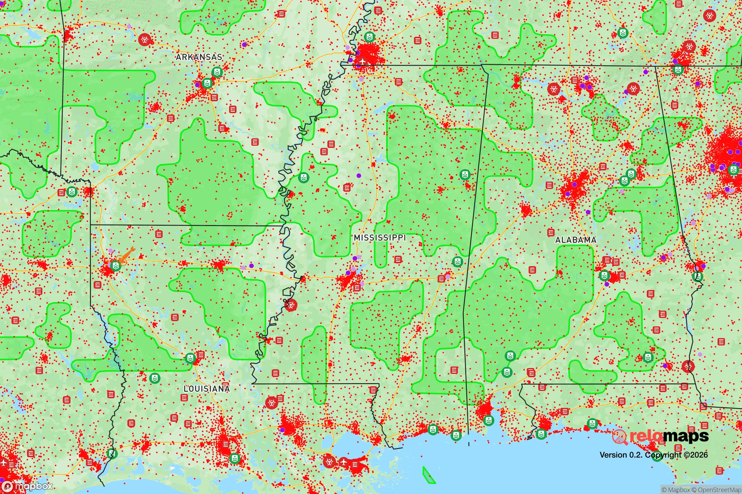
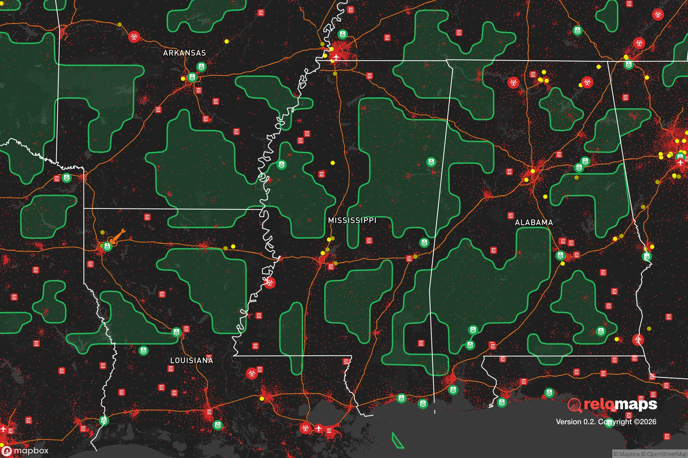
Important Note: For informational purposes only. This does not mean nothing bad ever happens in the green zones. Please use common sense. This is based on public data and modeled with AI. We tried to take a conservative approach but mistakes happen. We update this regularly as new information becomes available.
Solar Generator Recommendations
Backup power matters more here than in safer locations. We've picked three solar generators across budgets and capacity tiers — start with the budget unit if you only need a few essentials, or step up if you want to run a fridge and HVAC for days at a time.

Jackery Portable Power Station Explorer 300
Budget OptionPower on the Go: Weighing only 11 lbs, it's convenient to set up and store with book-sized foldable solar panels

BLUETTI Portable Power Station AC180
Designed for both indoor and outdoor scenarios, AC180 is highly capable as it has a robost capacity and continuous output power.

EF ECOFLOW DELTA Pro Ultra Power Station
Upgraded PickEcoFlow DELTA Pro Ultra is a whole-home energy system designed to grow with your family. Integrated with the Smart Home Panel 2, it scales to meet your evolving energy needs — keeping your home powered, intelligent, and secure through every stage of life.
We earn a commission, at no additional cost to you.
Strategic Assessment Analysis
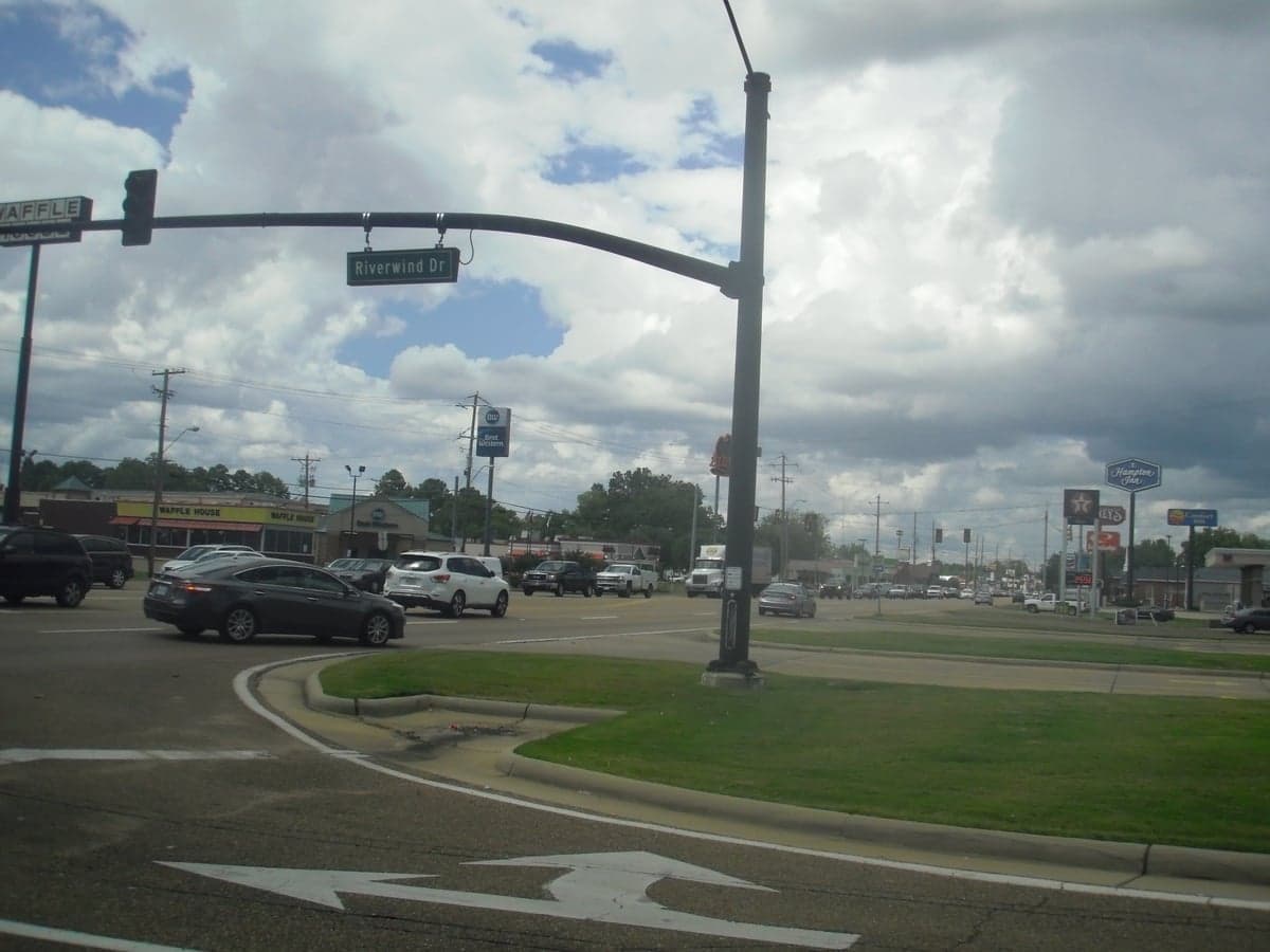
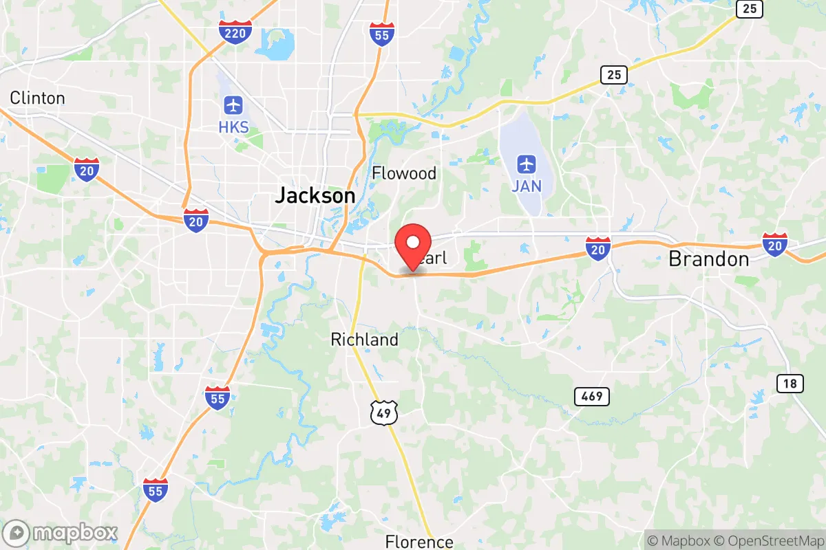
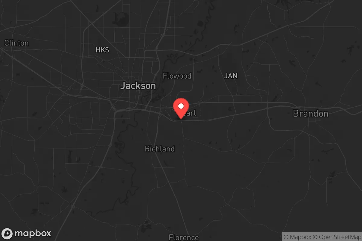
Pearl, Mississippi, sits in a strategic sweet spot that resilience-minded relocators should take seriously: close enough to Jackson’s infrastructure to be useful, but far enough to avoid the worst of urban collapse scenarios. The city’s position along Interstate 20 and its adjacency to the Rankin County line gives it a logistical edge for supply movement and evacuation routes, while the Pearl River offers a natural water source and a modest defensive barrier. For a conservative-leaning individual or family weighing long-term preparedness, Pearl presents a workable balance of access and buffer—provided you understand its specific vulnerabilities and plan accordingly.
Geographic position and natural advantages for long-term security
Pearl’s location in central Mississippi, roughly 10 miles east of downtown Jackson, places it at the junction of I-20 and U.S. Highway 80, two major east-west corridors that remain functional even during regional disruptions. The city sits on the eastern bank of the Pearl River, which provides a renewable water source and a natural choke point against movement from the west. The surrounding terrain is mostly flat to gently rolling piney woods, offering decent cover and agricultural potential for those with land. The climate is humid subtropical, with a growing season of about 230 days—long enough for serious food production if you’re willing to manage the heat and humidity. Rankin County, where Pearl is located, has a population density of roughly 200 people per square mile, which is low enough to avoid the worst congestion but high enough to maintain some community infrastructure. The area is also outside the 50-mile blast radius of any major military or nuclear target, though Jackson’s proximity introduces some risk.
Risks, exposures, and proximity to fallout-relevant landmarks
The most significant risk for Pearl is its proximity to Jackson, a city with a population of about 150,000 that has experienced chronic infrastructure decay, high crime rates, and political instability. Jackson’s water system has failed multiple times since 2022, and its police force has struggled with staffing shortages—both warning signs for anyone concerned about civic collapse. In a mass casualty event or widespread unrest, Jackson could become a source of refugees, looting parties, or resource competition. Pearl sits just east of the Pearl River, which means any evacuation from Jackson would likely flow directly toward Pearl along I-20 or Highway 80. The city is also within 30 miles of the University of Mississippi Medical Center, a Level I trauma center that could become a target or a bottleneck during a public health crisis. On the natural disaster front, Pearl is in a moderate tornado zone—Rankin County averages about 30 tornado warnings per year—and the Pearl River is prone to flooding after heavy rains, with several neighborhoods in the floodplain. There are no nuclear power plants within 100 miles, but the nearby Jackson-Evers International Airport could be a secondary target in a conflict scenario. For a prepper, these risks mean you need a solid bug-out plan that moves east or south, not west toward Jackson.
Practical resilience for a relocator: food, water, energy, and defensibility
For a family or individual looking to establish a resilient homestead, Pearl offers a mixed bag. The city itself has municipal water and sewer, but the Pearl River is a reliable backup source if you invest in a pump and filtration system—the river flows year-round and is generally clean upstream of Jackson’s industrial runoff. The local water table is high, so shallow wells are feasible in rural parts of Rankin County. Food production is viable: the soil is sandy loam in most areas, and local farmers’ markets in nearby Brandon and Florence provide seed stock and livestock connections. The growing season runs from March to November, allowing for two crop cycles of staples like corn, beans, and squash. For energy, Pearl is served by Entergy Mississippi, which has a mixed grid of natural gas and coal, but outages during storms are common, averaging 2-3 per year lasting 4-12 hours. Solar is a solid investment here—the area gets about 215 sunny days annually, enough for a 5-7 kW system to cover basic loads. Defensibility is moderate: the city’s layout is mostly suburban sprawl with cul-de-sacs and strip malls, not ideal for a perimeter defense. However, rural properties east of Pearl along Highway 80 or near the Ross Barnett Reservoir offer better terrain for a retreat, with wooded lots and limited road access. Gun ownership is common and culturally accepted in Rankin County, and the sheriff’s office is well-funded and responsive, which is a plus for community security during low-grade disruptions. For food storage, the local climate is humid, so you’ll need dehumidifiers and sealed containers to prevent mold—this is not arid desert country where dry goods keep indefinitely.
The overall strategic picture for Pearl is one of cautious viability. It’s not a remote bunker location, but it’s also not a high-risk urban core. The city’s main strength is its access to resources—multiple grocery stores, hardware outlets, and medical clinics within a 15-minute drive—while its main weakness is the shadow of Jackson’s instability. For a conservative relocator who wants to stay connected to a regional economy but maintain a prepared lifestyle, Pearl works if you buy property east of the river, invest in water independence, and build a network with like-minded locals in Rankin County. The sweet spot is a 5-10 acre parcel in the rural parts of the county, within 20 minutes of Pearl’s amenities but far enough to avoid the Jackson spillover. If you’re looking for a place that balances convenience with a realistic prepper posture, Pearl deserves a hard look—just don’t expect it to be a fortress. It’s a base camp, not a final redoubt, and that’s exactly what many families need in an uncertain decade.
* Values derived from national, state, county, city and local statistics and may differ in a specific area. Last updated: 2026-05-04T02:49:31.000Z
Narrative content on this page is AI-generated and may contain mistakes. Verify any details that matter before acting on them.
ReloMaps may earn a commission from affiliate links at no extra cost to you.