
Photo: Wikipedia
Strategic Assessment of Franklin County
Meaningful friction. Expect exposure to either population pressure, blast zones, or natural disaster risk. Consider buying a retreat property.
What does the Strategic Assessment tell us?
Our Strategic Assessment grades tactical survivability of an area. Major population centers, military targets, fallout zones, natural disasters, and border exposure all drive risk — lower exposure means a more defensible position in a crisis.
This is heavily inspired by Joel Skousen's Strategic Relocation book. Highly recommended you checkout the book ($)What does this tell us?
Our Strategic Assessment grades tactical survivability of an area. Major population centers, military targets, fallout zones, natural disasters, and border exposure all drive risk — lower exposure means a more defensible position in a crisis.
This is heavily inspired by Joel Skousen's Strategic Relocation book. Highly recommended you checkout the book ($)Strategic Pillars

Key Distances
Strategic Assessment Analysis
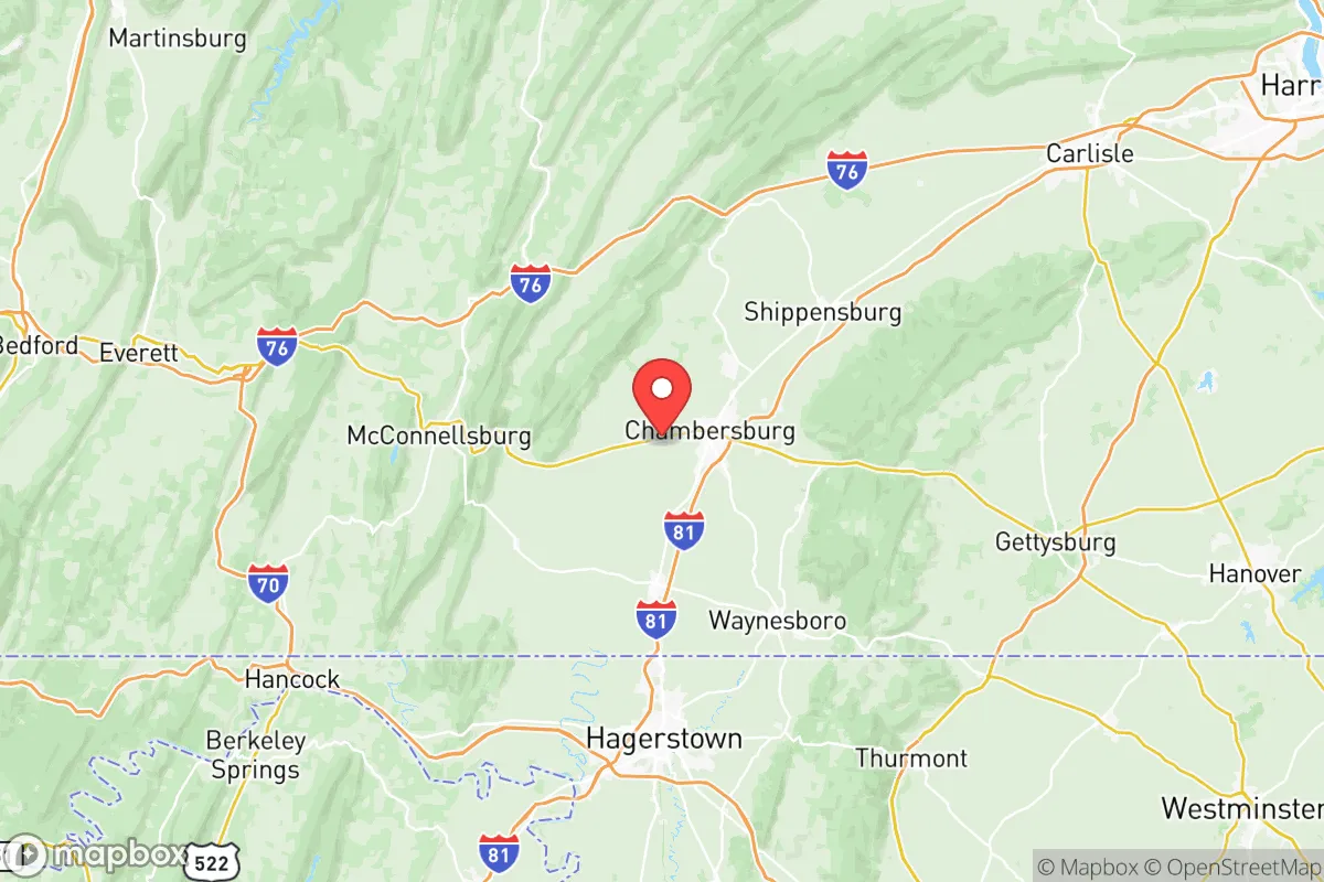
Franklin County, Pennsylvania, occupies a strategic position in the Cumberland Valley that offers a compelling mix of geographic isolation from major metropolitan fallout zones and practical access to essential supply chains. Located roughly 90 miles northwest of Baltimore and 50 miles southwest of Harrisburg, the county sits in a natural corridor between the Blue Ridge and Tuscarora Mountains, providing both defensible terrain and a buffer from the immediate blast and fallout risks associated with the Washington D.C.-Baltimore corridor. For a relocator prioritizing disaster readiness and self-sufficiency, Franklin County presents a balanced profile: close enough to urban resources to be practical, far enough to avoid the worst of a regional collapse scenario.
Geographic position and natural advantages for long-term stability
Franklin County's geography is its primary strategic asset. The county is anchored by the borough of Chambersburg, the county seat, which sits in a broad valley flanked by South Mountain to the east and the Tuscarora Mountain range to the west. This topography creates natural chokepoints and defensible positions, particularly along the mountain passes that control access from the east. The county's position in the Great Appalachian Valley means it benefits from fertile soils and a moderate climate suitable for extended growing seasons, a critical factor for food security. The Conococheague Creek and the Potomac River watershed provide reliable surface water sources, with numerous springs and aquifers feeding the region. The area's elevation, averaging 600-800 feet in the valley floor, reduces flood risk compared to low-lying coastal areas, while the surrounding mountains offer timber, game, and natural barriers against large-scale population movement from the east. The proximity to Michaux State Forest (over 85,000 acres) provides a substantial buffer zone and a potential resource for fuel, building materials, and wildlife. For a family or individual looking to establish a long-term resilient homestead, the combination of arable land, water availability, and natural barriers is difficult to match in the Mid-Atlantic region.
Risk exposure and proximity to fallout-relevant landmarks
While Franklin County avoids the worst of coastal and metropolitan risks, it is not without exposure. The most significant man-made risk comes from the Three Mile Island Nuclear Generating Station, located roughly 60 miles northeast near Harrisburg. While decommissioned, the site still contains spent fuel rods, and any catastrophic event there could affect the Susquehanna River watershed, which feeds into the Potomac system. More immediately, the county lies within 100 miles of the Baltimore-Washington metropolitan area, a high-value target in any conflict scenario. Fallout patterns from a strike on D.C. or Baltimore would likely track east-northeast with prevailing winds, placing Franklin County in a lower-risk zone, but not entirely immune. The county also sits near the Letterkenny Army Depot in neighboring Cumberland County, a major munitions storage and maintenance facility that could be a secondary target. On the natural disaster front, the region experiences occasional ice storms, nor'easters, and the remnants of hurricanes that can cause power outages and road closures. The Chambersburg area has a history of flash flooding along the Conococheague Creek, particularly during heavy rain events. Earthquake risk is low, and tornado activity is below the national average. Overall, the risk profile is moderate: the county is far enough from primary targets to avoid direct effects, but close enough to experience secondary disruptions from regional instability.
Practical resilience for a relocator: food, water, energy, and defensibility
Franklin County offers strong practical resilience for those willing to invest in preparation. The agricultural base is robust: the county is a leading producer of apples, dairy, and livestock in Pennsylvania, with over 1,200 farms covering more than 150,000 acres. Farmers' markets and local food networks are well-established in Chambersburg, Waynesboro, and Greencastle, providing immediate access to fresh produce and meat. For water security, the county's groundwater resources are generally reliable, with many rural properties drawing from private wells. The Conococheague Creek and its tributaries offer surface water options, though treatment would be necessary. Energy resilience is a mixed picture: the grid is served by FirstEnergy and is vulnerable to weather-related outages, but the prevalence of rural properties means many residents already use backup generators, wood stoves, or solar panels. The county's zoning is relatively permissive in unincorporated areas, allowing for rainwater catchment, livestock, and alternative energy installations without excessive bureaucratic hurdles. Defensibility is aided by the natural mountain barriers to the east and west, which limit approach routes. The Mercersburg area in the southern part of the county offers particularly good terrain for a retreat, with narrow valleys and limited road access. However, the county's position along Interstate 81 and U.S. Route 30 means it is a natural corridor for evacuation traffic from the east coast, which could become a liability during a mass exodus scenario. A relocator should plan for self-sufficiency of at least 30 days, given the potential for supply chain disruptions and population movement through the valley.
The overall strategic picture for Franklin County is one of moderate resilience with significant upside for the prepared relocator. It is not a remote wilderness retreat, nor is it a high-risk urban zone. Instead, it occupies a middle ground: close enough to essential infrastructure and medical facilities in Chambersburg and Waynesboro, yet far enough from primary targets to offer a realistic chance of weathering regional disruptions. The combination of fertile land, reliable water, natural barriers, and a conservative, self-reliant local culture makes it a strong candidate for a family or individual seeking a balanced relocation strategy. The key weaknesses are its position along major evacuation routes and its proximity to secondary targets like Letterkenny Army Depot. For a reader who values preparedness without extreme isolation, Franklin County deserves serious consideration as a base of operations in the Mid-Atlantic region.

* Values derived from national, state, county, city and local statistics and may differ in a specific area. Last updated: 2026-08-09T13:49:47.000Z
Narrative content on this page is AI-generated and may contain mistakes. Verify any details that matter before acting on them.
ReloMaps may earn a commission from affiliate links at no extra cost to you.

