Photo: Wikipedia
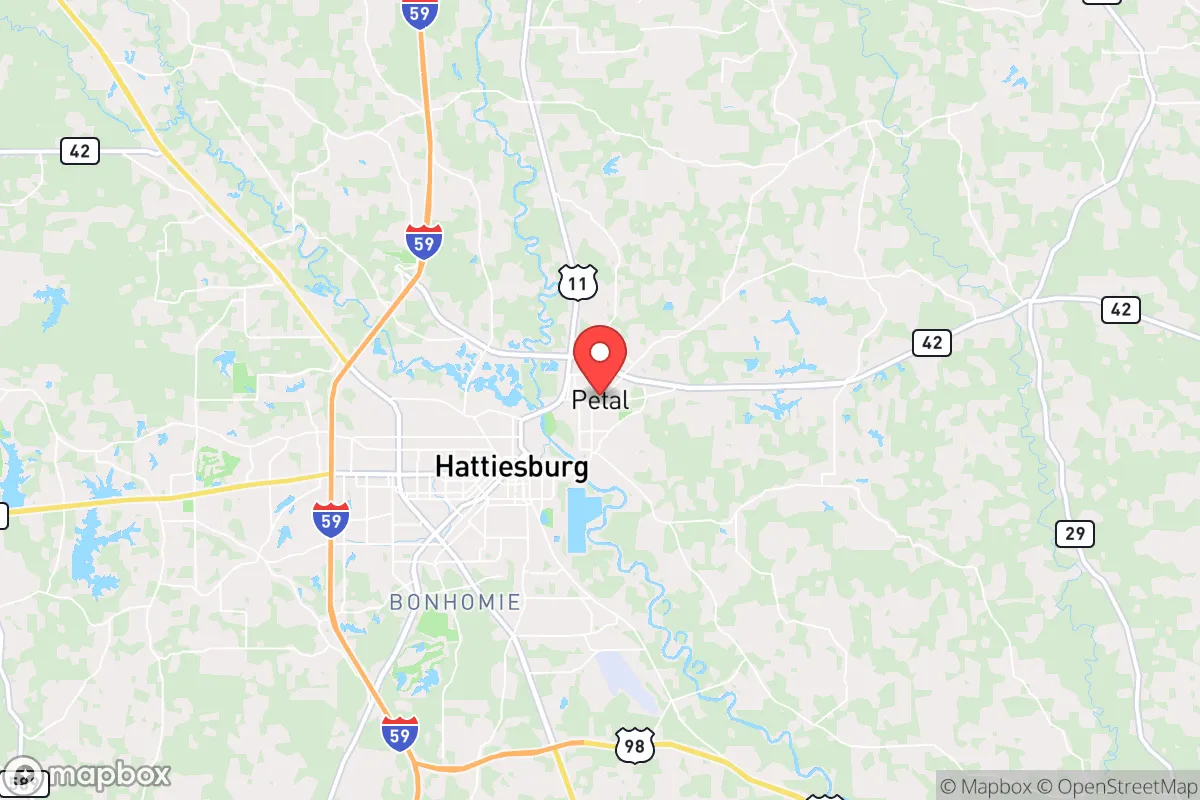
Strategic Assessment of Petal, MS
Workable tactical position. Some exposure to population density or targets, but generally defensible in a crisis.
What does the Strategic Assessment tell us?
Our Strategic Assessment grades tactical survivability of an area. Major population centers, military targets, fallout zones, natural disasters, and border exposure all drive risk — lower exposure means a more defensible position in a crisis.
This is heavily inspired by Joel Skousen's Strategic Relocation book. Highly recommended you checkout the book ($)What does this tell us?
Our Strategic Assessment grades tactical survivability of an area. Major population centers, military targets, fallout zones, natural disasters, and border exposure all drive risk — lower exposure means a more defensible position in a crisis.
This is heavily inspired by Joel Skousen's Strategic Relocation book. Highly recommended you checkout the book ($)Strategic Pillars

Key Distances
Regional Safe Places
Below is our recommended "safe zones" in Mississippi and the surrounding area based on our strategic heuristics. For most people, it's unrealistic to live in a “safe zone” full-time due to work, family or other personal reasons. They tend to be more rural. However, many of these areas are perfect for second homes and retreat properties that double as a vacation home or even a short-term rental.
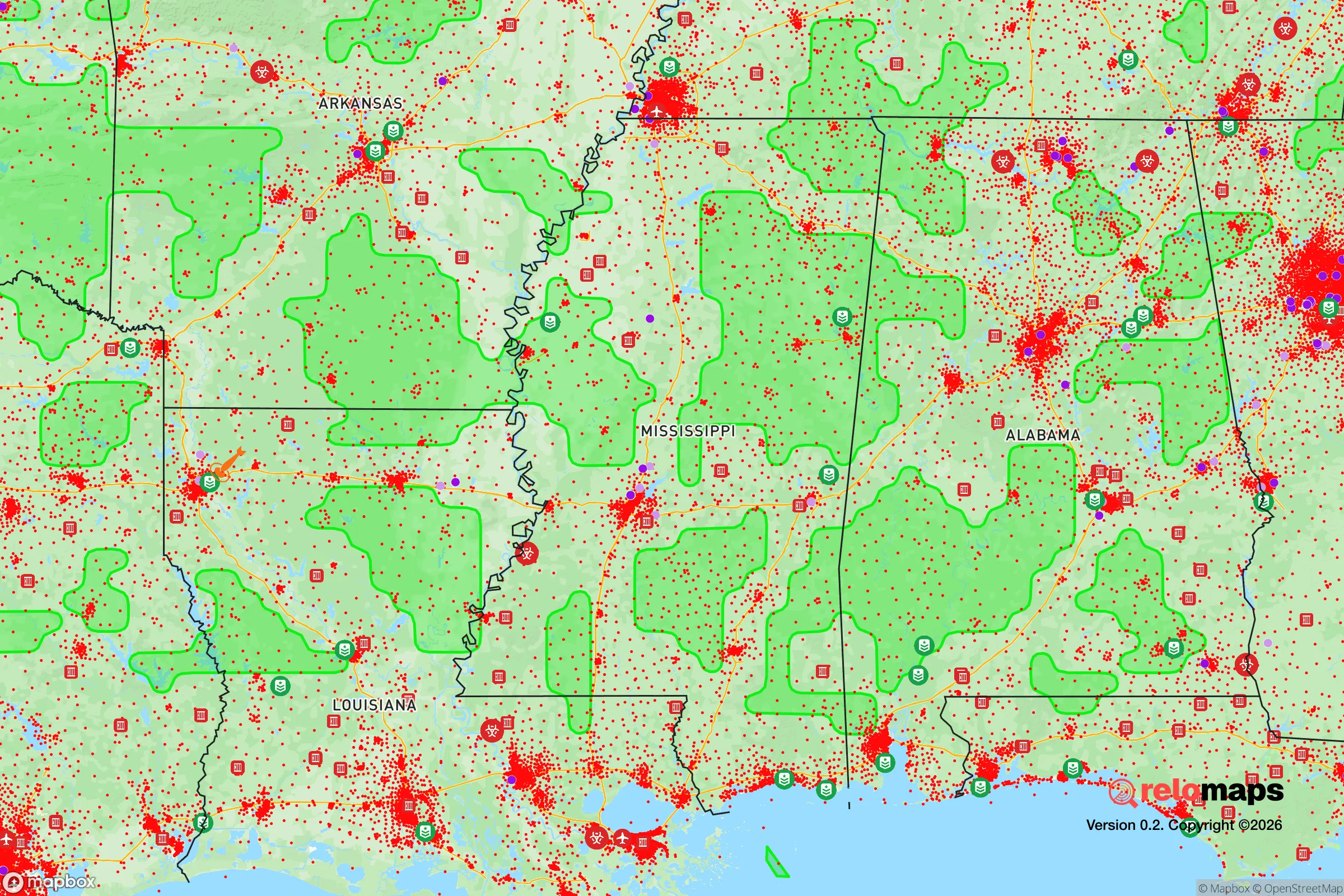
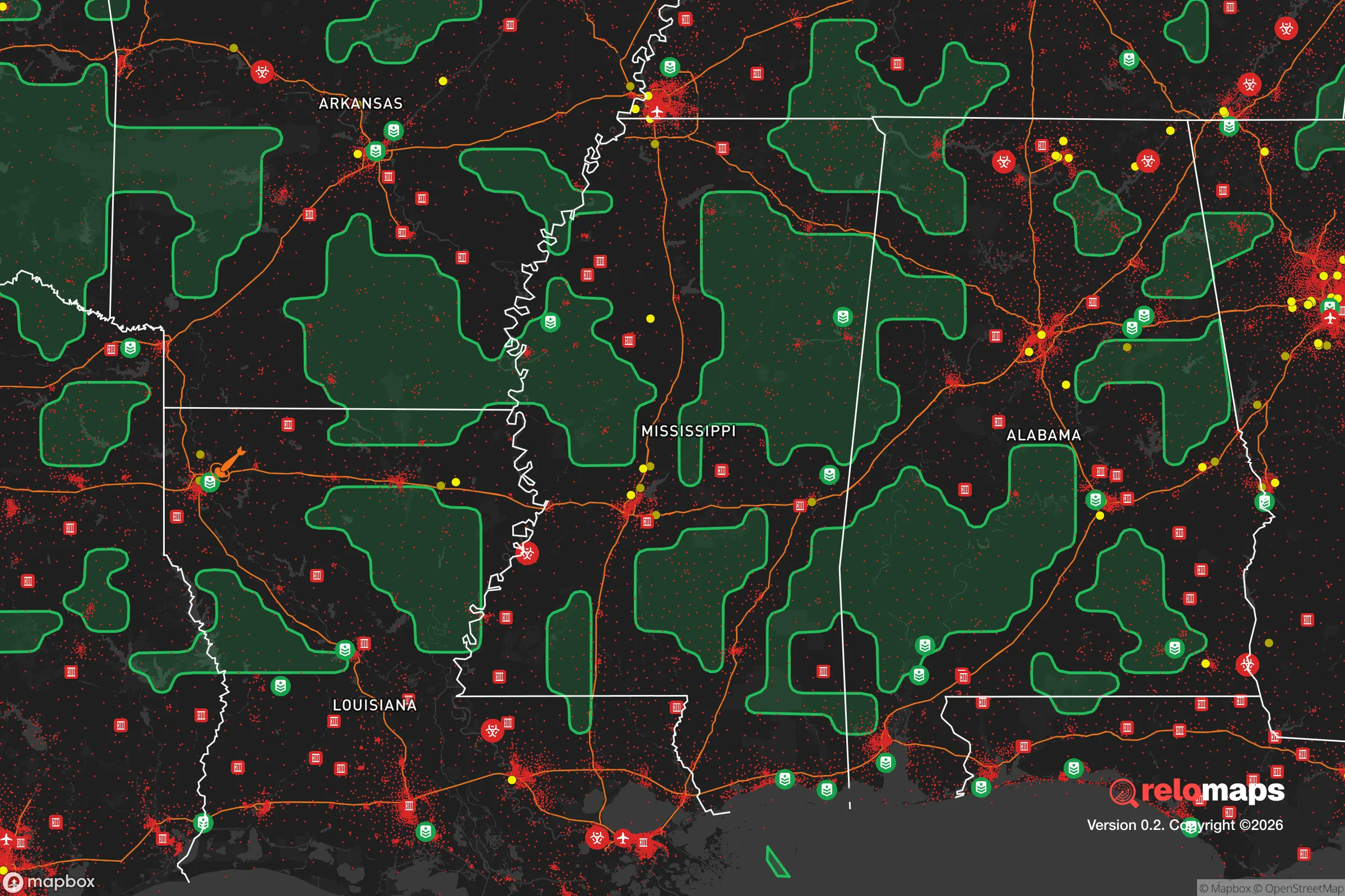
Important Note: For informational purposes only. This does not mean nothing bad ever happens in the green zones. Please use common sense. This is based on public data and modeled with AI. We tried to take a conservative approach but mistakes happen. We update this regularly as new information becomes available.
Solar Generator Recommendations
Backup power matters more here than in safer locations. We've picked three solar generators across budgets and capacity tiers — start with the budget unit if you only need a few essentials, or step up if you want to run a fridge and HVAC for days at a time.

Jackery Portable Power Station Explorer 300
Budget OptionPower on the Go: Weighing only 11 lbs, it's convenient to set up and store with book-sized foldable solar panels

BLUETTI Portable Power Station AC180
Designed for both indoor and outdoor scenarios, AC180 is highly capable as it has a robost capacity and continuous output power.

EF ECOFLOW DELTA Pro Ultra Power Station
Upgraded PickEcoFlow DELTA Pro Ultra is a whole-home energy system designed to grow with your family. Integrated with the Smart Home Panel 2, it scales to meet your evolving energy needs — keeping your home powered, intelligent, and secure through every stage of life.
We earn a commission, at no additional cost to you.
Strategic Assessment Analysis
Petal, Mississippi, sits in a strategic sweet spot that many relocators overlook: close enough to the Gulf Coast’s logistical arteries to access supplies and trade, yet far enough inland to dodge the worst of hurricane storm surge and the chaos of a major metro collapse. This town of roughly 11,000, nestled just south of Hattiesburg, offers a blend of rural quiet and practical infrastructure that makes it a viable base for those thinking long-term about resilience. For a conservative-leaning individual or family weighing the risks of civic unrest, natural disasters, or supply-chain disruptions, Petal’s position—outside the blast radius of any major target, yet within a day’s drive of multiple resources—deserves a hard look.
Geographic position and natural buffers: why Petal’s location matters for long-term security
Petal’s primary advantage is its location in the Pine Belt region of southern Mississippi, roughly 70 miles north of the Gulf of Mexico and 90 miles east of Louisiana’s border. This puts it outside the 50-mile evacuation zone of any major city—New Orleans, Mobile, and Jackson are all at least 90 minutes away—while still being connected via U.S. Highway 98 and Interstate 59. For a prepper, that distance from population centers is gold: in a crisis, the first 48 hours of any urban evacuation will clog every major highway, and Petal sits far enough back to avoid being a choke point or a target for looters fleeing the coast. The area’s natural geography—rolling pine forests, numerous creeks, and the Leaf River running along its eastern edge—provides natural cover and defensible terrain. Unlike the flat, open farmland of the Delta, Petal’s wooded hills offer concealment and multiple escape routes if roads become impassable. The region also sits atop the Citronelle Formation aquifer, one of the most productive groundwater sources in the Southeast, meaning well water is a realistic option for those who drill deep enough—a critical factor when municipal systems fail.
Risks, exposures, and proximity to fallout-relevant landmarks
No location is a fortress, and Petal has its share of vulnerabilities. The most immediate natural threat is hurricane-related flooding and wind damage. While Petal is far enough inland to avoid catastrophic storm surge, it’s still within the cone of uncertainty for major hurricanes like Katrina (2005) or Camille (1969). Inland flooding from slow-moving storms—think 2019’s Tropical Storm Olga—can overwhelm local drainage and knock out power for days. The Leaf River, while not a major flood risk for most of Petal, can rise quickly during prolonged rain events. Tornadoes are a real, recurring hazard; the Pine Belt sits in the Dixie Alley corridor, and the April 2020 Easter tornado outbreak that devastated parts of Jones County came within 20 miles of Petal. On the man-made risk side, Petal’s proximity to Hattiesburg (population 46,000) is a double-edged sword. Hattiesburg hosts Camp Shelby, a major Army National Guard training base, and the University of Southern Mississippi. In a national emergency, Camp Shelby could become a staging area for federal forces or a magnet for refugees—both scenarios that could draw unwanted attention to Petal. The nearby Kemper County coal plant (about 50 miles north) and the Pascagoula shipyards (70 miles south) are industrial targets that, while not nuclear, could be secondary objectives in a conflict scenario. Petal itself has no major military or industrial targets, which is a net positive, but the surrounding region’s infrastructure means you’re not completely off the grid.
Practical resilience for a relocator: food, water, energy, and defensibility
For a family or individual serious about self-sufficiency, Petal offers a workable baseline. Water is the strongest suit: the area’s high water table and abundant rainfall (averaging 55-60 inches per year) mean that a properly sited well can provide potable water even during extended grid outages. Rainwater catchment is also viable, with enough roof space to collect thousands of gallons annually. Food production is feasible but not effortless. The growing season runs from March to November, and the sandy loam soil—while not as rich as Delta clay—supports gardens, fruit trees (pecans, figs, persimmons), and small livestock. The local agricultural extension service in Forrest County offers soil testing and canning classes, and the Petal Farmers Market operates seasonally, giving you a local network for seeds and barter goods. Energy resilience is a mixed bag. The grid in this part of Mississippi is served by Mississippi Power (a Southern Company subsidiary), which has a decent reliability record but is vulnerable to hurricane-related outages. Solar is viable—the region gets about 215 sunny days per year—but battery storage is essential for nighttime and cloudy periods. Propane is widely available for backup generators, and the rural character of Petal means noise from a generator is less likely to attract attention than in a dense suburb. Defensibility is moderate. Petal’s layout—a small downtown surrounded by subdivisions and rural acreage—means you can choose a property with standoff distance. The Petal Police Department is small (about 30 officers) and response times in the outer areas can be 15-20 minutes, which is typical for a town this size. For a prepper, that means you need to be your own first responder. The local gun culture is strong—Mississippi is a constitutional carry state—and the Forrest County Sheriff’s Office is generally supportive of Second Amendment rights. Neighbors tend to know each other, which can be a force multiplier in a crisis, but it also means you’ll be vetted. Outsiders who keep to themselves are viewed with suspicion; community integration is a practical necessity for long-term security.
The overall strategic picture for Petal is one of moderate resilience with manageable trade-offs. It’s not a remote bunker in the Rockies—you’re still within 90 minutes of a major port and two hours of a nuclear submarine base (Pascagoula). But for a relocator who wants to stay in the South, maintain access to medical care and supply chains, and avoid the immediate blast zones of major cities, Petal offers a defensible middle ground. The key is to treat it as a base of operations, not a final redoubt. Stockpile for 30-60 days of self-sufficiency, build relationships with local farmers and gun clubs, and have a secondary bug-out location further north (the De Soto National Forest, about 30 miles east, offers public land options). In a world where the next crisis could be a hurricane, a cyberattack on the grid, or something worse, Petal gives you a fighting chance without requiring you to live off the grid entirely. It’s a place where you can prepare without being paranoid—and that, for most conservative families, is the real strategic advantage.
* Values derived from national, state, county, city and local statistics and may differ in a specific area. Last updated: 2026-04-19T09:41:54.000Z
Narrative content on this page is AI-generated and may contain mistakes. Verify any details that matter before acting on them.
ReloMaps may earn a commission from affiliate links at no extra cost to you.