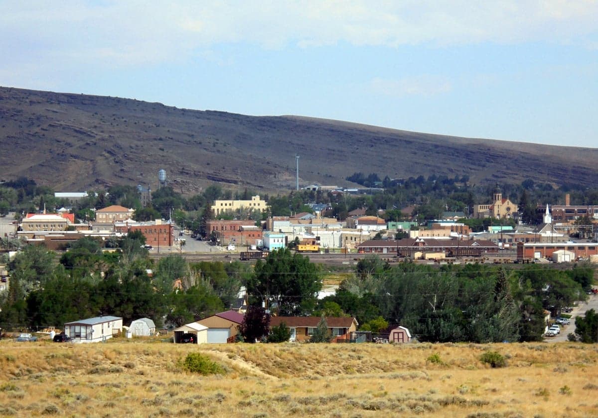
Photo: Wikipedia
Strategic Assessment of Rawlins, WY
Workable tactical position. Some exposure to population density or targets, but generally defensible in a crisis.
What does the Strategic Assessment tell us?
Our Strategic Assessment grades tactical survivability of an area. Major population centers, military targets, fallout zones, natural disasters, and border exposure all drive risk — lower exposure means a more defensible position in a crisis.
This is heavily inspired by Joel Skousen's Strategic Relocation book. Highly recommended you checkout the book ($)What does this tell us?
Our Strategic Assessment grades tactical survivability of an area. Major population centers, military targets, fallout zones, natural disasters, and border exposure all drive risk — lower exposure means a more defensible position in a crisis.
This is heavily inspired by Joel Skousen's Strategic Relocation book. Highly recommended you checkout the book ($)Strategic Pillars

Key Distances
Regional Safe Places
Below is our recommended "safe zones" in Wyoming and the surrounding area based on our strategic heuristics. For most people, it's unrealistic to live in a “safe zone” full-time due to work, family or other personal reasons. They tend to be more rural. However, many of these areas are perfect for second homes and retreat properties that double as a vacation home or even a short-term rental.
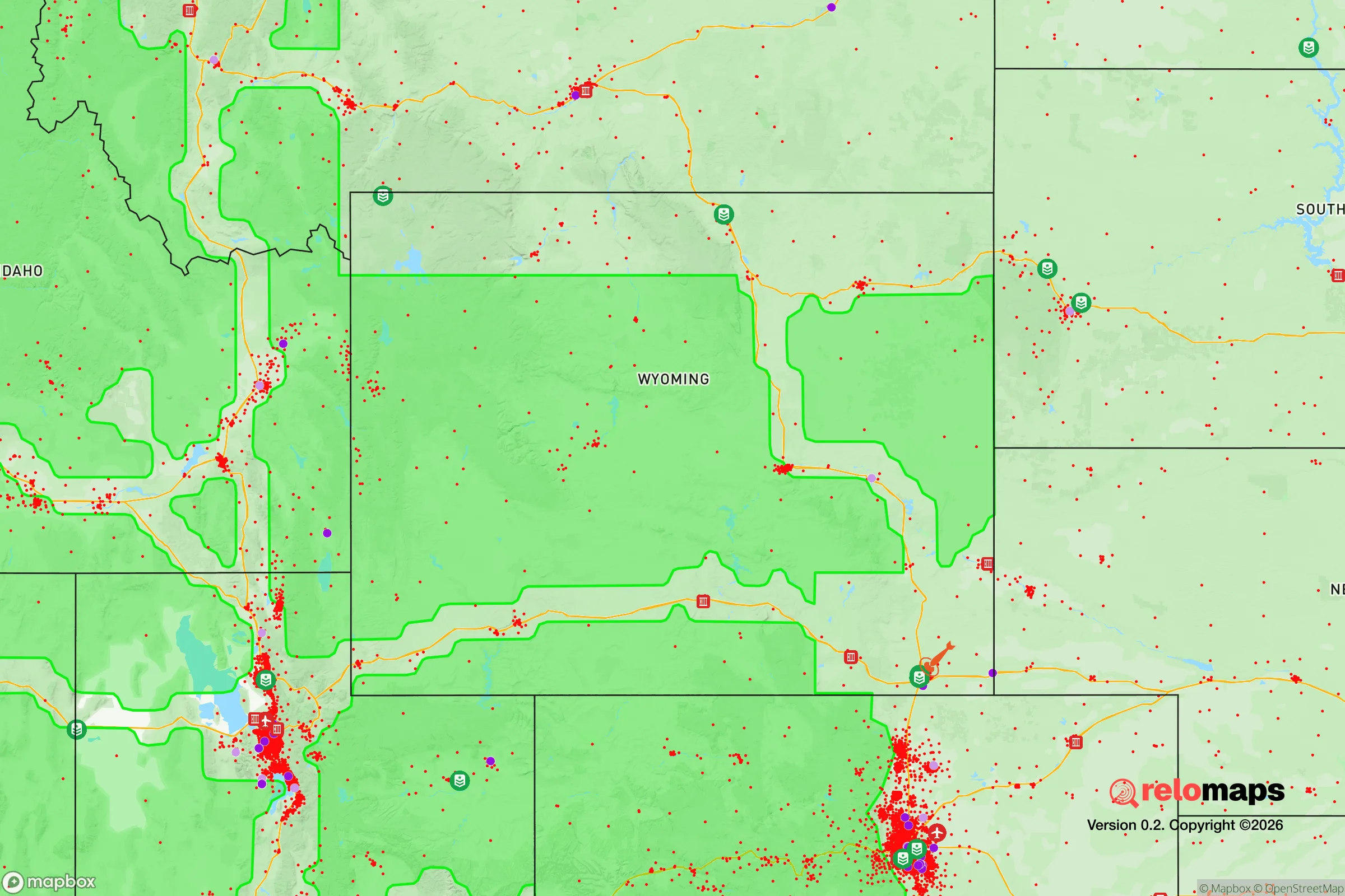
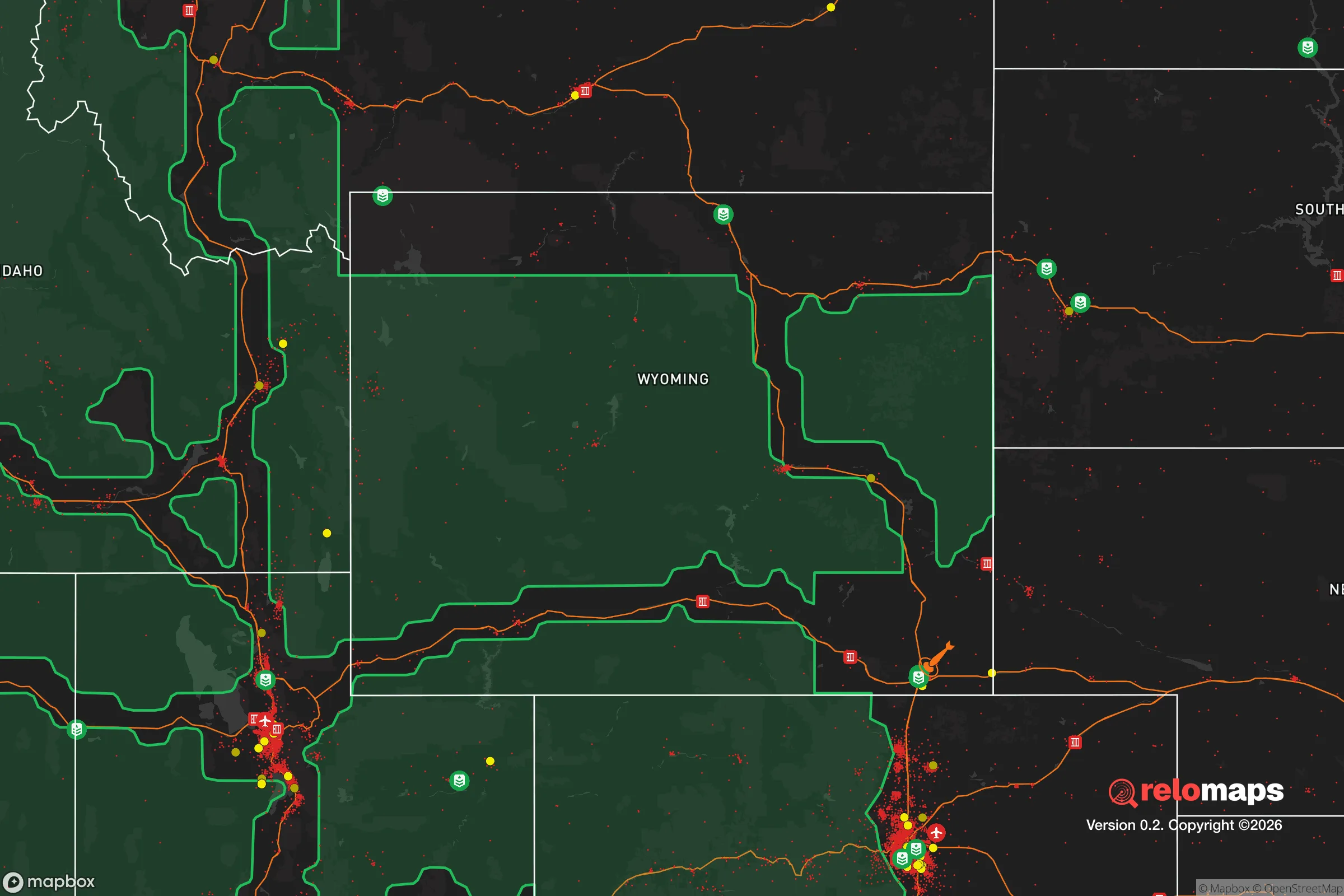
Important Note: For informational purposes only. This does not mean nothing bad ever happens in the green zones. Please use common sense. This is based on public data and modeled with AI. We tried to take a conservative approach but mistakes happen. We update this regularly as new information becomes available.
Solar Generator Recommendations
Backup power matters more here than in safer locations. We've picked three solar generators across budgets and capacity tiers — start with the budget unit if you only need a few essentials, or step up if you want to run a fridge and HVAC for days at a time.

Jackery Portable Power Station Explorer 300
Budget OptionPower on the Go: Weighing only 11 lbs, it's convenient to set up and store with book-sized foldable solar panels

BLUETTI Portable Power Station AC180
Designed for both indoor and outdoor scenarios, AC180 is highly capable as it has a robost capacity and continuous output power.

EF ECOFLOW DELTA Pro Ultra Power Station
Upgraded PickEcoFlow DELTA Pro Ultra is a whole-home energy system designed to grow with your family. Integrated with the Smart Home Panel 2, it scales to meet your evolving energy needs — keeping your home powered, intelligent, and secure through every stage of life.
We earn a commission, at no additional cost to you.
Strategic Assessment Analysis
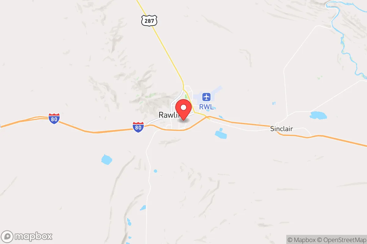
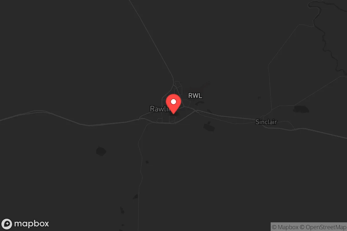
Rawlins, Wyoming, sits at a strategic crossroads for those prioritizing long-term resilience and distance from likely flashpoints of civil unrest or disaster. Its location along Interstate 80, roughly midway between Cheyenne and Salt Lake City, offers a critical advantage: it is far enough from major population centers to avoid the immediate fallout of a mass casualty event or supply chain collapse, yet connected enough to allow for measured movement if needed. For a conservative-leaning relocator concerned with the state of the country, Rawlins represents a hardscrabble but defensible outpost—a place where the harsh climate and sparse population naturally filter out the unprepared, leaving a community that values self-reliance and low-key living.
Geographic position and natural advantages for long-term survival
Rawlins sits at an elevation of roughly 6,800 feet in the high desert of south-central Wyoming, a region defined by wide-open spaces, brutal winters, and limited water. The natural advantages here are not about comfort but about isolation and resource control. The area is surrounded by the Medicine Bow National Forest and the Great Divide Basin, which provide vast, trackless terrain for hunting, foraging, or simply disappearing if things go sideways. The Continental Divide runs just west of town, meaning water flow is split—but in practice, the region is arid, with annual precipitation under 10 inches. This forces a relocator to think seriously about water storage and well access, which is a positive filter: those who can secure a reliable water source here are already ahead of the curve. The nearest major city, Denver, is over 200 miles south—far enough to avoid the immediate chaos of a grid-down event or civil unrest, but close enough that Rawlins could serve as a fallback position for those fleeing the Front Range. The lack of any significant military or nuclear target within 100 miles (the closest is F.E. Warren Air Force Base near Cheyenne, about 120 miles east) reduces the risk of fallout from a strategic strike, though the Transcontinental Railroad and I-80 corridor could see secondary disruption.
Risks, exposures, and proximity to fallout-relevant landmarks
Rawlins is not without its vulnerabilities, and a serious assessment must account for them. The town itself sits directly on I-80, a major east-west artery that in a crisis would become a chokepoint for refugees fleeing the coasts or the Front Range. During a mass evacuation event, Rawlins could see transient populations passing through, which raises risks of resource competition, disease spread, and opportunistic crime. The nearby Sinclair Oil Refinery (about 20 miles west) is a double-edged sword: it provides a local fuel source but also represents a potential industrial accident or target for sabotage. The Union Pacific rail yard in Rawlins is another critical node—if rail traffic halts, the town loses its primary supply line for bulk goods. On the positive side, the area has no major dams, nuclear plants, or chemical storage facilities within 50 miles that would create catastrophic secondary hazards. The biggest natural risk is winter: blizzards can shut down the town for days, and temperatures regularly drop to -20°F. For a prepper, this means a robust heating plan (wood, propane, or coal) is non-negotiable. The local hospital, Memorial Hospital of Carbon County, is a small critical-access facility—adequate for routine care but not for mass casualty events. Any serious medical emergency would require a medevac to Cheyenne or Salt Lake City, which in a grid-down scenario could be a fatal delay.
Practical resilience for a relocator: food, water, energy, and defensibility
For a relocator serious about self-sufficiency, Rawlins offers a mixed but workable baseline. Water is the primary constraint: the town draws from the North Platte River via the Rawlins Water Treatment Plant, but municipal supply is vulnerable to power loss or contamination. A well on private land, ideally 200+ feet deep, is the gold standard here, and properties with existing wells command a premium. Food production is limited by the short growing season (roughly 90 frost-free days) and alkaline soil, but cold-hardy crops like potatoes, carrots, and kale can be raised in raised beds or hoop houses. Local game includes mule deer, pronghorn, and elk, with hunting pressure low due to the sparse population. Energy is a bright spot: Wyoming is a net energy exporter, and Rawlins sits near wind and natural gas fields. Solar is viable but less efficient at this altitude and latitude; a hybrid system with propane backup is practical. The town has a coal-fired power plant (the Dave Johnston Plant, east of town) that provides grid stability, but a prepper should plan for off-grid capability. Defensibility is where Rawlins shines. The terrain is open and flat to the south, but the town is ringed by low hills and ridges that provide natural observation points. Properties on the outskirts, especially those with a clear line of sight to the main roads, allow for early warning of approaching threats. The local culture is gun-friendly and law enforcement is present but not overbearing—Carbon County has a sheriff’s office with about 20 deputies, which is thin for a county the size of Connecticut. In a prolonged crisis, community defense would fall to organized neighbors, and the existing population skews older and more conservative, which aligns with a prepper mindset.
The overall strategic picture for Rawlins is one of calculated trade-offs. It is not a bug-out paradise with abundant water and mild weather—it is a high-altitude outpost that demands serious preparation and a tolerance for isolation. For the relocator who values distance from coastal chaos, low population density, and a community that largely minds its own business, Rawlins offers a defensible position with manageable risks. The key is to arrive with a plan: secure a property with a well and a heating system that doesn’t rely on the grid, stockpile at least six months of supplies (including medical gear and ammunition), and build relationships with neighbors before a crisis hits. The town’s location on I-80 is both its greatest vulnerability and its greatest asset—it gives you an exit route if needed, but it also means you’ll see the trouble coming before it arrives. In a world where the next mass casualty event or civil unrest could erupt anywhere, Rawlins buys you time, space, and a fighting chance. That’s more than most places can offer.
* Values derived from national, state, county, city and local statistics and may differ in a specific area. Last updated: 2026-04-21T11:15:38.000Z
Narrative content on this page is AI-generated and may contain mistakes. Verify any details that matter before acting on them.
ReloMaps may earn a commission from affiliate links at no extra cost to you.