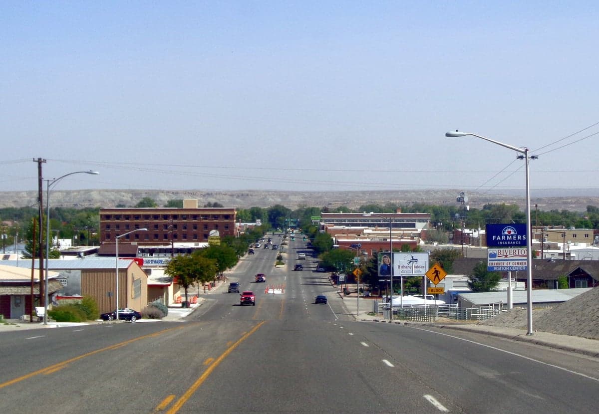
Photo: Wikipedia
Strategic Assessment of Riverton, WY
Workable tactical position. Some exposure to population density or targets, but generally defensible in a crisis.
What does the Strategic Assessment tell us?
Our Strategic Assessment grades tactical survivability of an area. Major population centers, military targets, fallout zones, natural disasters, and border exposure all drive risk — lower exposure means a more defensible position in a crisis.
This is heavily inspired by Joel Skousen's Strategic Relocation book. Highly recommended you checkout the book ($)What does this tell us?
Our Strategic Assessment grades tactical survivability of an area. Major population centers, military targets, fallout zones, natural disasters, and border exposure all drive risk — lower exposure means a more defensible position in a crisis.
This is heavily inspired by Joel Skousen's Strategic Relocation book. Highly recommended you checkout the book ($)Strategic Pillars

Key Distances
Regional Safe Places
Below is our recommended "safe zones" in Wyoming and the surrounding area based on our strategic heuristics. For most people, it's unrealistic to live in a “safe zone” full-time due to work, family or other personal reasons. They tend to be more rural. However, many of these areas are perfect for second homes and retreat properties that double as a vacation home or even a short-term rental.
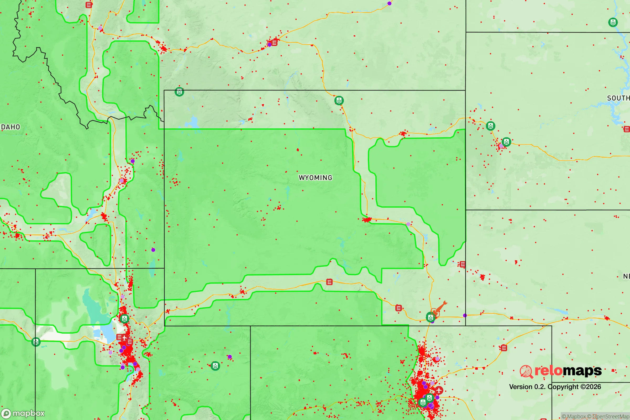
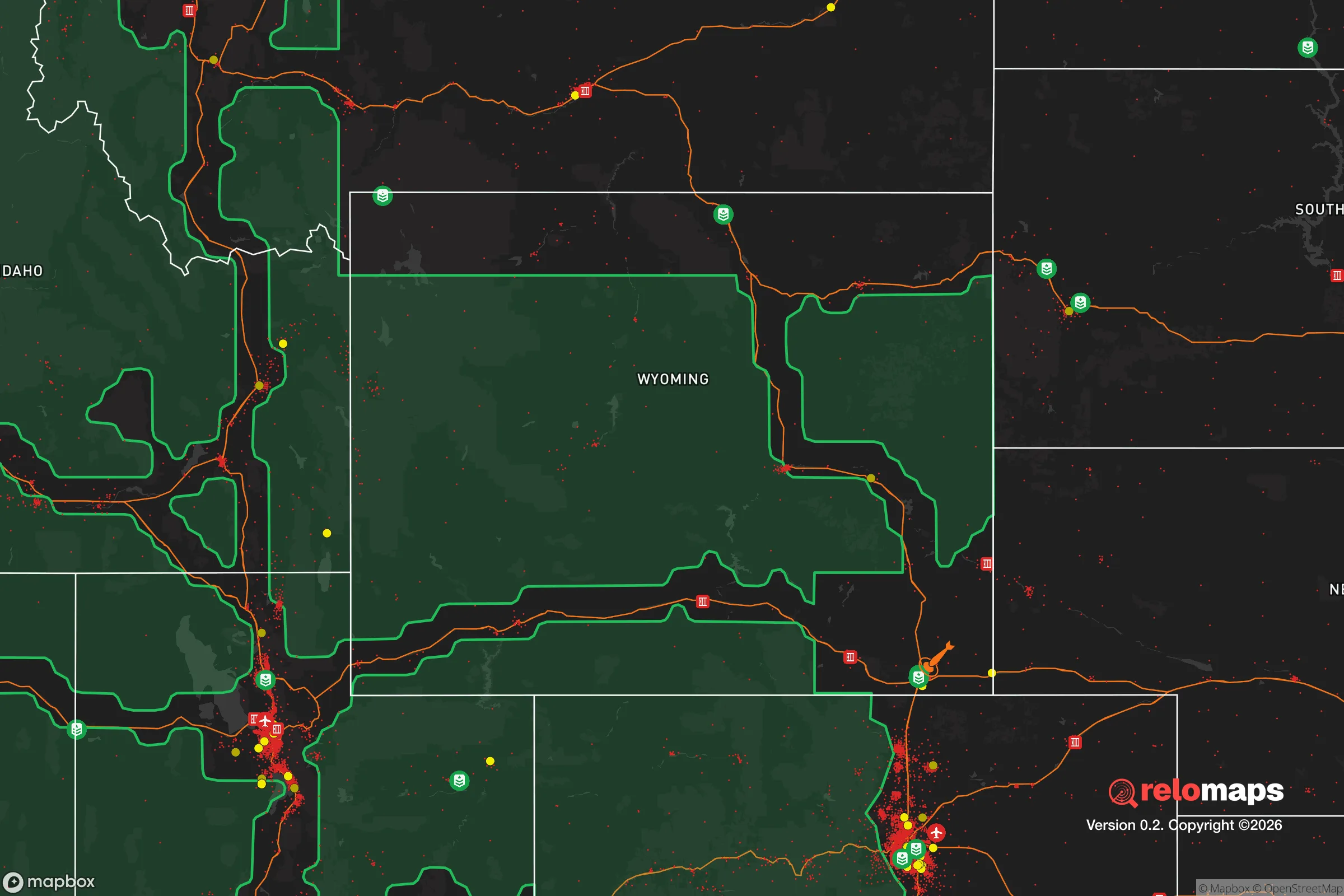
Important Note: For informational purposes only. This does not mean nothing bad ever happens in the green zones. Please use common sense. This is based on public data and modeled with AI. We tried to take a conservative approach but mistakes happen. We update this regularly as new information becomes available.
Solar Generator Recommendations
Backup power matters more here than in safer locations. We've picked three solar generators across budgets and capacity tiers — start with the budget unit if you only need a few essentials, or step up if you want to run a fridge and HVAC for days at a time.

Jackery Portable Power Station Explorer 300
Budget OptionPower on the Go: Weighing only 11 lbs, it's convenient to set up and store with book-sized foldable solar panels

BLUETTI Portable Power Station AC180
Designed for both indoor and outdoor scenarios, AC180 is highly capable as it has a robost capacity and continuous output power.

EF ECOFLOW DELTA Pro Ultra Power Station
Upgraded PickEcoFlow DELTA Pro Ultra is a whole-home energy system designed to grow with your family. Integrated with the Smart Home Panel 2, it scales to meet your evolving energy needs — keeping your home powered, intelligent, and secure through every stage of life.
We earn a commission, at no additional cost to you.
Strategic Assessment Analysis
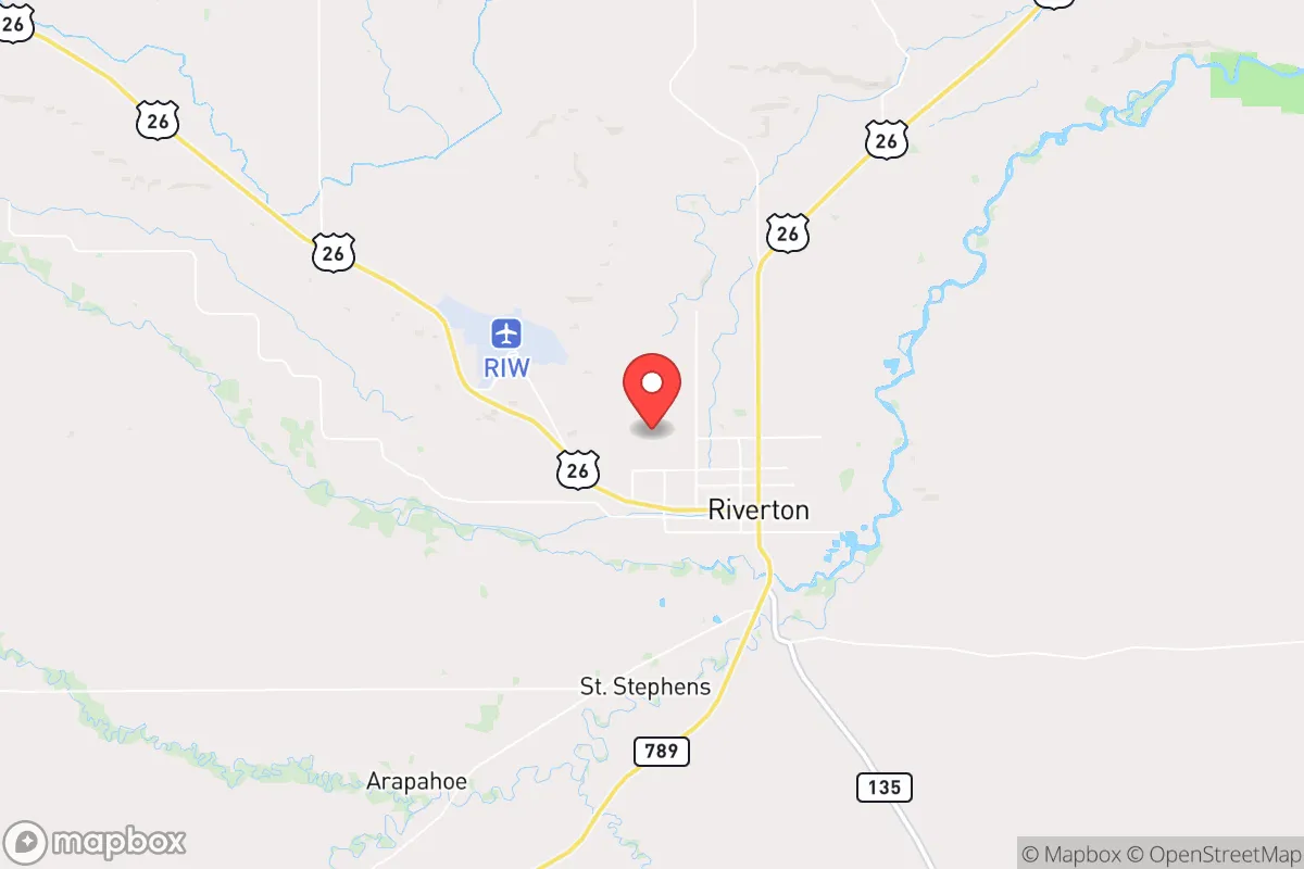
Riverton, Wyoming sits at a strategic crossroads for those prioritizing resilience, offering a rare combination of geographic isolation, resource independence, and low population density that makes it a serious contender for relocation in an uncertain future. Located in Fremont County at the confluence of the Wind River and Little Wind River, this town of roughly 11,000 people is far enough from major metropolitan targets to avoid the immediate fallout of a catastrophic event, yet connected enough to supply chains and emergency services to sustain daily life. For a conservative-leaning individual or family concerned with civic unrest, mass casualty events, or natural disasters, Riverton presents a defensible, resource-rich anchor point in the Mountain West—provided you understand its specific vulnerabilities and plan accordingly.
Geographic position and natural advantages for long-term survival
Riverton’s location in the Wind River Basin gives it a distinct edge for preppers and survivalists. The town sits at roughly 5,000 feet elevation, surrounded by the Wind River Range to the west and the Owl Creek Mountains to the north, creating natural barriers that slow movement and provide defensible terrain. The area receives less than 10 inches of precipitation annually, which is a double-edged sword—it reduces flooding risk and mold issues in stored supplies, but demands careful water planning. The Wind River itself is a reliable surface water source, and the underlying aquifer supports wells, though drilling depths can exceed 200 feet in some areas. For those willing to invest in rainwater catchment or a well, water independence is achievable. The region’s low humidity also preserves food stores and ammunition longer than in coastal or humid climates. Critically, Riverton is over 200 miles from any major population center (Denver, Salt Lake City, Cheyenne), placing it well outside the likely blast radius or fallout zone of a nuclear event targeting those cities. The nearest interstate (I-80) is 90 miles south, meaning refugee flows from a collapsed urban corridor would likely bypass Riverton unless they specifically knew to head here.
Risks, exposures, and proximity to fallout-relevant landmarks
No location is without risk, and Riverton has several that a strategic relocator must weigh. The most immediate concern is proximity to the Wind River Indian Reservation, which surrounds the town on three sides. While this creates a buffer of undeveloped land, it also introduces jurisdictional complexity—tribal and county law enforcement may not coordinate seamlessly during a crisis. The reservation’s population of roughly 26,000 includes communities with limited economic opportunity, which could lead to resource competition if supply chains fail. Additionally, Riverton lies within 50 miles of the Boysen Reservoir and Dam, a hydroelectric facility that, if compromised, could cause downstream flooding along the Wind River corridor. The dam is well-maintained, but any critical infrastructure is a potential target or failure point. On the fallout front, the nearest strategic target is Warren Air Force Base near Cheyenne (200 miles southeast), which houses nuclear-capable missiles. While 200 miles provides significant protection, prevailing winds from the southeast could carry fallout particles into the basin in a worst-case scenario. More realistically, the area’s wildfire risk is moderate—the surrounding sagebrush steppe and juniper woodlands can burn, but the town’s irrigated agricultural fields create natural firebreaks. Earthquakes are rare in this part of Wyoming, and tornado activity is far lower than in the Plains states.
Practical resilience for a relocator: food, water, energy, and defensibility
For a family or individual serious about self-sufficiency, Riverton offers a surprisingly workable base. The town sits in the Wind River Irrigation Project, one of the oldest federal irrigation systems in the West, which supports alfalfa, barley, and hay fields. This means local food production is viable—you can grow your own vegetables in the short growing season (90-110 frost-free days) or barter with nearby ranchers for meat and dairy. The area has a strong hunting culture, with mule deer, pronghorn, and elk in the surrounding mountains, plus fishing in the Wind River and Boysen Reservoir. For water, the Wind River is perennial, but treatment is necessary—boiling or filtration is standard. Energy resilience is mixed: Rocky Mountain Power provides grid electricity, but outages from winter storms or equipment failure are common (2-4 per year, typically lasting a few hours). Solar is viable here, with over 260 sunny days annually, but winter snow cover on panels requires manual clearing. Wood heating is popular, with BLM land offering firewood permits for $5 per cord. Defensibility is strong: the town’s layout is compact, with a single main highway (US-26) entering from the east and west, and secondary roads that can be monitored. The surrounding terrain—open sagebrush flats broken by arroyos—offers limited cover for anyone approaching on foot, giving residents with line-of-sight weapons a tactical advantage. The Fremont County Sheriff’s Office has a reputation for being responsive, but response times in rural areas can exceed 30 minutes, so personal security is a must. Medical care is limited to SageWest Health Care, a 50-bed critical access hospital—adequate for routine issues but not for trauma. A serious injury or illness would require a 90-minute medevac to Casper or a 2.5-hour drive to Idaho Falls.
Overall, Riverton presents a compelling strategic picture for the conservative relocator who values isolation, resource access, and a community that still practices self-reliance. It is not a prepper’s paradise—the water situation demands planning, the medical infrastructure is thin, and the proximity to a large reservation introduces social variables that are hard to predict. But for someone willing to invest in a well, solar panels, and a solid pantry, this town offers a defensible, low-profile position in a state that consistently ranks among the most politically and socially stable in the nation. The key is to arrive with a plan, not just a dream: secure your water source first, build relationships with local ranchers and the county emergency manager, and understand that the same isolation that protects you from urban chaos also means you are largely on your own when things go sideways. If that trade-off sounds acceptable, Riverton is worth a serious look.
* Values derived from national, state, county, city and local statistics and may differ in a specific area. Last updated: 2026-04-21T11:22:13.000Z
Narrative content on this page is AI-generated and may contain mistakes. Verify any details that matter before acting on them.
ReloMaps may earn a commission from affiliate links at no extra cost to you.