Photo: Wikipedia
Strategic Assessment of Ronan, MT
Workable tactical position. Some exposure to population density or targets, but generally defensible in a crisis.
What does the Strategic Assessment tell us?
Our Strategic Assessment grades tactical survivability of an area. Major population centers, military targets, fallout zones, natural disasters, and border exposure all drive risk — lower exposure means a more defensible position in a crisis.
This is heavily inspired by Joel Skousen's Strategic Relocation book. Highly recommended you checkout the book ($)What does this tell us?
Our Strategic Assessment grades tactical survivability of an area. Major population centers, military targets, fallout zones, natural disasters, and border exposure all drive risk — lower exposure means a more defensible position in a crisis.
This is heavily inspired by Joel Skousen's Strategic Relocation book. Highly recommended you checkout the book ($)Strategic Pillars

Key Distances
Regional Safe Places
Below is our recommended "safe zones" in Montana and the surrounding area based on our strategic heuristics. For most people, it's unrealistic to live in a “safe zone” full-time due to work, family or other personal reasons. They tend to be more rural. However, many of these areas are perfect for second homes and retreat properties that double as a vacation home or even a short-term rental.

Important Note: For informational purposes only. This does not mean nothing bad ever happens in the green zones. Please use common sense. This is based on public data and modeled with AI. We tried to take a conservative approach but mistakes happen. We update this regularly as new information becomes available.
Solar Generator Recommendations
Backup power matters more here than in safer locations. We've picked three solar generators across budgets and capacity tiers — start with the budget unit if you only need a few essentials, or step up if you want to run a fridge and HVAC for days at a time.

Jackery Portable Power Station Explorer 300
Budget OptionPower on the Go: Weighing only 11 lbs, it's convenient to set up and store with book-sized foldable solar panels

BLUETTI Portable Power Station AC180
Designed for both indoor and outdoor scenarios, AC180 is highly capable as it has a robost capacity and continuous output power.

EF ECOFLOW DELTA Pro Ultra Power Station
Upgraded PickEcoFlow DELTA Pro Ultra is a whole-home energy system designed to grow with your family. Integrated with the Smart Home Panel 2, it scales to meet your evolving energy needs — keeping your home powered, intelligent, and secure through every stage of life.
We earn a commission, at no additional cost to you.
Strategic Assessment Analysis
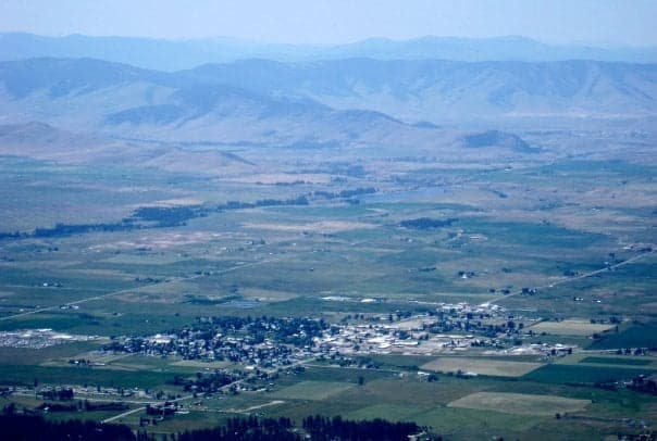
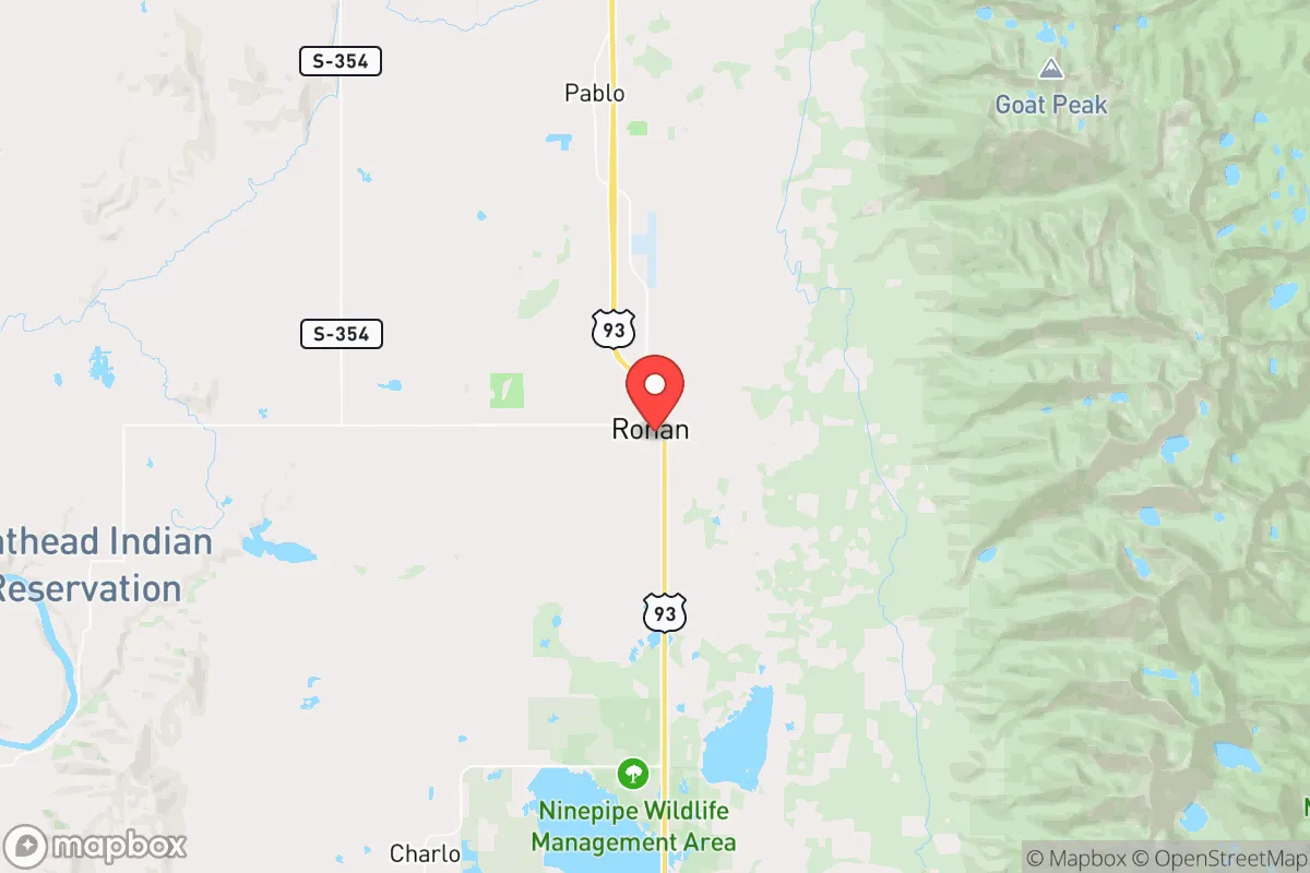
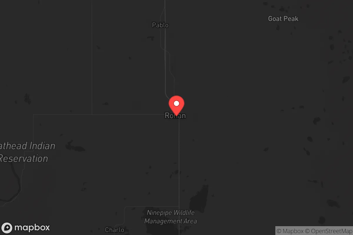
Ronan, Montana, sits in a strategic pocket of the Mission Valley that offers a rare combination of geographic isolation and practical self-sufficiency, making it a serious candidate for those prioritizing long-term resilience over convenience. Located roughly 30 miles north of Missoula and 60 miles south of Kalispell, Ronan is far enough from major population centers to avoid the immediate chaos of a collapse event, yet close enough to access critical supplies if you plan ahead. The area’s low population density—around 2,000 residents in town, with sparse rural holdings stretching toward the Flathead Indian Reservation—means fewer people competing for resources when things go sideways. For a conservative-leaning relocator who views federal overreach, economic instability, and social fragmentation as credible threats, Ronan presents a viable base of operations, provided you understand its specific vulnerabilities and prepare accordingly.
Geographic position and natural advantages for long-term survival
Ronan’s location is defined by the Mission Mountains to the east and the Flathead River system to the west, creating a natural funnel that limits approach routes and makes the area inherently defensible. The valley floor sits at roughly 3,000 feet elevation, with ample surface water from the Flathead River, Post Creek, and numerous smaller streams that run year-round—critical for off-grid water security if municipal systems fail. The surrounding national forest land (Flathead National Forest to the north, Lolo National Forest to the south) provides a buffer zone that’s difficult to traverse quickly, slowing any large-scale movement of displaced populations from Missoula or Kalispell. The agricultural base is real: the Mission Valley is one of Montana’s most productive farming regions, with irrigated fields of alfalfa, barley, and wheat, plus cattle ranching that could sustain a community through a prolonged supply chain disruption. For a prepper, this means you’re not just storing food—you’re in a place where food can still be grown and traded after the trucks stop running. The climate is harsh (winter lows can hit -20°F, with deep snow from November through March), but that same severity acts as a natural filter, discouraging unprepared transients and rewarding those who stockpile fuel, cold-weather gear, and preserved food.
Risks, exposures, and proximity to fallout-relevant landmarks
No location is a fortress, and Ronan has specific exposures that a strategic relocator must account for. The most immediate concern is the Flathead Indian Reservation, which surrounds Ronan on three sides. While many tribal members are self-sufficient and neighborly, the reservation’s governance structure is separate from state and county authority, creating jurisdictional ambiguity that could complicate law enforcement and resource allocation during a crisis. If civil unrest triggers federal intervention or tribal sovereignty disputes, Ronan’s position inside the reservation boundary (the town itself is not reservation land, but it’s surrounded by it) could become a legal and logistical headache. Further out, the nearest major fallout-relevant landmarks are Malmstrom Air Force Base (home to Minuteman III ICBMs, roughly 200 miles east near Great Falls) and the Hanford Site (a decommissioned nuclear production facility in Washington, about 250 miles west). Neither is close enough for direct blast effects, but prevailing westerly winds could carry particulate from a Hanford incident across the Rockies into western Montana. More practically, the BNSF Railway line running through the valley—used for grain and freight—could become a target for sabotage or a vector for displaced populations moving along the corridor. The biggest day-to-day risk is wildfire: the 2021 Mission Creek Fire burned over 4,000 acres within 10 miles of Ronan, and the surrounding timber stands are dry and overgrown. A major fire season could cut off road access (primarily US-93 and MT-35) and overwhelm local fire resources, which are volunteer-based and limited.
Practical resilience for a relocator: food, water, energy, and defensibility
For someone serious about self-reliance, Ronan’s practical infrastructure is a mixed bag that rewards advance preparation. Water is the strongest asset: the Flathead River flows year-round and is clean enough for treatment with basic filtration (a Berkey or Sawyer system will handle the sediment and microbial load). Shallow wells in the valley bottom typically hit water at 20-40 feet, and many rural properties already have hand pumps or solar-powered well systems. Food production is viable but requires land and labor—the growing season is short (roughly 100 frost-free days), so cold-hardy crops like potatoes, carrots, kale, and grains (oats, barley) are the staples. Livestock (chickens, goats, a family milk cow) are common and accepted; the local feed stores in Ronan and Polson stock supplies that could be bartered post-collapse. Energy is the weak link: the grid is served by Flathead Electric Cooperative, which is reliable in normal times but vulnerable to ice storms and wildfire shutoffs. Solar is viable (the valley gets about 200 sunny days per year), but winter generation is poor, so a backup generator with stored propane or diesel is essential. Wood heat is the default for rural homes—most properties have a wood stove or fireplace insert, and firewood permits on national forest land are cheap and accessible. Defensibility is moderate: the valley floor is open, so a rural homestead with clear sightlines and a gravel driveway is easier to secure than a town lot. The nearest law enforcement is the Lake County Sheriff’s Office (based in Polson, 12 miles north), with a response time of 20-40 minutes in rural areas. For a prepared group, Ronan’s low population density and limited road network (US-93 is the only paved north-south route) mean you can monitor and control access to your immediate area with basic perimeter awareness. The local gun culture is strong—Montana is a constitutional carry state, and Ronan’s sporting goods stores and pawn shops stock ammunition and firearms—so you won’t stand out as an outlier for being armed.
The overall strategic picture for Ronan is one of high potential with moderate risk, best suited for a relocator who values isolation and agricultural self-sufficiency over proximity to urban amenities. You’re trading the convenience of a city like Missoula for a lower profile and a more defensible position, but you’re also accepting a harder winter, a shorter growing season, and the complexity of living adjacent to a sovereign tribal nation. If you can secure a property with a well, a wood stove, and enough land for a garden and small livestock, Ronan offers a realistic base for weathering the kind of systemic disruptions that many conservative preppers are planning for—economic collapse, supply chain failure, or civil unrest. The key is to arrive with your supplies already in place, because the local hardware store and grocery co-op are fine for daily life but will empty out fast when the panic hits. For a single individual or a family willing to put in the work, Ronan is a solid B+ location: not a fortress, but a place where preparation and community ties can make the difference between surviving and thriving.
* Values derived from national, state, county, city and local statistics and may differ in a specific area. Last updated: 2026-04-21T14:49:03.000Z
Narrative content on this page is AI-generated and may contain mistakes. Verify any details that matter before acting on them.
ReloMaps may earn a commission from affiliate links at no extra cost to you.