
Photo: Wikipedia
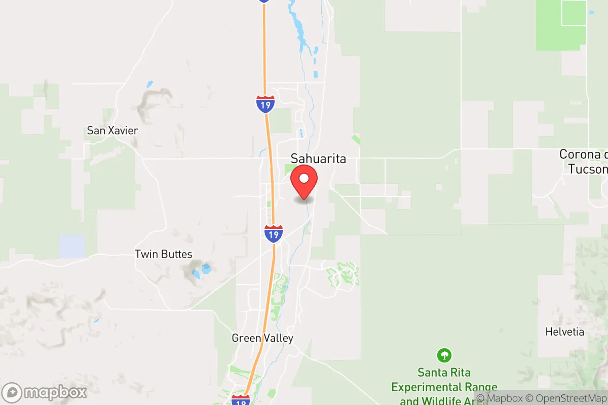
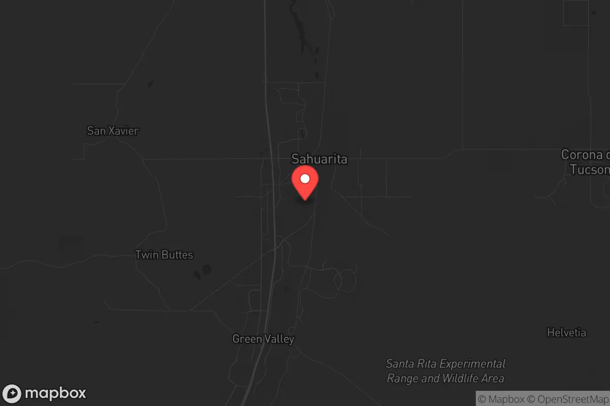
Strategic Assessment of Sahuarita, AZ
Multiple tactical vulnerabilities. Population density, target proximity, or disaster risk are likely compounding. A retreat property and exit planning is required.
What does the Strategic Assessment tell us?
Our Strategic Assessment grades tactical survivability of an area. Major population centers, military targets, fallout zones, natural disasters, and border exposure all drive risk — lower exposure means a more defensible position in a crisis.
This is heavily inspired by Joel Skousen's Strategic Relocation book. Highly recommended you checkout the book ($)What does this tell us?
Our Strategic Assessment grades tactical survivability of an area. Major population centers, military targets, fallout zones, natural disasters, and border exposure all drive risk — lower exposure means a more defensible position in a crisis.
This is heavily inspired by Joel Skousen's Strategic Relocation book. Highly recommended you checkout the book ($)Strategic Pillars

Key Distances
Regional Safe Places
Below is our recommended "safe zones" in Arizona and the surrounding area based on our strategic heuristics. For most people, it's unrealistic to live in a “safe zone” full-time due to work, family or other personal reasons. They tend to be more rural. However, many of these areas are perfect for second homes and retreat properties that double as a vacation home or even a short-term rental.
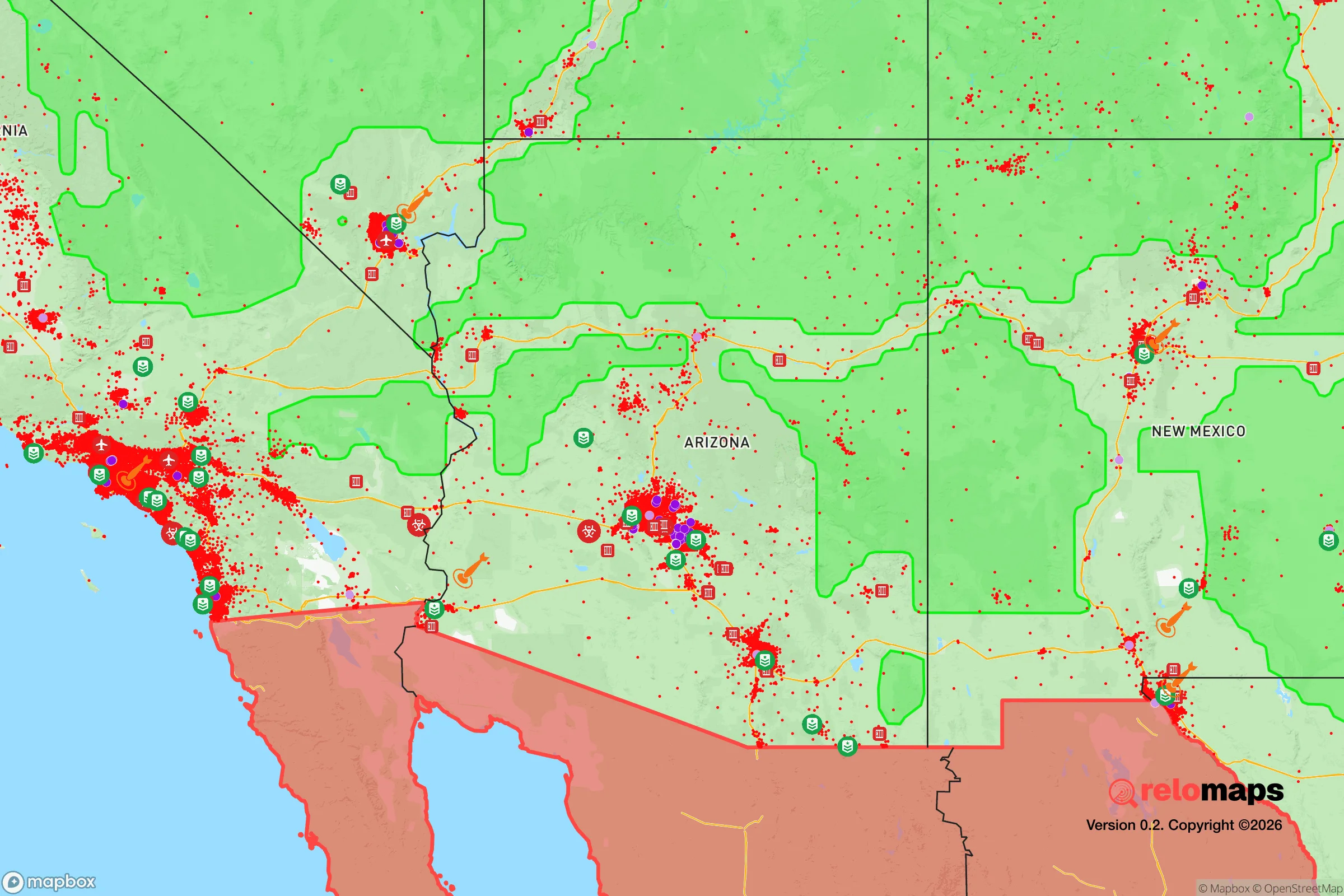
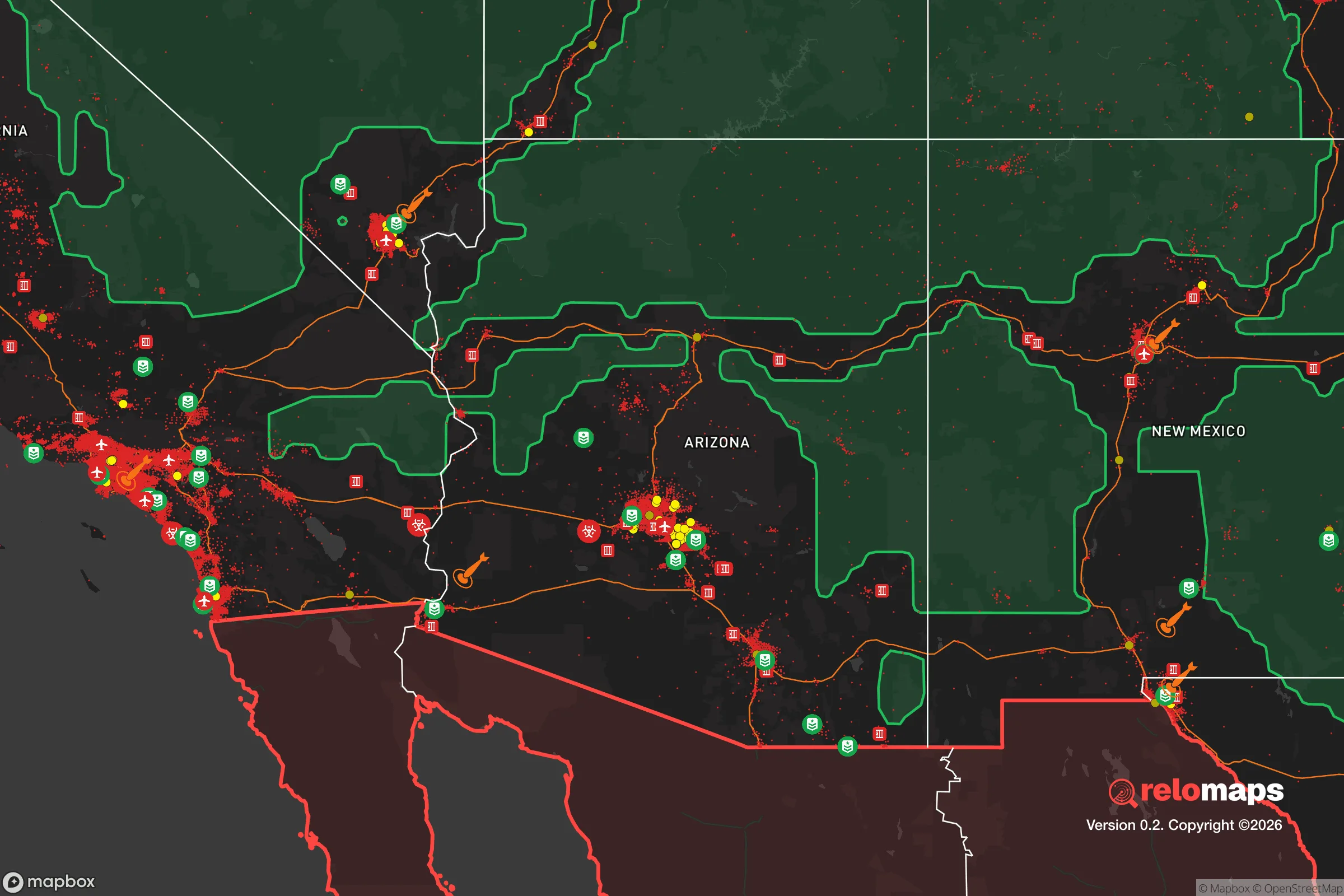
Important Note: For informational purposes only. This does not mean nothing bad ever happens in the green zones. Please use common sense. This is based on public data and modeled with AI. We tried to take a conservative approach but mistakes happen. We update this regularly as new information becomes available.
Solar Generator Recommendations
Backup power matters more here than in safer locations. We've picked three solar generators across budgets and capacity tiers — start with the budget unit if you only need a few essentials, or step up if you want to run a fridge and HVAC for days at a time.

Jackery Portable Power Station Explorer 300
Budget OptionPower on the Go: Weighing only 11 lbs, it's convenient to set up and store with book-sized foldable solar panels

BLUETTI Portable Power Station AC180
Designed for both indoor and outdoor scenarios, AC180 is highly capable as it has a robost capacity and continuous output power.

EF ECOFLOW DELTA Pro Ultra Power Station
Upgraded PickEcoFlow DELTA Pro Ultra is a whole-home energy system designed to grow with your family. Integrated with the Smart Home Panel 2, it scales to meet your evolving energy needs — keeping your home powered, intelligent, and secure through every stage of life.
We earn a commission, at no additional cost to you.
Strategic Assessment Analysis
Sahuarita, Arizona, presents a mixed strategic picture for the conservative prepper or survivalist. Its primary advantage is its position as a fast-growing exurban buffer zone between Tucson and the Mexican border, offering a degree of physical separation from a major metropolitan center while still providing access to its resources. However, this location also places it squarely in the path of several significant risks, including proximity to a major international border, a large military installation, and critical transportation corridors that could become chokepoints or targets in a crisis. The town’s resilience is not inherent but must be actively built by the individual relocator, with careful attention to water, energy, and community networks.
Geographic position and natural advantages for long-term security
Sahuarita sits roughly 25 miles south of downtown Tucson and about 60 miles north of the U.S.-Mexico border at Nogales. This places it in the Santa Cruz Valley, a relatively fertile corridor flanked by the Sierrita and Santa Rita mountain ranges. For the prepper, this geography offers several natural advantages. The surrounding mountains provide natural barriers and potential retreat areas, while the valley floor itself is flat and open, offering good lines of sight and limited avenues of approach for any large-scale movement. The climate is arid high desert, which means fewer natural disaster risks like hurricanes, tornadoes, or major floods compared to other regions. The dry air also reduces corrosion and mold issues for stored supplies. However, the area is seismically active, with the potential for moderate earthquakes along the Santa Rita fault system, a risk that must be factored into any long-term infrastructure planning. The primary natural advantage is the ability to see threats coming from a distance, both literally and figuratively, due to the open terrain and the relative isolation from the dense urban core of Tucson.
Risks, exposures, and proximity to fallout-relevant landmarks
The most significant strategic liability for Sahuarita is its proximity to multiple high-value, high-risk targets. Davis-Monthan Air Force Base, a major installation housing the 355th Wing and the 309th Aerospace Maintenance and Regeneration Group (the "Boneyard"), is located just 15 miles north of Sahuarita. In any major conflict, this base is a primary target for enemy action, whether kinetic or cyber. The fallout from a strike on Davis-Monthan would directly impact Sahuarita, depending on wind direction. Additionally, the town lies along Interstate 19, the main artery connecting Tucson to the border. In a crisis involving civil unrest, mass migration, or border security breakdown, I-19 would become a major chokepoint and likely a vector for both fleeing populations and potential threats. The nearby border itself is a persistent source of risk, including cartel activity, human trafficking, and the potential for spillover violence. While Sahuarita is not directly on the border, its proximity means that any large-scale border event—whether a mass release of migrants or a security incident—will have immediate second-order effects on the town’s resources, law enforcement, and community stability. Finally, the Raytheon Missile Systems plant in Tucson is another high-value industrial target that could draw attention in a conflict scenario.
Practical resilience for a relocator: food, water, energy, and defensibility
For the individual or family looking to establish a resilient homestead, Sahuarita presents both opportunities and hard constraints. Water is the single most critical issue. The town relies on groundwater from the Santa Cruz Basin, and while the aquifer is currently managed, it is not infinite. A relocator must secure a property with a private well or a legal right to a substantial water allocation. Relying on municipal water in a crisis is a failure point. Rainwater harvesting is possible but yields are low (around 10-12 inches annually), so storage and conservation are paramount. Energy independence is achievable due to the high solar insolation. Solar panels with battery storage are a viable investment, but the grid itself is vulnerable to both natural (monsoon storms, heat waves) and man-made (cyberattack, EMP) disruptions. A backup generator with a fuel supply is a wise secondary measure. Food production is possible but requires significant effort. The growing season is long, but the soil is poor and water is scarce. Raised beds, drip irrigation, and shade structures are necessary. Local farmers' markets and the nearby Green Valley area offer some local food sources, but self-sufficiency in food is a multi-year project, not a quick fix. Defensibility is a mixed bag. The open terrain makes it hard to conceal a property, but it also makes it hard for anyone to approach unseen. A rural property with good sight lines, a perimeter fence, and a hardened structure is ideal. The community itself is growing rapidly, which means more eyes and potential allies, but also more potential competition for resources in a collapse scenario. The local sheriff's office (Pima County) is generally professional, but response times in a widespread crisis would be slow. Building a trusted network of like-minded neighbors is arguably the most important resilience investment you can make here.
The overall strategic picture for Sahuarita is one of calculated risk. It is not a remote, off-grid paradise, nor is it a fortress. It is a suburban-exurban interface zone that offers a reasonable balance of access and isolation for the prepared individual. The key is to go in with eyes open: the proximity to Tucson, the border, and Davis-Monthan are real liabilities. But the climate, the terrain, and the growth trajectory also offer opportunities for those who are willing to invest in water independence, energy security, and community building. For the conservative prepper who wants to be near enough to a city for work and supplies but far enough to have a fighting chance when things go sideways, Sahuarita is a viable option—provided you treat it as a base camp, not a final redoubt. The smart move is to secure your water and energy first, build your network second, and always have a bug-out plan for the worst-case scenarios that this region’s geography and politics make all too plausible.
* Values derived from national, state, county, city and local statistics and may differ in a specific area. Last updated: 2026-05-01T08:08:55.000Z
Narrative content on this page is AI-generated and may contain mistakes. Verify any details that matter before acting on them.
ReloMaps may earn a commission from affiliate links at no extra cost to you.