
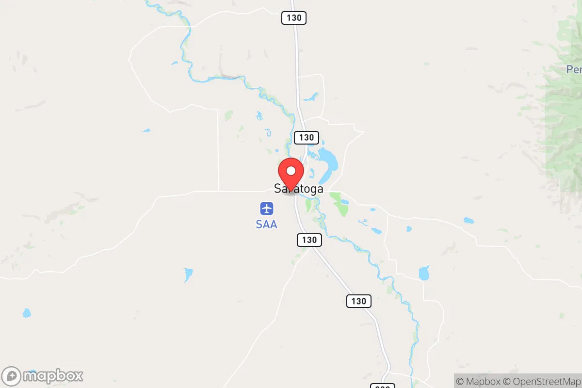
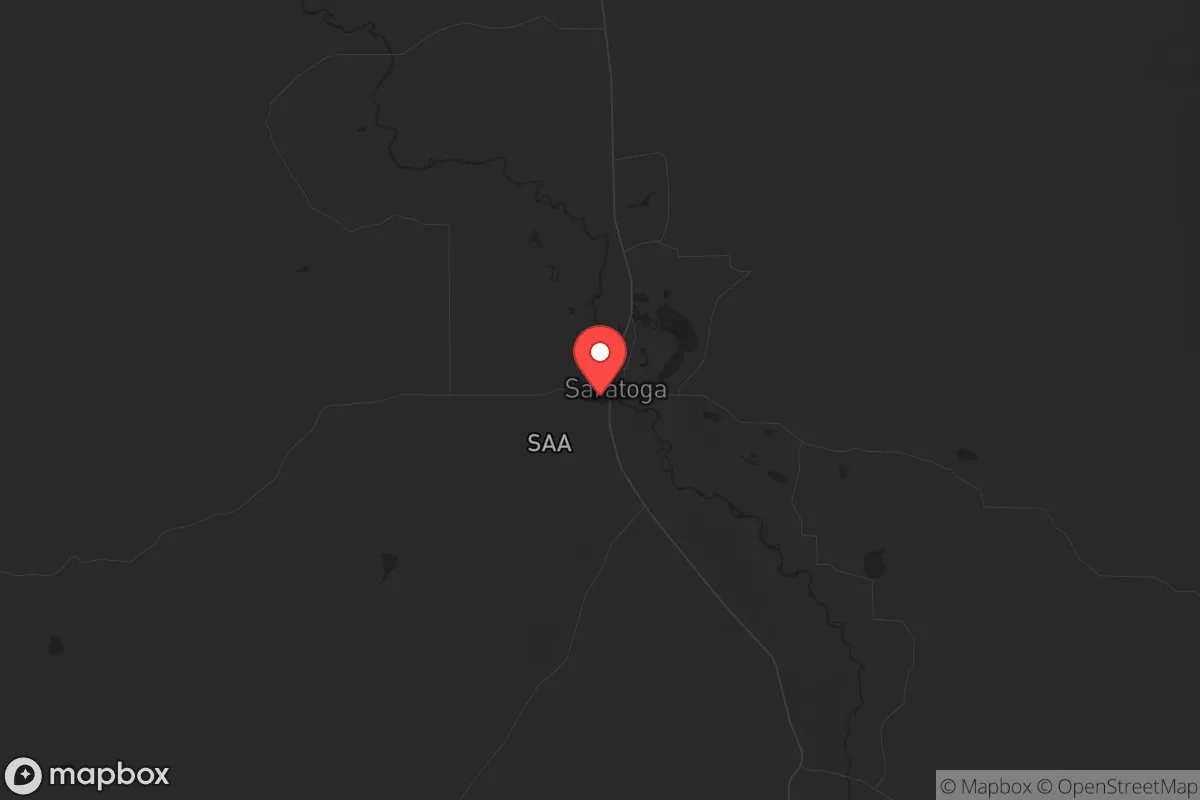
Strategic Assessment of Saratoga, WY
Strong survivability profile. Good buffer from population centers, with manageable environmental and tactical risks.
What does the Strategic Assessment tell us?
Our Strategic Assessment grades tactical survivability of an area. Major population centers, military targets, fallout zones, natural disasters, and border exposure all drive risk — lower exposure means a more defensible position in a crisis.
This is heavily inspired by Joel Skousen's Strategic Relocation book. Highly recommended you checkout the book ($)What does this tell us?
Our Strategic Assessment grades tactical survivability of an area. Major population centers, military targets, fallout zones, natural disasters, and border exposure all drive risk — lower exposure means a more defensible position in a crisis.
This is heavily inspired by Joel Skousen's Strategic Relocation book. Highly recommended you checkout the book ($)Strategic Pillars

Key Distances
Regional Safe Places
Below is our recommended "safe zones" in Wyoming and the surrounding area based on our strategic heuristics. For most people, it's unrealistic to live in a “safe zone” full-time due to work, family or other personal reasons. They tend to be more rural. However, many of these areas are perfect for second homes and retreat properties that double as a vacation home or even a short-term rental.
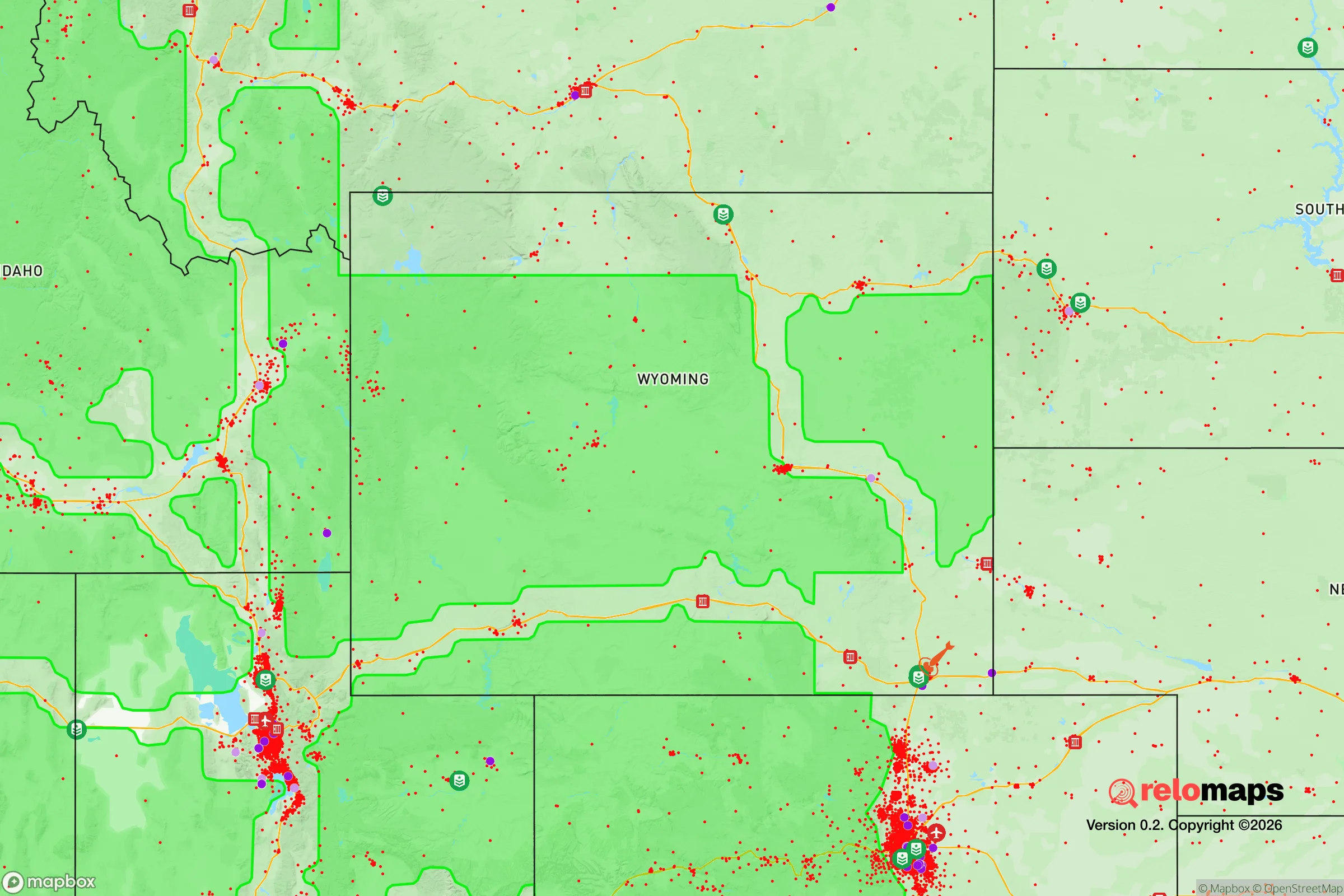
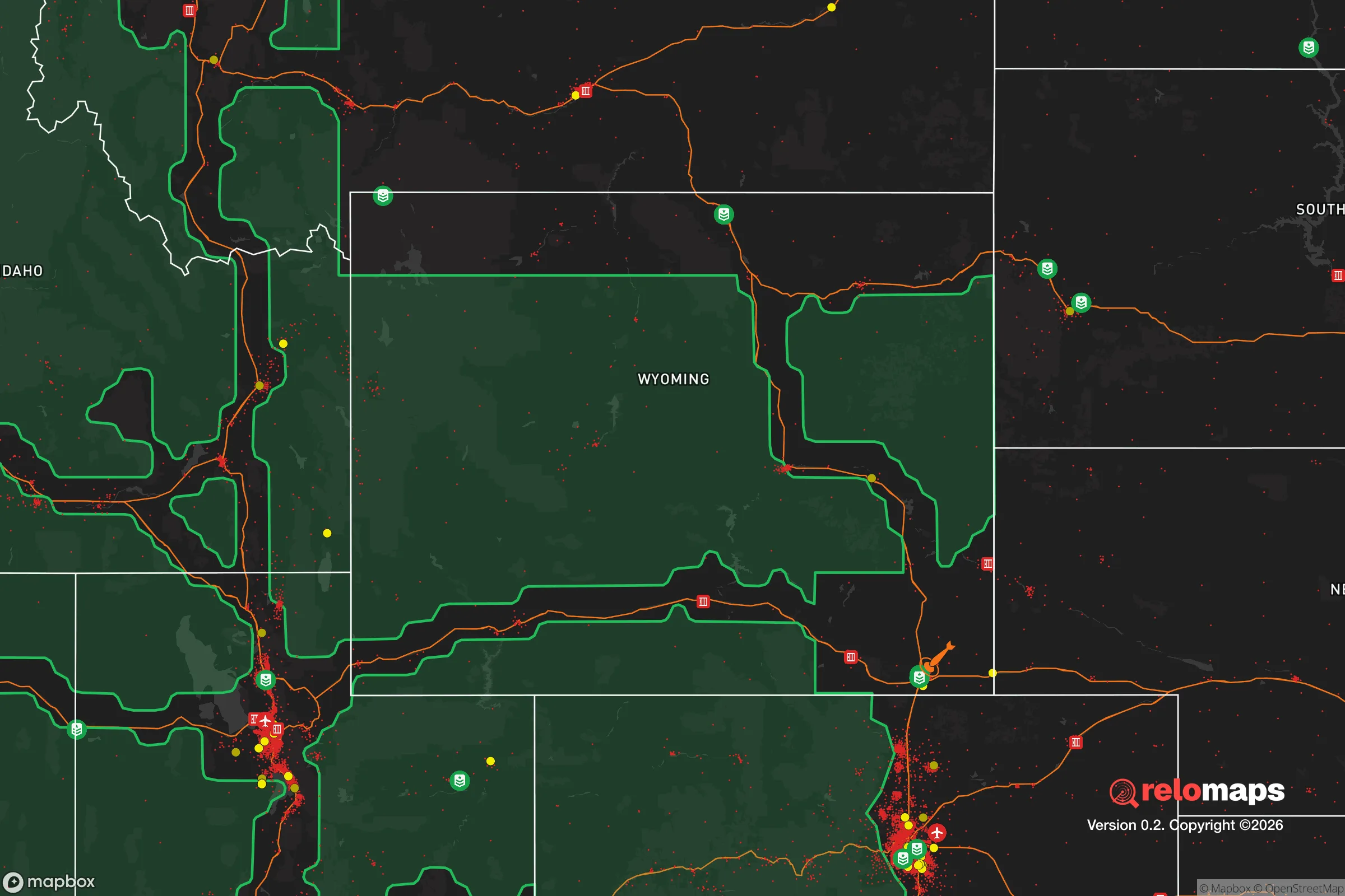
Important Note: For informational purposes only. This does not mean nothing bad ever happens in the green zones. Please use common sense. This is based on public data and modeled with AI. We tried to take a conservative approach but mistakes happen. We update this regularly as new information becomes available.
Solar Generator Recommendations
Backup power matters more here than in safer locations. We've picked three solar generators across budgets and capacity tiers — start with the budget unit if you only need a few essentials, or step up if you want to run a fridge and HVAC for days at a time.

Jackery Portable Power Station Explorer 300
Budget OptionPower on the Go: Weighing only 11 lbs, it's convenient to set up and store with book-sized foldable solar panels

BLUETTI Portable Power Station AC180
Designed for both indoor and outdoor scenarios, AC180 is highly capable as it has a robost capacity and continuous output power.

EF ECOFLOW DELTA Pro Ultra Power Station
Upgraded PickEcoFlow DELTA Pro Ultra is a whole-home energy system designed to grow with your family. Integrated with the Smart Home Panel 2, it scales to meet your evolving energy needs — keeping your home powered, intelligent, and secure through every stage of life.
We earn a commission, at no additional cost to you.
Strategic Assessment Analysis
Saratoga, Wyoming, sits in a sweet spot that few places in the Lower 48 can claim: it’s remote enough to dodge the chaos of a collapsing city, but not so isolated that you’ll starve when the supply chains snap. Nestled in the North Platte River Valley along the Medicine Bow Range, this town of roughly 1,700 people offers a blend of natural resources, low population density, and geographic defensibility that makes it a serious contender for anyone thinking long-term about riding out the storm. The key advantage here isn’t just the scenery—it’s the fact that Saratoga is far enough from major population centers to avoid the initial wave of panic, yet close enough to critical infrastructure like I-80 and the Union Pacific rail line to maintain some lifeline to the outside world. For a relocator with a prepper mindset, this is the kind of place where you can build a life that doesn’t depend on the grid staying up.
Geographic position and natural advantages for long-term survival
Saratoga’s location is its strongest card. It sits at the southern edge of the Sierra Madre Range, with the Medicine Bow National Forest wrapping around it like a buffer zone. The town is about 100 miles west of Cheyenne and 120 miles north of Denver—close enough to monitor what’s happening in those urban centers, but far enough that you won’t be caught in the exodus when things go sideways. The North Platte River runs right through town, providing a reliable water source that’s less likely to be contaminated than anything near a major city. The surrounding mountains offer natural barriers to movement, which means any large-scale unrest would have a hard time reaching you without warning. The area’s elevation—around 6,800 feet—also means cooler summers and harsh winters, which is a double-edged sword: it discourages casual visitors and keeps the population thin, but it demands serious preparation for cold-weather survival. The nearby Medicine Bow National Forest is a massive 2.2 million acres of public land, giving you room to hunt, forage, and retreat if needed. For a conservative-minded relocator, this is the kind of geography that rewards self-reliance and punishes dependence on fragile systems.
Risks, exposures, and proximity to fallout-relevant landmarks
No place is perfect, and Saratoga has its share of vulnerabilities. The biggest concern is its proximity to I-80, the major east-west corridor that runs about 30 miles south of town. In a national emergency, that highway will become a chokepoint for military movements, refugee flows, and supply convoys—all of which could spill over into the area. The Union Pacific rail line also runs through the valley, carrying freight that could be a target for looting or sabotage. More critically, Saratoga is about 150 miles from the Front Range urban corridor—Denver, Colorado Springs, and Fort Collins—which together hold over 5 million people. If a mass casualty event or civic unrest hits those cities, the secondary wave of refugees could push west toward the mountains, and Saratoga sits right in the path. The town itself has no major industrial targets, but the nearby F.E. Warren Air Force Base near Cheyenne (home to Minuteman III ICBMs) is a potential nuclear target. Fallout from a strike there could drift into the area depending on wind patterns. The risk is low but not zero, and any serious prepper should factor in the need for a fallout shelter and a plan to monitor wind direction. On the plus side, the area’s low population density means fewer eyes on your supplies and less competition for resources when things get tight.
Practical resilience for a relocator: food, water, energy, and defensibility
For someone serious about self-sufficiency, Saratoga checks most of the boxes. Water is the first priority, and the North Platte River provides a year-round source that can be filtered or boiled. The town’s municipal water comes from groundwater wells, which are less vulnerable to surface contamination than reservoir-fed systems. If the grid goes down, you’ll want a hand pump or a generator to keep your well running, but the water table here is shallow enough that a manual pump is viable. Food is trickier. The growing season is short—about 90 to 100 frost-free days—so you’re looking at cold-hardy crops like potatoes, carrots, and kale. The surrounding forest offers elk, mule deer, and small game, but hunting pressure will spike if food becomes scarce. The Carbon County area has a few small farms and ranches, so building relationships with local producers now is smart. Energy is a mixed bag. The area gets over 300 days of sunshine a year, making solar a solid option, but the heavy snow in winter means you’ll need to keep panels clear. Wind is also reliable here—the valley funnels gusts that can power a small turbine. For defensibility, Saratoga’s layout works in your favor. The town is compact, with most homes on the valley floor and the mountains rising on either side. A well-placed property with a view of the main access roads gives you early warning of anyone approaching. The local sheriff’s office is small but responsive, and the community is tight-knit—people here look out for each other, which is a double-edged sword if you’re trying to keep a low profile. Stockpiling ammunition, medical supplies, and fuel is essential, because the nearest major supply hub is Rawlins, 30 miles west, and that town could be overwhelmed fast.
The overall strategic picture for Saratoga is one of cautious optimism. It’s not a fortress, and it’s not immune to the shocks that will ripple out from the collapse of urban America. But it offers a rare combination of natural resources, geographic isolation, and community resilience that makes it a viable base for a long-term survival plan. The winters will test your grit, the remoteness will test your patience, and the proximity to I-80 will test your situational awareness. If you’re willing to put in the work—digging a root cellar, learning to hunt, building relationships with neighbors who share your values—Saratoga can be a place where you not only survive but thrive when the system cracks. For a conservative relocator who sees the writing on the wall and wants a spot that’s off the beaten path but not off the map entirely, this town deserves a hard look. Just don’t expect it to stay a secret forever.
* Values derived from national, state, county, city and local statistics and may differ in a specific area. Last updated: 2026-04-21T10:52:40.000Z
Narrative content on this page is AI-generated and may contain mistakes. Verify any details that matter before acting on them.
ReloMaps may earn a commission from affiliate links at no extra cost to you.