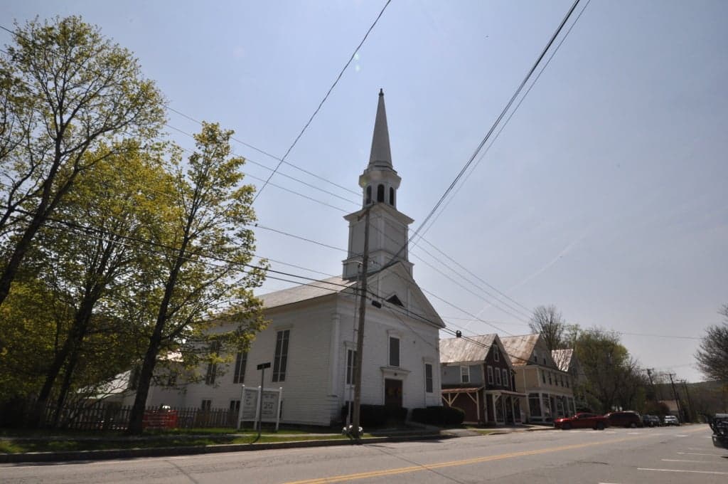
Photo: Wikipedia
Strategic Assessment of Saxtons River, VT
Meaningful friction. Expect exposure to either population pressure, blast zones, or natural disaster risk. Consider buying a retreat property.
What does the Strategic Assessment tell us?
Our Strategic Assessment grades tactical survivability of an area. Major population centers, military targets, fallout zones, natural disasters, and border exposure all drive risk — lower exposure means a more defensible position in a crisis.
This is heavily inspired by Joel Skousen's Strategic Relocation book. Highly recommended you checkout the book ($)What does this tell us?
Our Strategic Assessment grades tactical survivability of an area. Major population centers, military targets, fallout zones, natural disasters, and border exposure all drive risk — lower exposure means a more defensible position in a crisis.
This is heavily inspired by Joel Skousen's Strategic Relocation book. Highly recommended you checkout the book ($)Strategic Pillars

Key Distances
Regional Safe Places
Below is our recommended "safe zones" in Vermont and the surrounding area based on our strategic heuristics. For most people, it's unrealistic to live in a “safe zone” full-time due to work, family or other personal reasons. They tend to be more rural. However, many of these areas are perfect for second homes and retreat properties that double as a vacation home or even a short-term rental.


Important Note: For informational purposes only. This does not mean nothing bad ever happens in the green zones. Please use common sense. This is based on public data and modeled with AI. We tried to take a conservative approach but mistakes happen. We update this regularly as new information becomes available.
Solar Generator Recommendations
Backup power matters more here than in safer locations. We've picked three solar generators across budgets and capacity tiers — start with the budget unit if you only need a few essentials, or step up if you want to run a fridge and HVAC for days at a time.

Jackery Portable Power Station Explorer 300
Budget OptionPower on the Go: Weighing only 11 lbs, it's convenient to set up and store with book-sized foldable solar panels

BLUETTI Portable Power Station AC180
Designed for both indoor and outdoor scenarios, AC180 is highly capable as it has a robost capacity and continuous output power.

EF ECOFLOW DELTA Pro Ultra Power Station
Upgraded PickEcoFlow DELTA Pro Ultra is a whole-home energy system designed to grow with your family. Integrated with the Smart Home Panel 2, it scales to meet your evolving energy needs — keeping your home powered, intelligent, and secure through every stage of life.
We earn a commission, at no additional cost to you.
Strategic Assessment Analysis
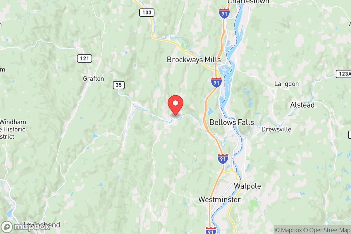
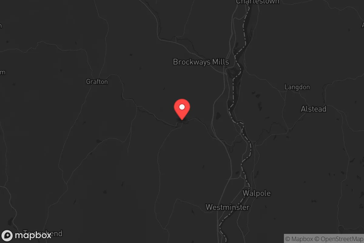
Saxtons River, Vermont, presents a mixed strategic picture for the conservative prepper or survivalist. Its primary advantage is genuine remoteness—tucked into the southeastern corner of Windham County, it sits roughly 30 miles from the New Hampshire border and 40 miles from Massachusetts, placing it well outside the immediate blast and fallout zones of major population centers like Boston (120 miles), New York City (200 miles), or even Albany (80 miles). The town itself is a tiny village of roughly 500 people within the larger town of Rockingham, which itself has fewer than 5,000 residents. This low population density, combined with the rugged terrain of the Green Mountain foothills, offers a natural buffer against the chaos of urban collapse. However, the same geography that provides isolation also creates significant logistical challenges—limited road access, harsh winters, and a thin local economy that could become a liability if supply chains snap. For a relocator prioritizing long-term survivability over convenience, Saxtons River is a viable option, but only if you come in with eyes wide open about its vulnerabilities.
Geographic position and natural advantages for long-term survival
Saxtons River sits in a valley carved by the Saxtons River itself, a tributary of the Connecticut River. The surrounding landscape is heavily forested, with elevations rising to over 1,500 feet in the nearby Green Mountain National Forest. This topography offers several hard advantages for a prepper. First, the dense tree cover provides natural concealment and a buffer against aerial surveillance or drones—a non-trivial consideration in a scenario involving widespread civil unrest. Second, the area's water resources are abundant: the Saxtons River runs year-round, and numerous smaller streams and springs dot the hillsides. A well-equipped homestead could secure a reliable off-grid water supply with basic filtration and gravity-fed systems. Third, the soil in the river valley is surprisingly fertile for Vermont, with historical records showing successful small-scale farming of vegetables, apples, and hay. The growing season is short (roughly 120 frost-free days), but with cold frames or a greenhouse, a determined family could produce a meaningful portion of their own calories. The nearby Connecticut River, about 10 miles east, offers additional fishing and transport potential, though it also serves as a major corridor that could see refugee movement in a crisis. The key takeaway: Saxtons River's geography buys you time and space, but it demands self-sufficiency in food production and winter heating.
Risks, exposures, and proximity to fallout-relevant landmarks
No location is a fortress, and Saxtons River has several hard exposures that a strategic relocator must weigh. The most immediate concern is the Vermont Yankee Nuclear Power Plant, located just 12 miles south in Vernon. Though the plant ceased power generation in 2014, it remains in decommissioning, with spent fuel stored on-site in dry casks. A catastrophic event—whether from sabotage, earthquake, or a coordinated attack—could release radioactive material. Prevailing winds in the region are from the west and northwest, meaning a release would likely push fallout toward the Connecticut River valley and into New Hampshire, but Saxtons River sits in a direct line if winds shift. A secondary concern is the proximity to Interstate 91, which runs 8 miles east of the village. In a mass evacuation scenario from Boston or New York, I-91 would become a chokepoint for refugees heading north. While Saxtons River is off the main highway, the village is accessible via Route 121, which connects to I-91 at Bellows Falls. That small town of 2,500 could become a bottleneck or a flashpoint if desperate people push inland. Additionally, the area's reliance on a single major road (Route 121) for resupply and egress is a vulnerability—a single bridge washout or deliberate blockage could isolate the village for days or weeks. Finally, the region's aging population (median age in Rockingham is 50) means that in a prolonged crisis, the local labor pool for mutual aid or defense would be thin. You would largely be on your own.
Practical resilience for a relocator: food, water, energy, and defensibility
For a relocator serious about self-sufficiency, Saxtons River offers a mixed bag. Water is the strongest suit: the river and tributaries provide year-round flow, and the water table is high enough that a hand-dug well or driven point well is feasible on most parcels. A basic rainwater catchment system on a barn roof could yield 10,000+ gallons annually. Food production is possible but labor-intensive. The soil is rocky and acidic, requiring amendment with lime and compost. Local deer populations are healthy, offering a protein source, but hunting pressure is moderate—expect competition. Small livestock (chickens, goats, rabbits) are practical, but winter housing and feed storage are non-negotiable. The nearest feed store is in Bellows Falls, a 15-minute drive that could become a 2-hour round trip in winter. Energy is a critical vulnerability. The region is served by Green Mountain Power, whose grid is vulnerable to ice storms and wind events—outages lasting 3-7 days are common in winter. Solar is viable but requires south-facing exposure and battery storage; the valley's tree cover and frequent cloud cover (especially November through March) mean you'll need a backup generator or a wood-fired system. Firewood is abundant, but processing it is a full-time chore. Defensibility is decent but not fortress-grade. The village itself is compact, with a handful of roads leading in. A small, organized group could establish checkpoints on Route 121 and the secondary roads. However, the terrain is not easily defensible from a distance—the surrounding hills offer cover for anyone approaching on foot. A single-family homestead on a dead-end road with a long driveway and clear fields of fire would be ideal, but such properties are rare and expensive (expect $300k-$500k for 10+ acres with a livable house). The local sheriff's office in Rockingham has 6-8 deputies covering 420 square miles—response times in a crisis would be measured in hours, not minutes. You are the first and last line of defense.
The overall strategic picture for Saxtons River is one of calculated trade-offs. It offers genuine isolation, abundant water, and a low population density that reduces the risk of immediate exposure to urban collapse or nuclear fallout. The Vermont Yankee plant is a lingering concern, but the risk is lower than living within 50 miles of an active reactor. The area's harsh winters, thin local economy, and reliance on a single road for egress are hard constraints that demand serious preparation—this is not a location for someone who wants to "wing it." For a conservative relocator who values independence, has the skills to manage a wood-heated, off-grid-capable homestead, and is willing to accept a slower pace of life with fewer amenities, Saxtons River is a defensible choice. But it is not a bug-out location for a weekend warrior. It is a long-term commitment to a hard, quiet life in the woods, where the biggest threat may not be the collapse of society, but the collapse of your own resolve during a February blizzard with no power and a foot of snow on the ground. If that sounds like a challenge rather than a deterrent, this valley might be worth a serious look.
* Values derived from national, state, county, city and local statistics and may differ in a specific area. Last updated: 2026-04-30T06:11:38.000Z
Narrative content on this page is AI-generated and may contain mistakes. Verify any details that matter before acting on them.
ReloMaps may earn a commission from affiliate links at no extra cost to you.