
Photo: Wikipedia
Strategic Assessment of Sevierville, TN
Meaningful friction. Expect exposure to either population pressure, blast zones, or natural disaster risk. Consider buying a retreat property.
What does the Strategic Assessment tell us?
Our Strategic Assessment grades tactical survivability of an area. Major population centers, military targets, fallout zones, natural disasters, and border exposure all drive risk — lower exposure means a more defensible position in a crisis.
This is heavily inspired by Joel Skousen's Strategic Relocation book. Highly recommended you checkout the book ($)What does this tell us?
Our Strategic Assessment grades tactical survivability of an area. Major population centers, military targets, fallout zones, natural disasters, and border exposure all drive risk — lower exposure means a more defensible position in a crisis.
This is heavily inspired by Joel Skousen's Strategic Relocation book. Highly recommended you checkout the book ($)Strategic Pillars

Key Distances
Regional Safe Places
Below is our recommended "safe zones" in Tennessee and the surrounding area based on our strategic heuristics. For most people, it's unrealistic to live in a “safe zone” full-time due to work, family or other personal reasons. They tend to be more rural. However, many of these areas are perfect for second homes and retreat properties that double as a vacation home or even a short-term rental.
Important Note: For informational purposes only. This does not mean nothing bad ever happens in the green zones. Please use common sense. This is based on public data and modeled with AI. We tried to take a conservative approach but mistakes happen. We update this regularly as new information becomes available.
Solar Generator Recommendations
Backup power matters more here than in safer locations. We've picked three solar generators across budgets and capacity tiers — start with the budget unit if you only need a few essentials, or step up if you want to run a fridge and HVAC for days at a time.

Jackery Portable Power Station Explorer 300
Budget OptionPower on the Go: Weighing only 11 lbs, it's convenient to set up and store with book-sized foldable solar panels

BLUETTI Portable Power Station AC180
Designed for both indoor and outdoor scenarios, AC180 is highly capable as it has a robost capacity and continuous output power.

EF ECOFLOW DELTA Pro Ultra Power Station
Upgraded PickEcoFlow DELTA Pro Ultra is a whole-home energy system designed to grow with your family. Integrated with the Smart Home Panel 2, it scales to meet your evolving energy needs — keeping your home powered, intelligent, and secure through every stage of life.
We earn a commission, at no additional cost to you.
Strategic Assessment Analysis
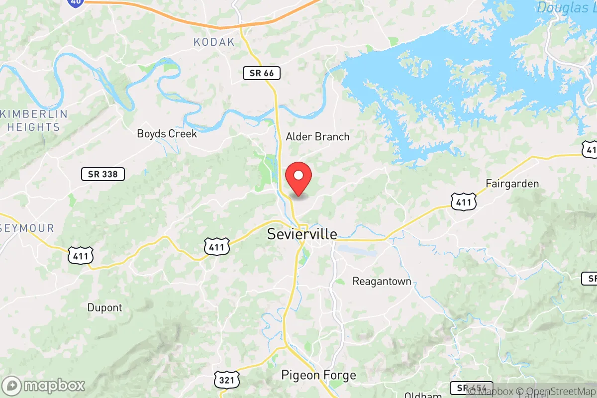
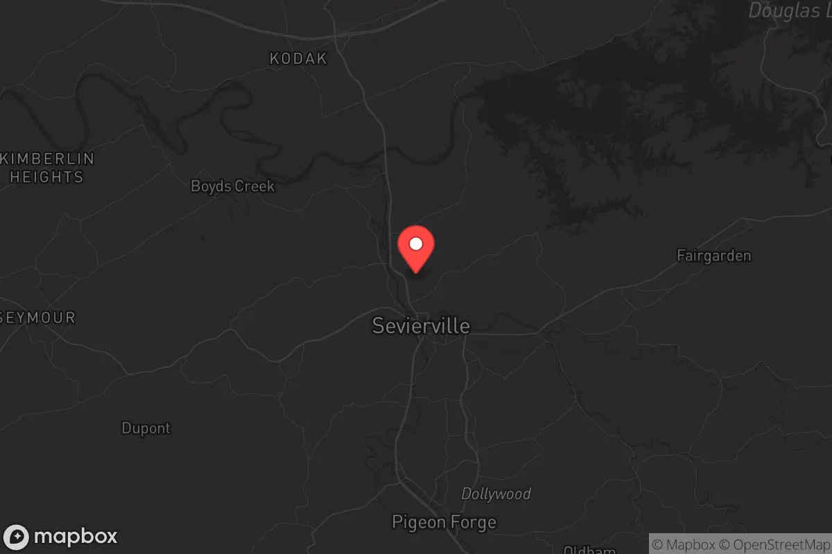
Sevierville, Tennessee, sits in a geographic sweet spot that offers genuine resilience advantages for those thinking seriously about long-term preparedness. Nestled in the foothills of the Great Smoky Mountains, it’s roughly 35 miles southeast of Knoxville and about 70 miles from the North Carolina border—close enough to access regional resources but far enough from major urban centers to avoid the worst of any civil unrest or disaster fallout. The area’s population of roughly 18,000 (2024 estimate) is dwarfed by the 8–10 million annual tourists who pass through, which creates both opportunity and risk for a relocator. The key strategic takeaway: Sevierville provides a defensible, resource-rich base with natural barriers, but its tourism-dependent economy and proximity to Knoxville’s 190,000 residents mean you must plan for supply chain disruptions and population surges during crises.
Geographic position and natural advantages for long-term survival
Sevierville’s location in Sevier County places it within the Tennessee Valley and the western edge of the Appalachian range, offering elevation advantages that reduce flood risk compared to low-lying areas along the Tennessee River. The surrounding Great Smoky Mountains National Park—over 800 square miles of rugged, forested terrain—acts as a natural buffer against large-scale movement from the east. To the west, the French Broad River and Douglas Lake provide water sources, though both are within a 20-minute drive and could become contested during a prolonged crisis. The area’s average elevation of 900 feet means cooler summers and milder winters than the Deep South, reducing heat-related stress on crops and infrastructure. For a relocator, the key geographic asset is the limited number of major road chokepoints: US-441 and I-40 are the primary arteries, and both can be monitored or blocked with relative ease. The mountains also offer abundant hardwood forests for timber, fuel, and concealment, though private land ownership is fragmented—over 60% of Sevier County is forested, but much is in national park or private resort holdings.
Risks, exposures, and proximity to fallout-relevant landmarks
The most significant strategic vulnerability is Sevierville’s proximity to Knoxville, home to the Tennessee Valley Authority headquarters, the University of Tennessee, and a major rail hub. In a scenario involving civil unrest or mass casualty events, Knoxville’s population could displace southward along US-441, overwhelming Sevierville’s infrastructure. The city itself has no major military installations, but the nearby McGhee Tyson Air National Guard Base (30 miles northwest) could become a staging area for federal response—drawing unwanted attention. Natural disaster risks include flash flooding in low-lying areas near the Little Pigeon River, which runs through downtown, and occasional ice storms that can knock out power for days. Tornado risk is moderate but real; Sevier County averages 2–3 tornado warnings per year. For those concerned with nuclear or radiological fallout, the nearest commercial nuclear plant is Watts Bar (80 miles southwest), well outside the immediate danger zone but within the 50-mile plume exposure pathway. The bigger concern is the tourist population density: during peak seasons, Sevierville’s effective population can swell to over 100,000, straining food, water, and medical resources. A pandemic or bioweapon event would find fertile ground in the packed hotels and attractions along the Parkway.
Practical resilience for a relocator: food, water, energy, and defensibility
For a single individual or family serious about self-sufficiency, Sevierville offers a mixed picture. Water is abundant but requires treatment: the Little Pigeon River and Douglas Lake are reliable surface sources, but both receive runoff from agricultural and tourist areas. A well on private property is the gold standard, and drilling costs in the region average $15–$25 per foot, with typical depths of 200–400 feet. The local water table is generally good, but limestone bedrock can complicate drilling. Food resilience is moderate—Sevier County has over 200 farms, but most are cattle or hay operations rather than row crops. The Sevierville Farmers Market (May–October) provides seasonal produce, but year-round food storage requires a robust pantry or greenhouse. The growing season runs roughly April to October, with average last frost around April 15. For energy, the area is served by the Tennessee Valley Authority, which has a strong grid but is vulnerable to cyberattack and EMP. Solar potential is decent—the region averages 4.5 peak sun hours per day—but tree cover on many properties limits rooftop options. Propane and wood are the most reliable backup fuels, and several local suppliers offer bulk delivery. Defensibility is the area’s strongest suit: the mountainous terrain provides natural cover, and many properties sit on winding, dead-end roads that are easy to monitor. However, the tourism economy means transient traffic is constant, making it hard to distinguish locals from outsiders during a crisis. A relocator should prioritize a property with a long driveway, good sightlines, and at least 5–10 acres to create a buffer zone.
The overall strategic picture for Sevierville is one of cautious optimism for the prepared relocator. It offers genuine natural defenses, abundant water, and a climate that supports subsistence agriculture—but these advantages are offset by a tourism-dependent infrastructure that could collapse under pressure and a proximity to Knoxville that introduces population and logistical risks. For a conservative-leaning individual or family who values self-reliance and is willing to invest in off-grid systems, Sevierville can work as a long-term base. The key is to buy land away from the Parkway and tourist corridors, ideally in the northern or eastern parts of the county, and to establish independent water, power, and food storage before any crisis hits. The mountains won’t save you if you’re dependent on the grid and the grocery store. But if you treat Sevierville as a starting point for building true resilience—not just a scenic place to wait out a storm—it holds up as one of the more viable options in the Southeast for those thinking decades ahead.
* Values derived from national, state, county, city and local statistics and may differ in a specific area. Last updated: 2026-05-01T10:46:07.000Z
Narrative content on this page is AI-generated and may contain mistakes. Verify any details that matter before acting on them.
ReloMaps may earn a commission from affiliate links at no extra cost to you.