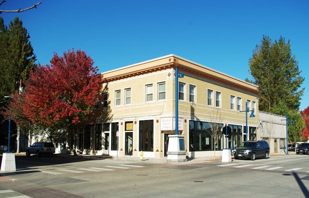
Photo: Wikipedia
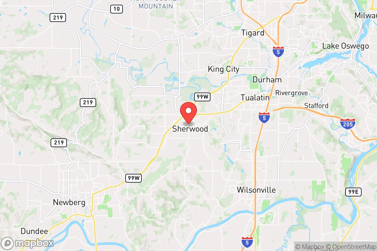
Strategic Assessment of Sherwood, OR
Multiple tactical vulnerabilities. Population density, target proximity, or disaster risk are likely compounding. A retreat property and exit planning is required.
What does the Strategic Assessment tell us?
Our Strategic Assessment grades tactical survivability of an area. Major population centers, military targets, fallout zones, natural disasters, and border exposure all drive risk — lower exposure means a more defensible position in a crisis.
This is heavily inspired by Joel Skousen's Strategic Relocation book. Highly recommended you checkout the book ($)What does this tell us?
Our Strategic Assessment grades tactical survivability of an area. Major population centers, military targets, fallout zones, natural disasters, and border exposure all drive risk — lower exposure means a more defensible position in a crisis.
This is heavily inspired by Joel Skousen's Strategic Relocation book. Highly recommended you checkout the book ($)Strategic Pillars

Key Distances
Regional Safe Places
Below is our recommended "safe zones" in Oregon and the surrounding area based on our strategic heuristics. For most people, it's unrealistic to live in a “safe zone” full-time due to work, family or other personal reasons. They tend to be more rural. However, many of these areas are perfect for second homes and retreat properties that double as a vacation home or even a short-term rental.


Important Note: For informational purposes only. This does not mean nothing bad ever happens in the green zones. Please use common sense. This is based on public data and modeled with AI. We tried to take a conservative approach but mistakes happen. We update this regularly as new information becomes available.
Solar Generator Recommendations
Backup power matters more here than in safer locations. We've picked three solar generators across budgets and capacity tiers — start with the budget unit if you only need a few essentials, or step up if you want to run a fridge and HVAC for days at a time.

Jackery Portable Power Station Explorer 300
Budget OptionPower on the Go: Weighing only 11 lbs, it's convenient to set up and store with book-sized foldable solar panels

BLUETTI Portable Power Station AC180
Designed for both indoor and outdoor scenarios, AC180 is highly capable as it has a robost capacity and continuous output power.

EF ECOFLOW DELTA Pro Ultra Power Station
Upgraded PickEcoFlow DELTA Pro Ultra is a whole-home energy system designed to grow with your family. Integrated with the Smart Home Panel 2, it scales to meet your evolving energy needs — keeping your home powered, intelligent, and secure through every stage of life.
We earn a commission, at no additional cost to you.
Strategic Assessment Analysis
Sherwood, Oregon, sits in a geographic sweet spot that offers genuine strategic depth for those prioritizing resilience, but it is not without significant trade-offs. Located roughly 25 miles southwest of Portland, this Washington County community of about 20,000 provides a buffer from the immediate chaos of a major metropolitan collapse while still being close enough to monitor regional threats. The town’s position along the Tualatin Valley, flanked by the Chehalem Mountains and the Coast Range foothills, creates natural chokepoints and defensible terrain that a savvy relocator can leverage. For a conservative-leaning prepper, Sherwood’s relative insulation from Portland’s political and social instability—combined with its access to agricultural land, water resources, and a network of rural backroads—makes it a viable base camp, provided you understand the risks baked into its proximity to critical infrastructure and population centers.
Geographic position and natural advantages for long-term survival
Sherwood’s location is its primary strategic asset. The city sits at the intersection of Oregon’s fertile Willamette Valley and the forested slopes of the Coast Range, giving residents access to both productive farmland and timber resources. The Tualatin River flows just north of town, and the area receives ample rainfall—roughly 40 inches annually—which means water catchment and well drilling are realistic options for those who secure property with adequate acreage. The surrounding Chehalem Mountains provide elevation advantages: from certain ridgelines, you can observe movement along Highway 99W and the 99W corridor, which are the primary arteries connecting Portland to the southern valley. This elevation also offers natural defensibility, as the terrain limits approach vectors for any large-scale movement of people or vehicles. The soil in the Tualatin Valley is among the most productive in the Pacific Northwest, supporting vineyards, nurseries, and small farms. For a relocator focused on food security, this means you can realistically establish a garden or small orchard that yields year-round, especially with season extension techniques like hoop houses. The area’s mild winters (average lows in the mid-30s) and moderate summers (highs in the low 80s) reduce the energy burden for heating and cooling, a critical factor in a grid-down scenario.
Risks, exposures, and proximity to fallout-relevant landmarks
The most glaring vulnerability is Sherwood’s proximity to Portland—a city that, in a crisis, would likely become a source of uncontrolled population movement, resource competition, and potential civil unrest. Portland is a major transportation hub with an international airport, a deep-water port, and multiple rail lines. In a national emergency—whether economic collapse, pandemic, or geopolitical conflict—these assets become targets. Sherwood sits within 30 miles of Portland International Airport and within 20 miles of the Port of Portland’s industrial terminals, which handle hazardous materials and containerized cargo. A detonation or attack on these facilities could produce fallout patterns that, depending on wind direction, might affect the Tualatin Valley. Additionally, the nearby Intel campuses in Hillsboro (about 12 miles north) are high-value targets for cyber or kinetic attacks, given their role in semiconductor manufacturing. The region’s electrical grid is heavily dependent on the Pacific Northwest’s hydroelectric system, which is vulnerable to both seismic activity (the Cascadia subduction zone) and targeted sabotage. A major earthquake on the Cascadia fault—estimated at a 37% probability of a magnitude 8.0+ event in the next 50 years—would devastate the Willamette Valley’s infrastructure, including roads, bridges, and water systems. Sherwood’s location on the valley floor means it is not immune to liquefaction risks, though the city’s elevation (around 200 feet) provides some protection from tsunami inundation that would hit coastal areas.
Practical resilience for a relocator: food, water, energy, and defensibility
For a prepper, Sherwood offers a mixed bag of practical advantages and logistical hurdles. Water is the most critical resource, and the area’s high rainfall is a double-edged sword: it provides ample catchment potential but also means you need robust filtration and storage systems to handle the seasonal variability. The Tualatin River is a reliable surface water source, but it is also a shared resource with upstream industrial and agricultural users, so a private well on your property is the gold standard. The local water table is generally accessible at depths of 50 to 150 feet, but drilling costs in the area run $15,000 to $30,000, so factor that into your budget. Food production is feasible: the growing season runs from April to October, and you can cultivate staples like potatoes, beans, squash, and berries. The local farmers’ markets and U-pick operations (e.g., Smith Berry Barn) are good for building community connections, but in a collapse scenario, you cannot rely on them—you need your own seed bank and preservation setup (canning, dehydrating, root cellaring). Energy resilience is a challenge. The grid is relatively stable in normal times, but the region’s reliance on hydroelectric power means that a prolonged drought or earthquake could cause extended blackouts. Solar is viable, with the area averaging about 150 sunny days per year, but you will need a battery bank and possibly a backup generator for the overcast winter months. Defensibility is moderate: Sherwood’s layout—with its historic downtown, suburban neighborhoods, and surrounding rural parcels—offers multiple egress routes (Highway 99W, Bald Peak Road, and Scholls-Sherwood Road) but also multiple ingress points for potential threats. The Chehalem Mountains provide natural barriers to the west, but the flat valley floor to the north and east is open. A well-chosen property on a dead-end road with good sightlines and a defensible perimeter (e.g., a farm with a long driveway and fencing) is your best bet.
The overall strategic picture for Sherwood is one of calculated risk. It is not a remote bunker location—it is a suburban-rural hybrid that offers genuine resilience advantages for those willing to invest in infrastructure and maintain a low profile. The proximity to Portland is a liability, but it also means you have access to medical facilities (Providence Willamette Falls Medical Center is 15 minutes away), hardware stores, and a pool of like-minded individuals if you network through local gun clubs, churches, or preparedness groups. The political climate in Washington County leans left, but Sherwood itself is more conservative than its neighbors, with a strong sense of community and a history of agricultural self-reliance. For a relocator who values strategic depth over total isolation, Sherwood provides a defensible base with good water, decent soil, and manageable risks—provided you are honest about the threats and prepared to bug in or bug out as the situation demands. The key is to treat it as a forward operating base, not a final redoubt, and to have a secondary plan for retreat into the Coast Range or eastern Oregon if the Portland basin becomes untenable.
* Values derived from national, state, county, city and local statistics and may differ in a specific area. Last updated: 2026-05-29T11:01:14.000Z
Narrative content on this page is AI-generated and may contain mistakes. Verify any details that matter before acting on them.
ReloMaps may earn a commission from affiliate links at no extra cost to you.