Photo: Wikipedia
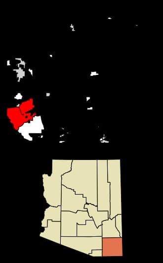
Strategic Assessment of Sierra Vista, AZ
Meaningful friction. Expect exposure to either population pressure, blast zones, or natural disaster risk. Consider buying a retreat property.
What does the Strategic Assessment tell us?
Our Strategic Assessment grades tactical survivability of an area. Major population centers, military targets, fallout zones, natural disasters, and border exposure all drive risk — lower exposure means a more defensible position in a crisis.
This is heavily inspired by Joel Skousen's Strategic Relocation book. Highly recommended you checkout the book ($)What does this tell us?
Our Strategic Assessment grades tactical survivability of an area. Major population centers, military targets, fallout zones, natural disasters, and border exposure all drive risk — lower exposure means a more defensible position in a crisis.
This is heavily inspired by Joel Skousen's Strategic Relocation book. Highly recommended you checkout the book ($)Strategic Pillars

Key Distances
Regional Safe Places
Below is our recommended "safe zones" in Arizona and the surrounding area based on our strategic heuristics. For most people, it's unrealistic to live in a “safe zone” full-time due to work, family or other personal reasons. They tend to be more rural. However, many of these areas are perfect for second homes and retreat properties that double as a vacation home or even a short-term rental.
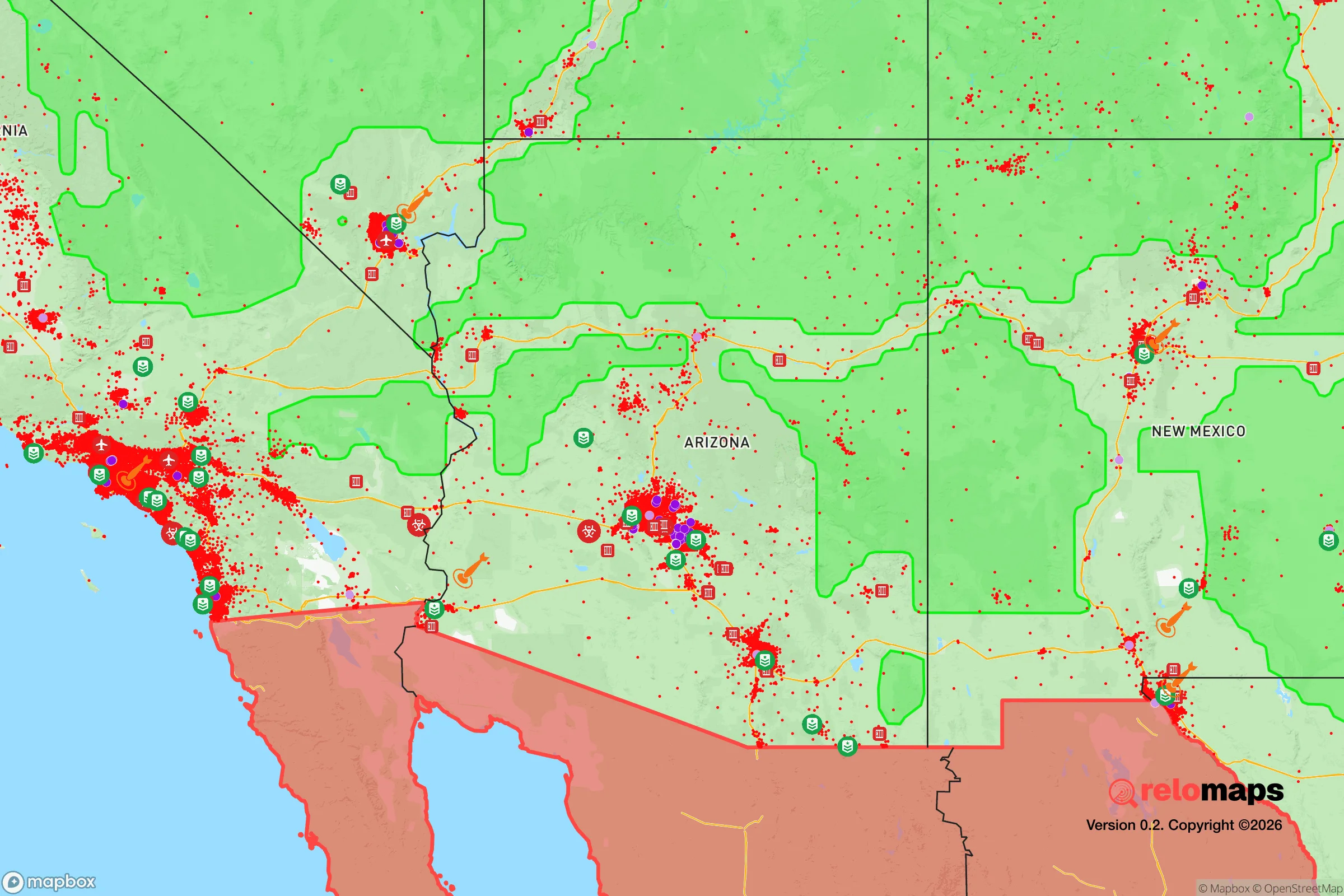
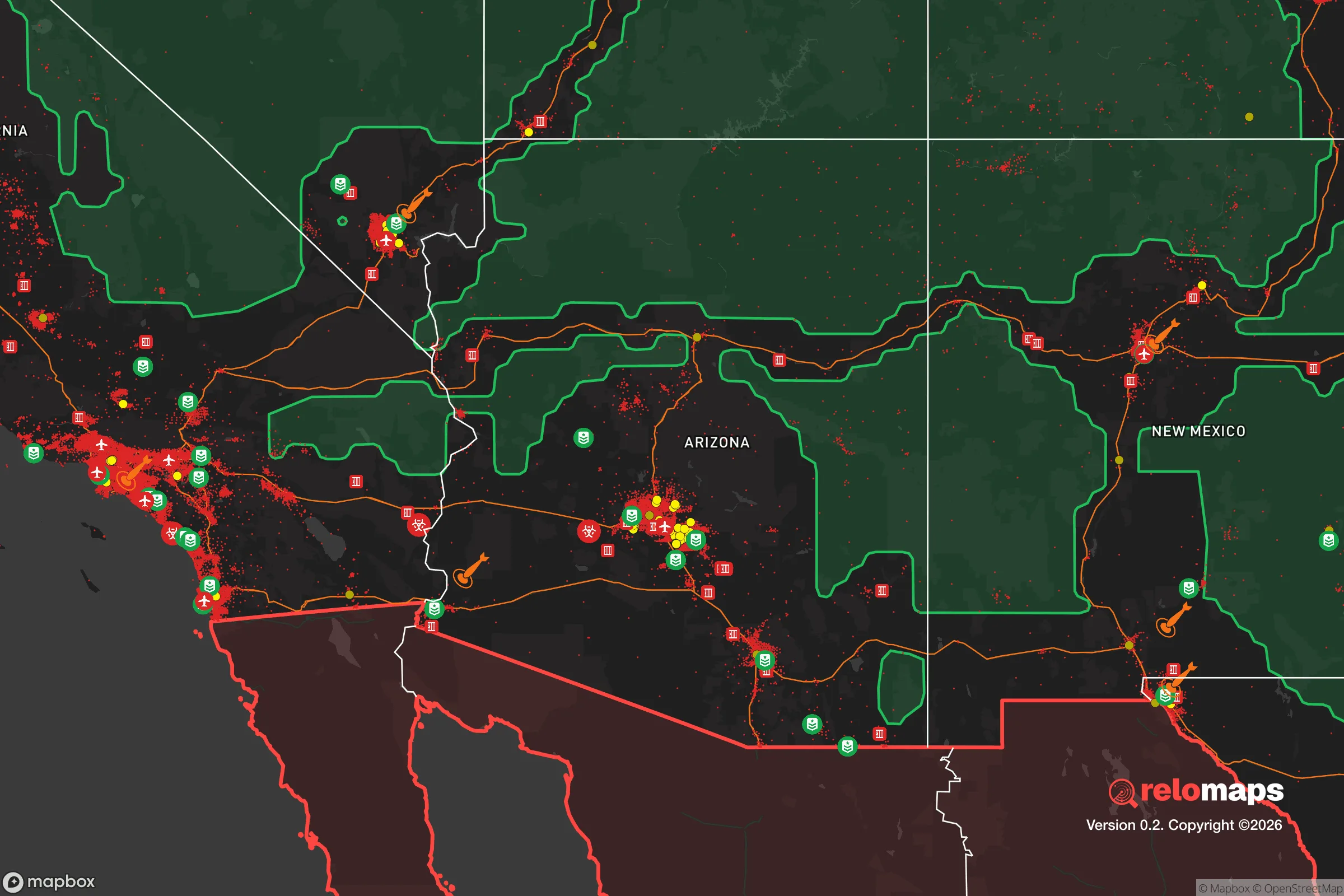
Important Note: For informational purposes only. This does not mean nothing bad ever happens in the green zones. Please use common sense. This is based on public data and modeled with AI. We tried to take a conservative approach but mistakes happen. We update this regularly as new information becomes available.
Solar Generator Recommendations
Backup power matters more here than in safer locations. We've picked three solar generators across budgets and capacity tiers — start with the budget unit if you only need a few essentials, or step up if you want to run a fridge and HVAC for days at a time.

Jackery Portable Power Station Explorer 300
Budget OptionPower on the Go: Weighing only 11 lbs, it's convenient to set up and store with book-sized foldable solar panels

BLUETTI Portable Power Station AC180
Designed for both indoor and outdoor scenarios, AC180 is highly capable as it has a robost capacity and continuous output power.

EF ECOFLOW DELTA Pro Ultra Power Station
Upgraded PickEcoFlow DELTA Pro Ultra is a whole-home energy system designed to grow with your family. Integrated with the Smart Home Panel 2, it scales to meet your evolving energy needs — keeping your home powered, intelligent, and secure through every stage of life.
We earn a commission, at no additional cost to you.
Strategic Assessment Analysis
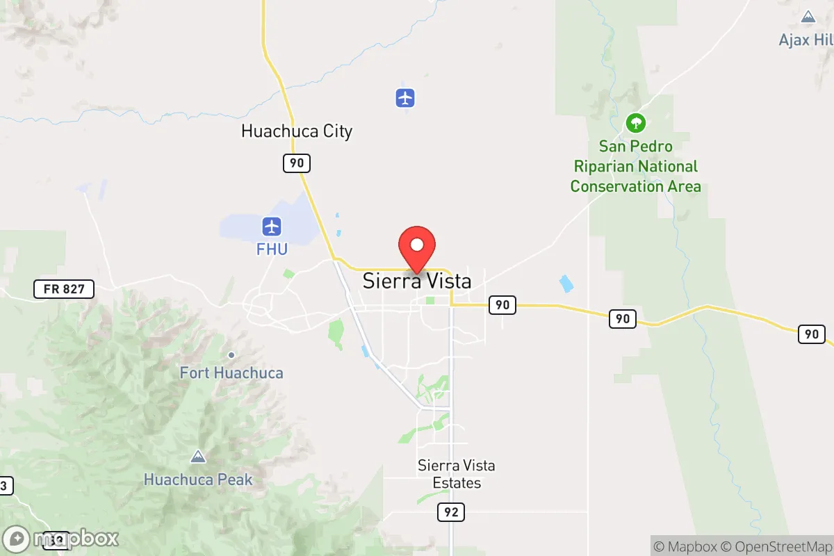
Sierra Vista, Arizona, offers a compelling strategic position for those prioritizing resilience and self-sufficiency in an uncertain future. Its location in Cochise County, roughly 75 miles southeast of Tucson and 20 miles north of the Mexican border, provides a buffer from major urban centers while maintaining access to critical infrastructure. The city's elevation of 4,600 feet and proximity to the Huachuca Mountains create a microclimate that is cooler and wetter than the surrounding desert, supporting more reliable water sources and agricultural potential. For a relocator concerned with civic unrest, mass casualty events, or supply chain disruptions, Sierra Vista presents a defensible, resource-rich environment that is far enough from the chaos of Phoenix or Tucson to offer breathing room, yet close enough to those cities to monitor threats and access specialized services if needed.
Geographic position and natural advantages for long-term security
Sierra Vista's geographic position is its strongest asset for a prepper or survivalist mindset. The city sits in the San Pedro River Valley, one of the last free-flowing rivers in the Southwest, which provides a perennial water source—a critical factor in arid Arizona. The surrounding Huachuca Mountains offer natural barriers to the east and west, funneling access through a limited number of routes, which simplifies perimeter monitoring and defensibility. The area is also home to Fort Huachuca, a major U.S. Army installation that brings a steady military presence, federal employment, and a population accustomed to security protocols. This military connection means the local economy is less dependent on tourism or volatile industries, and the base itself could serve as a stabilizing force during regional disruptions. The climate supports year-round outdoor activity, with mild winters and moderate summers, reducing the strain on energy and shelter systems compared to lower desert locations. For a relocator, this means the land can sustain gardens, livestock, and rainwater harvesting without the extreme heat stress found in Phoenix or Yuma.
Risks, exposures, and proximity to fallout-relevant landmarks
No location is without risk, and Sierra Vista has specific exposures that a strategic relocator must weigh. The most significant is its proximity to the Mexican border—roughly 20 miles south. While this provides a buffer from the immediate chaos of border crossings, it also places the area in a corridor for cartel activity, human trafficking, and drug smuggling. The nearby Douglas and Naco ports of entry are known hotspots for illicit traffic, and occasional cross-border violence has spilled into Cochise County. For a prepper, this means heightened awareness of security, especially on rural properties near the border. Additionally, Sierra Vista is within 75 miles of the Davis-Monthan Air Force Base in Tucson, which houses the 309th Aerospace Maintenance and Regeneration Group (the "boneyard") and is a potential target in a major conflict. The city is also within 100 miles of the Palo Verde Nuclear Generating Station near Phoenix, one of the largest nuclear plants in the country. While prevailing winds generally blow from the west, a worst-case scenario at Palo Verde could affect the region. The area is also seismically quiet, with no major fault lines, and wildfire risk is moderate due to the surrounding grasslands and oak woodlands, though the Huachuca Mountains can see intense fires during dry years. Flooding is localized to the San Pedro River corridor, but most residential areas are on higher ground.
Practical resilience for a relocator: food, water, energy, and defensibility
For a relocator focused on practical resilience, Sierra Vista offers strong fundamentals. Water is the most critical resource, and the area benefits from the San Pedro River aquifer, which is recharged by mountain runoff. Many properties have wells, and the city's municipal water supply is considered reliable, though conservation is wise. Rainwater harvesting is feasible with average annual rainfall of 15-18 inches, and the cooler climate reduces evaporation losses. Food production is viable: the growing season runs from April to October, and the soil in the valley is loamy and fertile with proper amendment. Local farmers markets and the Sierra Vista Farmers Market provide fresh produce, but a serious prepper should plan for home gardens, fruit trees (apples, pears, peaches), and small livestock like chickens or goats. The area has a strong hunting culture for deer, javelina, and quail, adding a protein source. Energy independence is achievable with solar panels, as the region averages 280 sunny days per year. Net metering is available through local utilities, but off-grid setups are common on rural parcels. Defensibility is enhanced by the terrain: the mountains create natural choke points on the main roads (AZ-90 and AZ-92), and the city's layout is compact, with most residential areas clustered around the base and the downtown core. Rural properties in the surrounding canyons offer even greater seclusion, with limited access points and long sightlines. The local law enforcement presence is robust due to the military influence, and the Cochise County Sheriff's Office has a reputation for responsiveness. However, a relocator should not rely solely on authorities; building a community network of like-minded neighbors is essential for mutual aid during extended disruptions.
The overall strategic picture for Sierra Vista is one of balanced opportunity and manageable risk. It is not a bunker location—it is a working town with a military backbone, a reliable water source, and a climate that supports self-sufficiency. The proximity to the border and to potential targets like Davis-Monthan and Palo Verde are real concerns, but they are offset by the area's natural defensibility, its distance from the major population centers of Phoenix and Tucson, and the stabilizing presence of Fort Huachuca. For a conservative-leaning relocator who values preparedness without complete isolation, Sierra Vista offers a realistic path: a place where you can build a resilient lifestyle, grow your own food, store water, and maintain a low profile while still having access to medical care, schools, and a community that understands security. The key is to choose a property wisely—away from floodplains, with good solar exposure, and with a well—and to invest in relationships with local prepper and homesteading groups. In a world of increasing uncertainty, Sierra Vista stands out as a location that doesn't just survive—it can thrive, provided you do the work.
* Values derived from national, state, county, city and local statistics and may differ in a specific area. Last updated: 2026-04-19T08:28:42.000Z
Narrative content on this page is AI-generated and may contain mistakes. Verify any details that matter before acting on them.
ReloMaps may earn a commission from affiliate links at no extra cost to you.