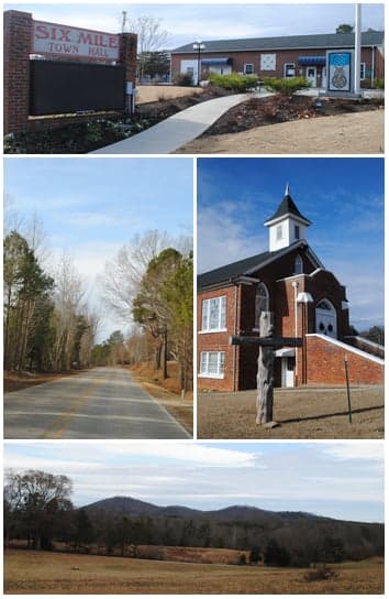
Photo: Wikipedia
Strategic Assessment of Six Mile, SC
Meaningful friction. Expect exposure to either population pressure, blast zones, or natural disaster risk. Consider buying a retreat property.
What does the Strategic Assessment tell us?
Our Strategic Assessment grades tactical survivability of an area. Major population centers, military targets, fallout zones, natural disasters, and border exposure all drive risk — lower exposure means a more defensible position in a crisis.
This is heavily inspired by Joel Skousen's Strategic Relocation book. Highly recommended you checkout the book ($)What does this tell us?
Our Strategic Assessment grades tactical survivability of an area. Major population centers, military targets, fallout zones, natural disasters, and border exposure all drive risk — lower exposure means a more defensible position in a crisis.
This is heavily inspired by Joel Skousen's Strategic Relocation book. Highly recommended you checkout the book ($)Strategic Pillars

Key Distances
Regional Safe Places
Below is our recommended "safe zones" in South Carolina and the surrounding area based on our strategic heuristics. For most people, it's unrealistic to live in a “safe zone” full-time due to work, family or other personal reasons. They tend to be more rural. However, many of these areas are perfect for second homes and retreat properties that double as a vacation home or even a short-term rental.
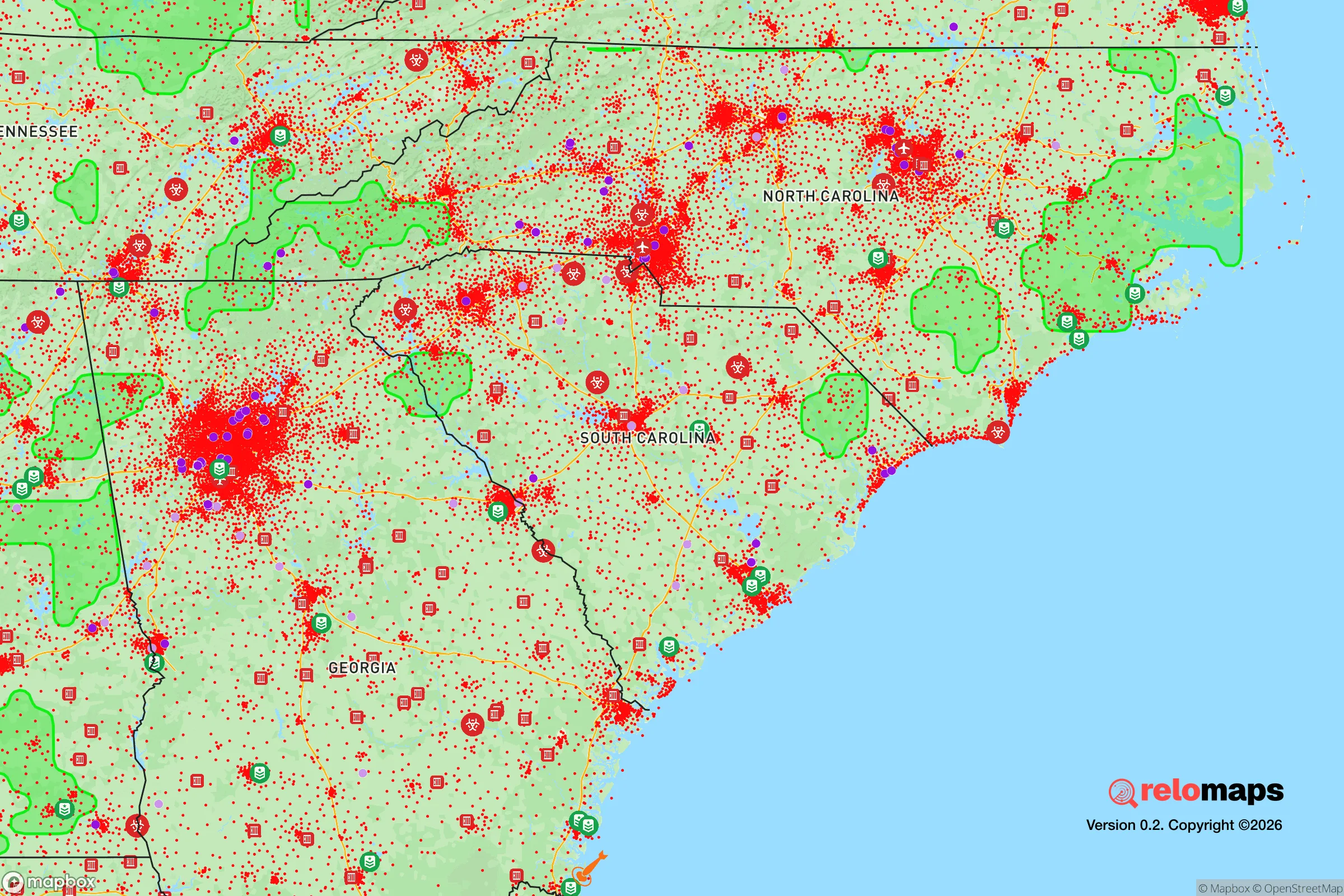
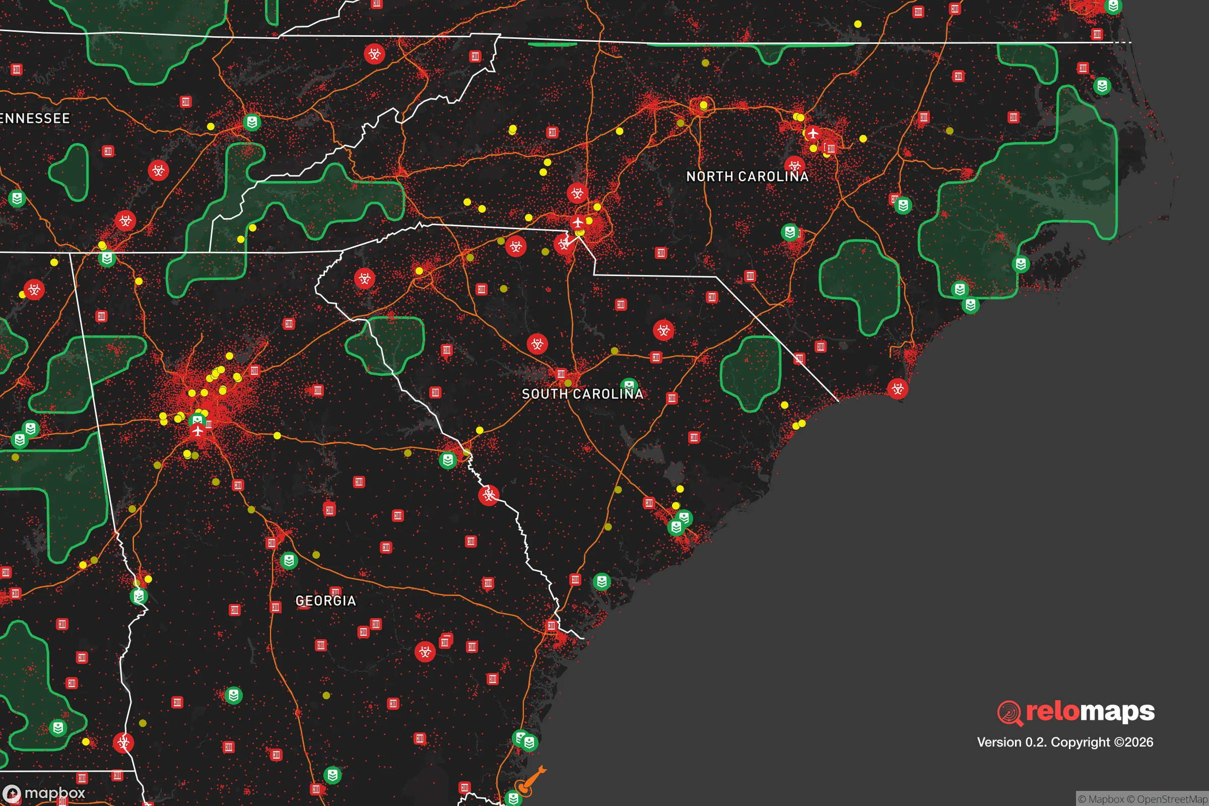


Important Note: For informational purposes only. This does not mean nothing bad ever happens in the green zones. Please use common sense. This is based on public data and modeled with AI. We tried to take a conservative approach but mistakes happen. We update this regularly as new information becomes available.
Solar Generator Recommendations
Backup power matters more here than in safer locations. We've picked three solar generators across budgets and capacity tiers — start with the budget unit if you only need a few essentials, or step up if you want to run a fridge and HVAC for days at a time.

Jackery Portable Power Station Explorer 300
Budget OptionPower on the Go: Weighing only 11 lbs, it's convenient to set up and store with book-sized foldable solar panels

BLUETTI Portable Power Station AC180
Designed for both indoor and outdoor scenarios, AC180 is highly capable as it has a robost capacity and continuous output power.

EF ECOFLOW DELTA Pro Ultra Power Station
Upgraded PickEcoFlow DELTA Pro Ultra is a whole-home energy system designed to grow with your family. Integrated with the Smart Home Panel 2, it scales to meet your evolving energy needs — keeping your home powered, intelligent, and secure through every stage of life.
We earn a commission, at no additional cost to you.
Strategic Assessment Analysis
Six Mile, South Carolina, sits in a sweet spot that few relocators fully appreciate: close enough to real infrastructure to matter, far enough from the big targets to breathe. Tucked into the northwest corner of Pickens County, this unincorporated community of roughly 800–1,000 residents offers a strategic mix of mountain terrain, rural spacing, and access to the I-85 corridor that makes it a serious candidate for anyone weighing disaster readiness and long-term self-sufficiency. The calculus here is not about escaping everything — it’s about positioning yourself where the downsides are manageable and the upsides are structural.
Geographic position and natural advantages for long-term resilience
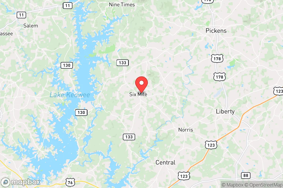
Six Mile’s defining asset is its location in the foothills of the Blue Ridge Escarpment, roughly 15 miles north of Clemson and about 30 miles southwest of Greenville. That puts it on the edge of the Piedmont and the mountains, which translates into a few concrete advantages. Elevation across the area ranges from about 900 to 1,200 feet, which means less flood risk than the low-lying coastal plain and better drainage than the clay-heavy flats further south. The topography also provides natural defensibility — the winding roads off SC-133 and the rural side roads off SC-8 create chokepoints and limited through-traffic, which is a genuine asset if you’re thinking about security in a disrupted scenario.
The water picture is strong. Six Mile sits near the headwaters of Six Mile Creek and is a short drive from Lake Keowee and Lake Hartwell, both of which are substantial reservoirs managed by Duke Energy and the U.S. Army Corps of Engineers. Surface water is abundant, and groundwater in the region is generally reliable for private wells, though yields vary with rock fractures. The climate is temperate — hot, humid summers and mild winters — with an average annual rainfall around 55 inches, which supports year-round gardening and rainwater catchment. The growing season runs roughly 200 days, from early April to late October, which is workable for serious food production.
Risk profile: natural hazards and proximity to fallout-relevant landmarks
No place is risk-free, and Six Mile has its own set of exposures. The most realistic natural threats are severe thunderstorms, tornadoes (the area sits on the western fringe of Dixie Alley), and occasional ice storms in winter. The 2024 tornado outbreak that struck nearby Anderson County is a reminder that this region can see EF-2 and EF-3 events, though Six Mile itself has not taken a direct hit in recent memory. Wildfire risk is moderate — the forested hillsides can dry out in late summer, but the area lacks the prolonged drought cycles of the West. Flooding is localized, mostly along creek bottoms, and the 1,000-year flood event in 2018 that damaged parts of Pickens County did not significantly impact Six Mile proper.
The man-made risk picture is where the analysis gets more serious. Six Mile is roughly 35 miles from the Savannah River Site (SRS), a 310-square-mile Department of Energy nuclear reservation that handles tritium processing and nuclear materials. While SRS has a strong safety record in recent decades, a major incident — whether accidental or targeted — would put Six Mile within the zone where fallout could arrive within hours depending on wind patterns. The same applies to the Oconee Nuclear Station at Lake Keowee, just 12 miles northwest of Six Mile. That plant is a three-unit pressurized water reactor facility, and while the NRC rates it as well-run, its proximity is a fact you cannot ignore. Additionally, the I-85 corridor between Greenville and Atlanta is a high-value logistics artery; in a conflict scenario, that corridor is a plausible target for disruption, and Six Mile’s access to it is a double-edged sword — useful for supply runs, but also a vector for refugees or military traffic in a crisis.
Practical resilience: food, water, energy, and defensibility for a relocator
For a relocator serious about self-sufficiency, Six Mile offers a workable baseline. The soil is a mix of sandy loam and clay, acidic but amendable with compost and lime; local growers successfully produce tomatoes, peppers, squash, beans, and root crops. The Pickens County Farmers Market in nearby Easley and the Clemson-area growers’ network provide both supply and community for anyone wanting to plug into local food systems. Hunting is viable — deer and turkey populations are healthy on the surrounding national forest land (Sumter National Forest is about 20 minutes west) — and fishing in Lake Keowee and the Chattooga River is solid. For long-term food security, a household with a half-acre to two acres can realistically produce a significant portion of its own calories here, something that is far harder in suburban Greenville or Anderson.
Water is the strongest card. Private wells are common in the area, and the water table in the foothills is generally accessible at depths of 100–300 feet. Rainwater harvesting is legal and practical — South Carolina has no restrictions on residential catchment — and the 55 inches of annual rainfall means a 1,000-square-foot roof can collect roughly 30,000 gallons per year. For energy, the picture is mixed. Duke Energy provides grid power, and outages from ice storms or high winds are a recurring reality, typically lasting a few hours to a couple of days. Solar is viable — the region gets about 4.5 peak sun hours per day — and net metering is available, though Duke’s interconnection process has gotten slower in recent years. Wood heat is a realistic backup, with firewood abundant and cheap from local suppliers. Propane is widely available for generators and cooking.
Defensibility is a function of layout. The community is spread out, with homes on one-to-five-acre lots separated by wooded ridges and creek valleys. That spacing makes it harder for any outside group to apply pressure, and the limited road network — primarily SC-133, SC-8, and a handful of county roads — means a small number of chokepoints can be monitored or controlled. The nearest significant population center, Clemson, is about 15 minutes away; in a crisis, that proximity is a liability (crowds, resource competition) but also an asset (medical care at Prisma Health Oconee Memorial, supplies, and information). The local culture leans self-reliant — Pickens County is heavily rural, with a strong hunting and farming tradition, and the county’s Republican voting pattern (Trump carried it by roughly 30 points in 2024) reflects a population that generally values preparedness and individual initiative.
The overall strategic picture for a relocator
Six Mile is not a bug-out bunker location, and it is not a remote mountain hideaway. It is a middle-ground play: a rural foothills community with good water, workable soil, and a defensible layout, sitting at a manageable distance from both the risks and the resources of the Upstate. The biggest weaknesses are the proximity to Oconee Nuclear Station and the Savannah River Site, and the fact that the I-85 corridor can bring trouble your way as easily as it brings supplies. But for a family or individual who wants to build a resilient life — not just survive a week — the fundamentals here are solid. Land is still affordable relative to the rest of the Southeast, the community is small enough to know your neighbors, and the natural systems (water, soil, forest) are robust enough to support a genuinely self-sufficient household. If you are looking for a place to dig in, raise food, and ride out whatever comes, Six Mile deserves a serious look.

* Values derived from national, state, county, city and local statistics and may differ in a specific area. Last updated: 2026-10-20T05:46:57.000Z
Narrative content on this page is AI-generated and may contain mistakes. Verify any details that matter before acting on them.
ReloMaps may earn a commission from affiliate links at no extra cost to you.

