Photo: Nolan Kent via Unsplash
Strategic Assessment of St Peters, MO
Meaningful friction. Expect exposure to either population pressure, blast zones, or natural disaster risk. Consider buying a retreat property.
What does the Strategic Assessment tell us?
Our Strategic Assessment grades tactical survivability of an area. Major population centers, military targets, fallout zones, natural disasters, and border exposure all drive risk — lower exposure means a more defensible position in a crisis.
This is heavily inspired by Joel Skousen's Strategic Relocation book. Highly recommended you checkout the book ($)What does this tell us?
Our Strategic Assessment grades tactical survivability of an area. Major population centers, military targets, fallout zones, natural disasters, and border exposure all drive risk — lower exposure means a more defensible position in a crisis.
This is heavily inspired by Joel Skousen's Strategic Relocation book. Highly recommended you checkout the book ($)Strategic Pillars

Key Distances
Regional Safe Places
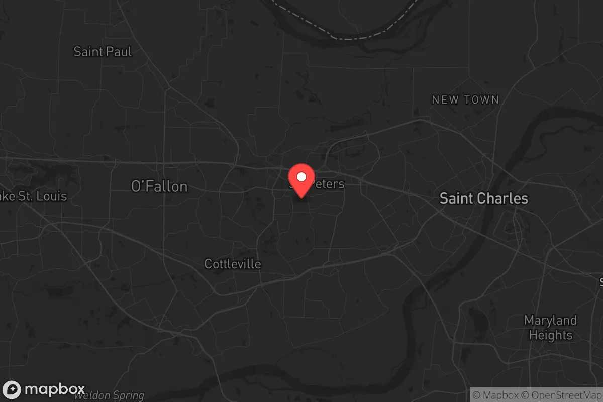
Below is our recommended "safe zones" in Missouri and the surrounding area based on our strategic heuristics. For most people, it's unrealistic to live in a “safe zone” full-time due to work, family or other personal reasons. They tend to be more rural. However, many of these areas are perfect for second homes and retreat properties that double as a vacation home or even a short-term rental.


Important Note: For informational purposes only. This does not mean nothing bad ever happens in the green zones. Please use common sense. This is based on public data and modeled with AI. We tried to take a conservative approach but mistakes happen. We update this regularly as new information becomes available.
Solar Generator Recommendations
Backup power matters more here than in safer locations. We've picked three solar generators across budgets and capacity tiers — start with the budget unit if you only need a few essentials, or step up if you want to run a fridge and HVAC for days at a time.

Jackery Portable Power Station Explorer 300
Budget OptionPower on the Go: Weighing only 11 lbs, it's convenient to set up and store with book-sized foldable solar panels

BLUETTI Portable Power Station AC180
Designed for both indoor and outdoor scenarios, AC180 is highly capable as it has a robost capacity and continuous output power.

EF ECOFLOW DELTA Pro Ultra Power Station
Upgraded PickEcoFlow DELTA Pro Ultra is a whole-home energy system designed to grow with your family. Integrated with the Smart Home Panel 2, it scales to meet your evolving energy needs — keeping your home powered, intelligent, and secure through every stage of life.
We earn a commission, at no additional cost to you.
Strategic Assessment Analysis
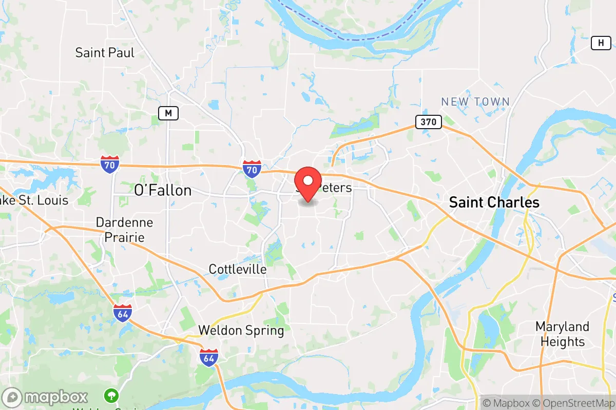
St. Peters, Missouri, sits in a precarious but potentially advantageous position for those prioritizing long-term resilience and strategic relocation. Located in St. Charles County, roughly 30 miles northwest of downtown St. Louis, the city benefits from being far enough from the urban core to avoid the worst of immediate civil unrest or a mass casualty event, yet close enough to access critical supply chains and medical infrastructure if they remain functional. The area’s growth over the past two decades—fueled by families and businesses fleeing St. Louis City—has created a robust tax base and modern infrastructure, but the real strategic value lies in its geographic buffer and the natural resources of the Missouri River corridor. For a conservative-leaning prepper, St. Peters offers a middle ground: not a remote bunker, but a defensible suburban base with escape routes and community cohesion that many urban areas have already lost.
Geographic position and natural advantages for long-term survival
St. Peters is anchored by the Missouri River to its south and the Mississippi River to its east, providing both a natural barrier and a critical water source. The city sits on the eastern edge of the Missouri River bluffs, which offer elevated terrain that reduces flood risk compared to low-lying areas like St. Charles or Chesterfield. This elevation also provides line-of-sight advantages for communications and observation. The surrounding St. Charles County is predominantly rural and agricultural, with thousands of acres of farmland within a 20-minute drive—critical for food security if supply chains collapse. The area’s karst topography, with limestone bedrock and numerous caves, offers potential for off-grid storage or shelter, though most are on private land. The confluence of the Missouri and Mississippi rivers also means access to barge traffic and alternative transportation routes if roads become impassable. For a relocator, the key advantage is that St. Peters is not a choke point; it has multiple highway exits (I-70, I-64, and Highway 364) and secondary roads that allow for egress in multiple directions, including west toward the Ozarks or north toward less populated areas of Missouri and Iowa.
Risks, exposures, and proximity to fallout-relevant landmarks
The most significant risk for St. Peters is its proximity to St. Louis, a major metropolitan area with a population of over 2.8 million in the metro region. In a scenario involving civil unrest, mass casualty events, or a coordinated attack, St. Louis would likely be a primary target. The city is home to several high-value targets: Lambert International Airport (a major cargo hub), the St. Louis Federal Reserve Bank, multiple Fortune 500 headquarters (including Emerson Electric and Centene), and the nation’s largest inland port complex along the Mississippi. Additionally, the Weldon Spring Chemical Plant and the St. Louis Area Nuclear Waste Site (the West Lake Landfill) are within 20 miles, posing long-term contamination risks if disrupted. The Missouri River itself is a potential vector for contamination from upstream industrial sites. For a prepper, the biggest concern is the “panic radius”—St. Peters is close enough that a major event in St. Louis would trigger a massive outflow of refugees, overwhelming local resources. The city’s police and fire departments are well-funded (St. Charles County has one of the lowest crime rates in the state), but they cannot stop a determined mob or a cascading infrastructure failure. The presence of two nuclear power plants—Callaway County (50 miles west) and the now-closed but still monitored Fort Calhoun (60 miles north)—adds a low-probability, high-consequence risk of radiation exposure if containment fails.
Practical resilience for a relocator: food, water, energy, and defensibility
Water is the strongest suit for St. Peters. The city draws its municipal water from the Missouri River, and the local water treatment plant has backup generators and redundant intake systems. For off-grid setups, the shallow groundwater table (typically 20-40 feet) makes well drilling feasible, and the nearby rivers provide a surface source that can be filtered. Food resilience is moderate: the city has several large grocery chains (Schnucks, Dierbergs, Walmart) but no significant local food production within city limits. However, the surrounding county has dozens of farms, farmers’ markets, and a strong hunting culture (deer, turkey, waterfowl) that can supplement diets. Energy infrastructure is a mixed bag. St. Peters is served by Ameren Missouri, which relies heavily on coal and nuclear (the Callaway plant), but the grid is aging and vulnerable to ice storms and tornadoes—both common in the region. Solar potential is decent (about 4.5 peak sun hours per day), and many newer homes have natural gas hookups, which are more resilient than all-electric. Defensibility is the weakest link. St. Peters is a typical suburban sprawl with cul-de-sacs, strip malls, and open subdivisions—hard to secure against a determined group. The best defensive positions are the older neighborhoods near the river bluffs, which have fewer entry points and better sightlines. The city’s gun culture is strong (Missouri is a constitutional carry state), and the local sheriff’s office is pro-Second Amendment, which means a prepared relocator will find like-minded neighbors. But the sheer number of entry roads and the lack of natural chokepoints make St. Peters more of a “bug-out base” than a “bug-in fortress.”
The overall strategic picture for St. Peters is one of calculated trade-offs. It offers a solid foundation for a family or individual who wants to be within striking distance of St. Louis’s resources—hospitals, airports, industrial goods—without being trapped inside the blast zone of a major crisis. The community is politically conservative, with a strong sense of local identity and a low tolerance for the chaos that has engulfed larger cities. Property taxes are reasonable (around 1.1% of assessed value), and home prices are still affordable compared to the coasts, allowing a relocator to invest in hardening a property. The biggest vulnerability is the “St. Louis shadow”—the risk that a cascading failure in the city will spill over into St. Charles County. For a prepper, the smart play is to treat St. Peters as a forward operating base: buy a home with a well and solar panels, stockpile supplies for 90 days, and have a secondary bug-out location in the Ozarks (within a 2-hour drive) for when the situation deteriorates beyond local control. It’s not a survivalist paradise, but it’s a rational, defensible choice for someone who wants to stay connected to the modern world while preparing for its collapse.
* Values derived from national, state, county, city and local statistics and may differ in a specific area. Last updated: 2026-04-30T06:56:59.000Z
Narrative content on this page is AI-generated and may contain mistakes. Verify any details that matter before acting on them.
ReloMaps may earn a commission from affiliate links at no extra cost to you.