
Photo: Wikipedia
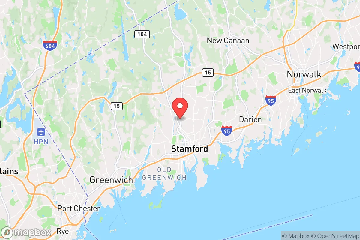
Strategic Assessment of Stamford, CT
High tactical risk. This location is likely close to major population centers, strategic targets, or sits in a high-disaster corridor. A retreat property and careful exit planning is required.
What does the Strategic Assessment tell us?
Our Strategic Assessment grades tactical survivability of an area. Major population centers, military targets, fallout zones, natural disasters, and border exposure all drive risk — lower exposure means a more defensible position in a crisis.
This is heavily inspired by Joel Skousen's Strategic Relocation book. Highly recommended you checkout the book ($)What does this tell us?
Our Strategic Assessment grades tactical survivability of an area. Major population centers, military targets, fallout zones, natural disasters, and border exposure all drive risk — lower exposure means a more defensible position in a crisis.
This is heavily inspired by Joel Skousen's Strategic Relocation book. Highly recommended you checkout the book ($)Strategic Pillars

Key Distances
Regional Safe Places
Below is our recommended "safe zones" in Connecticut and the surrounding area based on our strategic heuristics. For most people, it's unrealistic to live in a “safe zone” full-time due to work, family or other personal reasons. They tend to be more rural. However, many of these areas are perfect for second homes and retreat properties that double as a vacation home or even a short-term rental.


Important Note: For informational purposes only. This does not mean nothing bad ever happens in the green zones. Please use common sense. This is based on public data and modeled with AI. We tried to take a conservative approach but mistakes happen. We update this regularly as new information becomes available.
Solar Generator Recommendations
Backup power matters more here than in safer locations. We've picked three solar generators across budgets and capacity tiers — start with the budget unit if you only need a few essentials, or step up if you want to run a fridge and HVAC for days at a time.

Jackery Portable Power Station Explorer 300
Budget OptionPower on the Go: Weighing only 11 lbs, it's convenient to set up and store with book-sized foldable solar panels

BLUETTI Portable Power Station AC180
Designed for both indoor and outdoor scenarios, AC180 is highly capable as it has a robost capacity and continuous output power.

EF ECOFLOW DELTA Pro Ultra Power Station
Upgraded PickEcoFlow DELTA Pro Ultra is a whole-home energy system designed to grow with your family. Integrated with the Smart Home Panel 2, it scales to meet your evolving energy needs — keeping your home powered, intelligent, and secure through every stage of life.
We earn a commission, at no additional cost to you.
Strategic Assessment Analysis
Stamford, Connecticut, presents a deeply contradictory picture for the conservative prepper or survivalist. On one hand, its location on the Long Island Sound and its position as a major corporate hub offer economic resilience and access to maritime resources. On the other, it sits squarely in the bullseye of the Northeast Corridor, a region dense with population, political volatility, and high-value targets. For a relocator prioritizing strategic depth, Stamford is a high-risk, high-reward proposition that demands a clear-eyed assessment of its assets and its liabilities.
Geographic position and natural advantages for long-term stability
Stamford’s primary strategic asset is its access to the Long Island Sound, a massive, defensible body of water that provides a potential food source, a transportation corridor, and a natural barrier against ground-based threats from the south. The city sits on a deep-water harbor, which historically made it a shipping and industrial center. For a prepper, this means the potential for small-scale maritime trade, fishing, and a route to the open Atlantic if coastal evacuation becomes necessary. The surrounding terrain is a mix of coastal lowlands and rolling hills as you move north into Fairfield County, offering some natural defensibility against a mass movement from New York City, which lies just 35 miles to the southwest. The climate is temperate, with four distinct seasons, allowing for sustainable agriculture in the inland areas, though the growing season is shorter than in the mid-Atlantic. The region’s water resources are robust, with the Mill River and Rippowam River providing freshwater sources, though these are heavily developed and would require filtration and treatment in a grid-down scenario. Stamford’s position as a transportation hub—with I-95, the Merritt Parkway, and Metro-North rail lines—is a double-edged sword: it offers rapid egress but also makes the city a natural chokepoint for any mass evacuation or military movement along the coast.
Risks, exposures, and proximity to fallout-relevant landmarks
The most glaring risk for Stamford is its proximity to New York City, a prime target for any large-scale attack, whether nuclear, biological, or conventional. Stamford sits within the likely fallout plume zone for a ground-burst detonation in Manhattan, depending on wind direction. Even a conventional attack on the city’s financial infrastructure—its corporate headquarters for firms like Charter Communications, Synchrony Financial, and Pitney Bowes—could trigger a cascading economic collapse that would hit Stamford’s economy hard. The city is also within 50 miles of the Indian Point nuclear power plant (now decommissioned but still containing spent fuel), and the Millstone Nuclear Power Station in Waterford, Connecticut, is about 60 miles east. A release from either would put Stamford in a moderate-to-high risk zone. Additionally, the city’s dense population—over 135,000 people in just 52 square miles—makes it a prime target for civil unrest. Stamford has a significant wealth gap, with a median household income around $90,000 but with pockets of deep poverty. In a crisis, the city’s reliance on just-in-time supply chains for food and fuel would become a critical vulnerability. The I-95 corridor is a known chokepoint; a single accident or attack could paralyze movement for days. For the survivalist, Stamford’s biggest exposure is its lack of strategic depth—it is a coastal city with a single major highway north and a rail line that is a target itself.
Practical resilience for a relocator: food, water, energy, and defensibility
For a relocator looking to build a resilient household, Stamford offers some practical advantages but requires significant preparation. Water is the most immediate concern. The city’s water supply comes from the Stamford Water Pollution Control Authority, which draws from the Mill River and several reservoirs. In a prolonged grid-down event, this system would fail. A prepper would need a well on private property—rare in the city limits—or a robust rainwater catchment system. The Long Island Sound is a backup, but desalination is energy-intensive. Food security is a mixed bag. Stamford has a few farmers’ markets and community gardens, but the city is not a food-producing region. Most food comes via truck from the Midwest or via ship from global ports. A prepper would need to stockpile at least three months of supplies, as local agriculture is insufficient to support the population. Energy resilience is poor. The grid is old and vulnerable to storms—Hurricane Sandy in 2012 left parts of Stamford without power for over a week. Solar is viable, but most homes are not equipped for off-grid living. Natural gas is the primary heating fuel, and that infrastructure is also vulnerable. Defensibility is the weakest link. Stamford is a dense, urban environment with few natural chokepoints. The city’s layout—a mix of high-rise downtown, suburban neighborhoods, and coastal areas—makes it hard to secure a single property. The best bet for a relocator is to buy in the northern, more rural parts of the city, near the Stamford-North Stamford border, where lot sizes are larger and neighbors are fewer. Even then, the city’s proximity to I-95 means that any mass movement from New York would funnel through Stamford, making it a dangerous place to be in the first 72 hours of a crisis.
The overall strategic picture for Stamford is one of calculated risk. It is not a survivalist’s paradise—it is a coastal city with all the vulnerabilities that entails. But for the conservative relocator who values economic opportunity and is willing to invest heavily in preparation, it offers a unique combination of maritime access, corporate stability, and proximity to the Northeast’s political and financial power centers. The key is to treat Stamford as a base of operations, not a final redoubt. A prepper here would need a secondary location—a cabin in the Berkshires or a farm in upstate New York—to retreat to if the city becomes untenable. Stamford’s value lies in its ability to generate income and resources in peacetime, while its liabilities require a robust plan for extraction when the balloon goes up. If you can afford the real estate and the prep costs, and you have a bug-out location within a two-hour drive, Stamford can work. If you’re looking for a place to hunker down and ride out the collapse, look further north.
* Values derived from national, state, county, city and local statistics and may differ in a specific area. Last updated: 2026-04-30T03:48:24.000Z
Narrative content on this page is AI-generated and may contain mistakes. Verify any details that matter before acting on them.
ReloMaps may earn a commission from affiliate links at no extra cost to you.