Photo: Wikipedia
Strategic Assessment of Bosque County
Workable tactical position. Some exposure to population density or targets, but generally defensible in a crisis.
What does the Strategic Assessment tell us?
Our Strategic Assessment grades tactical survivability of an area. Major population centers, military targets, fallout zones, natural disasters, and border exposure all drive risk — lower exposure means a more defensible position in a crisis.
This is heavily inspired by Joel Skousen's Strategic Relocation book. Highly recommended you checkout the book ($)What does this tell us?
Our Strategic Assessment grades tactical survivability of an area. Major population centers, military targets, fallout zones, natural disasters, and border exposure all drive risk — lower exposure means a more defensible position in a crisis.
This is heavily inspired by Joel Skousen's Strategic Relocation book. Highly recommended you checkout the book ($)Strategic Pillars

Key Distances
Strategic Assessment Analysis
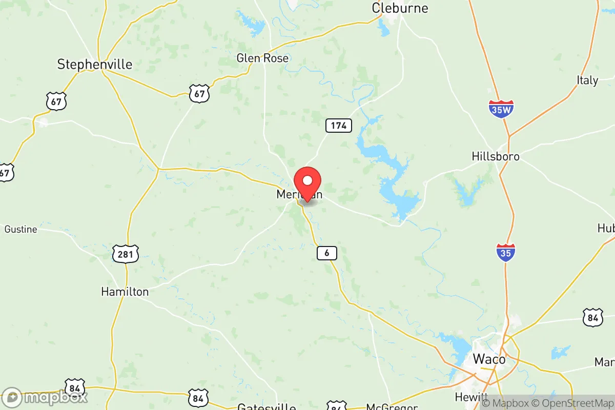
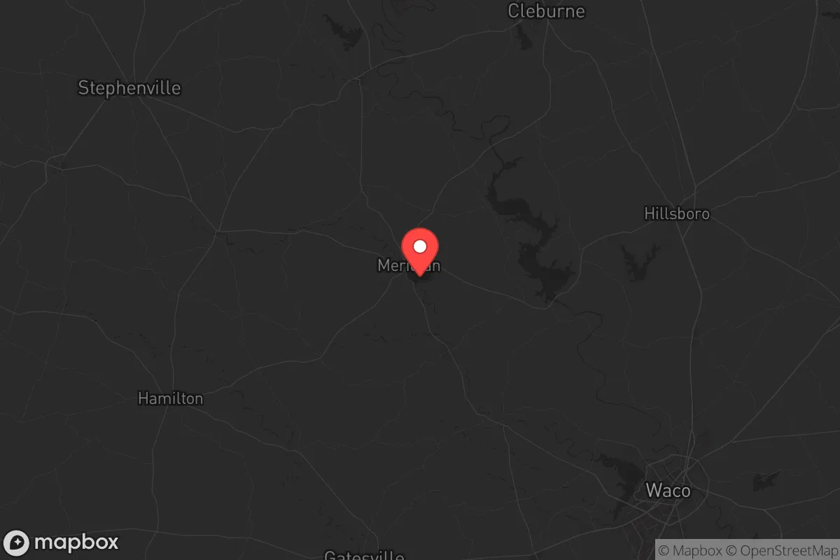
Bosque County, Texas, occupies a strategic middle ground for relocators prioritizing resilience and self-sufficiency, offering a blend of rural isolation and practical access to critical infrastructure without the direct exposure of major metropolitan areas. Located roughly 60 miles south of Fort Worth and 90 miles north of Austin, the county sits outside the immediate blast and fallout zones of these major population centers while remaining within a reasonable distance for supply runs or medical emergencies. The county seat, Meridian, and the largest town, Clifton, anchor a population of roughly 18,000 spread across 989 square miles, providing low population density that inherently reduces target value and social friction during disruptions.
Geographic position and natural advantages for self-sufficiency
Bosque County’s topography and water resources give it a meaningful edge over the flat, arid regions of West Texas or the flood-prone coastal plains. The county straddles the Brazos River and its tributaries, including the Bosque River and the North Bosque River, which provide reliable surface water for irrigation, livestock, and household use—a critical asset in drought-prone Texas. The terrain is rolling hills and limestone bedrock, with elevations ranging from 600 to 1,200 feet, offering natural drainage and defensible high ground near places like Lake Whitney and the Bosque River Valley. This geography supports mixed farming, cattle ranching, and hay production, giving residents a head start on food self-sufficiency. The county’s position in the Texas Blackland Prairie ecoregion also means fertile soils for gardening, though limestone outcroppings require some soil amendment. For a relocator, the ability to drill a well (average depth 200–400 feet) and the presence of multiple perennial creeks reduce dependency on municipal water systems, which are vulnerable to grid failure or contamination.
Risks, exposures, and proximity to fallout-relevant landmarks
While Bosque County avoids the worst of Texas’s risk profile, it is not immune to natural and man-made hazards that a strategic relocator must weigh. The primary natural threat is wildfire, particularly in the western half of the county where juniper and mesquite scrub dominate; the 2011 Texas wildfires burned parts of Bosque County, and dry summers with high winds remain a recurring risk. Tornadoes are a secondary concern, with the county lying in the southern edge of Tornado Alley—Clifton and Meridian have experienced EF-1 and EF-2 events historically, though damage is typically localized. Flooding along the Brazos River and Lake Whitney’s shoreline can impact low-lying properties, especially near Lake Whitney State Park and the town of Whitney. On the man-made side, the county’s most significant exposure is its proximity to Fort Cavazos (formerly Fort Hood), located about 40 miles southwest in Coryell County. This major Army post houses roughly 40,000 active-duty personnel and extensive armored vehicle and aviation assets, making it a plausible target for conventional or asymmetric attack. Additionally, the county lies within 100 miles of the Dallas-Fort Worth metroplex, a high-value economic and transportation hub, and within 150 miles of the Houston Ship Channel and its refinery corridor—both potential fallout-relevant landmarks in a major conflict or terrorist scenario. Fallout patterns from a strike on DFW or Fort Cavazos could deposit radioactive material over eastern Bosque County depending on wind direction, though the county’s western areas (near Iredell and Morgan) offer slightly better separation. The county’s lack of major industrial targets itself—no refineries, nuclear plants, or large military bases within its borders—is a net positive, but relocators should plan for evacuation routes west toward Hamilton County or south toward the Hill Country if conditions deteriorate.
Practical resilience for a relocator: food, water, energy, and defensibility
Bosque County offers a strong baseline for practical self-sufficiency, but it requires upfront investment and local knowledge to realize fully. Water is the county’s standout asset: the Brazos River and Lake Whitney (a 30,000-acre reservoir) provide abundant surface water, and groundwater from the Trinity Aquifer is generally accessible via private wells, though yields vary by location—consult the Bosque County Groundwater Conservation District for specific data. Rainwater catchment is viable, with annual precipitation averaging 35 inches, and many rural properties already have cisterns or stock tanks. Food production is feasible: the county has over 1,200 farms and ranches, with cattle, hay, and small grains dominating. Relocators can tap into local networks like the Clifton Farmers Market or the Bosque County Livestock Association for seeds, livestock, and equipment. Gardening is productive in the sandy loam soils of the river bottoms, but the limestone-heavy uplands require raised beds or imported topsoil. Energy independence is achievable but not automatic: the county has no natural gas deposits or significant wind farms, but solar irradiance is good (4.5–5.0 kWh/m²/day), and many rural homes already use propane or diesel generators as backup. The local electric cooperative, United Cooperative Services, serves most of the county and has a moderate reliability record, but grid outages during winter storms (like 2021’s Uri) are a known risk. Defensibility is a mixed picture: the low population density and limited road network (mainly US-6, TX-22, and TX-174) mean that choke points exist, but also that escape routes are few. The county’s rolling hills and wooded draws provide natural cover and observation points, especially on larger parcels (20+ acres) common near Walnut Springs and Cranfills Gap. However, the lack of a centralized law enforcement presence—the Bosque County Sheriff’s Office has roughly 15 deputies for the entire county—means that community watch and private security arrangements are prudent for long-term resilience. Medical infrastructure is limited: the county has one small hospital (Bosque County Hospital in Meridian) with basic emergency services, and serious trauma cases require a 45-minute drive to Waco or a 60-minute drive to Fort Worth, so a well-stocked medical kit and telemedicine capability are strongly recommended.
The overall strategic picture for Bosque County is one of moderate-to-high resilience with clear trade-offs. Its geographic isolation from major targets, abundant water resources, and agricultural base make it a viable destination for relocators seeking a balance between rural self-sufficiency and access to urban supply chains. The primary weaknesses—wildfire risk, limited medical infrastructure, and proximity to Fort Cavazos and the DFW metroplex—are manageable with proper planning, including defensible space around structures, a robust medical cache, and a pre-planned evacuation route west or south. For a conservative-leaning audience valuing preparedness, community cohesion, and land-based living, Bosque County offers a realistic foundation that rewards effort and local engagement. It is not a bug-out location for the unprepared, but for those willing to invest in water systems, food production, and neighborly networks, it provides a solid platform for weathering both natural disasters and broader societal disruptions.
* Values derived from national, state, county, city and local statistics and may differ in a specific area. Last updated: 2026-06-11T03:46:01.000Z
Narrative content on this page is AI-generated and may contain mistakes. Verify any details that matter before acting on them.
ReloMaps may earn a commission from affiliate links at no extra cost to you.